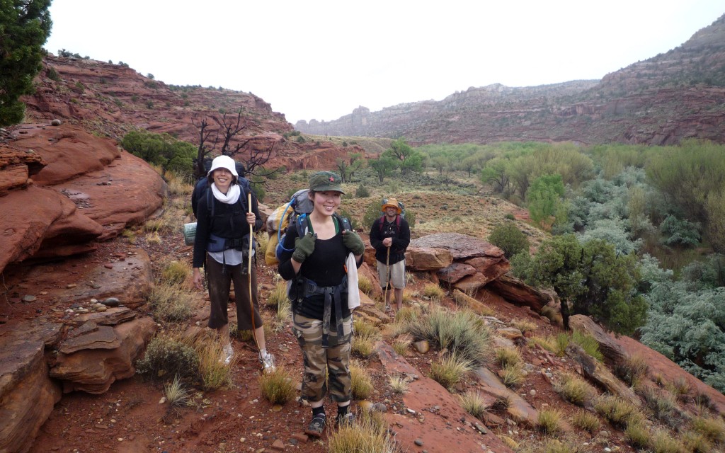
From the Across Utah 2009 Trip Report
Day 23 – The Badlands
 In the morning I headed up Wahweep Wash cross country. I was anxious about my water supply which was already running low. There was supposed to be a spring ahead, but I failed to confirm its status before I headed out. When I got to Headquarters Spring it was indeed flowing. Not a huge oasis, but enough to have a good lunch and then tank up with 1.5 gallons for the dry stretch ahead.
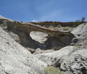 I made my way up and over a ridge to Blue Wash. I found a natural bridge on the way. This is one of the biggest thrills — to accidentally stumble across a feature you’ve never read about or seen on any map.
Then I worked my way through the Blue Wash Badlands for the next few hours. Found a small pothole so I grabbed an extra liter of water.
Though I wanted to head NorthEast, I decided to climb Paradise Peak to the East instead. Though taller and slightly out of the way, the route looked safer on the topo map and by a basic visual check.
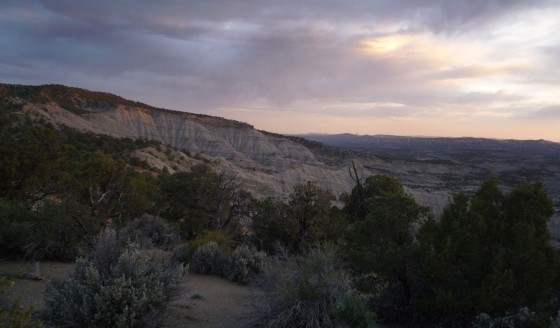
Coming down the back side I finally found the Jeep road I wanted to intersect with that would take me to the North. Hiked several more miles and then camped overlooking the badland. I realized I could have made the NorthEast route- oh well, the peak afforded me great views.
Great sunset as clouds moved in.
14.1 miles
Day 24 – Bad Water
Woke up just after sunrise to raindrops on the tent. I had to get up and put the fly on. 10 minutes later it was raining and gusting hard. 10 minutes after that, the sun was out again.
I followed the rough 4×4 road North keeping tabs on my water. I stopped to filter my final liter when it started to rain. I got out my rain fly and trapped 1.5 liters of water in the 10 minute shower.
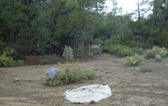
The rain water was dirty so I ran 1 liter through the filter and mixed it with my other water. I took a big drink, and almost gagged. Something was wrong- the water was salty. I sampled the remaining dirty rainwater straight- and it was fine. Evidently the extra liter I got from the pothole was over-evaporated and tainted. Now I was down to .5 liter of water and only a questionable spring a long ways off. Luckily it was cool day.
Made my way over the highest ridge yet. On the other side, the northern slope, the environment changed to a thick pine forest. The aroma was great. The smell of pine and sage. Soon it began to sprinkle so there was also the sweet smell of rain. Good stuff- it should be a cologne. PINEsageRAIN- a new fragrance for men from Calvin Klein!
A little later I got to the spring and was glad to see it was flowing, though cows had made somewhat a mess of it. I filtered some and yuck- cow **** water!!! I went back and got more trying to get as close to the source as possible in a bunch of reeds. Filtered again- better, but still pretty bad. It tasted like woody water with a splash of cow. Oh well- that’s as good as it was going to get and I needed water.
Continuing on I made my way up to Death Ridge. Here the dirt road actually resembled a road — as it was much more traveled than what I had been on all day. I made my way down and into the valley where I camped for the night. I should be able to make it into Escalante by mid-afternoon tomorrow.
16.7 miles
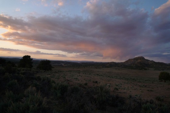
Day 25 – Half-Way Rendezvous
Soon I was on Smokey Mountain Road headed to town. I had about 11 miles to go.
A few miles down the road I was at the spot on the map that showed a spring- but it was dry. There was only enough water to dampen my cut-up T-shirt which I had made into a bandana. Boo — more woody cow water was still on tap. 🙁
I was moving pretty fast down the dirt road and had still yet to see another person or auto since leaving Grosvenor Arch. Around one bend I noticed an increase in vegetation, but still around only a stream of sand. I pondered how such brush could exist w/o water and as I rounded the next bend the sand got dark, then turned into a trickle of water. Hoo-ray!
A few hydrated hours later I walked into the town of Escalante. This wasn’t the original plan, but to make the “meet up” easier with the friends from LA who were going to hike with me for three days, as well as the later meet up with my parents, I changed my route. Since I knew I was ahead of them at least an hour, I walked through town and got a Subway sandwich. I figured it was my half-way reward. Then back to the visitor center to wait for the gang.
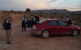 A bit later Hanzel, Celia and Iris arrived. Yay- good times. I’m bummed that Deo couldn’t make it though. They helped me retrieve my next cache, south of town on the original route, then they dropped me back in town and I walked the remaining 2 miles to the trailhead and met them again.
We hiked just a ways into Escalante Canyon and made camp and had a feast. The stars were great and the strange lights on the canyon walls were definitely not UFOs said Hanzel. Tomorrow into Death Hollow.
16.8 miles
Original Comment
-
uncle davo said,
May 24, 2009 at 2:00 pm
Congrats on Half Way ! Stay Safe Say HI to Mary and Larry for me , Davo
Day 26 – Death Hollow
Got up and did an uplink before getting too deep into the canyon. Learned there was a severe weather advisory posted for southern Utah. It specifically called out the national monument we are in and said to use extra precaution. Yay- more drama!
Soon everyone was up and enjoying breakfast as a group. Then we packed up and headed down the trickle that was the Escalante River. The walls grew higher with each bend we took.
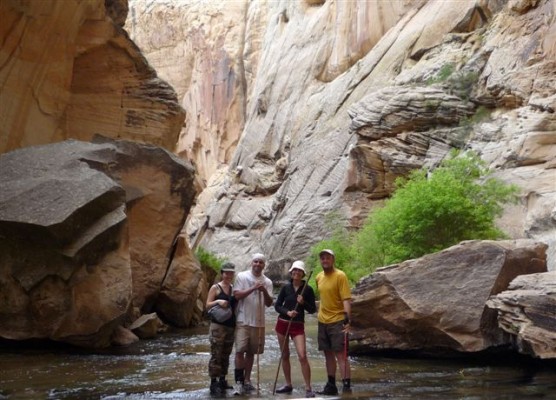
Early afternoon we arrived at the entrance to Death Hollow and headed upstream. This is such a beautiful canyon! It has sheer white, yellow and red Navajo Sandstone walls and a shin-deep, crystal-clear creek flowing over sandstone most of the way. Hanzel forgives me for all of the sand it took to get to this point.
We get to Emerald Pool Alcove and are ecstatic to find nobody camped there. We promptly set up camp under the deep overhang.
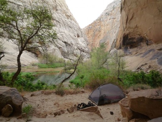
We head up Death Hollow to explore more w/o our heavy gear. It starts to rain lightly. This is not a good thing while in a slot or narrow canyon like Death Hollow. I explain how extremely unlikely it would be for a flash flood this time of year. For a slower flood though I explained we should watch for the water to turn murky.
We continued up a ways- I really love this canyon. I hiked it last year with my buddy Josh, but I am amazed again at just how spectacular it is as we go deeper into the canyon. We got to the place I call “the scary step”. Here the canyon constricts to about 15′ wide and there is a deep green pool apparently spanning the entire width. But on one side the gap is fairly short and there is a six-inch ledge just submerged underwater. Here one can take one big stride by stepping on the ledge and get past the pool. It’s not that hard, but the idea of slipping and falling into the over-your-head pool of cold water, makes it one big scary step.
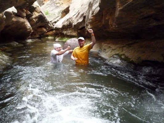
Not too much farther and we got to the lower narrows of Death Hollow. Here the walls constrict once again and quick rushing water separating deep pools makes upstream travel very difficult unless you are willing to get in the belly-deep water. But, we did it! Hanzel and I took the cold, wet approach and powered up through the rapids. Celia and Iris were somehow able to cling to the slippery wall and managed to only get wet up to their thighs. Success!
After that we turned around and did it all again in reverse to get back to camp.
I took another “river bath” then we all had a feast for dinner as we all sampled one another’s dinners.
11.4 miles
Original Comment
-
trabera said,
May 26, 2009 at 4:48 pm
Damn I’d love to know how that water felt! Love to go back there in some warmer months…I will never forget that awesome weekend Jamal and I had laughing at death and asking for more. If this is actually Death Hollow, I plan on living to be at least one hundred…maybe two! 8^)
Day 27 – Cloudy Turns Rainy
We woke up to rain this morning. We stayed dry though because we were under the alcove. Had a nice big (for me) breakfast and geared up to head out in the rain. Hanzel and Celia didn’t have real rain gear so we had to improvise with tent rainflys. We called ourselves “The Komono”, “The Bus” and the “Red Blob” . I didn’t have a nickname—but can you guess who was who?
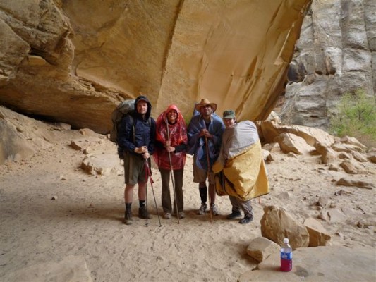
We headed out down and out Death Hollow and then down Escalante. The river didn’t show any sign of flooding.
A little bit later it was raining pretty hard and we needed a break. Hanzel spotted a small overhang so we all went up and tried to dry out and warm up for a bit. We stayed there for almost an hour and a half and finally the rain did let up some. When we got back to the river our little clear-water stream was gone and we were greeted with an chocolate-milk-colored river. It still wasn’t that deep, so we kept going downstream crossing the river every 15 minutes or so. I warned that seeing debris was the next real sign of a flood and we should be fine.
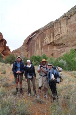 We stopped at Sand Creek later in the day and had a good lunch among the red rocks. The sun actually popped out for a bit—but not for long. After lunch we kept going and went by a nice natural arch. There was also a small Indian dwelling with some pictorgraphs underneath the arch. A little father down we saw the impressive Escalante Natural Bridge. The whole area was really nice.
A little farther and we crossed the Hwy 12 bridge, saw a few people, and then continued right down the river as it started to drizzle again. The orange and red rocks of the Kayenta formation farther downstream were really picturesque.
We skipped our planned side-hike into Phipps Wash — too far behind schedule as we didn’t want to leave too long of a day for tomorrow.
Next we ran into a herd of cows. They didn’t seem too happy that we were crossing their little corner of the Escalante. We quietly and slowly moved by (Celia took pics!)
With the rain still coming down and it getting really late we tried to find a camp. At first there was nothing appealing, but finally we found a small alcove where we could all get out of the rain. It was dark by the time we were cooking dinner, but it was nice to have a hot meal. With our little lights we realized our alcove was infested with daddy-long-leg spiders. I mean everywhere! They would crawl up on us as we were eating. Luckily none of us were scared of spiders—right?
It rained into the night, but I was confident tomorrow would be a nice day! It cannot continue to rain… not in May. More rain tomorrow will make it very hard for us to get through the Narrows of Boulder Creek which lie ahead. I told Mother Nature she would not beat us!!!
12.5 miles
Day 28 – Mother Nature Wins
We woke up to nice steady ready rain. That was a bummer, but the really bad news was our river which was already high was now up about another 18 inches and a ragging torent! I concede. Mother Nature wins and we have to retreat. There is no way that we were going to be able to cross the river multiple times and then successfully get up through the the narrows of Boulder Creek.
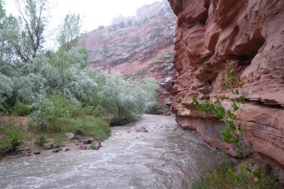
The water from the river is now too murky to properly filter. As we break camp we collect rain water to filter. Then—we had major excitement. All of a sudden water comes gushing over the top of our little alcove. There’s a new waterfall just about ten feet up from where we had made camp. We quickly pack up the rest of our gear and within 5 minutes there is a small stream flowing through the area that our tents had been set up.
We head back UP canyon and fight through the brush as we go and get completely drenched in the process. We come to a place that we have to cross the river. I got out and tested the water w/o my gear. It was waist-deep and the flow was strong. We looked for a wider spot where the water wouldn’t be so deep. We found such a spot down stream and made the crossing. It was a little sketchy, but not that bad.
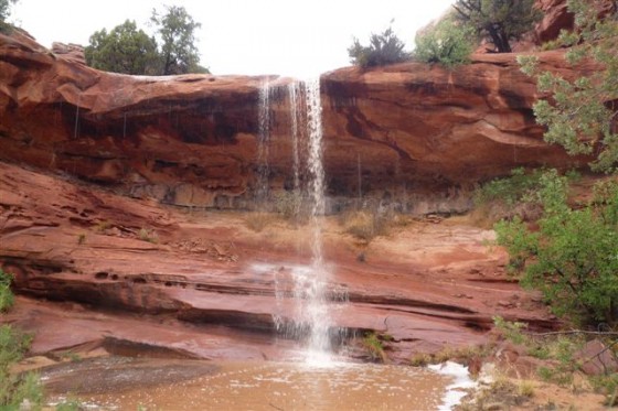
We kept going and loved the incredible waterfalls which were now forming over every ledge which poured into the canyon. It was an incredible sight and despite the misery of the rain, everyone’s spirits were still high. Kudos to the group.
We finally get to a place we need to cross the river again. After another test I decide it’s too risky and go off to scout for another way. I finally found a route high above through the Kayenta ledges. We climb up and follow the ledge system around the bend of the river. (Deo—you would not have liked it!) Though also a little sketchy, it was better than the river and it actually afforded us a really nice view of the entire foggy/rainy valley.
Back down to river level we continue up stream and get to another place where the river pinches out against the sheer cliffs. This time the bend is relatively short, so we decide to get into the river and hug the bend and work our way up the river about 10 feet where we could reach the bank again. The river was strong—but we all made it ok. Though everyone failed the “keep the underwear dry” goal at this point!
From there our river crossings were done and after a short stretch across private property (sorry) we were back to the Hwy 12 bridge. Once there we made a home under the bridge and cooked a warm meal.
After the short break, I headed out up the highway alone as everyone else stayed under the bridge. Without my gear I was hoping I could get up the highway and maybe hitch a ride to the point where we were supposed to meet up with my parents who were going to furnish a car shuttle. After 5 miles of walking in the rain, a great couple from Alpine UT picked me up and gave me a ride the final 16 miles. Met up with my parents who were surprised to see me arrive by auto. After the obligatory explanations we headed back to pick up the rest of the gang.
Once all re-united we all went to camp. My parents recently got an RV. I’m not much of a RV guy myself—but it made for a great evening as we cooked a good meal and all hung out inside telling stories. Hanzel and I still camped outside, but were happy that the rain had finally stopped.
8.5 miles
N 37.85118
W 111.43017
* Coordinates are where I got a ride (I will resume here tomorrow)
Original Comments
-
Alex Quintana said,
May 26, 2009 at 5:41 pm
Hey, i am amazed by your guyes effort it is realy enspiring to do a thing like this…i hope one day i can do this like u have done. I also hope it enspires other kids to take a hike now and again. I hope ur journy keeps going as good as it has, besides mother nature lol well good bye
Alex Quintana
curtis said,
May 28, 2009 at 6:23 pm
Hi, this is Curtis and I am shocked how far you have already and are going to travel 600+ miles is pretty incredible. My friend and I have always talked about doing a 14 day campout only me and him, but we never got around to planing it, but you have just reminded me how cool and fun it would be to do again. You have really inspirered me and i’m sure that i’m not the only one that you have inspired, I am glad that your food has been safe so far I wish you luck on the rest of your trip and go show mother nature who’s the boss!
Day 29 – 20 For 3
Got up in the morning and had a great RV breakfast with the gang and my parents. It was sunny with clear skies—Yay!!! My parents drove us back down the highway. They dropped me off at the point where I had been picked up the day before. I decided I would try and go cross-county and make it back to where I was supposed to be yesterday. I was able to do this w/o my gear as the plan was to meet my parents again tonight. But, it was time to say goodbye to the rest of the gang. My parents would take Hanzel, Celia and Iris back to their car in Escalante. They were going to drive to Bryce Canyon and then head back to LA tomorrow. I hope they had fun despite the rain—they definitely did a good job getting through the canyons in less than prime conditions!
So I headed down the gully away from the highway. I headed over to see some pictographs marked on map, but then decided it was too far and went straight into the canyon. I knew immediately that I had gone down the wrong drainage, but looking at the topo map, it looked like it would get me to the same spot via a slightly steeper route. About 30 minutes later I came to a short slot canyon which was filled with water from the day before. I probably could have gotten through it, but I didn’t want to get so wet so early in the day. So, I decided to climb back out and head toward the easier canyon.
On my way back out I see a HUGE dark storm could forming above the mesa. I get up to the highest point and couldn’t believe how quickly the clouds were returning. They looked worse than the day before. At this point I decided I shouldn’t be headed back into the canyons. So, instead, I decided to climb back out to the highway and I would walk the road all the way around the canyons to where I would meet my parents. The route would take me 20 miles to go to the camp which was only 3 miles away “as a crow flies”.
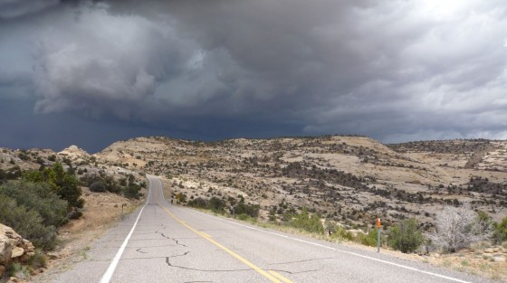
Along the road I got pretty wet. I thought it was going to be a nice day—so I didn’t have my rain gear. I found a few plastic bags along the road that someone had thrown out as litter. I used them to cover my camera bag and my head. I’m sure I was a pretty goofy sight walking along the road.
For a short section of the walk I met a nice couple from Salt Lake City—John and Emily if I recall correctly. He was originally from St. Louis. They had just hiked a ways down Boulder Creek and said it was waist deep, so it was a good thing that I was on the road.
A little later the sun came out, and though I never like road-walking—it was a nice walk. If there’s any road to walk—this is it. Highway 12 from Escalante to Boulder is absolutely gorgeous. I think it is one of the most scenic roads in the United States.
Several hours later I get to Boulder and head down the historic Burr Trail road. Along the way the couple from earlier passed me again. They offered me a ride—but I said I had to walk to really make it “AcrossUT”. Ranger Jeff also stopped. He was really nice as well and said that I made the right decision to not be in the canyons today. Evidently they had to rescue someone the day before!
A few hours more and I was back to camp—ready for a warm RV meal and then back out in the rain to sleep in my tent!
20.1 miles
N 37.84874
W 111.37064
Original Comment
-
Daniel said,
May 26, 2009 at 3:30 pm
Wow .. I admire the spirit and stamina of your friends, wading the Escalante is cold going even in the best of weather, but pretty miserable in rain! Did you actually plan to go all the way up through the Boulder Creek Narrows? I’ve been through there once, and it involved long stretches of swimming even at low water… no idea how you wanted to make this with your pack. The “best” trail I know is actually exiting Boulder creek canyon, there’s several possible scrambles that lead up to Brigham Tea Bench. Go across, then descend into the Gulch near the spring, and follow the Gulch (easy going) up to Burr Trail. But hey – I never got to hike Hwy12, and it *is* gorgeous even when driving it. All the best .. wish you good weather and easy going across the Waterpocket Fold up into the Henrys. Can’t wait to read your log on PSCR/Happy Canyon 🙂
Guest Entry
After a long day of flying and driving, we finally met up with our slightly skinnier and scruffy friend, Jamal. First night at the campsite was a gorgeous one. Set our tents under the clear, starry sky, and I witnessed my first shooting star! The others informed me that they’re a dime a dozen, but it was beautiful, nonetheless.
Next day, we head toward Death Hollow. I should first explain the type of gear Hanzel, Iris and I have prepared. Before we left LA, weather reports promised us blue skies in the upper 70’s, and Jamal told us that we would walk in and out of water and a little bit of sand. Easy, right? Iris and Hanzel ended up purchasing a pair of $7 water flats at a local grocery store in Cedar City, JUST in case their sneakers don’t hold up. Well, the craftsmanship is what you would expect from a pair of $7 shoes, but that spontaneous purchase ended up saving them because as it turned out, we spent half the time treading through deep water that second day. Lesson learned: if you know there is water, invest in a good pair of water shoes and neoprene socks. (Thanks, Jules! Your shoes saved me!)
We were forewarned by Jamal’s father that a new weather report came in of ‘monsoon-like’ conditions, and the weather definitely started to get a little hairy towards the end of Day 2. But ‘in Jamal We Trust’, so we looked to him to get us through the stormy weather. And thank GOD for him, because the 3 of us would’ve been stranded underneath a spider-infested alcove (which is exactly where we camped on night 3!), balled up in fetal positions until passersby would come rescue us. The rivers were now waist-deep for Jamal (which meant they were neck-high for me) and we had to quickly change our route and retreat back to the trailhead. We felt defeated by the weather, and Jamal cursed Mother Earth. But taking that detour back to the trailhead ended up being a blessing in disguise. It forced us to make our own trail over and above the canyons to stay out of the water, and it ended up being an amazing adventure! We had to walk along steep ledges and extremely muddy slopes, but when we looked up, we experienced some breathtaking views!
So all in all, the three of us are so grateful to have joined Jamal on this short leg of his great journey. The 3 of us were a bit under-prepared with our lack of rain gear, but Jamal always made sure that we were safe and having the time of our lives. And we did.
~ Celia (on behalf of Celia, Hanzel and Iris)
