From the Across Utah 2009 Trip Report
Day 30 – Royal Day
May 25th, 2009
For the unaware, I am a huge Prince fan and crazy things go through one’s mind after walking 30 days straight. So… see how many Prince songs you can find in today’s update. 2 make it more challenging 4 U, I have removed all Prince-speak. Also, spelling, spacing and punctuation doesn’t matter.
Got up and had a good breakfast with my parents. Then it took quite a while to re-org my gear and add new supplies. Then I spent some time working on the computer- writing updates and pulling photos. Then I said “let’s go.” Crazy as it sounds, it was already 2pm. We drove a long ways up the road and dropped my gear. Then we went back to our camping spot so I could start walking from there. Quick lunch of roast beef sandwich and cream cheese danish. Mom gave me a kiss goodbye and then they went one way and I went the other.
Almost immediately it began to rain. But it didn’t last long and then it cleared up a bit. I could see fresh snow on Boulder Mt.
When I got to The Gulch I picked up a permit at the trail register so that I could camp another night in the monument. I wanted to get off the road and explore Upper Gulch, but it was late so I decided to push on.
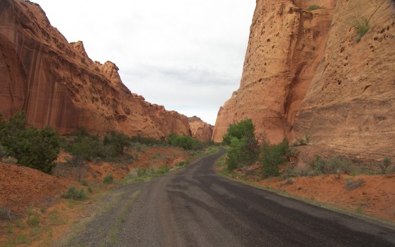
Almost 7 miles into the day I entered Long Canyon. I adore this extraordinary canyon and it was fun to walk. I even spotted an arch I have never noticed before. When it comes to beautiful red rock canyons, nothing compares to Utah. So many of the beautiful ones are along my route. There were a lot of people driving through this stretch: mini-vans, motorcycles, even one guy hot-rodding in his little purple Porsche. If I didn’t know my cars or colors as well, I may have mistook it for a little red Corvette (Ok- that one was forced.) It was strange to think of how slow I was going compared to those driving through the canyon, and then even more so compared to the those in the jets overhead possibly going half way around the world in a day. Hours later when I reached upper Long Canyon it was sunny. I followed 5 deer for a ways. They were much happier than the one I saw 17 days ago in the Barracks.
The view on top was great. The Circle Cliffs were visible as were the Henry Mountains in the distance. They didn’t have any snow like they did a month ago, so I guess sometimes it snows in April in the Henrys, but not in May.

The road continued to be paved at this point. In a scandalous move, in a protest to the national monument, the county paved this previously dirt section years back. It was quite the controversy and still riles many environmentalists. It was a sign of the times and IMHO there are too many paved roads on planet Earth.
The mudhills in the area were fascinating. Deep red and purple. Soon I was out in open country with amazing views all around. It was great. I was walking down the middle of the road. Since it was Memorial Day, earlier had been somewhat of a manic Monday, but now all the holiday tourists were gone and I was alone.
The sun was now down and the sky streaked red, deep blue and purple. Rain could still be seen falling from thunderheads in several directions. I kept hiking until it was almost fully dark. In the darkness I kept thinking I saw animals scurrying across the road. But I was just tired and probably somewhat delirious by this point.
Finally I made it to the spot I had dropped my gear. The ground was really soft and wet from the rain. Tonight the tent would get dirty. Mind you no worse than before. I found a semi-dry place under a juniper and made camp. For dinner, dried starfish and coffee. Just kidding- Chili Mac. Total miles for the “short” day was just over nineteen. 99% of that was along the road. But it was a good day. And now the stars were out and I could tell it’s gonna be a beautiful night.
19.1 miles
Original Comment
-
Daniel said,
May 29, 2009 at 3:11 pm
Yup, I know this ridiculous stretch of moronic pavement well .. and already knew it when it was still a little dirt track that got washed away anew with every summer monsoon. They also graded “the other end” down near Bullfrog Marina … but nicely enough, there’s a stretch of about 15mi in between that sits within Capitol Reef National Park. And whatever your opinion of the National Parkinglot Service might be, they so far luckily refused to pave their portion and to connect the two roads. Which makes the two stubs graded and paved by the county monumentally silly roads to nowhere for everything except 4WDs. Just fine, as far as I’m concerned… I just hope the one day the dirt road switchbacks within the National Park will wash out completely, and make the stretch impassable even for jeeps. Then again, I see that hiking on a graded road makes you clock in amazing 20 miles per day – can’t do that crawling through waterlogged slot canyons :).
Day 31 – Restart Day
Today was a tough day to get going. Having the heavy pack again is no fun. I got used to not having it the last two days. I also noticed I was more hungry today. I guess I also got used to having ample food. Even with the LA gang I ate more than normal, then with my parents I really gorged myself. Now my belly wants more.
I made my way along the Burr Trail with the Circle Cliffs diminishing behind me. A big storm was on my tail all day. Once I got past the east Wolverine road the scenery picked up as the Waterpocket Fold came into view of Capitol Reef National Park. I made my way down the switchbacks and over the reef and into Swap Canyon. It felt good to keep going at this point because this is where I ended my 1st big hike after 25 days. Not this time, I have 19 days left!
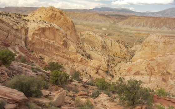
Not far up the canyon I made camp for the night relatively early. Though I am a full day behind, the storm looks like it has caught me. Besides, I am exhausted. By the time camp was set the sun popped out and I felt odd getting ready for bed. But I did.
16.7 miles
Day 32 – Rocky Day
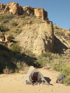 The zipper on my tent has broken along the way. Last night I was awakened twice with a big ants crawling on my face. Erg!
Once up for real I continued up Swap Canyon and made it to the spring. Just a small flow, which it looked like the cows shared, but it would have to do as I was running on empty.
The exit from Swap was a moderate climb. I was surprised to see a few cairns marking the route. Then it was a long way on the shelf above Swap, but with the cliffs of Tarantula Mesa towering above. It really was a rock wonderland with spires and balanced rocks all around. I even found some petrified wood and cool crystals.
I am moving slower today. It’s warm, I’m tired and hungry. I was hoping to get a boost when I got to the second water source, but it was no better than the 1st with just a meager flow.
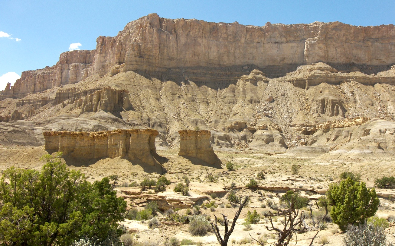
After I got over the saddle and into Muley canyon I decided to camp. I had hoped to make the tough exit climb onto the mesa today, but I don’t have the energy. One last happy note: Larabar Coconut Crème Pie bars are great!
13.4 miles to N 37.94837 W 110.93011
Original Comments
-
Ling said,
May 31, 2009 at 1:47 pm
Man! Little did we know that Whole Foods has TONS more LARABAR varieties than Trader Joe’s!!! You have yet to try, Key Lime Pie, Cocoa Mole, Peanut Butter & Jelly, Banana Bread, and Lemon Bar!!!
jarse said,
June 1, 2009 at 1:23 am
Wish I could get a Lara bar out here in Taiwan. Dude – you’re livin’ in style. L-I-V-I-N !
Daniel said,
June 1, 2009 at 12:53 pm
I’m just off a weekend dash across a section of the Appalachian Trail, 48 miles in two days, practically living off Larabars. Can’t see them anymore for a while now, but I agree they ware great before I got too much of them 🙂
Larry said,
June 2, 2009 at 10:39 am
Good luck Daniel with your adventure. Thanks for keeping Jamal posted with your expierence in this area. He’s in one of your favorite areas “Happy Canyon” right now. Jamal’s Parents
Daniel said,
June 2, 2009 at 7:42 pm
Larry – pretty much ALL of southern Utah is my favorite area …. I never hiked across it in one go – not even close – but all my hikes over the last 20yrs pieced together cover most of the ground. I won’t get back to Utah before September; following Jamal’s blog tidies me over the worst of the withdrawal symptoms 🙂
Day 33 – Sick Day
Thursday, May 28th
Got up today not feeling so great. I’m guessing the water I got in Swap Canyon is the culprit. My stomach is gurggling like something wants out! Back home it would be a sick day- cozy on the couch watching bad tv. But, not here. I must push on.
Almost right away I was scouting the route up and onto Tarantula Mesa. This is part of the Hayduke Route and I’m glad I had time to copy notes to my map because I would have never spotted this route. There are cairns, but unless you are in the exact right place to begin, you will never spot them. The climb begins with a steep ascent of a few hundred feet up a drainage gulley filled with rocks. Then there is a series of small ledges to be negotiated. Each ledge is really not that hard, but when you are wearing a big pack, several hundred feet up a steep slope, it’s kinda sketchy.
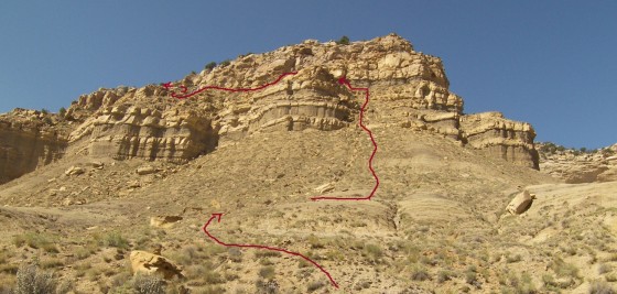
Next one must move laterally for a ways. There’s plenty of solid ground now, but below I have moved out over a sheer cliff. Again, no real danger here as the route is plenty wide, but there’s something about so much empty air below that works one’s nerves. And I’m sick!
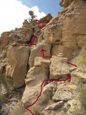 The final section requires moving up through another, chunkier cliffband. The crux is in the first few steps where I had to climb out on a boulder and push my gear up to a small ledge above. Then I must climb up onto that ledge and repeat the maneuver. This is easily the most dangerous spot. From there it’s still very steep, but there’s some room for error. I’m glad, as a little farther up, a rock I was climbing broke suddenly. I was able to catch myself with my arms, but it was painful and scary.
A little bit more and I’m on top. Wow! The view is great and it’s hard to believe one can get up that. The 1 mile took 1.5 hrs.
From there I made my way across the relatively flat land and finally found a 4×4 road- then things really picked up.
Farther along I passed a solar panel and what appeared to be a well. The water was visible on top, mostly clear but saturated with an orange algae. I was sick of cow water, so I gave it a try. I ran it through the filter and… it was good. Still sick, but at least I had better water now.
Miles pass by and finally I cross a ridge and I really feel like I’m in the mountains. The slopes rise steeply in front of me and big pines abound.
I make my way to Sweetwater Canyon, which is my route to take me higher. I was expecting a nice “sweet” mountain stream, but no- just a trickle and once again cows have been here. My well water is gone so I have no choice. Yuck.
I climb as high as I can before dark and make camp on a small ridge. The view of Capitol Reef is nice as the sun goes down. Hope I feel better tomorrow.
12.9 miles to N 38.02152 W 110.84938
Day 34 – Uphill Battle
Still wasn’t feeling great in the morning. I’m sure my body just needs time to eradicate the bug.
Had a screeching eagle circling my camp this morning.
Set out uphill through the forest. At one point I scared several large creatures ahead of me. My first instinct was cattle, but the one I got a glimpse of, through the trees, was brown and black and stocky. Could these have been the buffalo of the Henrys? Unfortunately I never got another look.
I kept climbing higher and higher now along the bottom of a dry streambed. Aspen groves begin to appear and it starts to rain. Thunder is all around me- like great surround sound. I put on the raingear and carry on.
A while later the rain picks up. I find shelter under a big juniper. Then the thunder is loud. The lightening strikes are close. I set up a shelter in the tree with my rainfly as I knew I would be here a while. Also, there is no way I’m going to be able to do the high ridge route today. I just hope to make it up to the next road.
I wait a big longer and the lightening subsides but all of a sudden the rain turns to hail and my make-shift shelter is getting pelted. The hail nearly covers the ground and I contemplate turning around and going back down. But soon it stops and quickly melts. I did manage to grab a liter of water and ice from the top of my shelter. Yum- fresh water.
With the weather calmed down, I decide to keep climbing. As I approach the ridge I see a herd of 12 deer. Looking to the opposite ridge I see more. They are all out grazing after the rain.
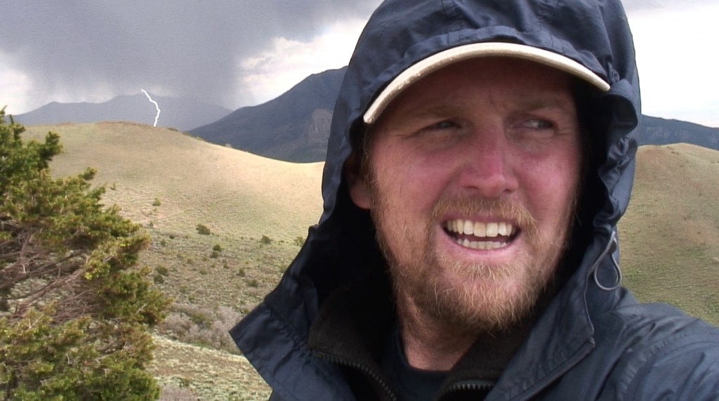
I reach South Creek Ridge and the views are great. I can see most of the reef below and the upper basin ahead. I can also see another big cloud dropping a lot of rain and producing lightening just south of me and quickly heading my way. This treeless ridge is no place to be in a storm. As quickly as I can, I head up and find the 4×4 road and take it into the basin and to the nearest trees. It has already began to rain by the time I make it there. The rain isn’t that hard and I think about pushing ahead since I’m so behind schedule. I look back at the storm and just then a triple-fork bolt of lightening hits near the ridge that I was just on 10 minutes earlier. I find a tree and make another shelter. Soon it was raining hard, then it turned to hail once again. But, after a bit, it all calmed down and I was able to continue. I could see fresh snow on the highest peaks.
The new plan was to take this small road to the pass in the middle of the mountains and cross to the eastern slopes. The road climbed higher and higher. The weather stayed nice, in fact in about an hour the sun popped out and there were more deer everywhere.
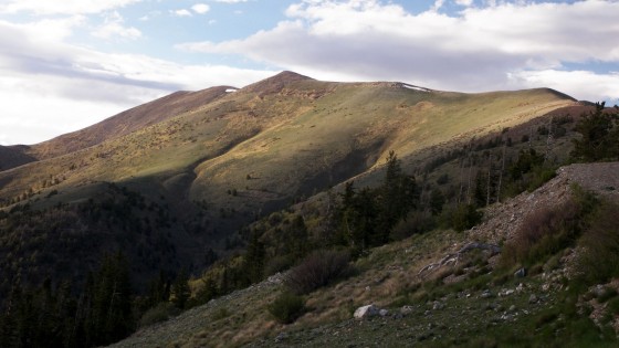
About 7:30 I make it to the pass at 10,500 feet elevation. The views are spectacular in both directions. For the first time I can see to the east. I see where I’m headed in the upcoming weeks: Dirty Devil, Happy Canyon, Lands End. I can even see as far as Island in the Sky and to a faint La Sal Mountains! Wow- I’m walking there.
I also see another big storm quickly approaching so I decide to camp at the pass. There not a lot of options but I find a somewhat flat space in the pines and make camp. I dig drainage channels around the tent then get inside and get in warm, dry clothes. It starts to rain as I eat dinner in my tent. The lightening illuminates the tent with each strike. Soon, I can tell the rain turns to sleet. It’s gonna be a cold one tonight!
8.4 miles
Original Comment
-
benita said,
June 1, 2009 at 11:59 am
Hope you are feeling better Jamal. Stay dry and we will be glad when you are home safe. Enjoy your trip. love benita
Day 35 – Summit and Down
After battening the hatches last night for the storm, it wasn’t that bad. It got cold, but it’s a toss-up with night 1 if it was my coldest night. At 6:30am I checked my thermometer and it was 38 degrees F. My tent usually stays about 10 degrees warmer than the outside temp.
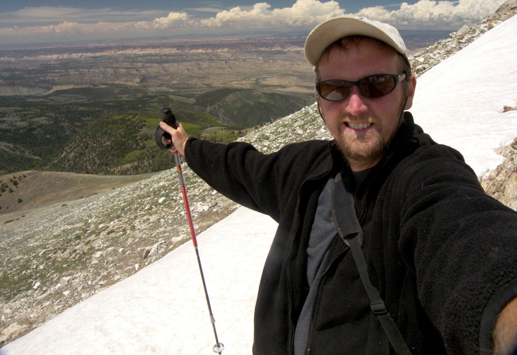
When I finally got out of the tent it was sunny and nice. I felt better today so I decided I was going to leave my gear and make a shot at the north summit. It took an hour to make the 2 mile, 1000 foot climb and I was sucking air pretty hard. But WOW was it worth it. I was standing on the highest point for over 70 miles in any direction. I could see the last 2 weeks of my trail behind me and the remainder ahead of me. I was higher than some of the clouds. Just amazing! I was just the 4th person this year to sign the summit register. But what goes up, must get down to try and get back on schedule. On the way down I grabbed some snow from one of several large snow banks and filled my bottle for ice-cold water later.
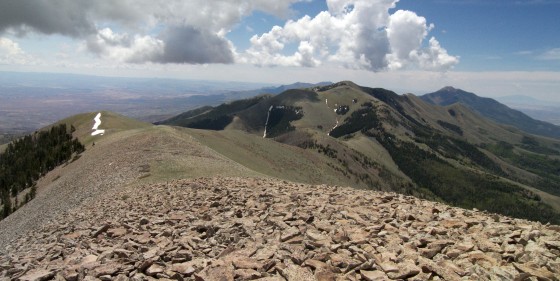
Back to my gear I headed down the mountain. There was still quite a bit of snow on the road in the forested shady NE slopes. All day it was down, down, down. Slowly features below in the distance began to have more shape and seemed more pronounced. Those farther away disappeared from view as my horizon got shorter. On the way down I passed two babbling brooks so I filled up on good water.
I was nearly out of the foothills before I saw another person- a couple in a pick-up going up to go ATVing. They were the first people I’d seen in 3 days.
Nearly down, the small creek cut through an uplifted rock formation. Here I stumbled across two stone structures and an old log cabin. An old homestead maybe?
From here I went cross country and found my way onto an official ATV trail- The Little Egypt Loop. Cool country through Chinle mudhills. Soon another storm was bearing down on me. I made camp atop a cliff where I could see Hwy 95 about a mile away. It never rained, but the gusts of wind were crazy. Re-hydrated classic BBQ beef for dinner.
18.8 miles


