From the Across Utah 2009 Trip Report
Day 15 – Mother’s Day
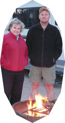 Got up and had a nice breakfast at camp with my parents. It was nice to be with Mom on Mother’s Day. They showed me some of the comments from the Blog. I can’t see these as I hike, but I appreciate them all and will read every one as soon as I finish my journey.
In the mid-afternoon, I said “So long” to my parents and got back to hiking. I reached cache #2 and all was good.
After that it was several tough miles through red sand to reach Red Canyon- my camp for the night.
9.8 miles
Day 16 – Kanab Creek
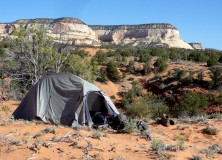 Started the day with a climb down into Red Canyon. Had to lower the pack and carefully climb down. It was more effort than it was worth as the best part of the canyon was farther up and I didn’t have time to explore.
Headed NE through the sand hills. I was dripping with sweat as it was so much work. But, I knew I would soon reach the oasis of Kanab Creek, so I trudged on.
I finally arrived at the creek and it was dry! Bone dry; not a even a pothole to be found anywhere. This made no sense to me as I had hiked this very route the same time of year 3 yrs ago and there was a nice flow even with some holes deep enough to wade into. This definitely shows how things change from season to season, year to year.
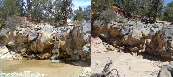
A dry Kanab changed the gameplan. What I had hoped to be a pleasant day, turned into a slow, hot day of rationing what little water I had left.
At the fork of Fourmile Hollow I decided to deviate from my route to go to a spring. It took me about 4 miles out of my way, but IT delivered water- relief!
I made it up to the dirt road and walked to the Grand Staircase-Escalante Monument boundary and camped.
17.0 miles
Day 17 – Skut Scoot
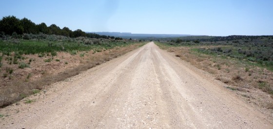
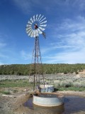 Spent almost the entire day walking along the Skutumpah Road. Only a two-mile shortcut through sage broke up the monotony of gravel and dirt. I could see several steps of the Grand Staircase as I walked: The Gray Cliffs and Pink Cliffs to the north, and the White Cliffs to the south. I had to seek out a windmill-driven well to fill up on water. My feet are sore after the long day.
20.8 miles
Day 18 – Rattle and Hmm…
The last several nights I’ve heard coyotes howling during the night. Got up this morning and quickly made it to cache #3 and re-loaded supplies. Then it was into the narrow canyon called Lick Wash. It’s a nice canyon, but not as impressive as Bull Valley or Willis canyons nearby.
By mid-day I was at No Mans Mesa so named because it is nearly impossible to get on top of. I was checking out the old Lyle Cabin when soon came along a group on ATVs- a nice couple from Miami and a local guide.
From here I went N and around the mesa. Miles through deep sand. It’s so tough walking through sand—a killer.
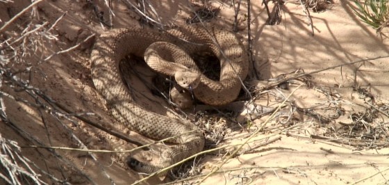
Then, all of a sudden, a noise. Someone shaking a box of Tic-Tacs? Someone playing maracas? Nope- it was a rattlesnake. He was coiled up in a bush about 5 feet away. Funny thing is I would have never seen him if he hadn’t started making the ruckus. I went over and took some pics, which made him really mad, so I backed away and watched him slither away as I did.
Then it was back to trudging through more sand as I made my way through a trail-less valley. I saw another snake- a yellow/brown guy sans rattles.
Headed up out of North Swag the view of Mollies Nipple was striking. The ground was littered which cool pieces of lava. It was ropey and smooth similar to that found in Hawaii. Some seemed to even have formed as tree molds.
Got to the top of the ridge and got a great campsite overlooking the entire Paria Basin and Deer Range Point. Chili Mac for dinner.
15.0 miles
Original Comments
-
- uncle davo said,
May 19, 2009 at 7:52 pm
Avoid the box of Tic Tacs!
I enjoy the daily posts. Love ya David
Day 19 – An Easy Day?
Had a hyper coyote last night near camp. He had a high-pitched bark more than a howl. Woke up to see the sunrise- which was really nice; then back to sleep for bonus time.
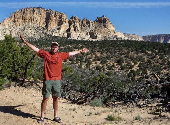
The plan for the day was to be an easy one exploring the Deer Creek drainages. The problem with that plan was I forgot to bring my notated maps for the area. I knew there were some petroglyphs and walk-through slot canyons as well as some repelling routes- I just didn’t know which was where.
Down into the first canyon I found some cool towering rock spires, or hoodoos. I also saw another snake. Not a rattler, this guy was huge- maybe 5 feet long. He was so incredibly fast as he slithered off across the sand to get away.
I got to the next canyon which was the one I wanted to descend. About halfway down I decided to retreat. It was very steep and if I had to backtrack the whole way it would have been a nightmare as it was a hot day and I was running low on water.
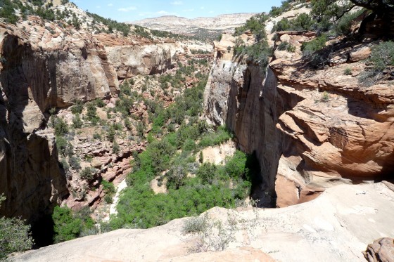
I took a short-cut back to the previous canyon and made the steep decent to its floor. I hiked down about a half a mile when I came to a dry fall with a 150 foot drop! I didn’t see a bypass so it was back up canyon and a climb back up onto the mesa.
Basically out of water I decided to make a bee-line for the Paria and hope to find a way down. Luckily I came across an old stock trail which I knew would go to the river- and it did!
Revitalized with water I decided to explore Deer Creek from the bottom. It was a nice canyon and I found the second set of pictographs I was hunting.
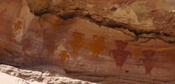
There was a register at the fork. It had a lot of bickering (to put it lightly) between 4-wheelers and backpackers. Can’t we all just get along?!
Playtime over I headed back down the Paria following its towering, chunky red walls. I found a good place to camp beside the river and called in a day. A good day- yes. An easy day- no.
13.2 miles
Original Comments
-
- Daniel said,
-
- May 17, 2009 at 12:42 pm
-
- Wow, you’re eating the miles lately … now take a big gulp of the Paria/Cottonwood mudwaters, it’s probably gonna be mighty dry for the next couple days on the Kaiparowits :). There’s lots of fossils up there – those near the jeep roads have most been collected or defaced, but since you’ll be hiking where hardly ever anyone goes, I sure hope you come upon something pristine!
ashley said,
May 17, 2009 at 6:55 pm
It must be great to walk all the way across Utah. I would love to say that i walked all the way across Utah. I bet your experiances have been great so far! I bet it does get lonely not having anyone to talk to. I hope you have a great time!
julie said,
May 18, 2009 at 2:59 pm
if u get lonely look for an old friend that goes by the name of peyote.
itll keep u busy for hours i hear.
benita said,
May 18, 2009 at 10:49 am
Hi Jamal !! TJ & I talk about your cool adventure all the time. I always comment,” I wonder how you are doing”. It is great that you can hike across UT. We are always with you in thought. Take care and be safe. Love Benita
austinj said,
May 18, 2009 at 8:59 pm
Hey jamal im in your moms class and she told us what you were doing and it sounds fun and interesting, i hope you can make it and hope you can make it in just 49 days.The stuff you said you’ve seen on your trip sounds cool and so do the pictures on here.Good luck
Masonking said,
May 18, 2009 at 9:04 pm
HI Jamal, good luck and that i might try to do it when im older have fun
Day 20 – Hog Tied
Headed down a little more of the Paria in the morning. It was easy walking, but the gnats were bad. No-see-ums they are called and they were a pain.
I saw 2 condors. They were circling me as if they didn’t know what to make of me.
Before leaving the Paria and heading up Hogeye Canyon I decided to take a river bath. It was nice, I actually washed my hair for the first time in 3 weeks!
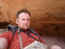 Headed up Hogeye which was really brushy at first, but then it turned into a nice canyon. Past a cascade there was a major rockfall which took some work to get past with the pack. The small stream went for a ways and it was nice.Then the stream disappeared and the canyon changed its character- it was sandy and hot.
Boxed in by the high red walls I started looking for a way out. Again- no detailed route info so I would have to find my own way. The first side canyon I tried was scenic with many pour-offs and rock spires, but no way out. Back to the main canyon I continued up through the deep sand. My second attempt at an exit was also denied. But, third time was the charm as I found a route up steep yellow and white slickrock which took me to the top of the mesa where the views were great.
Then the bad news struck: somewhere along the ascent I had lost my bandana. Nooooo! I loved that thing. I may have to write a poem- later. The sun was going down.
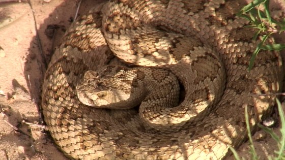
Headed across the mesa and into the next canyon I came across another rattler. This guy was coiled up out sunning himself right where I was going to walk. I actually thought it was a cow-pie at first. He wasn’t bothered by my presence. I tapped a stick near him to make sure he was alive. He was, but only stuck out his tongue to get a smell. As I walked around he slithered away slowly, never rattling once.
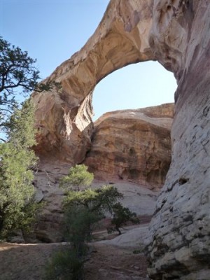 Made my way into the next canyon and found Sam Pollock Arch. Nice spot so I decided to camp within view of the arch. For dinner, my original fusion of vegetarian pad Thai mixed with sliced southwest BBQ beef sticks. Yum.
13.2 miles
Original Comments
-
- swishend said,
-
- May 19, 2009 at 1:38 pm
-
- Great trek, great blog! Losing your hankie probably means you also lost your pot holder, nose blower, air conditioner, headband, washcloth, towel, and surrender flag, among other things. Hope you packed a spare.
-
- My mouth waters for veg pad thai and beef stick. I might whip some up for the wife and me tonight.
-
- Safe travels.
-
- – Nathan
Stewie said,
May 19, 2009 at 8:08 pm
I just thought to say that this hike must be hard.
and I would like to wish you luck on this hike!
slmango said,
May 19, 2009 at 10:48 pm
Hey Jamal, Looks like you are headed in the right direction still. Hopefully you’ll find a substitute potholder! Good luck with the rest of your trip and happy trails!
Sarah and Brian
Wine Drinkers in Zion
Day 21 – Sand Sucks!!!
Got up in the morning and took some more photos, of the Sam Pollock Arch, in the morning sun. Then I headed down canyon instead of taking a cross-country route as originally planned. I was tired and didn’t feel like route finding.
Down canyon was nice. At one point there was about a 100 foot dry fall and I had to follow a scary, one-slip-you-die bypass. It was a well worn path, but I’m sure not by many wearing big packs. I met a nice group from Mt. Pleasant, UT in this section; first people I’d seen in 2 days.
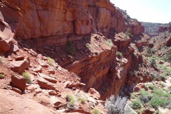
The rest of the canyon was a jumble of boulders, then I was at the confluence of Hackberry with its following stream.
 Had a quick lunch during which I was overrun by blue and yellow caterpillars. These guys seem to be everywhere out here near water. Not shy at all- several climbed right up on me.
Lower Hackberry was nice with its tall walls, big alcoves and pretty stream.
Mid-day I had to do another operation on one of my boots. Somehow sand had gotten in between the inner lining and the exterior and was causing a new blister. Once I cut out part of the inner water-proofing and removed the sand it was all better.
I got to Stone Donkey Canyon and decided to do a side hike exploration. I went about a half a mile and turned back- it was too brushy and I wasn’t in the mood to fight sticks.
About a mile farther up the stream dried up and I found myself again trudging through sand. And more sand. Deep, powder-like sand. Miles of it. I named this section “Sand Corridor of Hell”. Not sure if the conditions are worse this year, but nobody should hike through this. The scenery was nice, but no way worth the torture. It could be the most gorgeous canyon in UT, with money growing on trees and Victoria Secret models handing out lemonade… I still wouldn’t hike this route again!
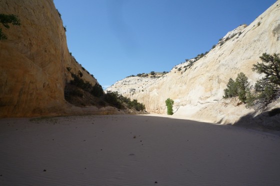
About where Death Valley Hollow enters, the canyon changes again. The sand is gone and replaced with cobble stones and dirt. Hallelujah. I hiked a bit farther and made camp. When I did I found that I had had a water leak. Had to sleep in a wet sleeping bag. Boo. At least it’s warm out.
Today I passed 288 miles, which surpassed my previous longest hike of 283 miles. I still have over 300+ miles to go before this journey ends.
13.2 miles
Day 22 – Up and Out
Broke camp and continued up upper Hackberry as the canyon walls got taller and more narrow.
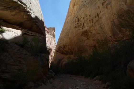
Soon after entering Round Valley Draw it became a slot canyon- still hundreds of feet deep, but narrow enough to touch both walls at once. Really nice. At one spot it felt more like a cave than a canyon.
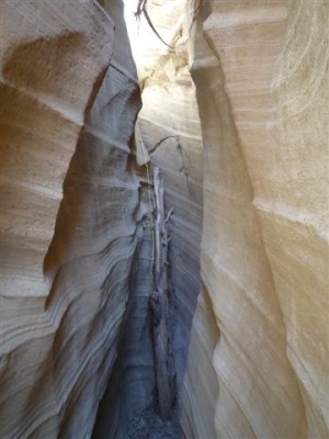
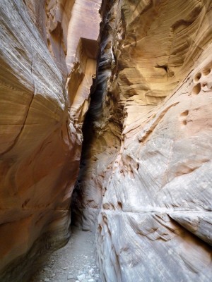 About half way through I came to a spot where a rockfall of huge boulder blocked the way. There was a rope in place to help with the climb. I had to do it twice to get up with all my gear.
A little farther up I met a family from the Czech Republic. They warned me of the exit climb ahead. Sure enough I arrived there soon and it was a challenge. Climbing the 12-15 foot exit wasn’t bad, but roping up the backpack through the tight crack took some work.
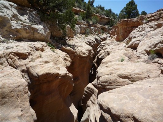
I exited the crack in the ground to emerge into a non-descript wash. I walked a ways to the trailhead which was also the location of cache #4.
Then it was a hot walk across a valley to get to Grosvenor Arch. It’s a popular spot on the main dirt road so I saw a lot of people while taking a break there. I saw the Czech family again and they gave me some extra water. I also ran into two different, very nice groups from British Columbia. What are the chances of that, eh?
There was also a chipmunk and a King Jay who were very curious about what I was doing with my SAT phone and PDA. I told them. I always talk to the animals, but on this trip I find myself doing a version of Mark Wahlberg Talks With Animals from SNL. “OK Mr. Chipmunk, say hello to your mother.”
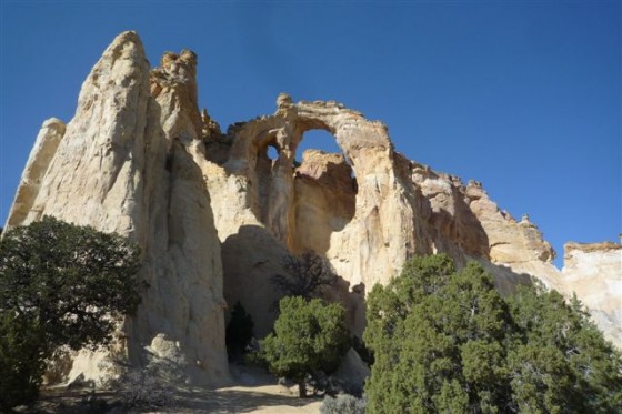
From there I headed E over the Cockscomb rock formation and onto the remote Kaiparowits Plateau. I have 3 days to get to Escalante to meet my friends who will be joining me for a short part of the hike.
Passed the 300 mile mark today. Half way there!
Slept under the clear, star-filled sky. Good stuff.
14.0 miles
Miles Contest
Now that I am past/near the half-way mark, I want to have a contest to see who can come closest to guessing my final mileage tally. No “Price is Right” rules, just closest high or low wins. The prize is something great, valued at up to $1million!!! (emphasis on UP TO — more like 20 bucks.) To enter leave a comment with your whole-number guess, on this post before end of day Friday. All comments will be hidden for this. Facebook viewers: you must leave a comment at www.AcrossUT.com to be eligible (ie not in Facebook.) Good luck!


