


The finale of Section 14 along the Hayduke Trail follows the East Rim Trail through Zion National Park from near the park’s east entrance to its terminus at Weeping Rock in Zion Canyon.
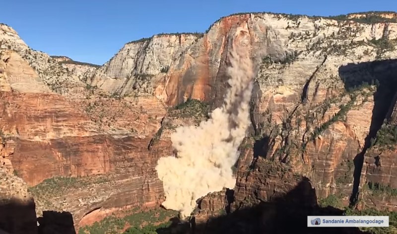
NOTE: The final section of this route is currently closed! After a rockfall the western portion of the East Rim Trail was closed making it impossible to connect to Zion Canyon this way. Read an updated post about various options to bypass closure.
Once Haydukers emerge from the Barracks and round Checkerboard Mesa, they end up at the park road in the East Canyon of Zion. The official route from here follows the wash for Clear Creek, but some might find it easier to just walk east on the road to check out the classic view of Checkerboard Mesa and take advantage of the trash receptacles there or the port-a-potties near the East Entrance.

Either way, one will soon be at the TH for the East Rim Trail and headed up the canyon toward Zion backcountry.
The first 1.8 miles up the trail are along a former road which makes its way up Cave Canyon. There’s a cool “wavey” rock along the way that almost everybody seems to take a picture of (including me!)

As one reaches the upper portion of the canyon, the trail abruptly doubles back and then climbs the cliffs to the west in a meandering fashion with good views back to the East Canyon along the way.

A little farther up one passes a big dryfall at Jolley Gulch. If your timing is right, one might see a group rappelling down this route popular with those wishing to practice their canyoneering skills.

A little farther up (4.8 miles from TH) there is an unmarked overlook just off the south/left side of the trail which looks back to the canyon. The view is back to the Checkerboard Pass route which most Haydukers will have just traversed earlier that same day (or maybe the day before.)
From here the trail angles to the right/north and cuts into a forested area. Fire damage is a common sight here as the area has been victim to a few forest fires over the last few decades.

In another mile or so hikers will top out on the mesa and then begin a slow descent. Just ahead is Stave Spring. The official spring is a very slow seep out of a pipe on the left (west) of the trail in a drainage. Note — if you first come to a trail junction for Deertrap Mountain, you’ve passed the spring, so retreat about 500 feet! The spot can be a popular location at times with backpackers/hikers looking to refill. If you find the wait too long (or if the spring dry as it was in 2009) try checking out “Not Stave” Spring which is about a 1/4 mile up the spur trail to Deertrap from the aforementioned junction. This spur trail is also the way to Cable Mountain and is definitely worth the diversion if you have the time for the incredible view and history at that overlook.

“Not Stave” Spring just off East Rim Trail
Continuing on the East Rim Trail past the junction it’s less than a mile to another junction. Here stay left when a spur trail runs out the east side of the park to the Stave Spring TH and the Zion Ponderosa (resort) area.
Within another 1/2 mile one begins to wind along the rim of Echo Canyon. There are good views down into the canyon and some decent camping near the rim.
NOTE: camping along the East Rim Trail requires a backcountry permit for that zone. It’s at-large camping, but only atop the mesa — no camping in Echo Canyon or Cave Canyon on the ascent/descent. There’s also some BLM camping outside some of the park boundary on the east side, but much of that land is private so check the map carefully before setting up camp.
Soon the route begins a rapid descent into Echo Canyon. This is the roughest part of the trail. While on the descent, eagle-eyed hikers will spot Angels Landing in the distance at the end of the canyon to the west. The famous landmark is barely visible in the center of this photo with the setting sun:

The trail can easily be lost near the bottom as many “use” trails have formed. Cross the wash and look for the official route once again heading down canyon on the north side of the wash.
Headed downcanyon one crosses two side canyons draining from the north. Here one is likely to find some seasonal pools of water. If late in the day, one is likely to hear the sound of frogs croaking away as well.
Continuing down the route the views of the towering cliffs get more and more impressive. The pines interspersed among the sandstone make for a lovely stroll.

The junction to the Observation Point spur trail leaves on the right soon and climbs the steep rock facade. This is a quite popular trail and one is likely to see 10x more people along the route from here on down to Zion Canyon. It’s popular for a reason though — it’s an amazing view if you want to spend a few hours to do the diversion.
NOTE: it’s currently at this junction where the East Rim Trail is closed and thus restricting access to lower Echo Canyon and Zion Canyon.
Continuing down Echo Canyon the impressive Cable Mountain can be seen towering above on the left. Those same eagle-eyed hikers that spotted Angels Landing from the rim can now test their eyesight again by spotting the cableworks remnants near the edge at the top.

Soon the trail comes to arguably its most impressive section as it descends into the slot in lower Echo Canyon. Some engineering was required to allow for casual hikers to get through a narrow section before emerging into the wash where it’s possible to turn around and explore the slot from the bottom.


As the trail continues down canyon, it switches to the southern side and follows above the slot as it becomes more entrenched. Then the trail climbs a bit as it rounds a knob and then abruptly comes to a great viewpoint of Zion Canyon across from Angels Landing and The Organ. Also visible is the lower portion of the trail which steeply switchbacks its way to the canyon floor.

One will pass the junction for Hidden Canyon as they descend. If it’s open, it’s also a worthy diversion (I know, I know — so many diversions, so little time!) Otherwise it’s less than 1/2 mile down to Weeping Rock and the end of the East Rim Trail and thus… the official end of the Hayduke.
Congratulations — you made it! You are done unless… do you wanna continue and see more of Zion? Or maybe hike all the way to St. George or even to Nevada?! If so… check out the Zion Traverse West
GALLERY:
-

- Checkerboard Mesa
-

- along park road
-

- the “wavey” rock
-

- more “wavey” | Zion East Rim ⮞⮞⮞
-

- eastern portion of East Rim Trail
-

- descending into East Canyon
-

- looking back to Checkerboard Mesa
-

- Jolley Gulch
-

- the unmarked overlook
-

- East Rim Trail
-

- fire damage along East Rim Trail
-

- “Not Stave” Spring
-

- Cable Mountain Ruins
-

- Cable Mountain View | Zion East Rim ⮞⮞⮞
-

- Echo Canyon Rim
-

- trail descending into Echo Canyon
-

- climbing out of Echo Canyon
-

- view down Echo Canyon
-

- Echo Canyon
-

- pools in side canyon
-

- Echo Canyon Cliffs
-

- Cable Mountain from Echo | Zion East Rim ⮞⮞⮞
-

- the slot in Echo Canyon
-

- lower Echo Canyon
-

- lower Echo Canyon | Zion East Rim ⮞⮞⮞
-

- above the lower slot
-

- near Hidden Trail Jct
-

- descent to Zion Canyon
-

- just above Weeping Rock
-

- Weeping Rock TH looking up

