From the Across Utah 2009 Trip Report
Day 36 — Into Poison
Sunday May 31st
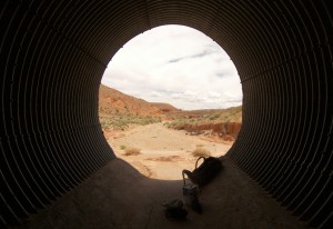 The wind continued in the morning. I followed the 4×4 road to Hwy 95 and then followed that up 2 miles to Poison Spring Wash, my next cache site. With absolutely no shade to be found, I went into the large culvert under the highway to do my re-supply. Felt like a homeless person, but in was cool. I guess I am homeless in a way!
Headed down Poison Spring which quickly turned into a nice canyon with entrenched red walls. I’m definitely back in the desert now; sand, cactus and warm temps.
Several miles down a small stream begins. With it arrives the deer flies. These little beasts dive-bomb into you and bite hard! Deet, did no good- they were killing me. I was really yelling obscenities with each bite. I finally had to break out the long pants.
Got to a spot known as the Black Jump. Here a volcanic intrusion creates a large block to the stream. The main route is S a ways and then rejoins the streambed. Instead I take a prospect route to the N along the cliffs.
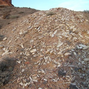 In this area I began to notice some petrified wood. Then more petrified wood. Soon it’s everywhere. It’s not the most beautiful stuff, tan and black with some red and yellow stains, but it’s all over in small chunks and chips. At one point it was if the trail was paved with p-wood. I set up my tent on top of p-wood!
Called it a night on a high point one bend up from the Dirty Devil River. I am 1.5 days behind schedule now. My plan is to try and make up a half day each of the next 3 days. Chicken a la King w/ Noodles for dinner.
Got word the Lakers are in the finals. Yay! Playing the Magic? LaBron- what happened? Go Lakers!
18.6 miles
N 38.10271
W 110.44283

Original Comments
-
Daniel said,
June 3, 2009 at 1:52 pm
I guess the deer flies there only get to snack on about one hiker per month, at best. No wonder they’re desperate … they have amazing motivational power though – I usually find myself hiking twice as fast in their presence 🙂
uncle davo said,
June 3, 2009 at 7:23 pm
Sleeping on Petrified Wood! Cool!
Hope your feeling better. davo
Day 37 – Crossing The Devil
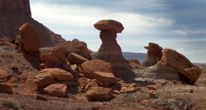 As I continued towards the overlook of the Dirty Devil it was another rock wonderland with spires and hoodoos all around. The petrified wood parade also continued. Now the pieces were getting bigger- full cross sections and small logs. The color changed too to black with dark brown with red streaks. It was similar in quality to that found in the Wolverine area. Here, outside any park, it’s legal to collect. So, my biggest challenge was deciding what pieces were nice enough, and small enough, to carry for 7 days! There were also more glass-like crystals about. It looked like the ground was covered with diamonds and pearls… oops, that game has ended.
The view at the confluence was really cool. The Dirty Devil ran dark and cut a winding inner canyon through solid rock several hundred feet below. It was hard to imagine how it would be possible to climb down. But for now, I would continue along the rim to the north. “Rim” isn’t completely accurate as I was still below the sheer Wingate sandstone cliffs which rose another few hundred feet above me to the true rim.
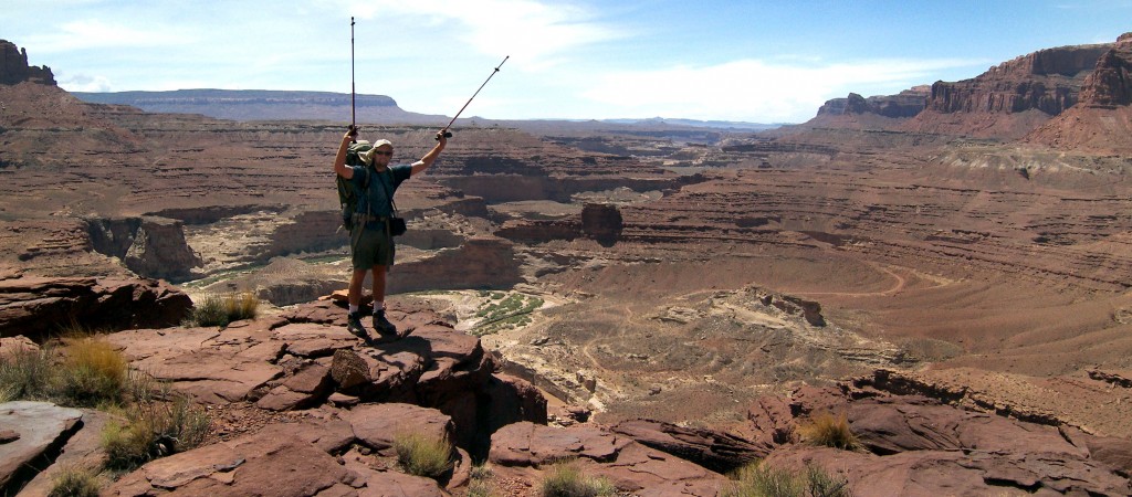
This route was slow. It was hot and I was low on water. I basically moved from the shade of one giant boulder to the next. There were no trees in this landscape.
A few miles north on a point, the slope to the river lessened and it was possible to get down. It was still steep and I had to remove the pack twice to get past broken cliffbands, but within 30 minutes I was down to the river.
The Dirty Devil is definitely a dirty one- at least on this day. It looked like Wonka’s chocolate river. I took a break here and had lunch and tried to filter water- a slow process as I had to clean the filter after each liter. I did a test crossing and it wasn’t too bad- knee deep in the middle. I also took a river bath too despite the silt-choked water. I hoped it would wash the stink off me at least.
Seemingly out of nowhere another storm moved in. The wind began to gust and it began to thunder. I knew I needed to get a move on as I was about to go through some narrows.
 I cross the river for real and head up Happy Canyon. The canyon gets narrow right away. I immediately found standing pools of water cleaner than the extra I brought from the river so I swapped it out.
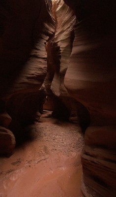
Soon the narrows turned into a slot. About that time it also started to rain- a very un-nerving thing while in a slot canyon due to the potential of a flash flood. But, I knew I’d be ok as this canyon drained from the east and the storm was coming from the west. Still, I quickened my pace a bit.
The slot really was fantastic with smoothly sculpted walls and several sections you could not see the sky above. Author M. Kelsey says the slot rivals Antelope Canyon. I wouldn’t go that far as the color isn’t as vibrant. But maybe, it was a rainy day for me, I’d love to see the slot again with some sunlight filtering down through. Definitely no crowds here that’s for sure.
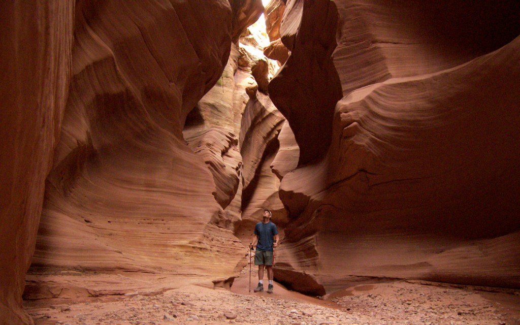
I managed to keep my feet dry all the way through, but near the end of the deep narrows there were several wall-to-wall pools. W/o the pack I may have been able to step across these, but with the pack I had to get in. I changed into my sandals and slid into the cold, thigh-deep pool. The red mud bottom was so gooey I thought I may lose a shoe. After a series of pools the canyon widens and I change back to boots.
The canyon walls become somewhat more shallow, but this slot is not done- more pools. I couldn’t believe it but the slot went on for a ways with maybe a dozen pools. It was a s-l-o-w progress in my light-weight, not-made-for-hiking, sandals. Tedious! The rain had stopped at least. At the very end of the canyon there were two 5-6 foot dryfalls to negotiate. With few hand-holds these were tricky. Short solo backpackers beware.
Soon I’m back out into open canyon and it felt so expansive. Kept hiking upstream along a bedrock ledges walled in by a cool Moenkopi formation. It was evening now and the bats were out- everywhere. Some would fly so close to me I could hear the flutter of their wings. I made camp near a formation called The Pinnacle. It had been a fun, but tedious, day.
15.4 miles to N 38.15517 W 110.34937
Day 38 – Happy All Day
It rained some in the night. I wasn’t expecting it so I had to get up in the middle of the night and put on the fly.
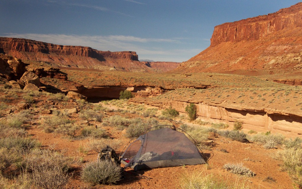
I moved up Happy Canyon pretty fast. The streambed was hard packed sand and pebbles and made for quick walking. I kept thinking of it as “The highway”. Then I got that “Life is a highway” song stuck in my head. Ug!
I passed some small pools of water early in the day as I was fairly confident there would be more farther up. I expected this to be a dry stretch, but I stumbled on a trip report online that documented a water hole from last year. (Thanks Daniel!)
When I got to the spot, sure enough there was water. I was surprised there really wasn’t that much, but with patience the 4-5 shallow pools yielded enough for me to tank up with 6 liters of water.
I like Happy Canyon. There is no liter, no cows, no ATVs and until mine, no footprints (until the next rain.) It’s a grand scene. The type of place John Ford would make a movie.
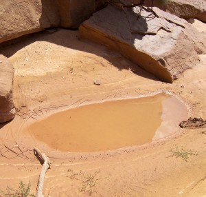 Farther up canyon I find more water. I top off what I have already consumed. I even find a little more when I turn into the South Fork.
A storm moves in again. It looks as if it could rain hard, but then it dissipated and the sun came back out- and it got hot again.
The South Fork of Happy meanders more than it shows on the topo map. I slowly made my way up toward the exit canyon.
To my surprise right at the exit canyon there was a string of shallow pools of water- the best collection I’d seen yet. I filled up yet again. Yay- less rationing!
I was nervous about the exit as I was only going by the old metric 100k map. I had no other confirmation that the route existed. But sure enough, once there a big cairn of rocks marked the beginning of the route up. I climbed to the middle bench and made camp as it was already 9:30. Ouch- 12.5 hrs on the trail today all in Happy.
Another storm moved in once I was in my tent. This one did bring rain and more lightening. Fun stuff!
Still over a day behind. Not really that bad considering I’m over 5 weeks in and the weather fiasco in Escalante. I’ll catch up soon.
19.6 miles to N 38.11392 W 110.16817
Original Comment
-
Daniel said,
June 5, 2009 at 2:59 pm
Glad you found the water..Every year is different in these canyons, and I was a tiny bit worried that you would hike in salivating anticipation, so to speak, to the water hole that I reported – only to find it completely dry :). Agree with your assessment completely, Happy Canyon is aptly named: no cows, no litter, no ATVs, just hiker happyness! I have yet to try that South Fork exit though – never been thru there. Thanks to give me yet another reason to go back :-D. And I’m also looking forward to your report on the going from French Spring down through the Maze to Spanish Bottom, that’s a hike I hope to do this September, time permitting.
Day 39 – Over The Orange
Had a decent rain during night. In the morning the sun was out. As I was eating breakfast a flock of medium-sized, black and white birds arrived in the tree right next to my tent filling every branch and raising a ruckus. They stayed for a few minutes, then took off to another tree in the distance.
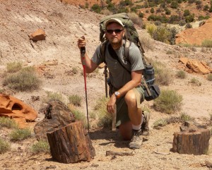 I made my way along the bench to the route to the top of The Orange Cliffs. Right at the foot of the climb was another great collection of petrified wood.
I began the climb up what actually used to be a road. I spotted the route using Google Earth and verified as a trail on some maps. It was hard to imagine anyone ever driving down this steep, narrow, rocky route.
Once on top I arrive at Lands End and there is a good view back, all the way to the Henrys. I make my way 1 mile across the mesa to the other side of The Orange Cliffs where I descend via the Flint Trail. Edward Abbey wrote about this classic 4×4 route in Desert Solitaire. The views to the east are astounding out to Land of Standing Rocks and more of Canyonlands. The La Sals are a bit closer in the distance.
Once down and on the road to the Golden Stairs I met two guys on motor bikes. The said the had spent the last 6 days in all corners the park. I began the Golden Stairs descent. I first cross what’s called China Neck- a 10-foot wide slab of sandstone which serves as a an isthmus to the farthest point of the mesa. Once across I begin making my way down the steep cliff via layered stone aka the stairs. This is another one of those “I-cannot -believe-there-can-be-a-trail-down-this” trails. But there is and after a careful hour of descending I am on bottom.
I come out near a rock formation named Mother and Child. It’s the perfect name for the two rock pinnacles one taller than the other. A small connection about half way up gives the appearance of holding hands.
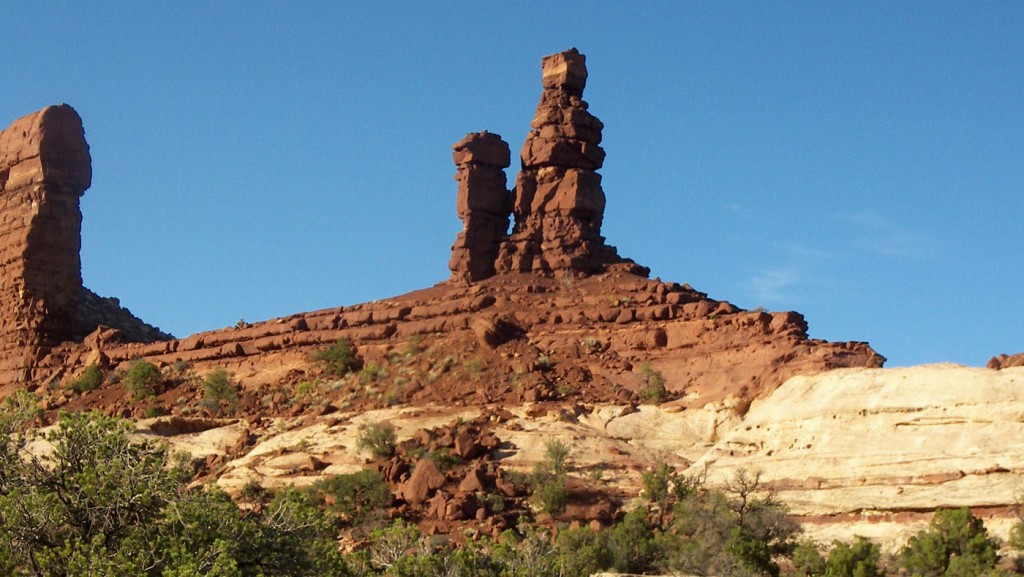
From here I make my way into Range Canyon and to Lou Spring. The is a good-sized spring developed by cowboys with a catch tank. Best water I’ve had in a while.
I climb to the top of a sandstone outcrop and make camp for the night. Great camp- right next to a 100′ chasm and splendid views back to the Golden Staircase.
16.1 miles N 38.13292 W 110.05634
Day 40 – The Fins
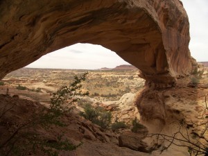 Wake up to cloudy skies. Take off and quickly arrive at the east fork of Range Canyon where I take a short side hike up to find Whitmore Arch. Unimpressive at first sight, it’s actually a nice arch once up inside of it. Looking back, the 50 foot span creates a nice picture frame for the canyon below.
While at the arch I had two swallows swooping in to check me out. These blue-green, black and white birds are common in canyon country and are always curious creatures, but these two came closer to me than ever before. I really thought the may land on my outstretched arm.
Back to the main trail I continue east. I fill up on water at Clell’s Spring then head over to Sand Trap canyon. The route on the map looks cool, but it’s really nothing special.
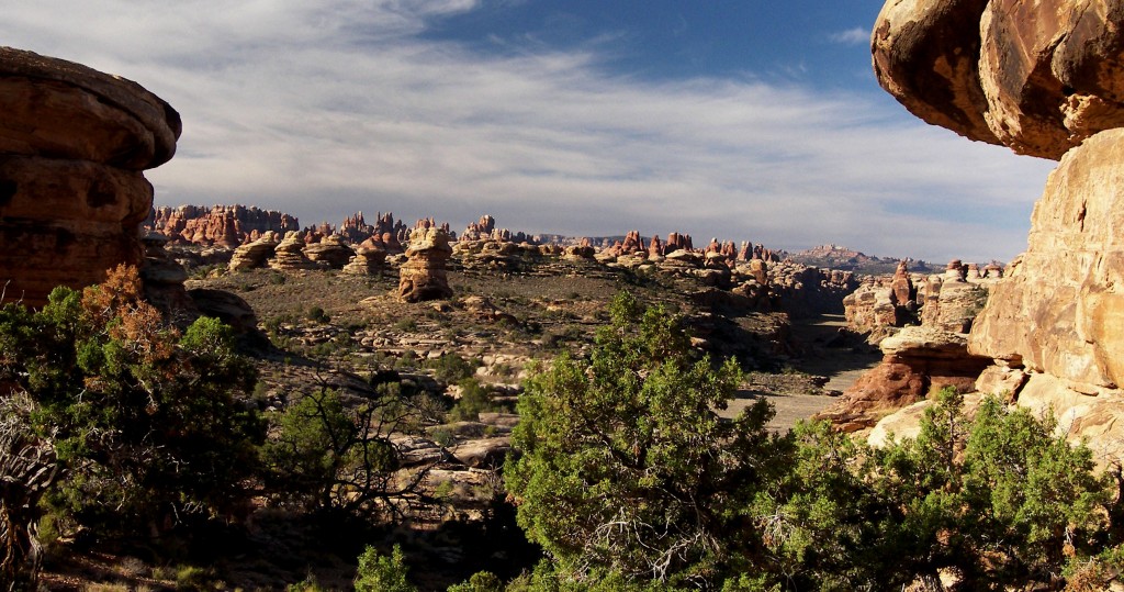
Once at Sand Trap I again head off for a side hike. Soon I am in the heart of this area’s namesake — The Fins. They are a very cool formation, much taller than I imagined- like huge stone dorsal fins stand over 100 feet into the air.
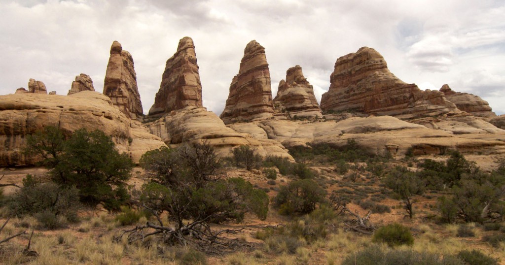
I continue all the way to Tibbett Arch. There is no getting up into this high-flying arch; or if there is I didn’t have the energy to find on this humid day.
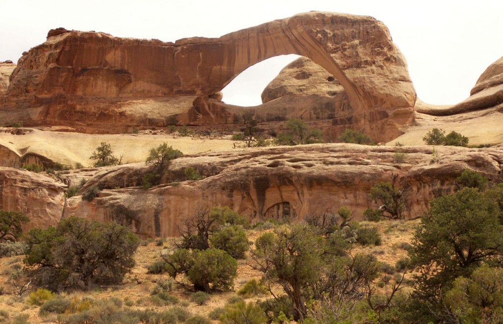
A headed back down Sand Trap Canyon and then to the east. The route over to Sweet Alice Canyon was not too sweet. Too much sand. I will say it again: sand sucks. Too hot to trudge through the stuff like bootcamp. No time to explore Sweet Alice Canyon, on toward The Dollhouse.
Nearing the Dollhouse I came across some pictographs. There were a bunch, not the best quality, but it was a nice surprise.
The Dollhouse was impressive as I remembered with its soaring red and white spires. It was 8pm by the time I was past the spires and headed down the steep trail to the Colorado River. The views of Spanish Bottom were great. It looked as if there had been a recent fire.
By 9pm I was at river level. The river was high and I couldn’t find a beach so I camped high above by some partially burned trees, but with a view of the mighty Colorado as it slowly flowed past.
15.9 miles
Day 41 – No Way Out
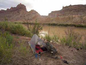 I had until 11AM for the boat to arrive which would take me across the river so I took a short morning hike to scout the river. Met some boating parties camped farther up.
Went back to the designated location to wait. Three other groups were there: a family of kayakers, some canoers and a rafting party. For being such a remote location, Spanish Bottom is a busy place!
The kayakers gave me some of their extra water. In my haste to fill up I spill about a liter into ny pack from a loose cap. The boat arrives early at 10:40. As I ready my gear, the kayakers say a rattlesnake has just killed a mouse and is swallowing it whole not 30 feet away. The boat is waiting for me though so I don’t check it out, but instead hop aboard and get my ride across the river. After the 5-minute ride I am across to the other side almost directly across from where I camped. From there it was up river along the bank of the Colorado. Frequently I couldn’t even see the river for the thick brush along its bank.
About an hour later I arrive at the confluence of the Colorado and Green Rivers. This is one of those places that I’ve wanted to visit for a long time, but never had the chance. Most see it from high above on the rim via Jeep trail or dayhike. The confluence is known for the two mighty rivers of different colors coming together. Unfortunately today both rivers are running brown- probably due to recent storms. There is only a subtle difference in shades of the two.
I continue up river to my exit route- an unofficial trail up a steep side drainage. I’m always a bit nervous about these “unofficial” routes. I arrive at the appropriate 2nd drainage and it is nothing more than a 50′ dryfall- not going up that. So… Maybe the author meant the2nd passable drainage. I continue up the river to drainage #3.Right before the third drainage the river pinches the cliff and I have to fight the brush for a ways. It was so thick the final 30 feet took me a half an hour to get through. Being close to the river gave me a chance to grab a liter of river water for reserve.
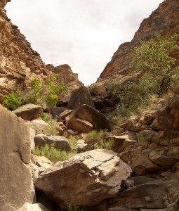 When I finally break through to the drainage I find a steep gully filled with giant boulders. There are no cairns or route markers, but it looks climbable so I figure it must he the way.
I make my way up over the first set of big rocks. Realizing it will take a lot of climbing I stop to re-org my gear. Camera and water bottles go inside my pack so as to have nothing smash against the rocks or fall out. At this time I realized I have lost one of my sandals which I keep bungeed to the back of my pack. The brush! I leave my gear and climb back down and go back through the worst of the brush. No luck- the sandal is lost. :(I return to my gear and continue the climb up. It’s a slow, tedious process climbing up the boulders. Some of the medium-sized ones shift beneath my feet requiring more focus. The last thing I want is Aron Ralston: Leg Edition.
I climb higher and higher on ledges my mother would not approve. It bothers me as I dont know for sure this is the correct way. The top wall is in view now and looks impassable, but the canyon turns in a way my view is partially blocked. So I climb higher. I climb 40 feet from the top before I can see the full view- dryfall! I’m stuck!
I had already considered plan B. Instead of going back down, I decided to walk the contour around the point of the canyon and back to the second drainage which looks less steep on top. So around I go walking laterally along the steep incline. The bonus is the view of the Colorado far below. I make it around the point and into the second drainage. I consider camping as its getting late, but decide to push on as I want to know if I can escape.
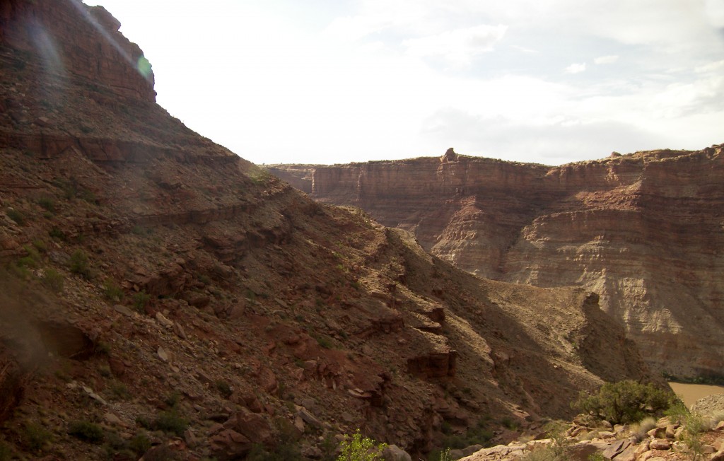
I lost a lot of elevation in the contour, so I have to begin climbing up again. This canyon also turns at its head so once again I cannot see the top. 45 minutes later I’m at the top, and I’m devastated to see another dryfall. Now what? Contour to the next drainage? Go all the way back? As I ponder I notice a rockfall on a side wall. It doesn’t go to the rim, but it get close. Maybe I can climb it, or stack rocks to get a boost.
I climb down and then over to the rockfall. Once on top I see it’s only a 5-foot ledge and an easy climb. Yay- I am out of the canyon! It’s almost dark so I find a camp nearby with great view of The Needles. It’s not the zone I’m permitted for, but it’ a special case. Besides, tomorrow is Saturday so the rangers are probably too busy getting ready for Junior Ranger day tomorrow to care! (See earlier post of Day 10.)
11.8 miles
Original Comment
-
Daniel said,
June 8, 2009 at 4:30 pm
Grin .. that’s what makes a good desert rat! I guess hiking up the perfectly nice trail through Red Lake Canyon was too boring and ordinary, because everybody takes that well marked route from opposite Spanish Bottom up to Chesler Park? I sure like your style :-D. Two years ago, I found a way from White Crack on Island in the Sky down to the confluence .. together with your exit up into the Needles, this opens interesting possibilities. We’ll have to get together one day, and swim across that mighty river while dragging our packs bobbing behind us on an inner tube :). Disclaimer: If you are an insurance agent, disregard the previous text. It is only a metaphor.
Day 42 – On The Edge
Woke up to a nice sunrise over the Needles. Minimal breakfast today. Because of the tough time getting out of the canyon yesterday I’m now running extremely low on water. I don’t expect to find any until I get to my cache near the end of the day.
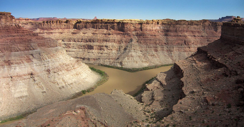
First thing I headed out on a side hike to Confluence Overlook. Along the last section I notice Hot Tamales candy dropped along the trail. I contemplate dusting them off and eating them, but think they will only make me more thirsty. Once at the edge the view of the canyon was great. I was hoping the elevated view would extenuate the difference in color of the two rivers. However, no such luck. But, it was cool to see two big rivers join and become huge. I didn’t fully grasp the magnitude down at river level yesterday. It was also cool to stand on the precipe of such a great canyon, where the walls fall away several hundred feet in a sheer drop, and NOT be closed in with guardrails. Nice. But, I do somewhat worry about the absent-minded kid who was dropping his Hot Tamales on the hike here.
I return to my gear and begin the hike to Elephant Canyon. It’s a fun hike forcing one to climb up, down and over a slickrock playground. I’d enjoyed it more if I had had ample water. I was rationing my last 12 ounces at this point. It’s such a terrible feeling to be thirsty and not have water. 10x worse than hunger. It’s mid-day and very warm. However, I realize I am lucky as this time of year it could easily be 10, even 20 degrees hotter! I trudge on.
I get to Big Spring Canyon- it’s dry. The spring is farther down canyon. The scenery is spectacular with stone spires everywhere, but I am out of water and only care about getting to the trailhead at roads end where I hoped to find some people with water. I do. I get 1 liter from a family in an RV. I walk half a mile to popular viewpoint and get more water from another family. Yes!
Now I must decide whether to walk the road, a ways out of the way, or take the shorter route through a canyon which I’m not sure is passable. The topo looks good, but here in Canyonlands one topo line can easily mean a 40-foot sheer cliff. But, I see the magic word on the map which makes me gamble on the canyon: spring. Yay- more water.
I get down into the canyon without too much effort. I walk a ways along its sandy bottom before coming to the spring. Suddenly the sandy, sparsely-vegetated canyon is transformed. Now there are trees, reeds and ivy. I actually have a tough time getting through the brush to the small stream. I pull out a gallon to filter and take a long break under a cottonwood tree. I had no idea if I could get out the other side of this canyon, but at that very moment it didn’t matter- life was good.
Back on the move I get to what appears to be the only way out. I round the bend and find a 40-foot dryfall. Blocked! I scan the side walls and spot a talus slope which almost reaches the top. At the top of the slope is a stack of rocks- some other hiker has done what I thought I would need to do yesterday. I go up and make the escape climb. It’s a sketchy climb on the wobbly stack of rocks up onto a small ledge from which one can side-step along the edge and then step up to a bigger ledge. I’m glad I’m tall- otherwise I wouldn’t have made it without putting more rocks on the Jenga pile!
I cross the next ridge and make my way over to the top of Lower Jump of Salt Creek. Wow- that’s a dryfall. The streambed just plunges some 200 feet to the canyon below. The entire canyon is enclosed with sheer walls.
I’m not one to get vertigo or be afraid of heights, but this one got to me. As I approach the canyon I’m on a perfect point where I can see the chasm on both sides. I’m a good 3 feet from the edge; a safe distance I surmise. I notice a rock to my right which juts out over the canyon’s sheer wall. Wow! I think how cool it would be to pose on that rock with that perfect angle which makes it look that much more dangerous. I’d stand 5 feet back for that.
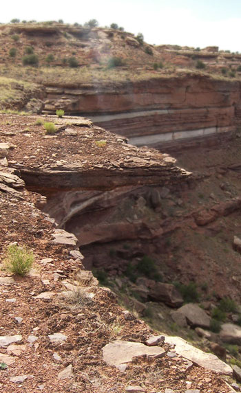 That’s when it hit me! That rock was the same formation I was standing on! I wasn’t on the perfect “point” of the canyon… I was 3-feet from the edge of a platform extending 10 feet out over the canyon’s edge! Beneath where I stood wearing my 40-pound pack was some dirt and grass, approximately 24 inches of bedrock and then nothing but air for about 200 feet to the canyon floor. I back away slowly, got back to connected ground and sat down almost got sick.
I don’t think I’ve ever been so affected. The daredevil picture will have to be PhotoShopped because there was no way I was going back out on that ledge.
Moving past Lower Jump I arrived at cache #8. It was good to get a re-supply as I was running low of the essentials needed to continue. I make my way into Indian Creek Wilderness and camp for the night.
What a last two days!
16.1 miles to N.38.23598 W 109.78680 (Note: I passed 600 miles today!)


