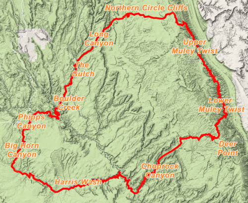
 Spring 2016 definitely didn’t turn out like I imagined. After months of planning, I scrapped my “Bryce to Canyonlands” itinerary due to a lingering ankle injury as well as schedule complications. Then more logistical conflicts doomed plan B as well. After Plan C seemed less than ideal, I ended up setting out on an abbreviated route inspired by the first “Big Hike” I’d ever dreamed up. Back in 2004 I sketched out a route weaving in and out of canyons in the upper Escalante drainage. The planned eight-day route would clock in at just over 100 miles. At the time I remember thinking “How awesome would it be to hike 100 miles in one trip?!” That trip never happened, but the planning process inspired my 2006 Grand Staircase/Escalante Hike which logged close to 300 miles and initiated my love for long-distance hiking in southern Utah!
In early May I set out on what I would call the Burr Trail Loop Hike. No, the plan wouldn’t follow the historical Burr Trail Road, but instead make a 200-mile loop around the canyon country that the Burr Trail dissects. That plan got whittled down due to slower-than-expected mileage per day, but it still ended up being a good 9-day, 153-mile trek though some great canyon country.
FYI: a Route Map and Hi-res Gallery are available as well as the Hike Video!
.
Here’s the detailed day-by-day report:
Day 1 — May 1, 2016
After parking the Jeep on Little Spencer Flat Road (aka Old Sheffield Road), headed down into the drainages leading toward Big Horn Canyon. It was nearly noon on a chilly, overcast day by the time I began hiking. I intended to go down the North Fork, but was hasty with my map reading in the wind so I accidentally went into the Main Fork. Both routes are good so it was no big deal. There’s one minor dryfall in the Main Fork which requires some careful steps to get past. There might be a longer bypass as well, but it’s likely more effort than necessary.
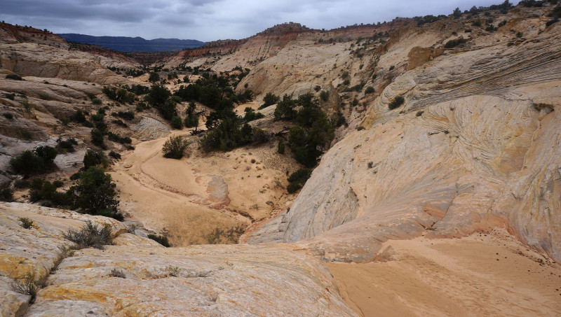
As the main fork meets the South Fork the canyon forms a mini slot which is fairly easy to get down in. A little farther down is another crack/slot which proved skinnier than I thought and I got temporarily stuck with my pack. Nothing that a few strong tugs couldn’t dislodge. Soon the canyon truly slots up for a short stretch and I was met with some pools of water. It looked possible to power through without too much effort, but with the cold temps, getting wet didn’t sound too enticing. So instead I climbed up and looked for a bypass on the western rim. The rim route afforded good views of the slot and the canyon as it opened up.
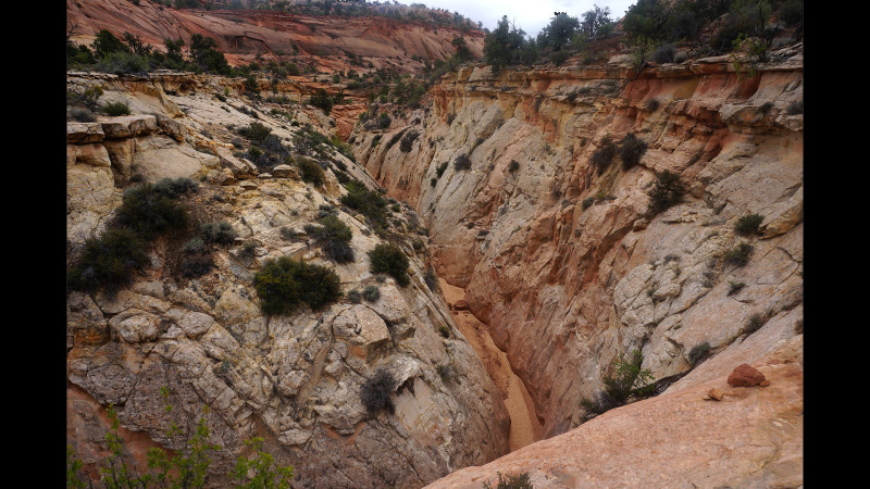
Unfortunately there wasn’t an easy way back down as the slickrock walls rounded off in a steep descent. Too sketchy for Day 1! So, I had to retreat and descend back into the slot and cross to the eastern side of the canyon. Following this rim led to an easy way back down into the wash downcanyon.
A little farther down the canyon slots up again at a big dryfall. This one was also easy to bypass. I did so via the west side, but both sides might work.
Soon the main drainage forms a shallow, narrow slot cutting through the slickrock. Though it’s never really deep, one is really walled in here. However, in a few spots the slot opens up to where it’s possible to get out and view the wonderland of colorful slickrock around you. The slot continues for about a quarter mile with several spots so narrow a big pack barely squeezes through.
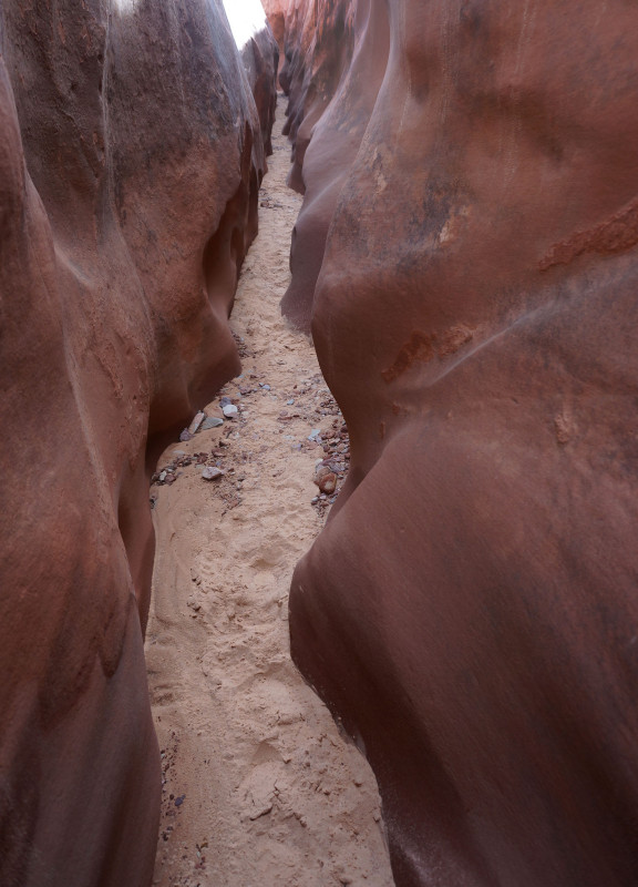
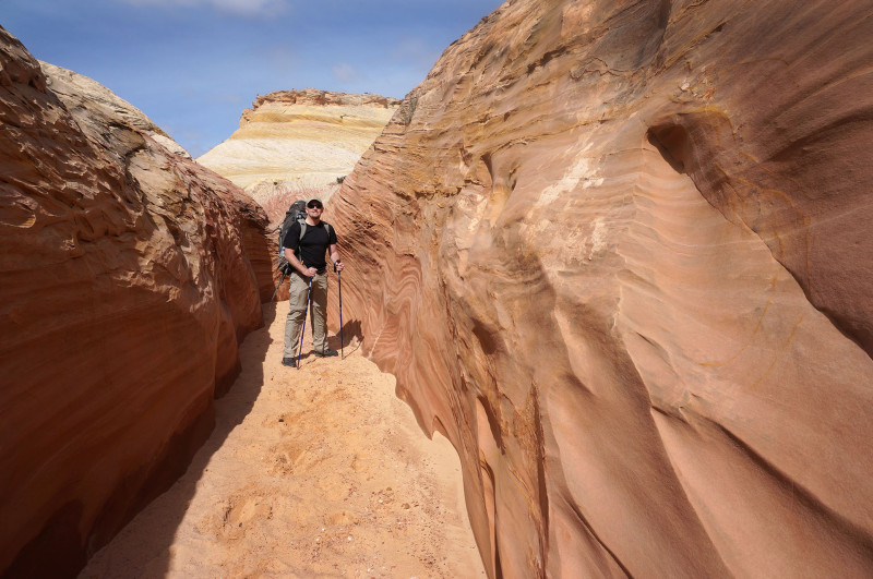
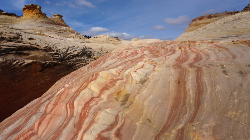
Once the canyon opens back up wide, one will soon come to the junction of West Fork of Big Horn. This should be considered a mandatory diversion as the lower end of this canyon includes the best slot in the entire drainage. Drop your gear and just walk up the canyon 10 minutes past the colorful slickrock “wave” and into the slot. Depending on the season there is likely to be some pools of water inside. Most can chimney over, but at times it might be necessary to get wet. The slot gets pretty skinny, but without any real obstacles before it opens up again in about 200 meters.
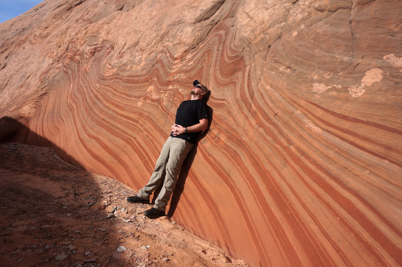
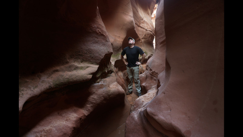
Returning to the junction and headed down canyon one quickly arrives at the confluence with Harris Wash. A hanging fence spans the wash to the west.
Headed down Harris Wash was fast walking. I followed cow trails across many of the meanders. The side canyons to the north looked inviting, but I didn’t take the time to fully explore. One striped spot not too far off Harris demanded my attention however.
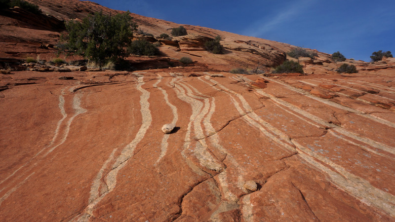
Late in the day I decided to pass Zebra Canyon knowing that it would likely be flooded and getting into water this late on a chilly day would not be a smart idea. I camped not too far down canyon and would assess my plan in the morning.
DAY 2
Though still fairly chilly, I awoke to sunshine. This was enough to convince me to go ahead and do the side-hike back to Tunnel and Zebra slot canyons. Arriving at Tunnel I found it was flooded as expected.
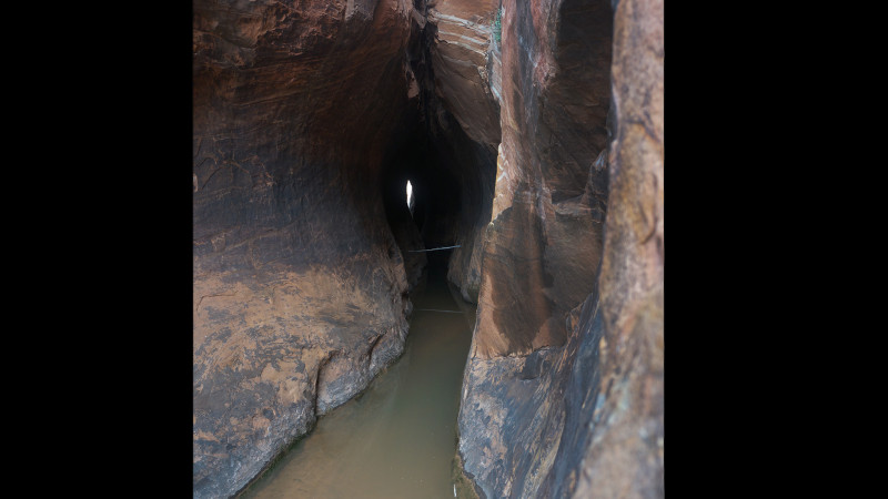
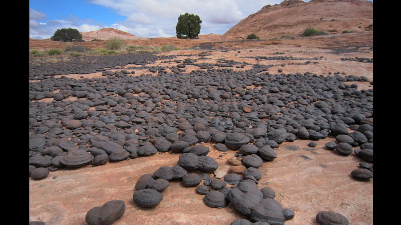
I decided NOT to go through the water but instead climbed to the rim and walked above it hoping to connect to the “backdoor” route to Zebra. Unfortunately, from the other side of Tunnel there is no way back down into the canyon. So instead I walked around the high point enjoying all the slickrock and Moqui Marbles along the way before connecting with the route near the pass and descending into the Zebra drainage.
Walking up to Zebra I was expecting it to be flooded as well. Sure enough… and it looked deep. I went back and changed my shoes and dropped some of my gear before heading back to the water. It was quickly above my knees and getting deeper. I backed out and contemplated bailing on the plan; after all I’d seen Zebra before. But… I couldn’t leave. I was here and only a few hundred meters of frigid water separated me from a beautiful canyon. I got back in and pushed on.
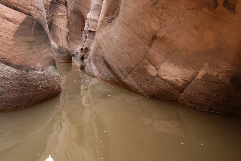
Did I say it was cold?! More like it was FREEZING! It seems unnatural that the water could be so cold. Soon it was above my waist. That was almost a show-stopper, but I pressed on slowly trying to find high ground as I slithered my way up the narrowing slot. Then the water was up to my chest. Slow deep breaths! I was ready to swim, but REALLY hoped I wouldn’t have to. And luckily… I didn’t. As the canyon got more and more narrow, the water became more shallow. Just before the best part of the canyon (the last 100 feet), I stepped up out of the water onto solid rock. My legs/feet burned from the cold water. I hopped around for a moment trying to warm up my core temp. Once stable, I enjoyed the canyon.
With only my wet/sandy Crocs on my feet, I wasn’t able to climb up into the highest perch of the canyon before it ends at a dryfall. This is the best photo spot, but unfortunately I’d have to settle for the lower angle this time. No tripod either, so my photo options were limited, but it’s still easy to get nice shots in here.
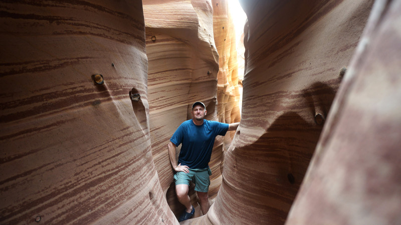
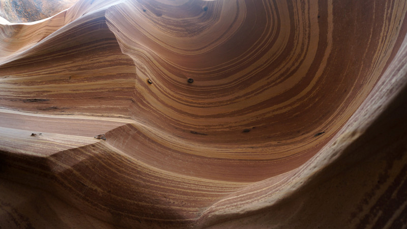
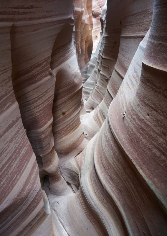
Headed back out I was not eager to get back into the water, but I was very eager to get out and into the sunshine. It was a quicker trip going out since I knew what to expect. And though much of the slot was now bathed in sunshine, it was still cold.
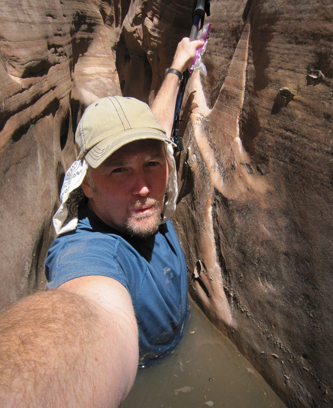
Soon I found myself free of the water and trying to warm up in the full on sunshine. Once out I ran into three other hikers sitting at the entrance of the canyon. They had already decided that they were not going to attempt the water and when they saw me wet up to nearly my shoulders they said it confirmed that they had made the right choice! As we spoke for a bit, my teeth began to chatter and my body shiver. I knew it was time for me to get hiking to build up some body heat so I wished them well and headed back down the canyon. Within 5 minutes of walking in the full sun I felt fine.
Below Tunnel Slot is a nice section of canyon I refer to as Upper Harris Wash. Water begins to flow and the canyon becomes entrenched as it cuts through the Navajo Sandstone. It’s not as impressive as lower Harris Wash, but it’s a nice reprieve from the open dry canyon farther up/down canyon.
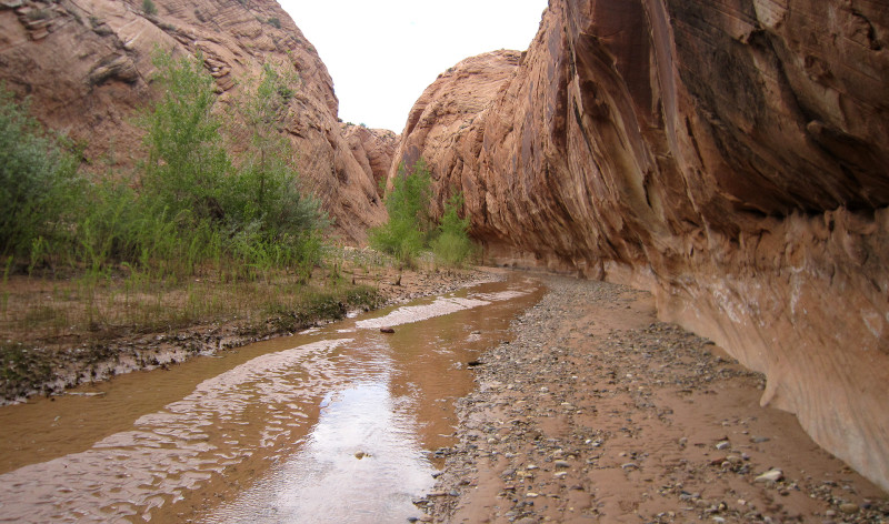
After the canyon opens up I ran into some cows. They were mostly congregated around the wash, so I angled up and towards the road and then followed it for the last mile or so to the Harris Wash TH. From here I began the long walk down a flowing Harris Wash.
Along the way I didn’t see any other hikers, though I heard a rowdy bunch as I began looking for a place to camp late in the day. I kept going another mile or so to ensure I wouldn’t hear the hooting and hollering at my camp. I camped at a spot where it looked possible to climb up to the northern rim of the canyon. I know Allen writes about such a location, so this must be it.
DAY 3
Continuing down Harris Wash I noticed that the quicksand was worse than years past. Even though I’d taken notice of this fact, I still got surprised at one bend where I quickly fell in past my knees. It’s such a disconcerting feeling when this happens. I like to carry my day’s maps in my pocket and they unfortunately got soaked as I tried to distribute my body weight to ensure I didn’t go in any deeper. I still maintain that the quicksand in southern Utah is not a real danger even though it can be scary. The people who I’ve seen get really stuck seem to have brought the situation on themselves as a challenge or attempting a fun photo.
The lower part of Harris Wash is a classic Escalante Canyon — nice streaked walls, huge undercuts.
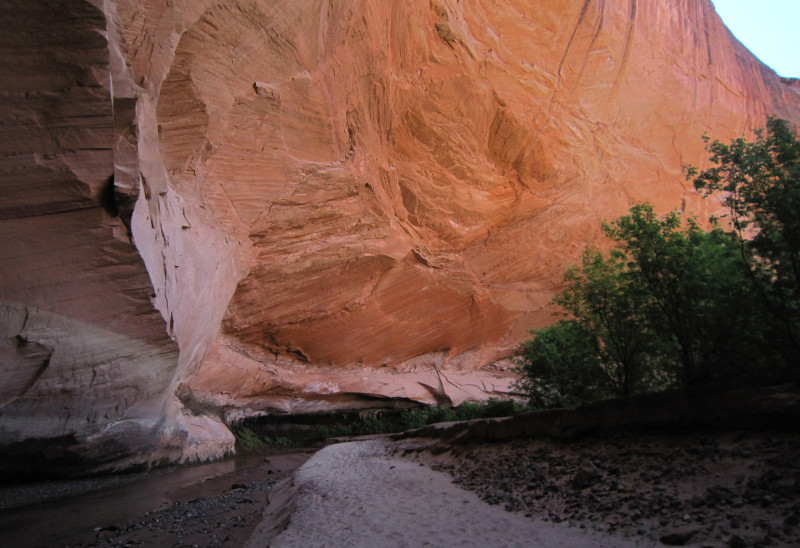
Before long I was at the Escalante. I’d already missed the spring run-off, so the river was only about knee deep and fairly clear making crossings pretty easy.
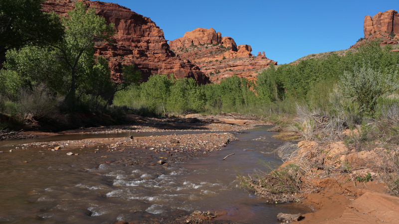
As I headed downriver I often walked the corridors behind the brush which lined the river. This made for fast travel as trails have formed via the many travelers in the area (though I saw nobody.) However, with each bend of the canyon, the trail seemed to dissipate as people sought different spots to cut through the brush. Finding the best way was often a tedious process of trial and error. I would fight through the brush for several minutes only to find that I’d emerged at a steep bank above the river. This is a common occurrence as the Escalante channels in along much of its course. Thus, I’d have to back out of the brush and try and another spot a little farther down or up river.
Four miles of this process finally landed me at the mouth of Choprock Canyon were I would make camp. I’d hoped to get in early enough to make a side-hike down to Neon Canyon, but the sun was already going down and as is often the case… Day 3 energy was running low. So, I made camp and called it a night after washing off in the river.
DAY 4
I awoke to the sound of bees buzzing outside my tent. I was glad they weren’t trying to get INSIDE my tent because it would have been easy for them with my screen door held in place with binder clips (the desert is very hard on zippers!) I peered out to see a dozen or more bees on my hiking boots! There must have been something on them, maybe the moisture alone, that the bees enjoyed. My first attempt to shoo away the bees had zero effect besides making a few of the bees angry. So…. I put some extra layers and gloves to protect myself as much as possible and used my trekking poles to pick up and launch my boots into a shaded area and I ran the opposite direction. (I don’t like bees!) The flying insects dispersed at first, but a few found their way back to my boots as I tried to put them on. I ended up having to carry the boots a ways up the canyon before being able to sit down and put them on.
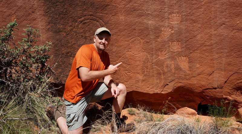
Finally with the bee-free boots on my feet, I was able to visit the petroglyph panel just a short ways up from the Escalante on a wall that faces south. Almost all rock art in this region (Freemont/Anasazi) is on walls that face south.
Continuing up canyon one notices an undercut ahead on the north side as well as a small arch high up on the rim above. The undercut is a nice place to camp. It looks to be frequented by canyoneers who do the technical route through Choprock as evidenced by a drying racks for wetsuits.
A little farther up canyon is a branch where South Fork enters on the right. I drop my bag to do the short side hike up this scenic canyon.
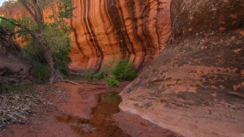
After about 15 minutes I’m at the end of the line for hikers — an impressive dryfall. This dryfall is the final rappel for those doing the technical route of Choprock.
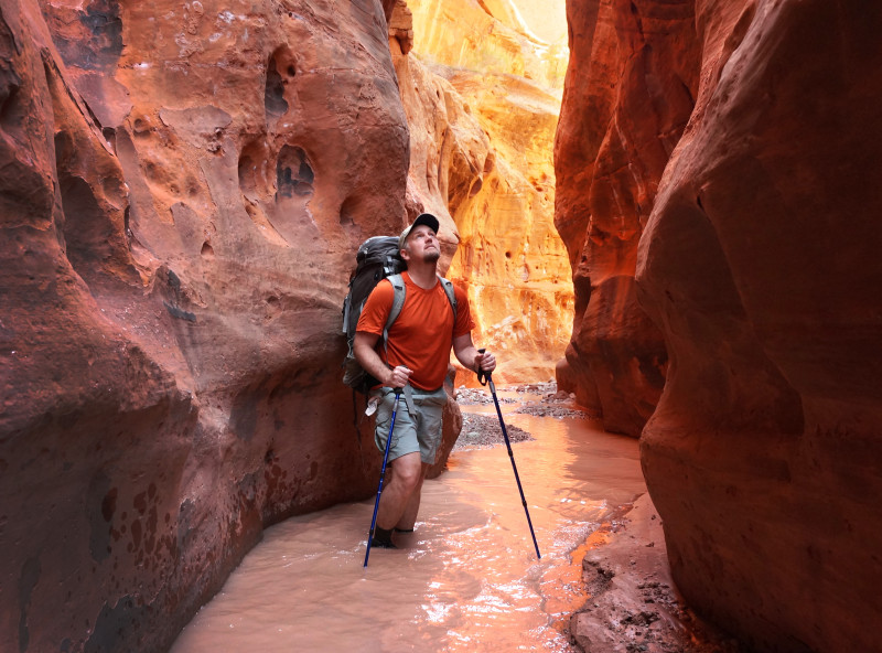
Back in the Main Fork I continue up canyon as the walls close in. The streaked walls are impressive. The water continues to flow through this section this year, though when I was here in spring of 2006 it was dry.
Soon the walls really close in and the narrows begin. Never truly tight enough to be considered a slot, but frequently the walls were only arms-length apart. The inner narrows aren’t incredibly deep and thus a moderate amount of sunlight gets in. I was there mid-day unfortunately which doesn’t make for the best photos. Early morning or late afternoon would be better for this purpose.
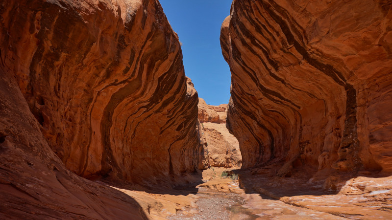
Once the narrows finally give way, the canyon opens up a bit and there are “subway”-like walls. The striped walls tower much higher than the real Subway and seem to close in at the top like a clam shell.
Just past this section look for Allen’s climbing route to access the northern rim — if you are into that kind of thing.
Then canyon opens up a bit more and then I’m surprised to spot a tent set up on the bank — but nobody seems to be around. I realize that I’m at a junction of the canyon which means I’m at the entrance to the North Fork or what author Allen calls the “Poison Ivy” Fork of Choprock. I drop my bag and set up my gravity filter to purify some water and head up the side canyon.
Only a few hundred yards up I run into a nice gentleman from Washington exiting the canyon. He was alone at the moment, but part of a group of 4 and one of the owners of the tents at the junction (I must have missed the other one.) He warns me that I’d have to get wet if I want to avoid the poison ivy ahead. OK by me — feet still very wet from the narrows earlier.
I don’t go up the fork very far — just about 15 minutes or so to check out a few big undercuts. The second of which had a nice camp spot complete with rock furniture. Nearby I also found the cover of a Hustler Magazine from 1991. Very odd — wonder who would bring it out here and how long it’s survived?
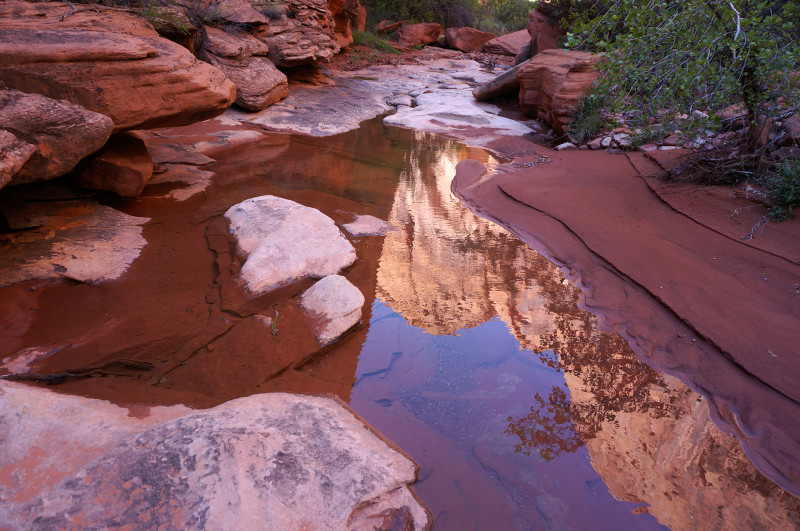
Back in the Main Fork I continue heading up canyon. The canyon widens a bit and before too long the running water disappears. Soon I spot the next junction in the canyon. I’d hoped to try and exit the canyon branch to my right, but instead I look the left branch and stayed in the Main Fork. I’d done this route before and felt it was the best option to a) find more water and b) exit the canyon by nightfall. It turned out to be the correct call on both counts as I did find another outbreak of canyon upstream and I got to the very top of the canyon just as the sun was going down. I also found the extact chunks of petrified wood that amazed me 10 years ago so I’m glad I took this route again.
DAY 5
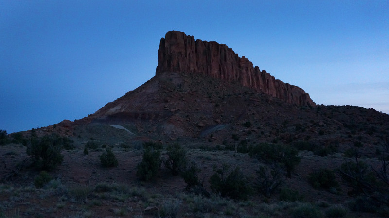
Got up and made my way over to edge of the Circle Cliffs. Just like 10 years ago, I just happened to stumbled upon an ideal place to make my way down the cliffs to access Moody Road below. From here I followed the dirt road north for about a mile to the edge of Colt Mesa. There is an old prospecting site here with a waterworks still maintained by ranchers. Once I filled up, I made my way along the southern side of the mesa.
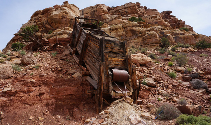
From the eastern slopes of Colt Mesa, I made my way cross-country toward Deer Point and north of the prominent point to its west. I followed a wash around the bend and was quite excited to find several large potholes of water. The potholes look like they might hold water for much of the season, but it’s hard to predict and this has been a wet season. If they are reliable though it would be a great discovery because this whole area is otherwise VERY dry with porous ground that sucks up water even immediately after a storm.
Eventually I climbed out of the drainage to the south hoping to find an old mining road that runs up to Deer Point. Sure enough, I quickly found the remnants of the road. Before the incline to the top I stumbled upon an old cowboy camp. I followed the route up and as I rounded the corner at the top, I suddenly came upon an elk. It spooked and ran away with a clamor. I never did see it again as I followed the rim and took in the distant views. Looking south I could see all the way across the Moody Canyons to the Straight Cliffs. Along the northern rim I got my first good look at the Henry Mountains. Petrified wood was everyone along this mesa.
Originally I hoped to follow this route underneath Deer Point and then down Red Slide, however in an attempt to make up time, I instead followed the old mining route back down to the lower bench and then followed it north along the high ridge of the Waterpocket Fold. The old route is barely noticeable and easy to lose as it travels through the junipers — though along the straight sections it’s still easy to spot the old cut through the vegetation.
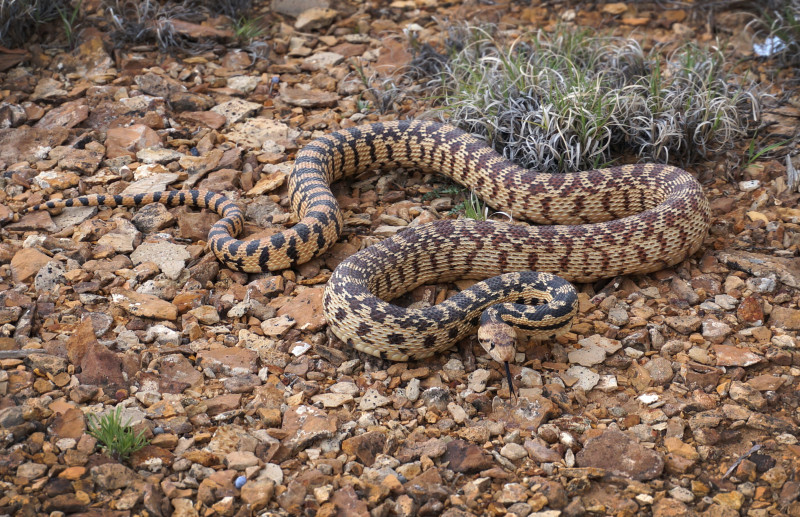
Making decent time along this stretch I drifted into daydreaming about something or another. I was shocked back into reality as a presumed Juniper branch beneath my next step coiled up and assumed the attack position of a rattler! I instinctually jumped back and was glad that a) the snake didn’t strike and b) it wasn’t a rattlesnake, but instead just a large Great Basin Gopher. After a few pics, I continued on my way with my heart still racing and now hyper-aware of every stick on the ground!
Over the high point along the ridge I saw the lower end of Lower Muley Twist come into view. The signature towering Navajo fins with a cut going through are the tell-tale signs. I’d made a similar descent 10 years ago from a little farther north and it was fairly difficult. I was hoping to find an easier route in from the south this time. Old maps even show another mining route descending in this area, but I didn’t see any signs of it.
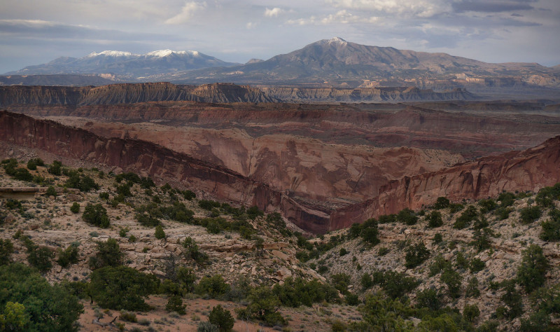
My route slowly bends downward and quickly comes to a cliff band. I was able to find a weakness where it was possible to get down — though it did require taking my pack off to ensure adequate balance. Once down the short scramble it was just matter of extremely steep scree walking to get down from the upper slopes. I’d spotted an elongated empty patch below me in flat area; thinking it might have been a part of the old road I headed that way. When I eventually got there, it wasn’t a road but just an unusual erosion pattern. I had to climb back out of the gully and down the next incline. In the distance I could see the drainage to my left and the one to my right coming together to form a sizable canyon cutting through the limestone. It was the path of least resistance, but I wasn’t optimistic about my forward progress once I got to the confluence. Downcanyon I knew it would likely slot up, and the canyon walls by that point looked challenging to climb. I pressed on.
As I got closer to the junction my legs were burning. The continuous drop in elevation over difficult terrain was taking its toll. Soon I heard frogs croaking down below. That was good news/bad new. Good because it meant water was ahead; bad because it likely meant potholes which would mean difficult progress. By the time I got down to the floor of the canyon I was beat. With the confirmed water I decided to camp nearby. I used the extra daylight to scout down farther without the big pack. Within 5 minutes I came to a series very difficult if not impassible dryfalls. Not doable by me. However, I sized up the canyon wall, and though steep, it definitely looked possible to climb up and out and continue on down the next inclined fin. Feeling a little confined in the canyon and anxious about the climb out, I decided to put the pack on and go ahead and climb out immediately instead of waiting until morning. So I filled up my water bottles and slowly climbed up and out. Back up on top of the incline I found a rare semi-flat pieces of land and made camp.
DAY 6
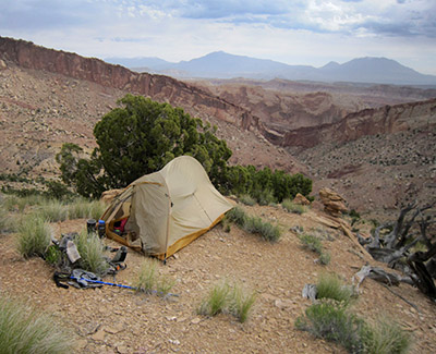 After a miserable night of sleep on the incline (no — it wasn’t even close to being semi-flat like I thought!) I headed on down toward the bottom. As a new major drainage began to form to my left, I began to worry about not being able to get down this way. If this happened it was going to be a lot of work to head back up the steep slopes and cross to next incline over. Undeterred I keep inching my way down and then all of a sudden the scree beneath my feet slipped and I started to fall. As I did I instinctually planted a trekking pole to try and regain my balance — but it was too late and my full body’s momentum was already in motion — my trekking pole bent like a bendy straw and I fell to the ground and slid another 6 feet or so. Nothing was hurt besides my pride and the aforementioned trekking pole. Back on my feet I put the bent pole between two boulders and tried to undo the damage. I straightened it the best I could and continued onward!
Soon I could eyeball the rest of the route all the way to the bottom. It continued to be steep, but I was relieved that I could see a way all the way down devoid of any impassable cliffs. Hooray. Soon I was down off the sloping inclines and back to canyon floor at the junction of the route I’d come in from the north many years ago. From here I knew the route was doable.
That’s not to say it was easy — huge boulders chocked much of the wash making progress slow. Nearing the bottom I spotted an arch up on the northern wall that I’d missed last time. It’s not easy to spot as it’s against a wall, but farther down I confirmed it was definitely an arch as I could see sky in behind it.
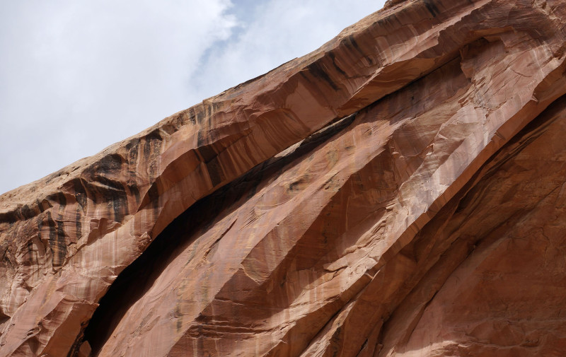
Soon after this I began to see footprints and then the canyon made a cut through the sandstone and I was out in the seemingly wide up Lower Muley Twist. Time to head north UP Lower Muley Twist to Upper Muley Twist.
There were sporadic pools of water in this part of the canyon. Not a big surprise with all the recent storms. Headed up canyon it’s just a few bends to the Cowboy Camp at the huge undercut. I once again checked out the artifacts and the cowboyglyphs. I stayed for a bit to enjoy some granola in this special place.
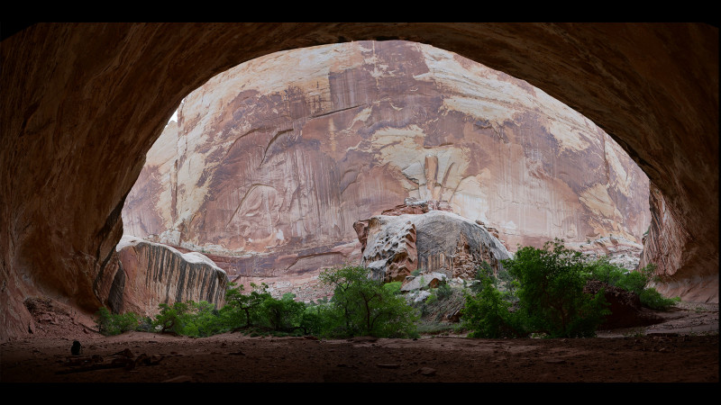
Continuing up canyon it started to rain. Distracted by the precipitation, I almost took the wrong direction at a junction and headed back up the Fold to the west. I quickly caught my mistake however and instead retreated and went the right way. I would like to try this alt route sometime though.
The rain didn’t last long and it was about then I’d noticed that the frequent pools of water from before had disappeared. There was still an occasional muddy pool, but I held out hoping for a semi-reliable pool a little farther up. Sure enough… it was there and it was a much better source by comparison. It would be the last water I’d see for a while.
Past the pool headed upcanyon I soon came to the rockfall which fills the canyon with huge boulders. There are a few different ways to climb over (or around) the boulders, but this time I spotted a “rabbit hole” tunnel as well. I tried it out and made quick work of the minor obstacle.
Just around the bend from the rockfall is another major undercut. This one is on the eastern side of the canyon and geologically speaking is likely “newer” as evidenced by the mountain of debris which remains underneath the alcove.
A few bends up is another impressive undercut. This one isn’t as tall, but it’s more impressive in a way as it doesn’t have as much debris blocking the view from underneath.
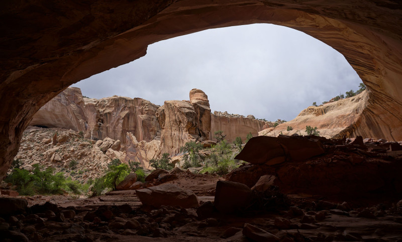
A little farther up I came to trail signs indicating a route junction. Climbing out of the canyon to the right is the Cut-off Route to The Post Trailhead and to the left my intended route up Lower Muley Twist continuing north to the Burr Trail. By chance, I just happened to be at this spot as two hikers were coming down the route from the Post and headed down canyon. They were the first people I’d seen since the middle of Choprock days earlier.
Headed up “upper” Lower Muley Twist (that’s not confusing, is it?!) I soon ran into more water. I still had plenty, but it was good to know there was more around and reinforced my belief that I would find water in proper Upper Muley Twist.
This section of trail was actually new to me. Somehow in all my wanderings through this area, I’d never actually hiked this next mile or so. It looks boring on the map so I didn’t expect much, but it was actually a fairly scenic entrenched section of canyon. It’s not as impressive as lower Lower Muley Twist or upper Upper Muley Twist, but it’s still a nice stretch. For Hayduke Hikers I think I’d still recommended the Cut-off Route via The Post, but it’s closer to a toss-up than I’d imagined.
As the sun was going down I crossed the Burr Trail road and continued up the drainage toward Upper Muley Twist. I got up near Peek-a-boo Rock before finding a spot to camp.
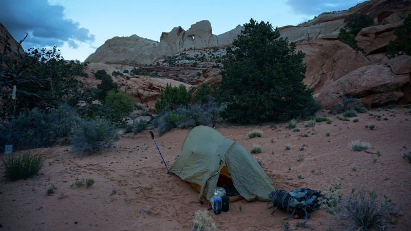
DAY 7
Woke up to another rainy day. The sun was struggling to burn through though. In fact, I saw a rare (to me) morning rainbow.
Headed up Upper Muley Twist, the first part is nothing too exciting. I stopped near the TH where the 4WD begins and hid a “reverse cache” — just a bag of trash, used batteries, etc. to be picked up after my hike. Continuing up the canyon I soon arrived at the beginning of “Arch Row” as I called it — a series of impressive arches along the canyon.
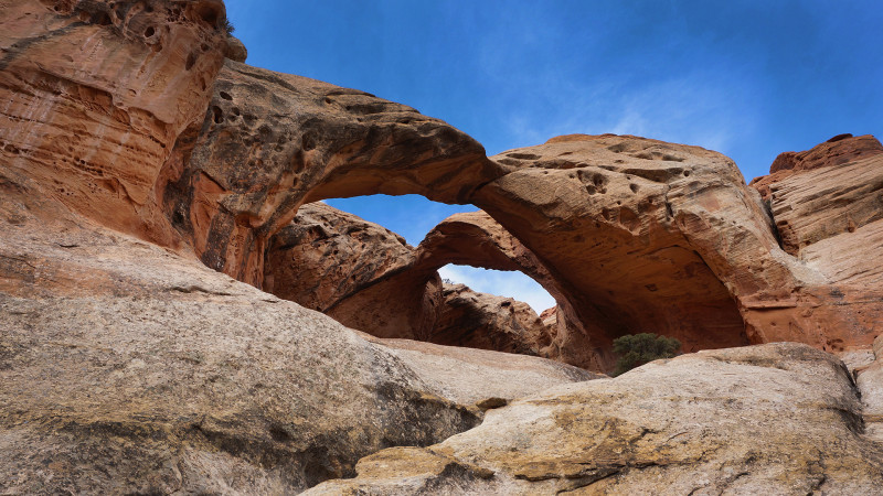
Trinity Double Arch
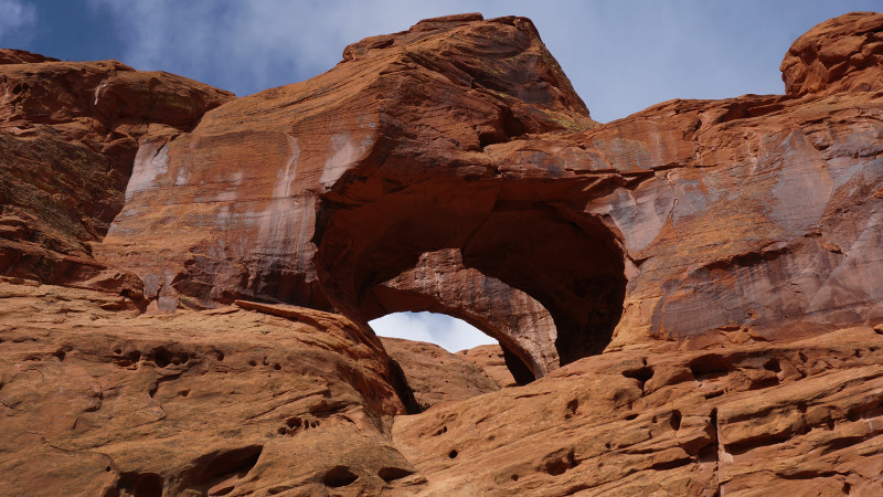
Cheerios Double Arch
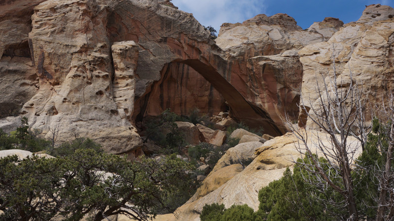
Muley Arch
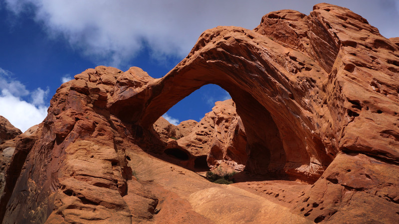
Saddle Arch
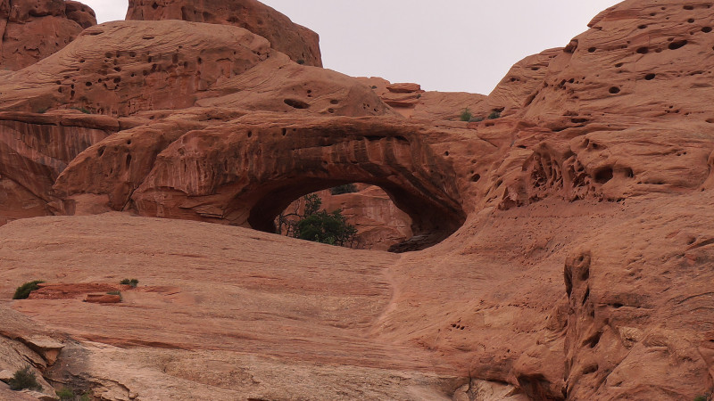
Shy Arch
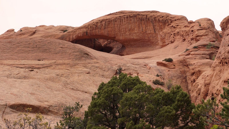
Dome Arch
In the middle part of Upper Muley Twist, I stared long and hard at the upper slopes of Wingate hoping to spot at least a portion of the large arch I’d spotted many years ago via the Rim Route. No luck unfortunately. I’d wanted to do some exploring from the bottom. The slopes didn’t look overly conducive to upward exploration and since I was hoping to make up time I instead pressed on.
I dropped my pack near Cap Arch and went on up the main canyon to explore the narrows. After a short boulder climb the narrows get fairly tight before opening back up right before a dryfall. A large pool was below the dryfall similar to 2011 (but it was dry in 2013).
I got back to my pack at Cap Arch just in time as the rain started to come down. This was the hardest rain of the trip so far, so I was glad to have the cover.
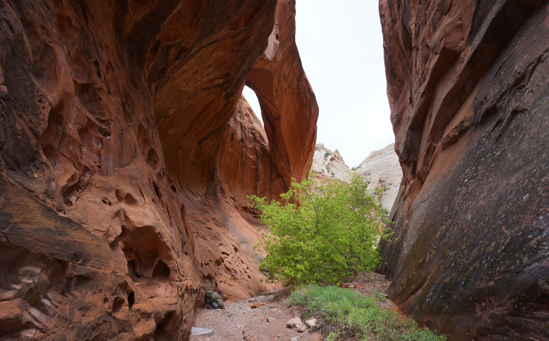
The storm didn’t last long though and so I headed up the drainage to the exit route to the west.
It’s a slow tedious climb up and out of the gully — it’s steep, but not as bad as the Lower Muley Twist gully! There are a few boulder jams which require some minor scrambles, but otherwise it wasn’t too hard to get up and to the top where I had views of the Circle Cliffs over to Boulder Mountain which was mostly hidden by storm clouds.
As I approached the Onion Beds there were a bunch of coyotes yipping and howling. I never did see any of them, but they sounded really close.
As expected the Onion Beds had water. This spot was surprisingly dry in 2013, but there was plenty of water this spring. I took a break and filled up my water. As I was stopped for a bit I realized how chilly the temps had gotten. I put on an extra layer and my gloves to stay warm. Soon I continued along the 4×4 backroad that runs to this location. Short spurts of rain would fall off and on for the next few hours.
I was going to go explore a spring the north, but with plenty of water I decided to take a more direct route over toward The Gulch. I followed the backroad for a little longer, and then went cross-country again toward the upper reaches of Horse Canyon.
Arriving at Horse Canyon I found a virtual highway of sand. I’d hoped to find some water here. Even though I had plenty, I thought it would be a good source for future travels. But I walked along the wash for several miles and found nothing even resembling a pothole despite storms earlier that day. As it got late in the day, I climbed up out of the shallow canyon to find a camp with a descent view. I enjoyed watching the fading light circled in by the Circle Cliffs.
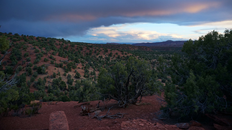
DAY 8
Woke to a nice sunny day, though temps were still cool. Fresh snow was evident up on Boulder Mountain.
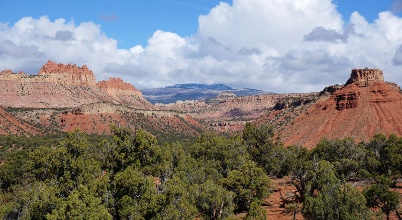
I headed back down into Upper Horse Creek — still dry even as it cut deeper into the bedrock. As the canyon turned south, I climbed out the far side to continue my westward heading. Soon I had to cross a western branch of the canyon in the same manner. Climbing back up to high ground I passed near (not over) some of the largest cryptobiotic soils mounds I’ve ever seen.
My original plan was to head northwest up an unnamed gully and to the top of Egg Canyon. From there I wanted to round the bend and descend the canyon to the south leading to the Upper Gulch. However, with time/rations running low, I decided to instead head south to the Burr Trail and take it down Long Canyon. I’m not a big fan of road-walking, but this shorter route would likely save me 3-4 hours and it’s a scenic route itself so it wasn’t a terrible alternative.
Walking down Long Canyon took several hours. I was surprised that I didn’t encounter more traffic. Only 10 or so cars passed me the whole time as I walked down the canyon and only a few of those were headed west. I found a little water along the way and also stopped at the scenic side canyon coming off of Rattlesnake Gulch Bench in the lower part of the canyon. Several cars were parked here, but I was lucky to have the canyon to myself.
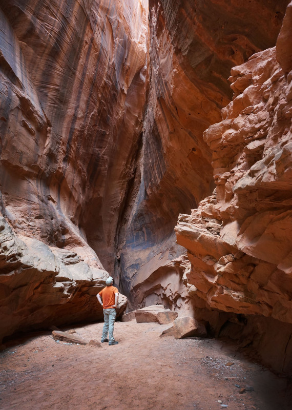
At the big bend, I left the road behind and continued south down The Gulch. I planned to climb up to the High Route, but decided instead to just follow the trail along the creek. I was making good time and didn’t feel like taking the extra time needed for route-finding along the ridge route. I was happy that this section of The Gulch didn’t smell like cows as it did back in 2012. I actually only saw one cow and it was as I climbed up into the sand dunes near the upper line shack. The cow was so skinny it made me sad. I’ll say it again… this is no place for cows!
It began to rain again as I made my way across the sandy ridge from the Gulch over to Sand Holler. With the temperature dropping quickly I expected it to start hailing, but it never did. Down Sand Holler was a trudge through the sand with one bypass where it slots up at a dryfall with a large pool below. Soon I was climbing up toward the saddle which leads to Boulder Creek. En route I was fascinated by the basalt rocks (aka lava bombs) littering the landscape including many precariously balanced on the underlying sandstone.
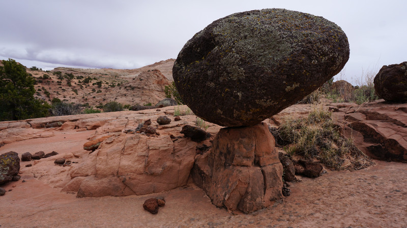
Once atop the saddle I didn’t linger too long as the chilly wind was channeling through the pass. I dropped down the sandstone landscape following the chain of huge tanks along the way down. It was pretty late by the time I got down to Boulder Creek so I sought out a place to camp. This was more of a challenge than expected as there were surprisingly few flat spots in this area and none that I could find with good protection from the wind. I made due, though had to get in my tent as quickly as possible to ensure the wind didn’t blow it away! Final night on the trail.
DAY 9
Got up and headed up and over the pass which bypasses a big bend in Boulder Creek. Last time through here I’d followed the creek the entire way and it’s a slow route. After doing some research I’d noted this shortcut on my maps and I was excited to check it out. It’s a scenic walk with good views of the colorful slickrock landscape and again more basalt boulders littering the ground.
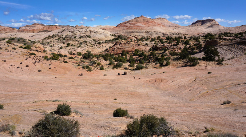
The slickrock steepened as I neared the return of Boulder Creek. A tough climb down put me on a bench above the river which is where I realized… there was NO WAY DOWN! Ug…I remember when I noted the shortcut I was surprised that there was a route though this section as so much of the canyon is entrenched along this stretch. I’d have to retreat. Unfortunately… I cannot find WHERE I saw this shortcut noted. I thought it was Kelsey at first, but upon review I don’t think so. Allen seems acquitted as well. So… TBD, but I can adamantly say it’s NOT possible.
Read more about the above fiasco in a follow-up post Boulder Creek Short-cut (or NOT!).
I backtracked and got back into the water near the bottom of the narrows. The water was fairly cold, but luckily today was a warmer day overall. It’s an awesome walk down the canyon along this stretch, but it’s a slow walk. One has to be careful in the swift water over slick boulders and there are several crossing of belly-deep water.
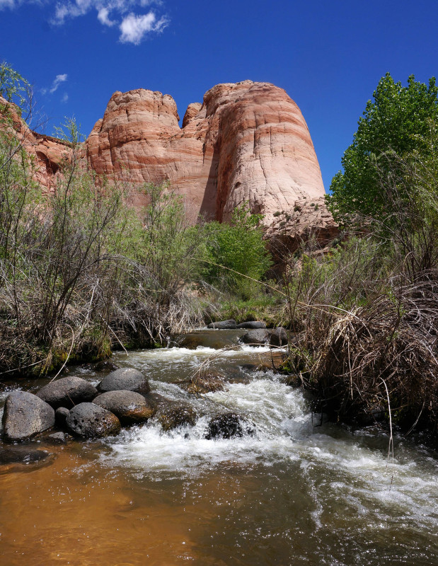
In the lower section of Boulder Creek it’s possible to shortcut a few bends via the benches. Along the biggest bend I ran into a tree that buzzed with the sound of hundreds (thousands? millions?) of bees. I wanted to get video of it, but again… I’m not a big fan of bees and the idea of a swarm coming after me convinced me to just keep walking.
Before too long I was at the confluence of the Escalante. I’ve read that Boulder Creek nearly doubles the volume of the Escalante. So… headed up the river didn’t seem that different (though going upstream is always more work.) Though the river isn’t as big as farther downstream, this section of the Escalante still requires tedious fighting through brush at each river crossing. It didn’t take too long though before I was at the junction of Phipps Canyon where I turned south.
The first part of Phipps had a small trickle of a stream running through it and the corresponding thick brush which was a fight at times. Soon though I was at the side-canyon which leads up to Phipps Arch. So, I dropped the pack and set up some water to filter and headed up the side hike.
I’ve read varying reports about the hike up to Phipps Arch regarding its difficulty. For experienced hikers, it’s not as treacherous as some have stated. There are a few spots which require scrambling up steep pitches, but nothing with real exposure. The route zig-zags as it climbs quickly upward and there are several erroneous cairns along the way probably placed by wanna-be do-gooders thinking they know a better route. I followed one well-worn route around the rim to the south even though it felt wrong. Sure enough, it soon completely faded out. I backtracked and spotted the correct route marked by a different cairn. I went back and knocked over the erroneous stack that led my awry. Soon… I was below the massive arch.
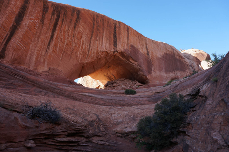
Walking through the arch led to an equally impressive view from the other side.
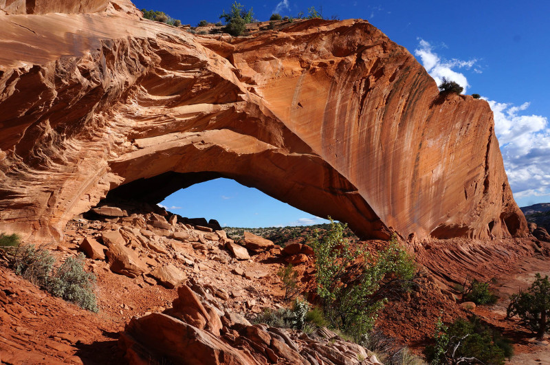
Allen documents a route up to the rim from here, but it would require someone very comfortable with slickrock climbing with exposure.
Back at my pack I continued up Phipps Canyon. After fighting some deep brush and a little more quicksand, the water dried up and I found myself walking up a wide-open sandy canyon.
Farther up the fading sun shone upon a nice tapestry-streaked wall. Swallows were flying about and I was treated to the screeches of two eagles.
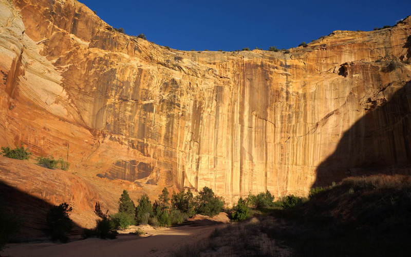
Around the next bend I took the branch to the left and soon came to an unexpected dryfall. It was fairly easy to retreat 20 yards or so and find a well-worn route up and around as a bypass.
Making my way back down into the wash from the bypass, a rock I stepped on broke. This resulted in me twisting my bad ankle again. I instantly fell full-force to the ground — smashing my camera and tearing my pants in the fall. I seriously thought my ankle was broken as I was in so much pain (and the fact that it remained crooked until I pushed it back straight with my other foot!) I lay there on the ground for about 5 minutes assessing the situation. I couldn’t believe this happened when I was so close to the end of my hike (though still a LONG way to hobble!) I sat up and slowly tried to move the ankle and see how much, if any, strength it had. Slowly the pain subsided and I could tell it wasn’t broken. After another 10 minutes or so I got up and tested it and was happy to see that I could still put some weight on it. So I hobbled on.
Slowly making my way up the slickrock bowl I was happy (and shocked) that I was more or less able to “walk off” the injury. It had been so incredibly painful, but it seems as it was not as bad as I thought. Near the top of the slickrock bowl I sat down to enjoy the last bits of light fading over the amazing landscape.
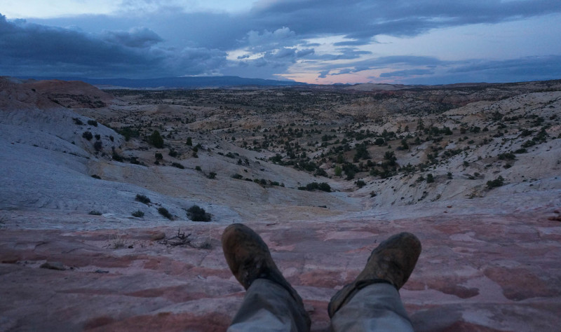
By the time I was up on top of the mesa it was pretty much dark. I needed to get up past one more ridge of slickrock, but in the dark it seemed too daunting. Because of this I went around the ridge to the east where I finally intersected the road. From there it was an easy quarter mile back to where even in the darkness I could still make out the silhouette of… my Jeep. The loop was complete! 🙂
DAY AFTER
All-in-all it was a good hike. I was slowed by my diminished conditioning after my the ankle injury in March and by weather which was less than ideal (for me). I was fairly happy with the route. There’s no reason for somebody to hike this route JUST to see the sights — as all can be seen via much shorter hikes separately by driving between trailheads. But, as I’ve said before, there’s a unique feeling one gets from an extended hike. It’s hard to explain, but it’s special. Thus, for me, this was a great way to link together several great spots and achieve that sensation while wandering uninterrupted through the landscape.
9 Days (4 w/o seeing another person)
153 Miles
FYI: a Route Map and Hi-res Gallery are available as well as the Hike Video!


Awesome, thanks for sharing. Sadly, I’m a one day man (and 72) but I was wondering if it’s possible to do a day walk into where you shot photo number 5. I’m heading over (from Australia) in March and trying to work out what I’ve got time to see. Cheers
Very interesting write-up. Great pictures too!
Such an awesome journey. I have explored that general area the last four spring’s with my daughter. We love it! Thanks so much for the TR. Love your website.
I am interested in a Deer Crek TH to Haymaker Bench (near MM 76-77 on Hwy 12) through hike. Are there any reasonable access/exit spots on the east banks of Deer Creek (right luc) not too far above the Deer Creek – Boulder Creek confluence? Thank you
I’ve never done that exact stretch of Deer Creek, but in general that’s a pretty tough area to get in/out of the creek to the upper slickrock. I know it’s possible down near the Narrows of Boulder Creek (both above and below.) The one spot that I’ve used above the narrows will require getting up/down about a 8′ slickrock wall.
Another great hike Jamal, and an excellent journal+ photos. Inspirational and thanks for sharing again!
Pingback: Boulder Creek Shortcut (or NOT!) - Across Utah!
I loved this post! You inspire us hikers to also dive into the backcountry and experience these special, beautiful places! Thank you for sharing!
Thanks for taking the time to share the map, the photos, the information. Very inspiring.
Good read and we loved the video, hope the ankle fully recovers, keep posting pics and videos
Jamal, Good to see another of your adventures. I think nomadic travel is in our genes. Brings peace of mind and just feels good to do. Do not grow old…take care of your legs. Wishing you another great adventure…thanks for all the posts…69 and bad legs make me a paddler…best Allen Bealle
Great post Jamal. I really appreciate all the detail. Your descent into Muley Twist had me captivated. As you know I’m hoping to come the other way and do that as an ascent. Doesn’t sound like it’s going to be easy. Glad your ankle injury wasn’t worse. That must have been really scary. Hope it’s feeling better.