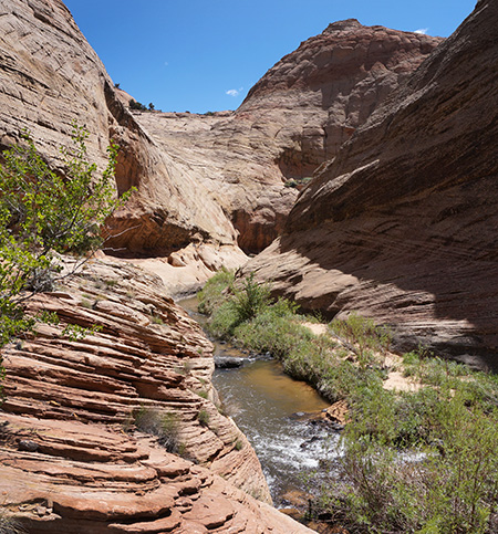
Boulder Creek
On my recent Burr Trail Loop Hike, I tried to save time by taking a shortcut to bypass a portion of the creek just below the Boulder Creek Narrows. If you watched the trip video, you know that I got frustrated when I got near the end of the route and couldn’t find a way down off the high cliffs and back to the creek. I was mad, but… I couldn’t remember from where I’d noted the route and thus didn’t know who to be mad at! Upon returning home I failed to find any documentation of the route so I began to think maybe I was the one in error and had somehow noted the route incorrectly. Inconceivable! 🙁
BUT.. thanks to a great discussion with several informative people over at Backcountrypost.com forum, it came to light WHERE I’d seen the route and possibly what went wrong. You can see that thread there or I will summarize it below.
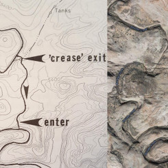
Turns out… it was desert hiker extraordinaire Steve Allen who published the suggested route in his guidebook Canyoneering 3 (Map 40, page 264). I refuse to believe that Allen is flat-out wrong, so I believe he just did a route up extremely steep slickrock that most mortals would find extremely scary/dangerous. At the time it didn’t look remotely feasible to me, but since I wasn’t 100% sure I was in the right spot my confidence was already low. Even if it IS possible, the author doesn’t note the challenge involved which I think is a mistake in this case (he carefully notes steep pitches in other locations). If you hope to travel his route, be prepared for the obstacle and read on for more detail about this beautiful area.
…
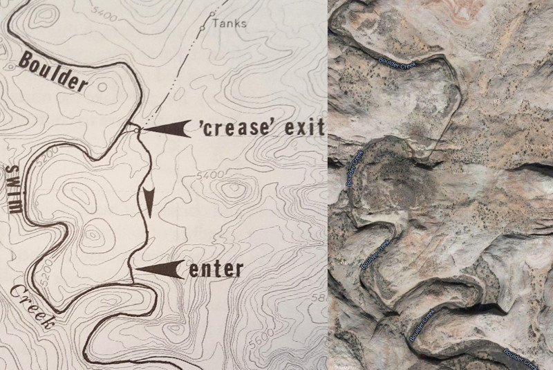
Below is the Allen map which I believe is in error or involves some incredibly steep slickrock. Google SAT imagery on the right for reference:
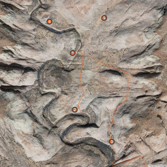
Here is the SAT image marked up with location tags for notes/pics below:
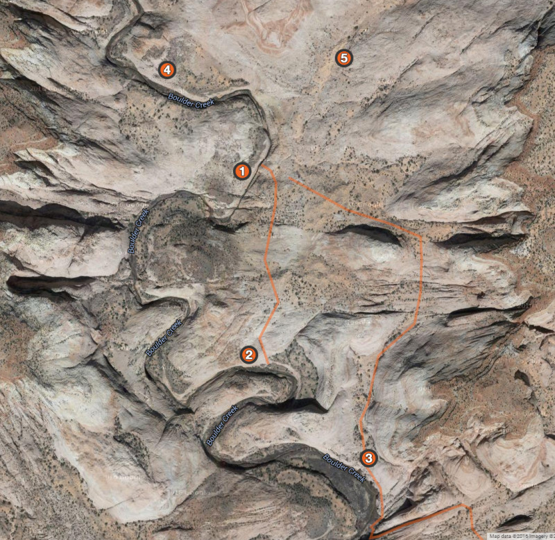
The center orange line is the bypass in question. The other orange line to the right is Allen’s route from Canyoneering 2 which leads down one bend farther south (and then continues back up through a slot.)
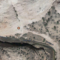
Closer on the area around Location #2 where Allen suggests to re-enter Boulder Creek:
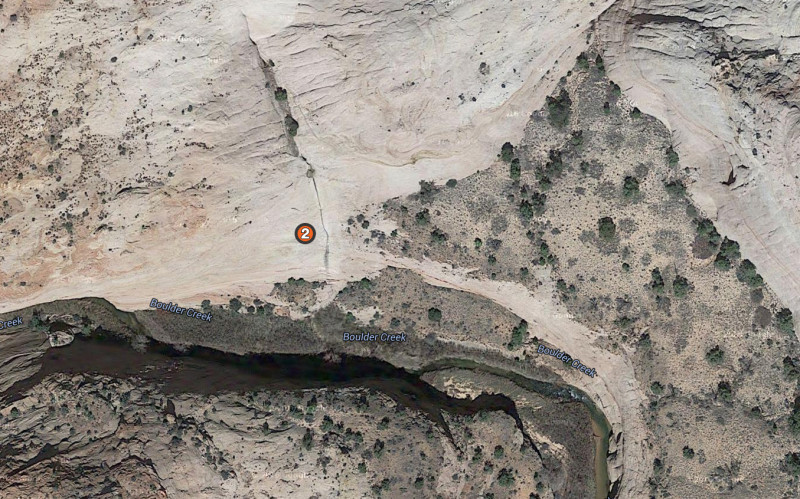
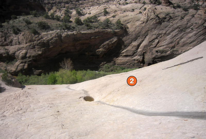
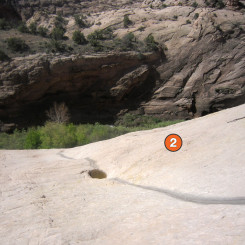
I made my way down the very steep slickrock to spot #2 which sits on a bench before rounding off into a cliff around the entire bend:
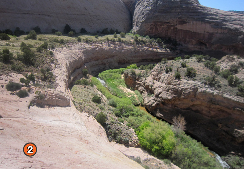
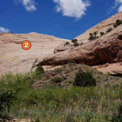
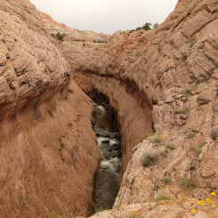
Giving Allen the benefit of the doubt, my guess is that he went straight down/up the drainage. I looked at this and chickened out before I could even see the route all the way down:
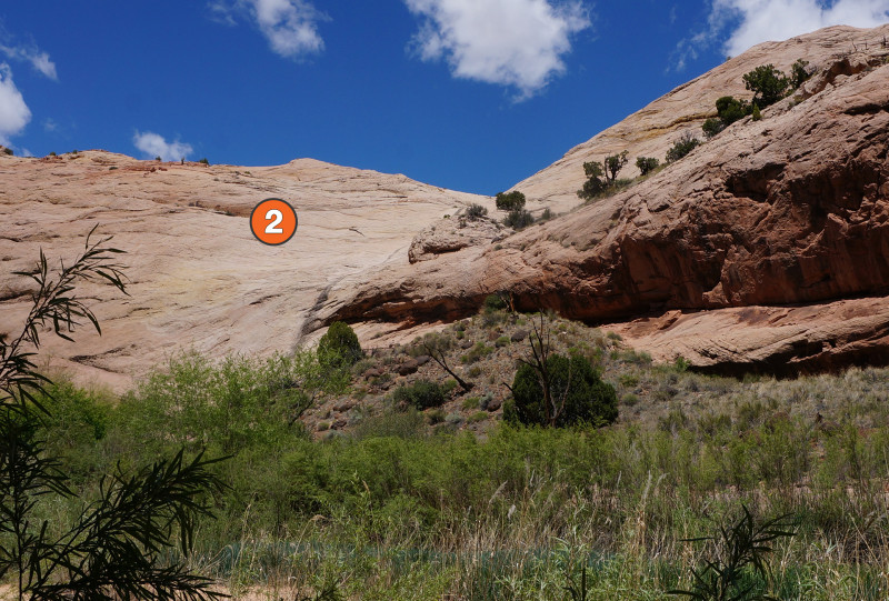
The same spot from below:
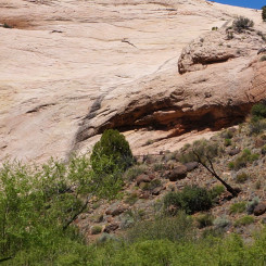
Zoomed in:
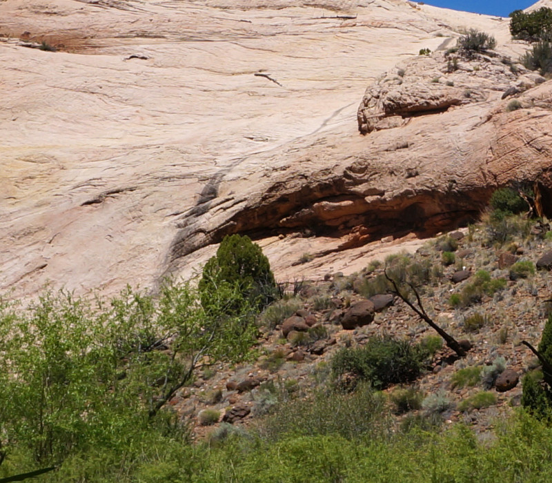
Definitely doesn’t seem doable to me. I checked the wall all the way down and it was cliffed out the whole way.
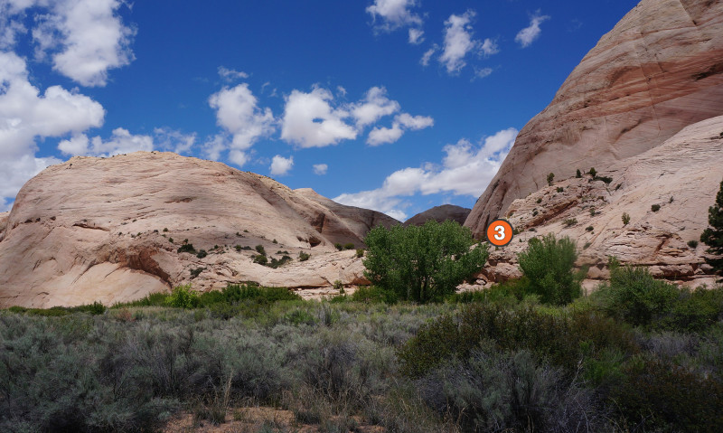
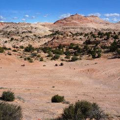
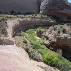
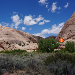
As noted above, according to Canyoneering 2 there is a route back down to the creek one bend to the south. I didn’t see this spot either, but I didn’t look too closely as I was short-cutting the bend on the opposite side. Here’s a shot of the area though and I suspect a way down might be hidden by that tree near the center:
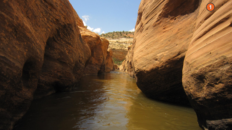
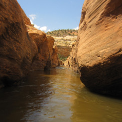
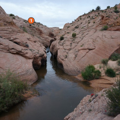
Both times through the area I entered/exited via the pass leading to The Gulch (marker #5). When I did do the loop through the narrows, I had to walk up to about marker #4 where I found a spot to do a controlled slide down a 8′ slickrock face to reach the bank of the creek. I remember thinking that it might be really hard to reverse if necessary. Luckily I didn’t have to. Some shots from the narrows:
Looking down out the bottom of the narrows:
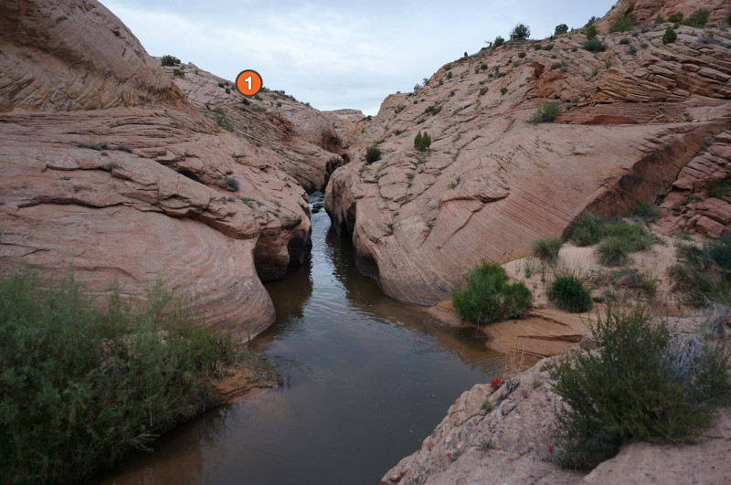
Looking up the narrows from the bottom and where one can access the rim:
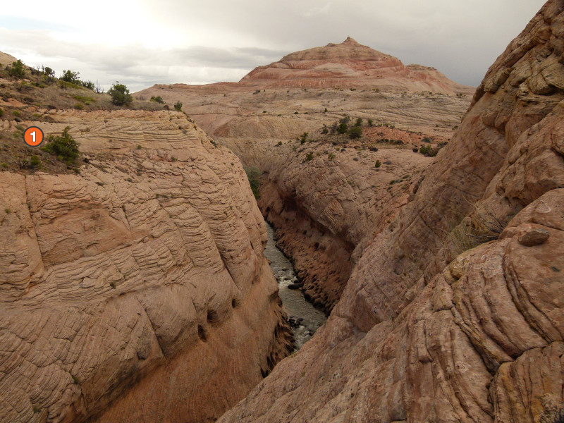
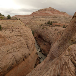
Along the rim:
If anybody knows more about the route, please share via a comment below. I’m curious if it’s even doable, but I definitely want it known it’s not for casual hikers!
High-rez Gallery:
- Allen’s Map and Google SAT
- Boulder Creek Narrows Reference
- slickrock near Boulder Creek
- Really steep, but in hindsight maybe this is it
- From below
- Bend to the south
- rim of the Narrows
- above Boulder Creek Narrows
- Boulder Creek Narrows | Trip Report ⮞⮞⮞
- Below Boulder Creek Narrows



Hi Jamal. So glad i found your post! We ran into the same problem this October. Here’s what I posted on Backcountrypost.com.
So glad I found this thread! In early October we did a loop down Deer Creek to Boulder to Escalante to The Gulch and back to the Deer Creek TH on Burr Trail road. Great trip BUT we ran into the same problem at this very spot (spot #2). Two of the three of us are very experienced rock climbers (old trad climbers, very familiar with friction climbing, desert climbing, ratings, etc) and there is no way that the #2 spot is safely climbable without encountoring very technical, unprotected climbing. Climbing out of Boulder Creek to avoid the narrows was, as Allen says, Class 4 climbing. Very solid and fun, and unprotected for the leader. No problem there. But the “trail” back to the creek after the narrows, as marked on Allen’s topo in Canyoneering 3, is not doable. We made it as far down as we could go and were cliffed out. We carried rope, harnesses, rappel devices and set up a 45 foot rappel from a tree anchor. It’s visible in some of your photos looking at spot #2. We were prepared but completely not expecting this. We hiked up canyon to see the bottom of the narrows and located a spot that would probably be much safer and less exposed. On Allen’s topo it’s NE of the word “creek” and next to the “5200” text on the contour line. Unfortunately we didn’t get to try it, but visually looked good and the contours appear to support this. It’s always an adventure! I’ll try and share some photos later.
That’s awesome — thanks for the update! I’d be curious to take a look at it again someday, but really I enjoyed the “long way” around through the two bends so I don’t think I’d ever try the climb or that other option via pt #3. Cheers!
I was watching this video on youtube where the guy does a loop and come back up to this car via Boulder Creek and it reminded me your (old) article I read a couple months ago while doing some route planning!
https://www.youtube.com/watch?v=fmJk1gm94WY – he shares the link to his route in the video description https://caltopo.com/m/7T40 and it seems that he went up the shortcut route described by Allen. He does mention the shortcut toward the end of the video but without giving too much details.
Always easier to go up than going down I guess!
That’s Joey! I know him and actually ran into him randomly on my 2015 hike, but hadn’t seen this video or his posted route so thanks. He’s a great slickrock hiker with nerves of steel, so I’m not surprised he made it up. I’ve talked to a few others who have done it since I made the post (and a few more who like me didn’t want to attempt it!) Thanks for sharing!
Thanks for your detailed hiking info and pics!
All I can add is that I looked for the Steve Allen short cut many years ago, and I couldn’t find anything that I dared to do on a solo hike, I need to go back and look again.