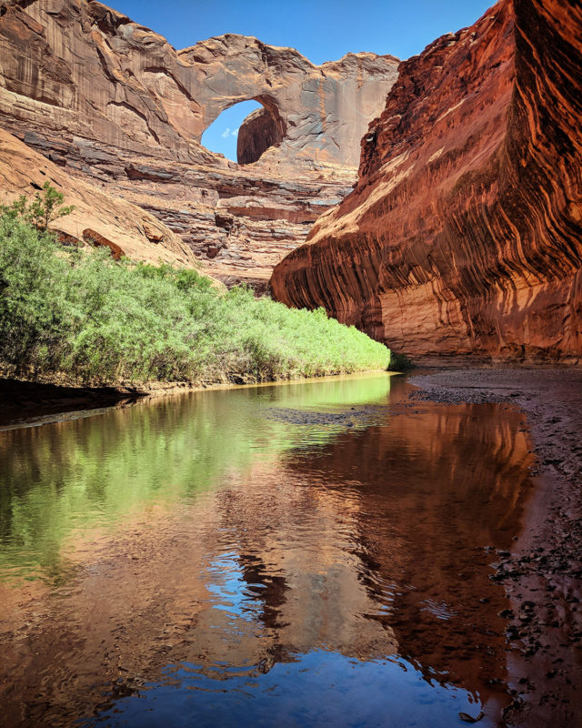
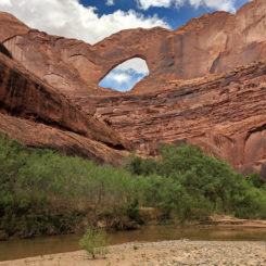
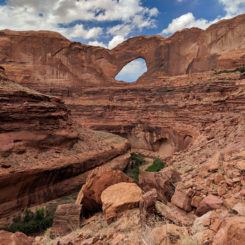
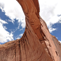
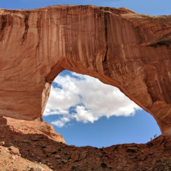
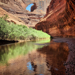
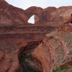
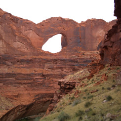
![]() Stevens Arch in the lower Escalante is one of the most impressive arches in Utah (and arguably the world!) At 220′ feet wide it’s rumored that a crazy pilot once flew a small plane through its opening. The arch stands high in the Navajo sandstone as the river flows in a sinuous path below. As beautiful as the view is of the arch from alongside the river…
Stevens Arch in the lower Escalante is one of the most impressive arches in Utah (and arguably the world!) At 220′ feet wide it’s rumored that a crazy pilot once flew a small plane through its opening. The arch stands high in the Navajo sandstone as the river flows in a sinuous path below. As beautiful as the view is of the arch from alongside the river…
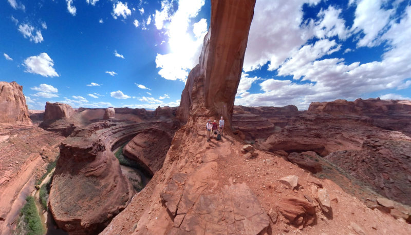
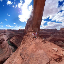
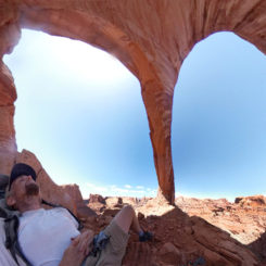
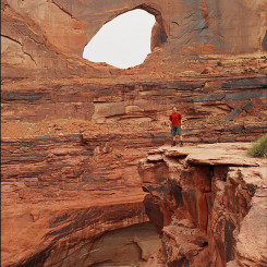
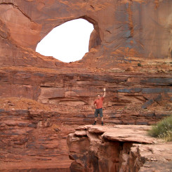
… it’s an equally amazing (but quite different) view when standing inside the arch’s span several hundred feet high above the river:
How to to Get There:
Nearly everyone doing this hike will do so as a part of a longer trip through Coyote Gulch and/or Stevens Canyon — and possibly even combining those while on a long-distance thru-hike like the Hayduke Trail. This description begins at the junction of Coyote Gulch and the Escalante River — get there via one of the aforementioned hikes, or by hiking down from the Crack-in-the-Wall TH at the end of the Fortymile Ridge Road.
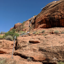
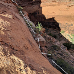
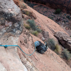
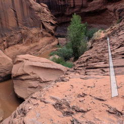
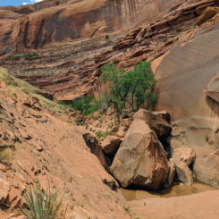
NOTE: the very bottom of Coyote Gulch includes one small section of slickrock with exposure which scares some people (especially when in wet/muddy shoes.) Others hike right past this spot w/o hesitation. See photos in gallery for reference. One can take a longer alternate route to the river if desired (see description below.)
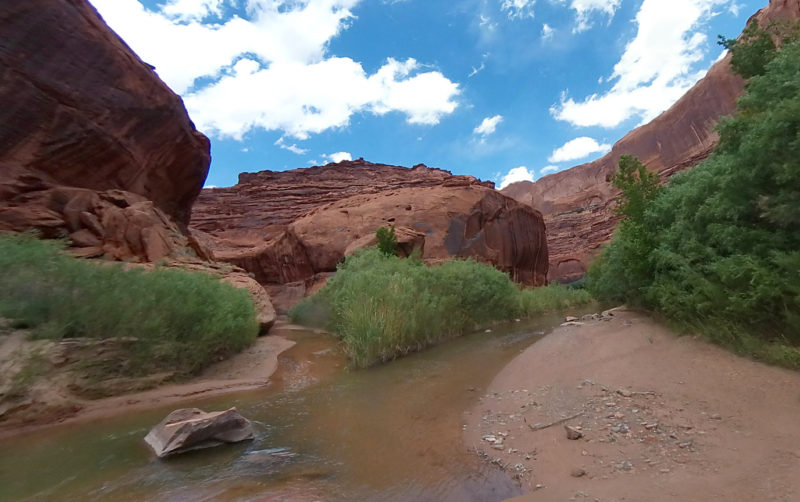
confluence of Coyote Gulch (left) and the Escalante River
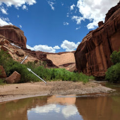
Once at the junction of Coyote Gulch and the Escalante River, just head upstream keeping an eye on the thick brush on the right. Eventually you will need to get through this brush, but it’s much easier to continue upstream for now. After just a few hundred yards a sandy bank will appear on the right and Stevens Arch will soon come into view high above the river ahead.
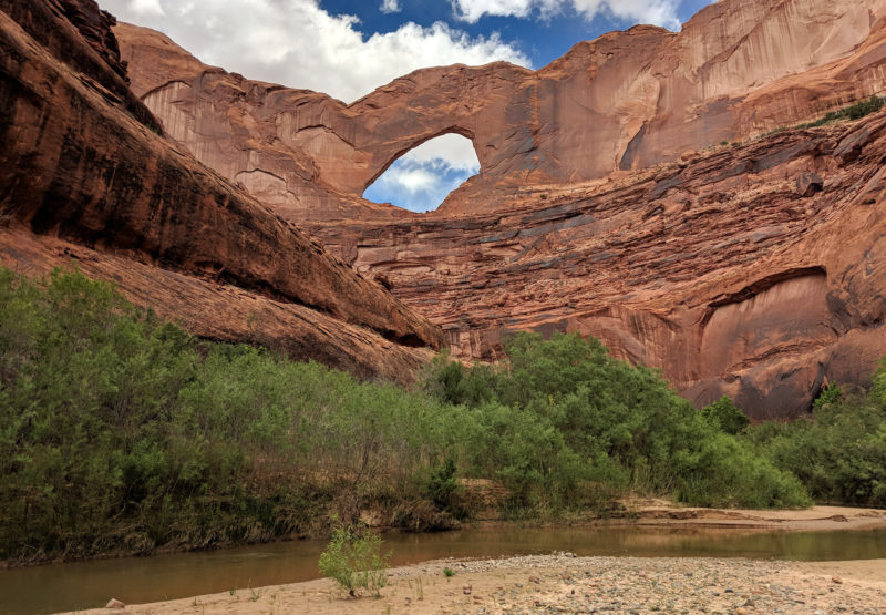
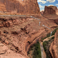
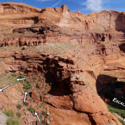
Stop here and look to the right (and likely behind you downriver) to see a large talus slope stretching up to the highest ledges before the sheer cliffs go even higher. With your eyes follow those ledges to the left and you will see where they intersect with the bottom of the arch. This is the route! It’s looks impossible, but it’s quite doable and not even really that sketchy (though not recommended for anyone afraid of heights.)
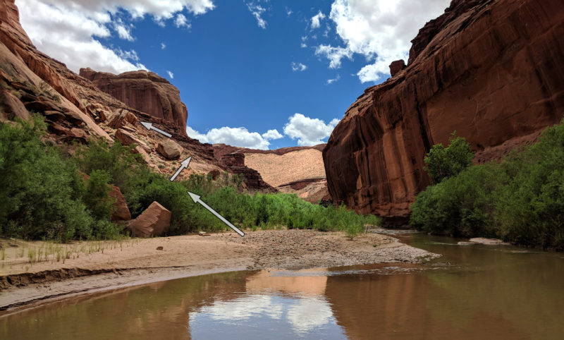
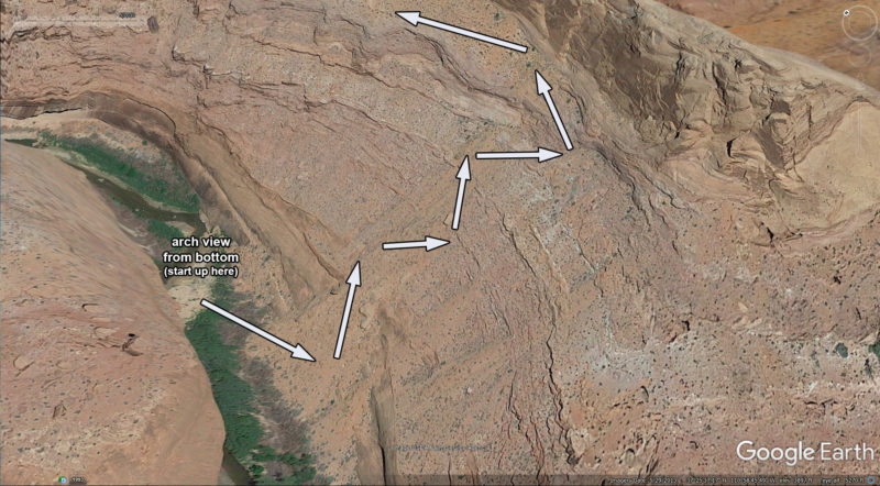
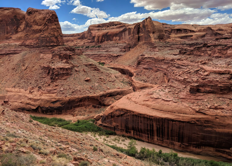
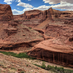
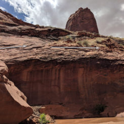
The brush along the bank in this area isn’t as thick as before, so fight through it if needed and then begin climbing up through the boulders/rubble. The route near the bottom is somewhat hard to find as it meanders through the many large boulders, but a defined route becomes more focused the higher one goes up. Looking across the canyon one has a good view of the lower end of Coyote Gulch cutting through the sandstone:
And looking upcanyon is a great view of where one is headed:
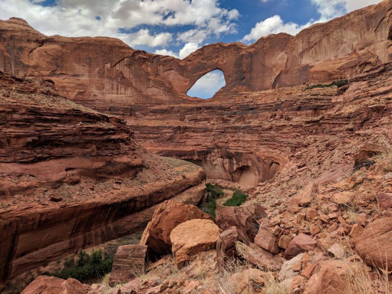
Keep climbing up and up. There’s little to no shade here, so definitely avoid doing this mid-day in the summer. Once near the top there are a series of “steps” required to get through the upper Kayenta ledges. Nothing requires true climbing, so if something seems overly difficult, stop and look for an alternate path.
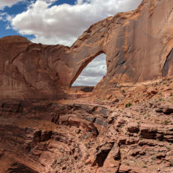
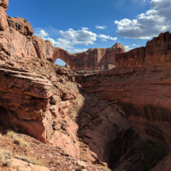
Once up on the highest ledge it’s actually a fairly easy stroll over to the arch with minimal up/downs as you wind around a few bends. It’s cool to see the arch from this unique angle as one gets close. Its incredible size really hits home as well as one approaches the arch:
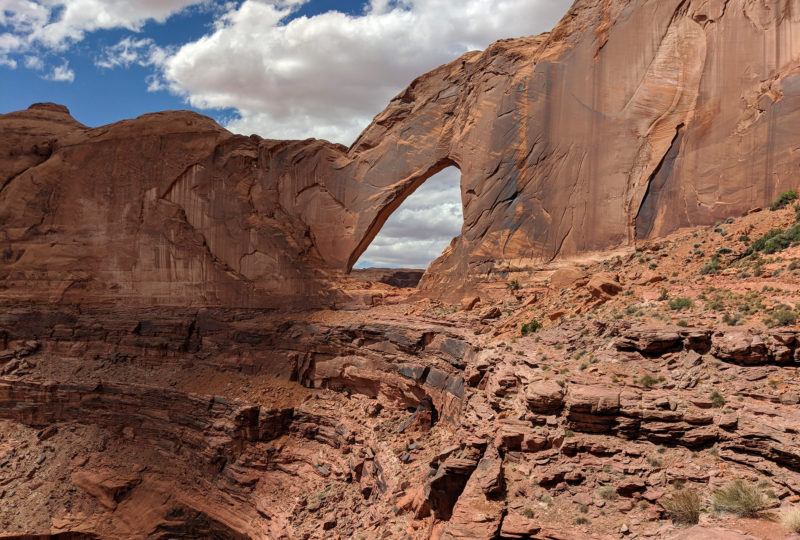
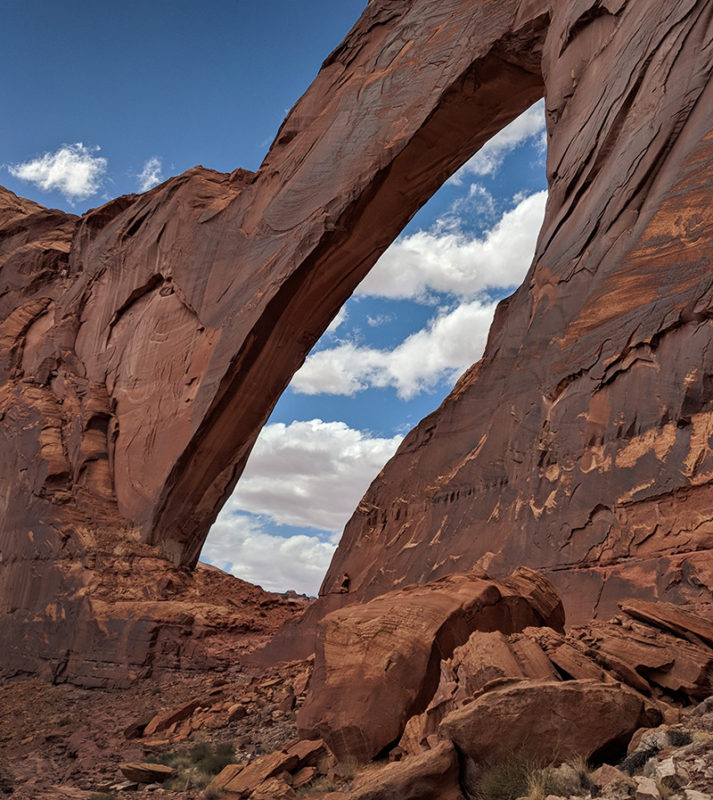
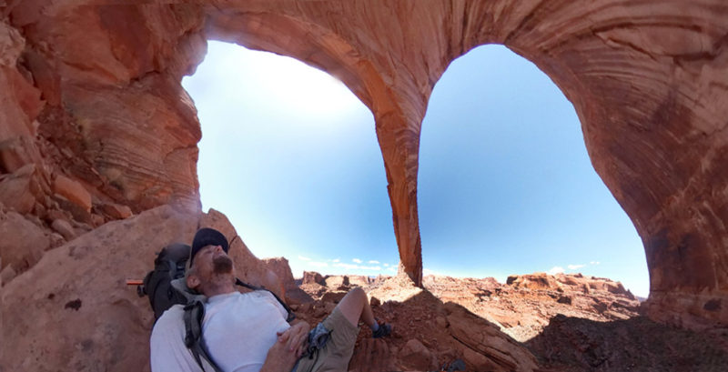
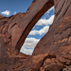
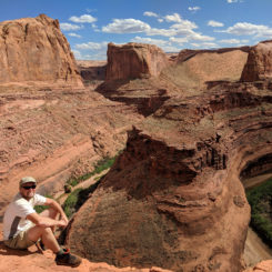
And with that… one is up and inside Stevens Arch! Looking down canyon is an impressive view of the lower end of the Coyote Gulch, and looking through the arch one can see the bottom portion of Stevens Canyon and the dramatic landscape through which the Escalante flows to get to this point.
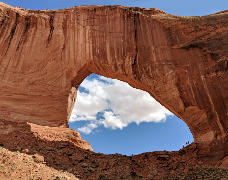
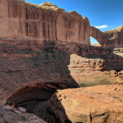
One can also walk through the opening and down to a level area below to get a good view of the arch from the north — an angle not too many people get to see:
Once you’ve had your fill of the amazing views, turn around and head back down the same way you came, UNLESS…
Through-the-Arch Stevens Loop
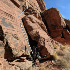
It is possible to continue through the arch and make a loop with lower part of Stevens Canyon. BUT… I really only recommend this route for strong DAY hikers who are very competent in their navigation and climbing skills. Even then, I’d recommend doing the route in reverse — going up through Stevens Canyon and returning through the arch. The route requires several short climbs with exposure which can be difficult to spot from above and intimidating to downclimb. I tried (and failed) to do this solo with a big pack from above. See my video reference below for that fiasco when I didn’t have detailed information about the route. 🙁
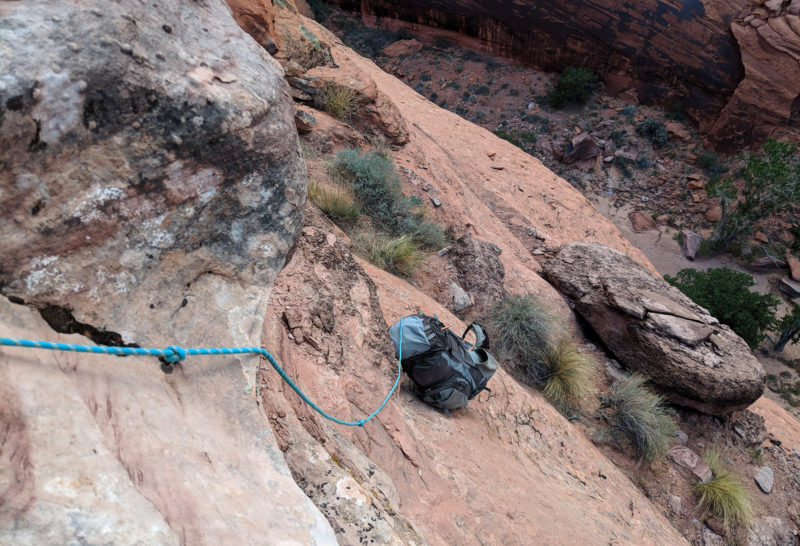
scramble route into Stevens (more pics in gallery)
Alternate Route to Coyote Gulch (aka the High-Water Route)
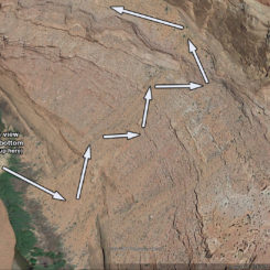
Once back down to the river, it’s possible to take an alternate route back to Coyote Gulch. This second loop option doesn’t require any sketchy climbs and bypasses the lower end of Coyote Gulch (and the rockfall obstacle/ledge there.) Head upstream taking in the amazing views as you walk underneath Stevens Arch. Around a few bends (and just after the arch is out of sight) look for a major drainage coming down on the left side. Unless you wish to continue up to see the lower end of Stevens Canyon first… fight through the brush and start making your way up the boulder-filled gully. Similar to the route up to the arch, the route will become more defined the farther you go up. Here’s a view of the route from the south:

Once up past all the boulders, bend back to the south to attain the higher ledges. Once there it’s easy to contour at that level to the location where the photo above was taken.
From here one turns the corner and follows the Kayenta ledges up Coyote Gulch. But first… one can take the spur route out on the peninsula across from Steven’s Arch for another great view:
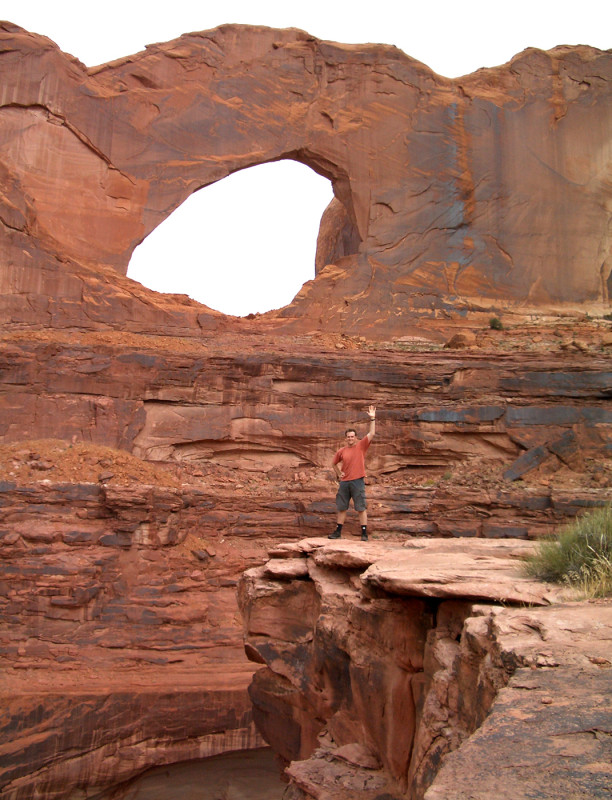
across from Stevens Arch
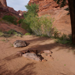
Otherwise it’s just about 1/2 mile up the canyon to the location where it’s possible drop down the ledges and into lower Coyote Gulch. The spot where the route hits bottom is right next to a few cottonwoods and a popular camping location which has a view of the arch downcanyon:
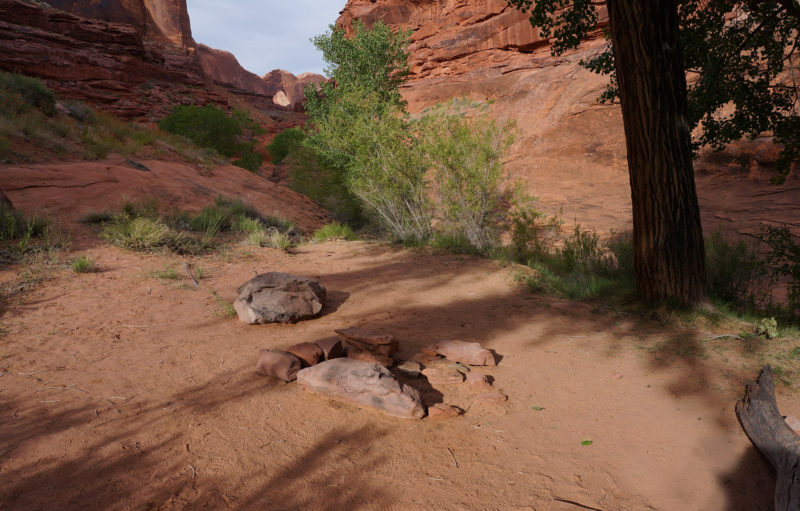
Video Reference:
(climb to arch begins at approx 9:30):
Gallery (30+ photos):
- confluence of Coyote Gulch and Escalante River
- Stevens Arch from near where trail up begins
- looking downcanyon to Stevens Arch Route
- Steven Arch Route
- view across to bottom of Coyote Gulch
- talus slope to Stevens Arch
- walking ledges | Stevens Arch ⮞⮞⮞
- Stevens Arch
- underneath | Stevens Arch ⮞⮞⮞
- Under Stevens Arch
- relaxing underneath | Stevens Arch ⮞⮞⮞
- view south from arch
- view of route up from inside Stevens Arch
- northside | Stevens Arch ⮞⮞⮞
- Lower Stevens Cyn Ledges
- Lower Stevens Cyn Ledges
- climb #1 out of Stevens
- climb #2 out of Stevens
- climbing looking for route
- climb #3 (easiest) near Stevens Arch
- along Escalante | Stevens Arch ⮞⮞⮞
- Alt Route to Coyote Gulch
- Stevens Arch
- Route to Stevens Arch Viewpoint
- Across from Stevens Arch
- Across from Stevens Arch
- Lower Coyote Gulch Camp near alt route to Escalante
- looking down scary ledge
- looking back at scary ledge and rockfall obstacle
- Coyote Gulch Ledge
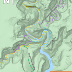
- overview map



Hey Jamal Ive been following your adventures for 2years now and really love what you capture and the presentation! Very entertaining! Made our first trip to southern Utah in June 2018 with family (Im 65 but in pretty good shape) but we just did touristy trip great time. But I do need some advice for the future, some of your canyon adventures I think I can do, but I am terrified of heights, even Hwy 12 totally freaked me out. Do you have just one or two hikes you could recommend for me, maybe a 3 day? PS: We live in southwest virginia App Trail country!
Heya Curtis — thanks for following along. There are several short-trip opportunities around Escalante — like Death Hollow, Wolverine/Little Death Hollow, Silver Falls/Choprock, Coyote Gulch, and more. Canyonlands Needles district has some great options as well. Try to avoid weekends in the popular spots. Feel free to email me as you get closer to your trip and I’d be happy to help more (if I’m not out hiking myself!)
It’s great to hear back from ya Jamal!! I will certainly email you later around June to talk trails. Watched your clips on choprock, and liked that but will watch others again to narrow down. Love the who dos too a lot to choose from! Also love your mapping being an old surveyor, always looking for markers, can’t help myself. Anyway keep em coming!
Once again your photos are beautiful and so majestic!! I wish Gary and I had tried to discover more of Utah when we had the chance. Thanks, Jamie, for sharing your hikes through Utah!!!
Thanks for “following along”! 🙂
How fascinating are your hikes. My parents (Lee and Dolly Jobes) were good friends of your grandparents Ben and Eleanor. I love seeing your adventures unfold.
How cool! Thanks for leaving a comment.