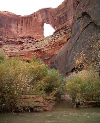
– Stevens Canyon meets The Escalante –
Stevens Canyon is a classic Escalante drainage which remains relatively infrequently visited thanks to its remote location. With no major obstacles, Stevens makes for a great backpacking destination. Combined with the historical Baker Route, it makes for a great “connector” for longer hikes and is becoming a popular alternate for hikers on the Hayduke Trail looking to avoid the long tedious segment along the Escalante River.
Here is my description headed east-to-west and DOWN the canyon. If heading the other direction, click to reverse and read about the hike headed up canyon.
The Baker Route (Halls Creek to Middle Stevens Canyon)
The Baker Route begins on the eastern side of the Waterpocket Fold at approximately N37.538538° W-110.852807°. Most hikers will likely get to this remote spot by coming down Halls Creek. Others may come up from Lake Powell. Coming from either way, it appears on the map that it might be possible to shave off some mileage by angling up sooner and hiking through the slickrock. This may indeed be the case, but it’s likely more work than it’s worth as walking a straight line in this country is impossible. Before heading up the slickrock though, try to stay in the wash or along its eastern side to avoid the deep brush that chokes the small streams entering from the fold.
Once headed up, the Baker Route can be confusing as it is only sporadically marked with cairns. Thus, excellent navigational skills are essential. At some points the route is marked every 10 feet, but then other sections there’s not a cairn to be found. In general I found it easiest to just pick my own route of least resistance. When I do, I frequently then find myself coming across route markers. A word of caution though: this is an extremely remote location and you likely won’t see anyone else. Make sure you generally know where you are as you don’t want to wander aimlessly along the Fold in the wrong direction. FYI: my linked map includes coordinates for several confirmed waypoints/cairns.
Depending on the season, one is likely to find multiple potholes going up the eastern slopes. They seem to be more prevalent on the lower slopes unfortunately instead of up on top where they’d be more beneficial.
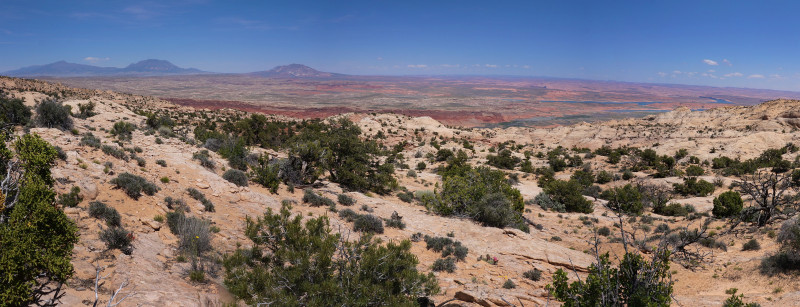
Eastern Panorama from top of The Fold
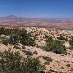
Once on top the views are great even though it’s not as prominent as other places along the fold. Ahead of you are views across Stevens Canyon to Fiftymile Mountain. Behind you is a great panorama of the Henry Mountains, the rolling domes/fins of the Fold and the Bullfrog Bay and Marina on Lake Powell. This location is also one of the spots that has Verizon cell reception so check in if needed.
The route along the crest wanders a bit before making its way down into a gully. The trail is sporadically marked in this section and it will be easy to lose it in spots, but generally if you keep heading west toward the canyon system below you will be fine. Soon the route will wind its way through some domes gradually losing elevation before making it to the top of a hill in about another ½ mile. Descend the hill and enter the wash.
Walk down the likely sandy and bone-dry wash for about ¾ a mile before exiting on the the right where a well-worn trail heads to and around some Navajo domes. If you miss this exit, you will eventually run into an impassable dryfall. This segment is maybe the trickiest part of the route and must be followed precisely as all other routes are impassable. Study my map to get the gist of the route through this section.
Rim-walking to the north around the domes one’s goal is to get to the next side canyon. There is no way down on this side though, so continue rimwalking until you cross the wash at another dryfall. Then continue around and eventually find a weakness (likely marked) where it is possible to double-back and get down below the dryfall. I call this the “Switchback” and it seems like the wrong direction, but it’s necessary to descend. Head back east and into the side canyon. From here descend to the main side canyon. Near the bottom progress may appear blocked, but a simple (steep) bypass is apparent. You are now down into the major side canyon which leads to Stevens — often referred to as Exit Canyon (I believe guidebook author Steve Allen dubbed it this.)
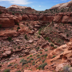
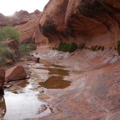
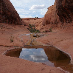
Immediately down canyon there is likely to be a large pothole of water which is reported to frequently hold water throughout the year. During wetter seasons one will likely find water in many of the potholes along this section. Before long the wash ends in another dryfall and one should rimwalk on the southern (left) Wingate Sandstone shelf. This section is quite scenic running above the entrenched inner canyon.
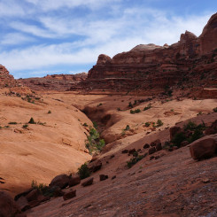
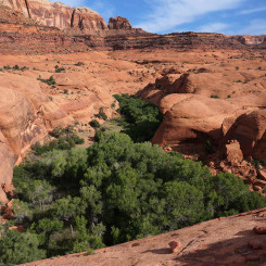
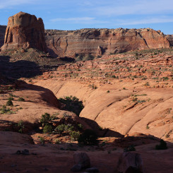
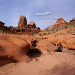
Keep going for 30 minutes or so and soon you will notice the canyon opens up as it nears Stevens providing excellent views of the lush area around the spring to the north and the prominent rock “Tower” to the south. From here the route quickly descends to Stevens where there is likely to be water.
- Halls Creek
- Route above Halls Creek
- Eastern Panorama from top of The Fold
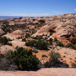
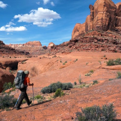
- Looking west to Navajo Domes from near top of Fold
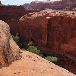
- Atop the “Switchback” point looking back to the domes
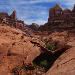
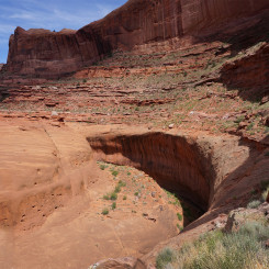
- Looking upcanyon after leaving main drainage of Exit Canyon
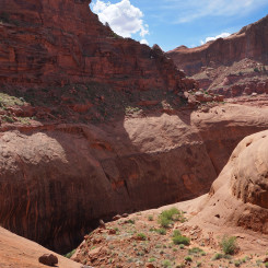
- Looking upcanyon while on the Wingate in the Exit Canyon
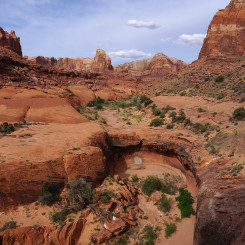
- View to Upper Stevens
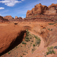
- Looking down Stevens to the Tower just above exit ramp
Upper Canyon
I have not explored Upper Stevens, but it is possible to continue up the canyon. Steve Allen’s guide Canyoneering 3 details this part of the canyon. Ambitious hikers/climbers can even gain access to Fold Canyon via a pass/saddle and make a loop back down to the Escalante (ropes required).
Upper Middle Canyon (Baker Trail End to Dryfall)
You are now in Stevens Canyon. If there is not water and you need it, there should be a few big potholes just down canyon, or if all else fails, the spring is just up canyon in the area with HEAVY vegetation to access the spring.
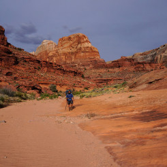
As you head downcanyon you will soon go through a short narrows/subway section. Then it opens up a bit as the canyon becomes very sinuous as it winds its way toward the “Tower”.
A little farther one comes to the “Triple Junction” where multiple canyon branches come together and the canyon seems really wide open. This spot can be tricky going UP canyon, but headed down it’s not as confusing. Climb up over slickrock ridge on the right as a shortcut and to avoid a short narrows section.
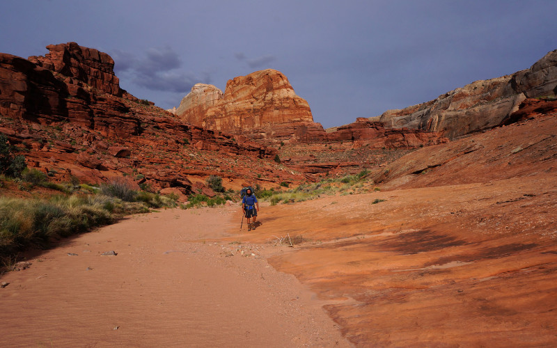
Wide-open canyon near Triple Junction
Just a little farther down canyon one comes to an impassable dryfall which marks the end of this section. Check out the arch where the main watercourse cuts its way through the dryfall. Make sure to get to the SOUTHERN side to rimwalk the next section.
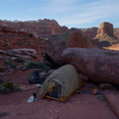
- Baker Route Exit Camp with Tower behind
- Narrow ‘Subway’ Section
- Water likely as canyon narrows
- Wide-open canyon near Triple Junction
- Looking upcanyon to the ‘Tower’
- The Dryfall where one enters/exits main drainage
Lower Middle Canyon (The Kayenta Ledges)
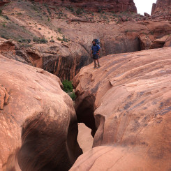
From the dryfall the route climbs up a large dune out of the main watercourse. The next 1.5 to 2hrs will be spent walking the Kayenta ledges (or Wingate rim) along the southern side of the canyon. As one travels around one bend after another, there are many spots that look quite daunting from afar as the route traverses the loose edge high above the entrenched canyon below. One might find themselves saying “there is NO way I’m walking along that edge!” However, as is often the case, things look worse from afar and once you arrive at the “scary” spot it’s really not that bad. In fact, turn around and look back and you might be saying “I just walked along that?!”
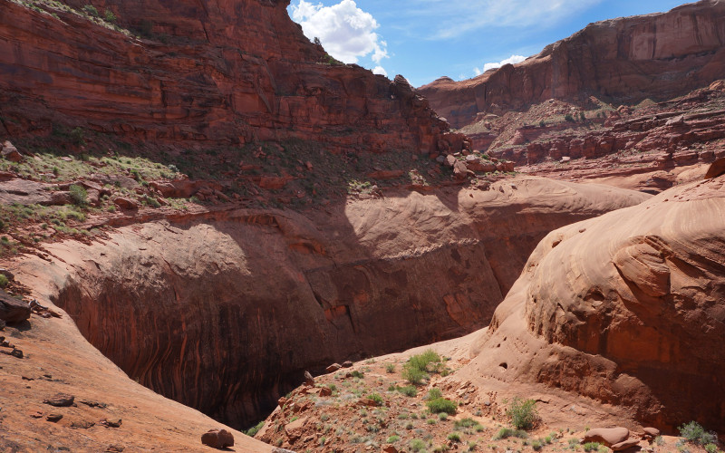
The exposure isn’t as bad as it appears from afar.
Less than an hour down canyon there is a talus slope which provides access down into the inner canyon once again. This is not the route, but an opportunity to explore if one so desires. Below one would likely find water and nice campsites if needed. However, retrace your steps back up to the ledges when finished exploring as there is no other escape from this section of the canyon.
Keep winding your way along the ledges to finally after about 2hrs there will be a slickrock ramp which you can use to regain access to the bottom of the canyon.
- Looking upcanyon to the dryfall where one enters/exits main drainage
- Looking downcanyon to (optional) inner canyon access point
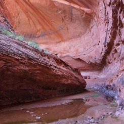
- Inner Canyon
- at the Wingate/Kayenta layer division | Stevens Canyon ⮞⮞⮞
- The exposure isn’t as bad as it appears from afar.
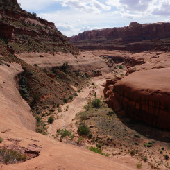
- Looking up canyon near the lower section of the Kayenta Ledges
Lower Canyon (Slickrock Ramp to the Escalante)
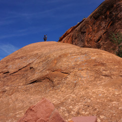
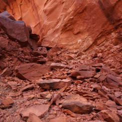
Make sure you are in the right spot here. The steep slickrock ramp drops about 100′ to get to the top of a small bench below. The route down may give those afraid of heights some pause, but it’s really not that bad as the exposure is minimal. The final bit is an easy scramble down the bench where a loosely cairned route descends through a jumble of rocks back to the wash.
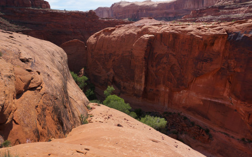
View from atop the Ramp
One can head about 3 minutes up canyon at this point to see the pool and a 10′ dryfall which blocks upstream progress. Turn around and head back down the canyon to continue.
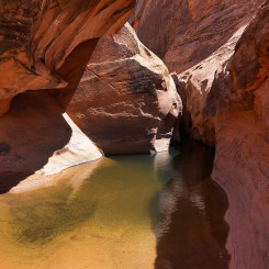
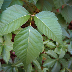
Not too far down canyon one is likely to start seeing water again. Then one will pass the only major side canyon branch on the left. I’ve read reports that there is a “climber’s route” which exits this way, but I have not explored the route. Continuing downstream one follows the twisting “subway”-like canyon where larger pools of water appear along with bunches of poison ivy which is extremely difficult to avoid.
Soon the water will likely begin to disappear and you will find yourself above another major dryfall. To descend here you will need to climb up the bench on the left (southern side again) and then down the hill on the other side. This is what’s often referred to as “Poison Ivy Hill“.
NOTE: a bend above the “Poison Ivy Hill”, a scramble route climbs back up to the Kayenta ledges which can then be followed all the way down canyon and through Stevens Arch. From there it’s possible to descend to the Escalante near the confluence with Coyote Gulch. I do not recommend this route for thru-hikers because a) the climb up is difficult, especially if solo or with a big pack and b) the lower part of Stevens Canyon is really great. Instead — just do the short hike up-and-back to the arch from the river. This route is shown on the Hayduke Reference Map. or you can read more about it on the Inside Stevens Arch page.
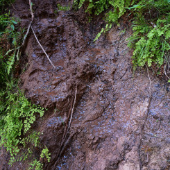
The top part of the hill is steep as it winds it way down down the jumble of rocks. Some have found this bit confusing in the past, but in 2015 and 2018 the route was fairly easy to follow. The lower part of the bypass descends the overgrowth on a muddy, slick path. Luckily there are enough exposed roots which provide hand-holds to get one down through the quagmire.
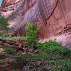
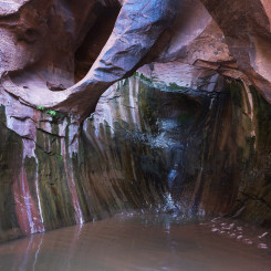
On bottom there again is a lot of water and lush vegetation. True to its nickname, there is also a lot of poison ivy in the area. Take a moment and go upstream to see how progress up the main water course is stopped by a fall which creates a scenic grotto with a hanging arch.
The canyon below this spot is highly entrenched in Wingate Sandstone, but the towering Navajo walls are still frequently visible high above. One can even catch a glimpse of Stevens Arch above at a few of the bends. One will likely be in and out of shallow water while traversing the lower canyon. There are a few points where deeper pools appear to block one’s progress, but there is always a way around — usually by climbing upon a slickrock shoulder nearby.
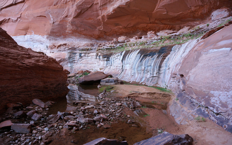
bend in Lower Stevens Canyon
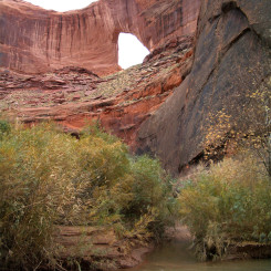
The only point that might require removing the pack is at the “rock stack” climb — an 8′ to 10′ climb which is assisted by, you guessed it… a stack of rocks. Before too long one will be at the Escalante River. Turn around for a great view of Stevens Arch which looms high above the small trickle coming out of Stevens Canyon where it meets the Escalante River.
From here more hikers will head down to Coyote Gulch and possible make a diversion up Inside Stevens Arch along the way.
- Atop the Slickrock Ramp
- Looking up the Slickrock Ramp
- The End of the Road
- Looking up the ascent/decent route from Lower Canyon
- desert varnish in Stevens Canyon
- Another Bend
- View from atop Poison Ivy Hill
- Looking up Upper Poison Ivy Hill
- Slippery Climb
- Poison Ivy
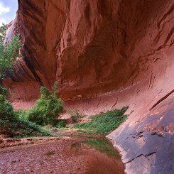
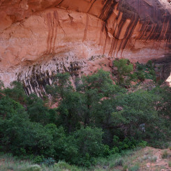
- Hanging Arch Alcove
- Looking up canyon at “Poison Ivy Hill”
- Another Bend
- Nice Alcove
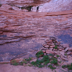
- The Stacked-Rock Climb
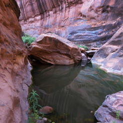
- Lower Pools (all bypassable)
- Stevens Canyon meets the Escalante
Video Reference:
Important Waypoints:
- N 37.538538° W -110.852807° — My exit point near bottom of Baker Route
- 37.533815° -110.858845° — My route down off slickrock
- 37.527753° -110.865784° — confirmed cairn along Baker Route
- 37.524010° -110.868782° — confirmed cairn along Baker Route
- 37.519900° -110.872542° — confirmed cairn along Baker Route
- 37.518281° -110.875464° — confirmed cairn along Baker Route
- 37.518723° -110.877286° — confirmed cairn along Baker Route
- 37.510955° -110.883167° — confirmed cairn along Baker Route
- 37.509143° -110.887013° — confirmed cairn along Baker Route
- 37.507823° -110.890982° — Baker Route exits wash and climbs toward summit
- 37.502556° -110.907140° — top of “Switchback” bypass
- 37.501749° -110.906932° — Exit Canyon Bypass
- 37.486306° -110.927106° — Leave Stevens for Exit Canyon
- 37.474815° -110.926551° — Triple Junction (main canyon runs north)
- 37.472523° -110.935138° — re-enter main drainage above dryfall
- 37.456455° -110.959043° — Inner Canyon Exit Ramp (south side)
- 37.441261° -110.974921° — Poison Ivy Hill
- 37.435471° -110.982170° — Stevens Canyon meets the Escalante




Great resource. Thanks! I figured someone needed to be the first to comment here.
Thanks! Comments on my site are a little hap-hazard/scattered, but… I still see and reply to them (well… most of the time!)