


 Another alternate to consider for those hiking the Hayduke Trail — an exciting route through The Maze and Happy Canyon. I don’t expect many to opt for this alternate, but it is actually my preferred route for a trek across Utah.
Approximate Mileage Comparison:
- Official Hayduke: 85.7 miles
- Happy Maze Alterante: 65.0 miles
Pros:
The Maze, Happy Canyon Narrows, The Doll House and only one crossing of the Dirty Devil
Cons:
Skipping Dark Canyon and managing a crossing of the Colorado River

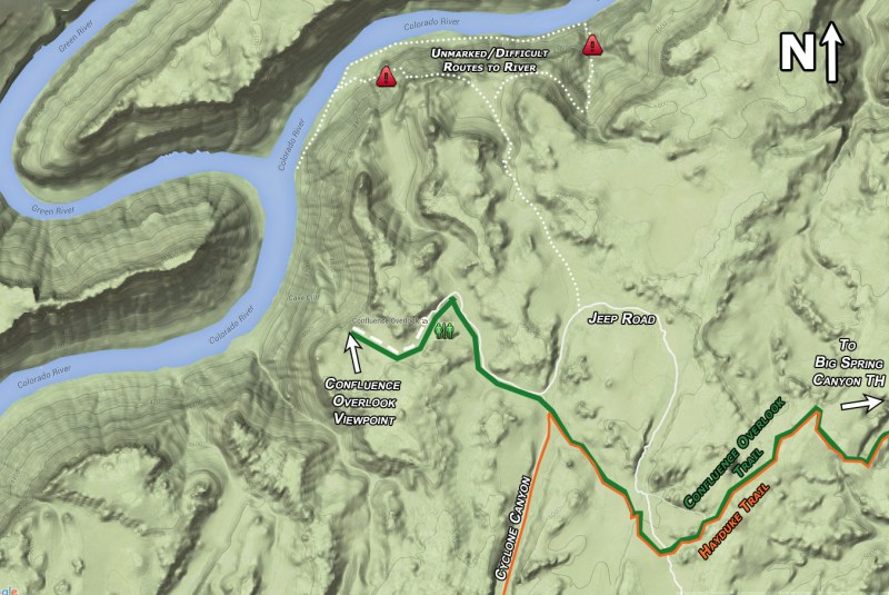
— click map to view full size —
Summary of West-bound Travel
When the Hayduke arrives at Cyclone Canyon early into Section 3, one can opt for this fun alternate. In either case, one may want to take the short spur to Confluence Overlook first.
To do this alternate one must somehow get across the Colorado River. More on that topic soon, but first let’s discuss two possible options for getting down to the river. The most straight-forward method is to continue a little farther on the Hayduke until you enter Red Lake Canyon. Here, instead of following the Hayduke south, simply follow the established trail down to the river via Lower Red Lake Canyon.

trail down Lower Red Lake Canyon
A more exciting option is to head NORTH in Cyclone Canyon along the Jeep road. Leave the road when it bends back to the east and follow the wash down to the northwest. There will be some route-finding at a few drops, but nothing too bad. An unofficial and loosely cairned route leaves the wash before the big plunge and contours west before zig-zagging down the steep slopes above the confluence. If you can’t spot this route, it’s also possible to contour the rim to the east until you hit a boulder-filled drainage which can be descended to the river.
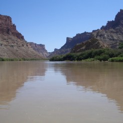
Now simply walk along the river until you are ready to cross. NOTE: the brush at the water’s edge can be extremely dense, but there is usually a gap between the brush and the rocky slopes where one can easily hike.
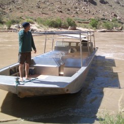
Crossing the river requires some work — either in terms of gear or pre-planning. I know people who have used packrafts to cross, but that is heavy gear to carry for 70+ miles. Author Kelsey mentions swimming across with a flotation device, but I don’t recommend this. The river’s current is deceptively swift here and even in late spring the water is COLD. So the alternative is to hitch a ride from rafters, canoeists, or a jetboat. Spring is actually a fairly busy time along this stretch, though boaters tend to camp on the west side of the river close to Spanish Bottom. Tex’s Riverways and other outfitters out of Moab make frequent runs to Spanish Bottom in the spring with jetboat shuttles (to pick up boaters/hikers). I’ve always coordinated with them to confirm a specific date to hitch a ride across. As a bonus, they have always been willing to bring a re-supply that I ship to them beforehand. They are good like that.

Tex’s Riverways Jetboat
Once across the river at Spanish Bottom, follow the established trail up to the Dollhouse.

overlooking Spanish Bottom
Note: the unofficial “Powell Route” is more of an adventure and would serve as a short-cut if you cross the river closer to the Confluence.
The Dollhouse is a cool region of towering Cedar Mesa sandstone. This is the end of the Jeep road which travels through this part of Canyonlands and there are a few backcountry campsites.

The Doll House
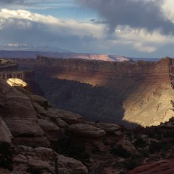
From the Dollhouse the next goal is to get to Chimney Rock. The simplest and recommended way to do this is to follow the Jeep road north. A more exciting way would be to take the trail past Beehive Arch to the Green and Colorado Rivers Overlook. From there one can take an unofficial route to Water Canyon and on to Shot Canyon which can be followed up to Chimney Rock. This route will definitely take longer, but has the added perk of having water along the way. If you follow the road, make sure to step off to take in the view of Water Canyon from the top.
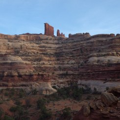
Once at Chimney Rock one has two ways to get down into the Maze. It’s a toss-up which is the ‘best’ option, but I will recommend the ridge route which heads north towards Pete’s Mesa and then drops down into the Maze to the west. The views along the ridge are great.

window along Pete’s Mesa ridge route
The other option is the trail that heads NW and quickly drops down into the Maze via a branch of Pictograph Canyon. Choose this route if you want to spend more time within the walled-in Maze versus walking the ridge and taking in the amazing views from high ground. Both routes are great and include an exciting scramble to get to the bottom.
Either route you choose, make sure to stop and see the Harvest Scene — one of the best pictograph panels around. The panel is about 10 minutes south into the Pictograph Fork on the western wall (ie a short diversion if you take the Pete’s Mesa ridge route).

Near the junction of Pictograph Fork and the side canyon where the ridge route enters there is a spring which should provide water in most seasons.
Rounding the bend you are in the heart of the Maze. At this junction stay left and follow the south fork of Horse Canyon up a short distance before locating the route which climbs up to The Maze Overlook. If in need of more water, there is a fairly reliable spring less than 1/4 mile upcanyon from this point.
Note: no camping allowed within view of Maze Overlook
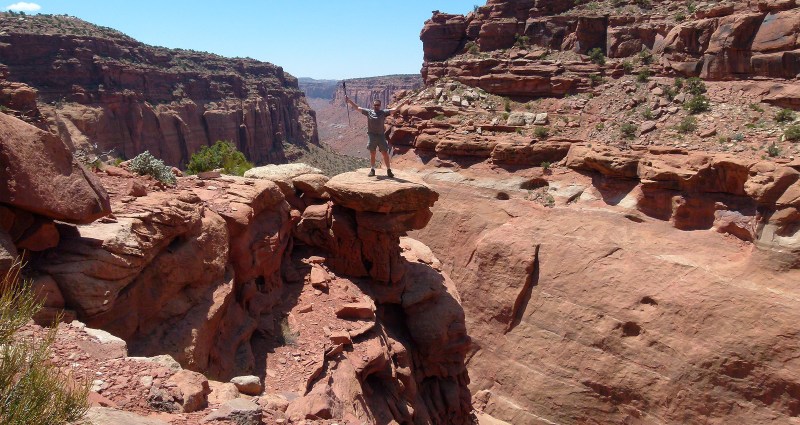
The route up to The Maze Overlook is nothing short of incredible. Abbey wrote about it in Desert Solitaire before it even became official. The route winds its way up through the various layers with four distinct climbs along the way. The first is the Moki steps climb. The second is the gray crack climb. The third is another crack climb. The fourth is the red wall climb. This last one is the most difficult and requires a climb up a 12′ wall, then a sideways shuffle on a narrow ledge before a climb up and through a scooped-out drainage. All three climbs are easier with a buddy to assist in passing packs up/down. A rope is likely to come in handy to assist with this process. The rest of the ascent is easier as the route meanders upwards past multiple ‘steps’ to the top near the iconic Nuts and Bolts formation.
Watch the descent from Maze Overlook in part of my 2007 Video.
Up on top the views are a-MAZE-ing. (Obligatory pun which must be used at least once when posting about the Maze!)

Chocolate Drops and Land of Standing Rocks from Maze Overlook
From here one can follow the Jeep road west, however a better way is to follow the ridge SW and then walk along a mesa which serves as a short-cut and provides more great views along the way. Drop off the mesa and re-connect with the Jeep road near the impressive edge of Horse Canyon.

Horse Canyon edge
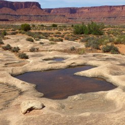
A little farther west a hiking trail splits from the road and descends into another branch of Horse Canyon. There is frequently potholes with water in the slickrock here.
Continuing on, the road soon branches. Go right and soon you leave the road when you see the North Trail Canyon which heads due west. It’s about 3.5 miles along this trail before one begins to climb up the Orange Cliffs. One may find an outbreak or two of water along the way in the spring. If not, one is very likely to find pools of water where the trail begins the steep ascent. This maintained route was originally created by ranchers to run cattle to/from atop the plateau.

North Trail Canyon
Once on top the trail ends at a TH along the Panorama Point Jeep road. Follow this road west until it ends at the intersection of another Jeep road. Turn right towards Hans Flat Ranger Station. Almost immediately will be a spur on the right which goes down to French Spring and the nearby old cabin. There’s not much water coming from this spring, but it’s the only water source around so use patience and fill up.
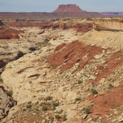
Following the main road there will soon be a marker of Millard Canyon Viewpoint. Take this short walk out to take in the great view.

Millard Canyon overlook
In just over another mile one arrives at the Hans Flat Ranger Station. There are pit toilets here and if there during business hours you will find information inside along with gallons of water for purchase. They also have a phone in case of an emergency.
From Hans Flat head about 2.5 miles west along the main road until a spur road branches to the left and heads south toward the canyons. Follow this road as far as you can before it finally fades near an old drill site. From here one needs to route-find down and through the Navajo sandstone domes and toward a spur of French Spring Fork. Follow the map closely here as there is really only one way down. Once you begin dropping down through the Wingate sandstone layer, the route winds its way past a prominent ‘nose’ before descending a major rock talus.
dropping into French Spring Fork Canyon
One might see remnants of an old trail here. Near the bottom of the talus, try to stay high above the boulder-choked wash as long as possible. Before long the the route becomes easier. In about a mile you will pass an area where the wash cuts through bedrock. It’s possible that you will find tanks of water here. In another 1/2 mile or so you will be at the junction of French Spring Fork and then still headed downcanyon the junction of Happy Canyon is less than a mile more.
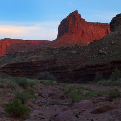
The next 10 miles or so down Happy Canyon is a fast walk. The wash is that great consistency of not too rocky, but not too sandy which makes for really fast travel. It’s not the most spectacular canyon, but it’s always felt special each time I’ve walked its length. One is surrounded by the towering red cliffs on all sides and it just feels ‘remote’. I’ve never seen another person in this stretch of Happy Canyon let alone a piece of litter or really any sign of human existence. If you are lucky, you will find an outbreak or two of water along the way (though don’t count on it.)
mid Happy Canyon
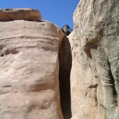
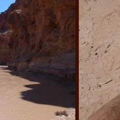
About 2 miles up from where Happy ends at the Dirty Devil, the canyon changes as the watercourse cuts down through the colorful bedrock and forms Happy Canyon Narrows.

Drop down in and let the fun begin. There might be shallow pools in the upper end of the narrows, but they will likely not be very deep and dry up soon. The walls grow higher and more narrow as you move down canyon making for great photography. It should go without saying, but you do NOT want to be here if there is a chance of a flash flood.

Happy Canyon Narrows
Once out of narrows emerge back into the full daylight and cross the muddy Dirty Devil. Climb the the hill to the west route-finding to locate the best way up. The upper portion is really steep, but without any real exposure. Before coming to the upper sheer cliffs you will intersect an old mining road with huge chunks of petrified wood in the area. Go left.
Follow the abandoned track to the south as it hugs the cliffs. After a few meanders you will emerge on a point where the the road is actually once again traveled by modern-day 4x4s. Continue walking the road and enjoying the great views from above the Dirty Devil.

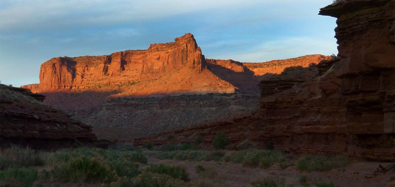
above the Dirty Devil River
Soon you will be above the junction with Poison Springs Canyon. Continue following the road which still hugs the high cliffs as it meanders in and out of the side canyons. Within a few miles you enter the wash above the Black Jump. At this point you intersect the main road in Poison Springs Canyon and re-connect with the official Hayduke Trail. You might find water here, but if not the good springs are just a few miles up.
Watch me hike this stretch (West to East) in part of my 2013 Hike Video.

Gallery:
-

- area map
-

- trail down Lower Red Lake Canyon
-

- descending to river via northern gulch
-

- northern gulch route
-

- walking along the river at the Confluence
-

- the Confluence from riverside
-

- register sign Cataract Canyon
-

- walking along the Colorado
-
- Tex’s Riverways Jetboat
-

- ready to board jetboat
-

- crossing the Colorado
-
- the Colorado at Spanish Bottom
-

- overlooking Spanish Bottom | The Maze ⮞⮞⮞
-
- near The Doll House
-

- The Doll House | The Maze ⮞⮞⮞
-

- The Doll House
-

- looking south on road to the Doll House
-

- Water Canyon Overlook
-

- Chimney Rock
-

- Chimney Rock
-

- window along Pete’s Mesa ridge route
-

- view along ridge route
-

- assist in descent into the Maze
-

- below Pete’s Mesa Ridge Route
-

- wandering in The Maze
-

- The Harvest Scene | The Maze ⮞⮞⮞
-
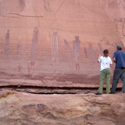
- hikers admiring The Harvest Scene | The Maze ⮞⮞⮞
-

- outbreak near spring at bottom of Pictograph Fork
-
- Chocolate Drops from below
-

- Moki steps climb
-
- gray crack climb
-

- Red Wall climb
-

- Nuts and Bolts | The Maze ⮞⮞⮞
-

- Nuts and Bolts | The Maze ⮞⮞⮞
-

- Chocolate Drops and Land of Standing Rocks | The Maze ⮞⮞⮞
-

- The Maze Overlook
-

- Horse Canyon edge | The Maze ⮞⮞⮞
-

- Horse Canyon
-
- Horse Canyon
-

- looking east on road to Maze Overlook
-

- spring flower and bugs
-
- potholes near train into Horse Canyon
-

- North Trail Canyon
-

- outbreak in North Trail Canyon
-

- tanks at bottom of North Trail Canyon
-

- top of North Trail Canyon
-

- looking east from near French Spring
-

- Millard Canyon overlook
-

- overlooking French Spring Fork (and Hans Flat)
-

- Foothills above French Spring Fork Spur
-

- dropping into French Spring Fork Canyon
-
- the talus slope used for descent/ascent in French Spring Fork spur canyon
-

- tanks in spur of French Spring Fork
-

- small outbreak in Happy Canyon
-

- mid Happy Canyon
-
- Mid Happy Canyon
-

- lower Happy Canyon
-

- narrows begin in Happy Canyon
-

- narrows begin in lower Happy Canyon
-

- upper Happy Canyon Narrows
-

- upper Happy Canyon Narrows
-

- Happy Canyon Narrows
-

- The Narrows | Happy Canyon ⮞⮞⮞
-

- The Narrows | Happy Canyon ⮞⮞⮞
-

- Happy Canyon Narrows
-
- The Dirty Devil
-

- Petrified Wood
-

- looking east across DIrty Devil up Happy Canyon
-

- old mining track follows the cliffs
-

- camp above Dirty Devil River
-

- collared lizard
-

- above the Dirty Devil River
Discover more from Across Utah!
Subscribe to get the latest posts sent to your email.


Thanks again for this info Jamal, a great route. We just hiked through- April 2022 – and I have added water and trail notes to the bottom of our blog post for reference…
https://aweewalk.blog/2022/04/11/needles-to-hanksville/
Awesome! I’m headed out in May… maybe we will cross paths out there somewhere.