Below is the Daily Journal account from my original website which tracked my hike intended to stretch from outside Escalante, Utah to Monticello in spring of 2010. Read the details to see how it all turned out:
FYI: a Route Map is available as well as the Hike Video!
.
May 14th – Prep Day
Driving down to set out two caches and get necessary permits. I’ll spend the night in a local motel and hit the trail around mid-day on Saturday. Not sure if I am ready — but I’m excited!
Day 1
Started in the late afternoon headed out from where Harris Wash crosses the Hole-in-the-Rock Road. There was a little bit of water in a stream at this point, but it would dry up before going too far. When I got to the junction of Big Horn Canyon, I dropped my pack and went up to explore the west branch. The slot was fairly short, but it was nice, getting very tight in one spot. The colorful swirls of sandstone were great in this area.
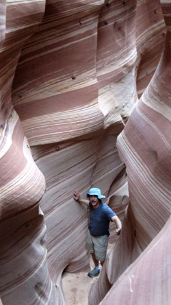
 A little farther down I was able to go up and into Zebra Slot. I’d been turned away from this colorful slot before by a cold pool of water in early winter. But — this time it was completely dry so it was no problem getting in and checking it out. This slot too was very short, but it was amazing. By climbing up a little at the top end, one is rewarded with a great view. Met a couple from Michigan in the canyon.
A little farther down was Tunnel Slot. It’s a cool feature, but wouldn’t be worth going to far out of one’s way to check out. I camped high above on the sandstone slickrock and watched a great sundown.
Day 2
I continued down Harris. Before too long a small stream formed and it would continue all they way down to the Escalante. Upper Harris was a nice surprise, then it opened up a bit around the Red Breaks area, then it became entrenched and lush once again — with several nice undercuts. Got to see a beautiful eagle at the campsite and the night sky was loaded with stars.
Day 3
Crossed the Escalante River in the morning. It was much easier than my past attempts as the river was not running too deep. Traveled up Silver Falls Canyon. It was a nice, but not as impressive as Choprock Canyon to the south. Some petrified wood along the way.

Day 4
Morning rain made for a slow start to the day. Filled up water containers at Colt Mesa. I met a nice couple backpacking for their 42nd anniversary. I then broke off the existing trail and traveled cross country toward and then into Capitol Reef National Park. It was a tough climb up and a tougher climb down! I was nervous the whole decent as I wasn’t sure if my route would connect with the main canyon, or if it might end at a dry. Lucky for me… it connected. It was cool to blaze my own route, but hard. It rained off and on all day so I was happy to camp under an alcove at an old cowboy campsite in Lower Muley Twist Canyon.

Day 5
In the morning I checked out cowboy relics near my campsite. People have been camping here for over 100 years. Did a side hike to the narrows to the south before hiking up Lower Muley Twist Canyon.
Farther north in the canyon the huge undercuts were awesome. I was surprised to see a few waterholes in the canyon as well– as I guess it is usually dry.
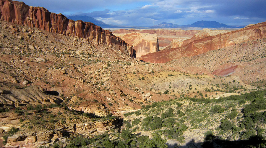
The cut-off route to exit the canyon was exhausting but gave great views of the Waterpocket Fold. Once down I headed just a few miles east on the Burr trail and all was good when I retrieved cache #1. Camped nearby.
Continue the journey with Escalante to Monticello — Part 2.


