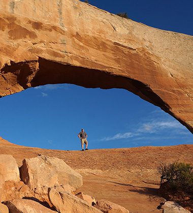
pre-hike at Wilson Arch
I procrastinated putting together this trip report because the process actually bummed me out somewhat. It’s now been TWO years in a row that my spring trip hasn’t gone as planned. 🙁 That makes me question… Am I getting too old for this? Am I losing the passion? Am I done doing multi-week hikes? I answer all of those with an emphatic “No”.
For this spring I’d planned a 28-day adventure from Arches to Bryce. I was excited about the route which would follow a few sections of the Hayduke Trail that I’d never done, hit a few “new-to-me” canyons near lake Powell, and then finish with some old favorites in the Paria/Bryce area. Unfortunately, all that planning was for naught, because I had to abort the plan after 7 days due to a strained knee. Below is the day-by-day detail for the abbreviated hike.
See the Photo Gallery or Route Map for this hike. Hike Video also available.
.
May 3rd, 2017
Day 1
After parking in the long-term lot at the airfield north of Moab, I set out walking. After a quick jaunt down the frontage road, I headed east cross-country toward Arches National Park. I soon passed a small spring (and its resident cows) and then connected with the maze of gravel roads which provide a playground for mountain bikers and 4-wheelers in the Little Valley area outside the park. I continued on toward the park along the road and then picked up a deprecated route that skirted the west side of Klondike Bluffs. I hoped to climb the sandstone domes and connect with the established 4×4 road in the national park. Despite extensive online research before my trip, I was never able to confirm whether or not such as route was possible.
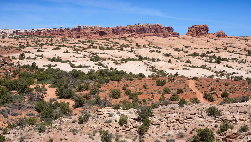
hiking toward the Klondike Bluffs
As I climbed higher up the slickrock I became pessimistic expecting a sheer drop on the far side. But, near the top, it leveled off and it was an easy walk to connect with the road.
After reaching the 4×4 parking area, I followed the trail into the sandstone fins and toward Tower Arch:
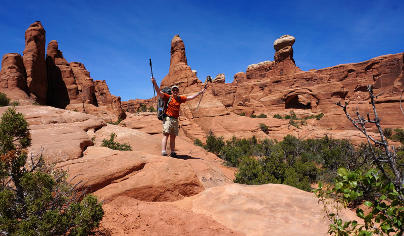
nearing Tower Arch
The only other people I’d seen were leaving as soon as I arrived at the arch. So, for the next 30 minutes or so I had the whole place to myself and it was glorious. 🙂
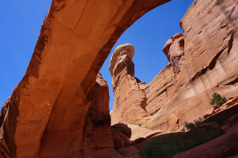
Tower Arch 360
Leaving Tower Arch I headed south along the sandy trail toward the rock formation known as the Marching Men.
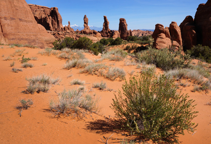
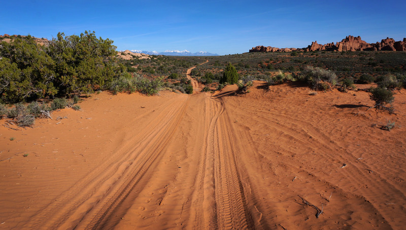
When the official trail turned east toward the Salt Valley Road TH, I instead continued down the wash to the south. I was able to walk around the Marching Men and eventually re-connect with the 4×4 road again. At the fork in the road, I went south and in doing so was then on the official route for the Hayduke Trail. I followed the incredibly sandy road south through “Not Little Valley” toward the snow-capped La Sals.
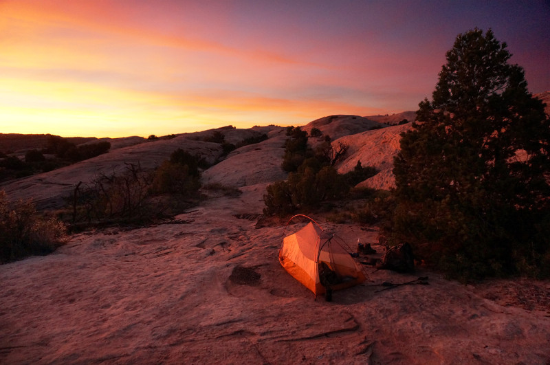
Late in the day I was near the western boundary of the park and hopped outside to legally camp on the slickrock. Sundown bathed the landscape in a pink hue.
Day 2
It was a fairly warm early in the morning. I contoured around some slickrock before heading back into the park and then continued slogging through more sand.
Next I followed a fence for a ways as I headed south as described in the Hayduke Trail Guide. When I unexpectedly ended up high on a sandstone outcrop, I realized that the guide was evidently out of date and that the fence no longer ran along the park boundary, but instead angles to the east. My GPS confirmed. No problem — it was a fairly easy scramble down and into the wash where I could pick up the Hayduke Trail again near Willow Spring.
The wash right below Willow Spring contained the first water I’d seen since starting my hike. I took a nice break and filled up. Glad I did, because the water didn’t flow too much farther below this location.
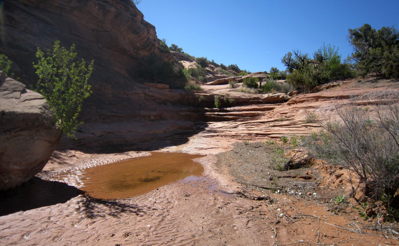
near Willow Spring
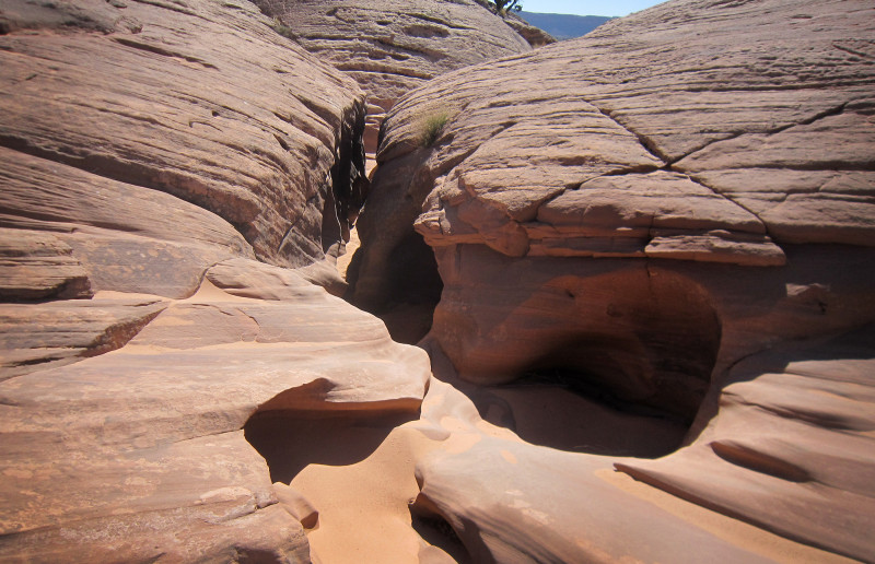
Soon the wash became impeded by a series of mini-slots. Some were a tight squeeze; others had drops which looked to be impassable. Fortunately there was always a fairly easy way to go up and around anything too problematic.
As I neared the junction with Courthouse Wash, water began to flow again and I could see the lush greenery ahead.
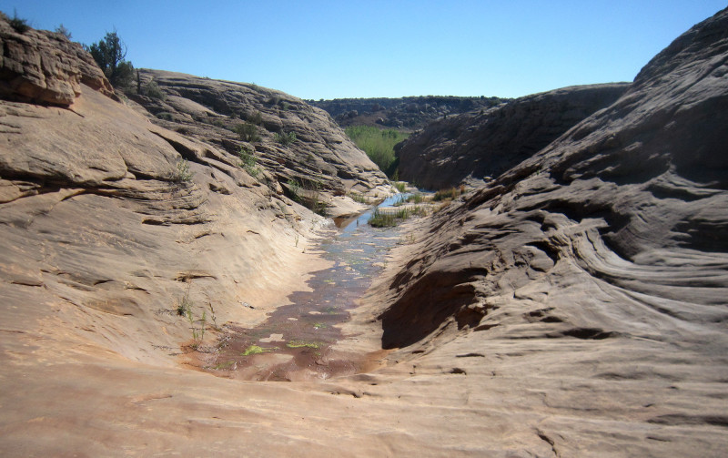
nearing Courthouse Wash
After dropping into Courthouse Wash it was at first extremely brushy, but soon it opened up a bit making walking much easier.
There was as strong flow of water through the upper part of Courthouse Wash, but below the junction with Sevenmile Canyon the flow suddenly disappeared. I was pretty confident the water would return, but after walking a ways in the sandy wash I decided to go back and re-fill my jugs just in case.
Soon I climbed up a steep bank out of the wash and continued toward the side canyon that is home to Ring Arch. Walking was much faster up on top and out of the wash.
Arriving at Ring Arch was a delight. This was one of my favorite arches as a kid, so it was cool to see it again after 30+ years. Several years ago the arch suffered a partial collapse. What was once a smoothly rounded span, now has a sharp face on its front edge. It’s still an incredible sight; maybe even more amazing considering that it’s still standing.
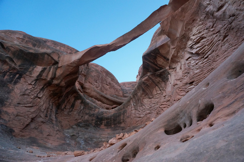
Ring Arch
Twilight settled in as I made my way south. It was cool to know that I was one of only a few “visitors” in the park at this moment. Due to the road construction, the main park road closed at 7pm and most visitors had to exit the park. I held one of only two backcountry permits which allowed me to be there!
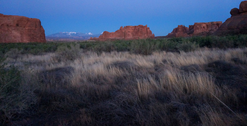
I think I enjoyed the moment a little too much because soon it was getting dark. As I got to the road I could see the construction crew up ahead. The flood lights and big machines tearing into the road made for a scary scene. Not sure why, but it felt like I shouldn’t be there — as if I was witness to a crime scene or something. Visions of Monkey Wrench Gang danced in my head. I slipped by unnoticed and continued on down the wash toward my designated camping zone. I could still hear the machinery from my tent later that night.
Day 3
I continued on down Lower Courthouse Wash navigating around a few beaver dams when necessary. Along the way I encountered several deer in multiple groups.
There were several nice slickrock/pond areas which encouraged slow travel on this hot day. Water dried up momentarily mid-way down the canyon, but then began to flow again after just a short break.
Nearing the lower end of the canyon there was a big alcove which made for a great lunch spot. A little farther was another great cascade/pool area.
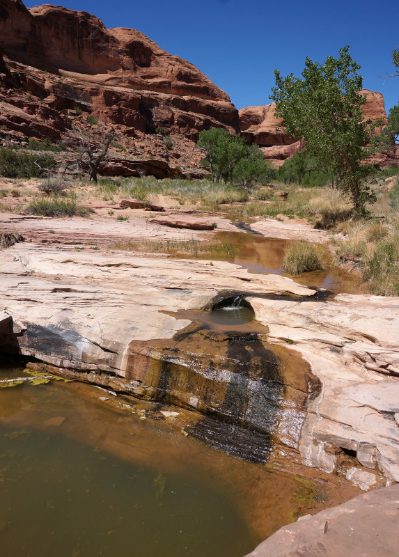
Lower Courthouse Wash
In this area I by chance ran into a hiker that recognized me! His name was Scott and I’d actually previously corresponded with him through my site. He was also headed out on a “Hayduke-ish” hike across the state.
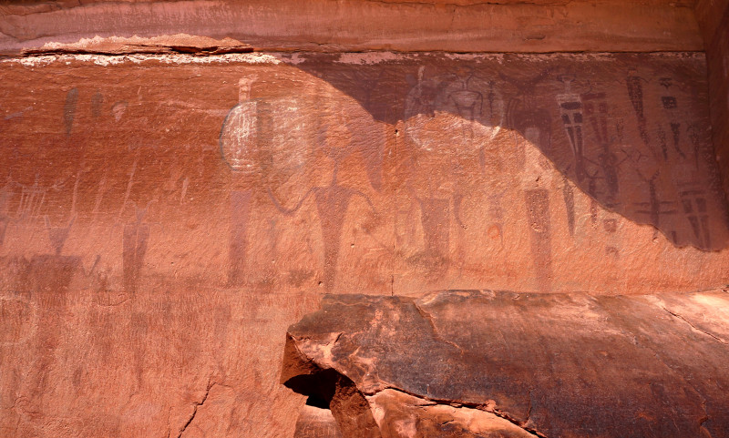
Before leaving the national park, I did the short side-hike up to see the Courthouse Wash pictograph panel. It was a furnace up there in the direct sun — but it was great to finally see this rockart up close.
As I headed toward Moab I took a break under the Colorado River Bridge. I was thankful for the shade as it was downright HOT. With phone service once again I was able to confirm this — 94 degrees! Yuck.
After my break I crossed the river via the pedestrian bridge and then took another break in the park on the south side. The new addition was a great spot to empty my trash and fill up on water and of course… escape the heat.
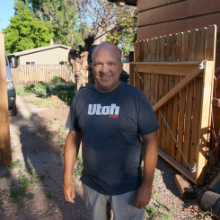
Mike Coronella in Moab
The next several miles walking through Moab were pretty miserable. There was little shade and the pavement was so hot it burned my feet through the soles of my boots. The only “cool” thing about walking through the city was that I randomly ran into Mike Coronella — the co-author of the Hayduke Trail Guidebook. It was awesome to meet him and chat a bit about wilderness hiking on the Colorado Plateau. After this short respite from walking, I continued on thru Moab.
It was late in the day by the time I got to the Moab Rim trailhead. With no water at the nearby campground, I had to walk down to Kings Bottom Spring in order to fill up. I headed up toward the rim, but ended up camping in a less-than-perfect spot along the way.
Day 4
I awoke to overcast skies and a much cooler day which was a relief. But, I also realized my feet were wrecked and my knee was sore from twisting it the day before.
I slowly made my way up the rest of the Moab Rim Trail along the fairly new “Stairmaster” hiking trail. This meant that I didn’t have to share the route with the several Jeeps making their way to the top as well.
Up on top it was a gloomy view overlooking Moab:
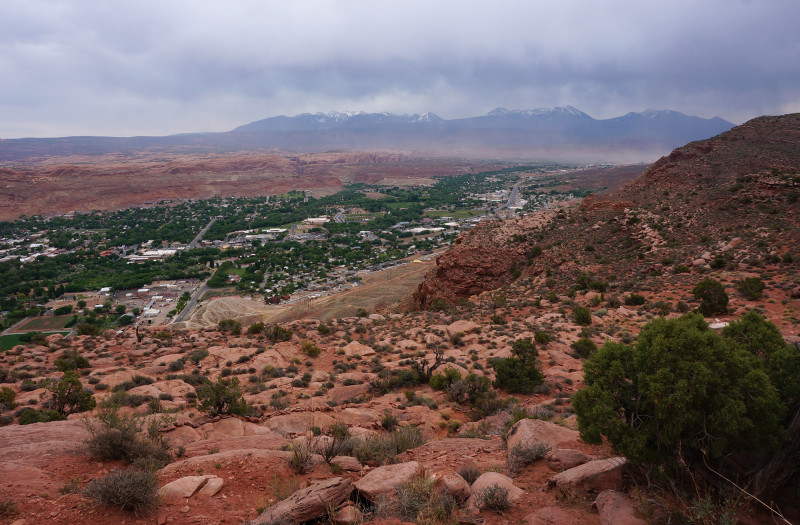
I continued on the 4×4 route south and toward Behind the Rocks. Atop a big sandstone island, I left the road and headed south toward the massive outcrop of fins.
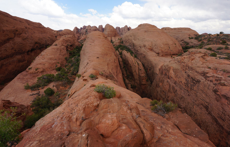
Navigation through the next section was tricky. It requires substantial up and down while winding through the fins. I’d done it before, but this time I’d hoped to find a more efficient route. Well — no such luck! If traveling through here be prepared for some steep slickrock friction walking, a minor downclimb at a pouroff, and then a cool, but exhausting, walk up and over a massive fin. To add to the excitement for me this time, it began to rain just as I crested the walk along the high fin:
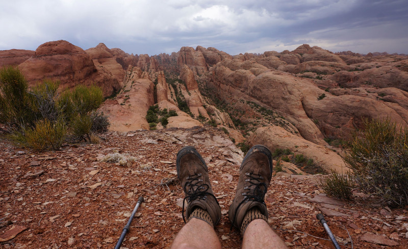
Once down and around the end of the big fin, the area opens up and it’s a fairly easy walk up to what I refer to as “Kidney Bean” Mesa. I borrowed this name from another hiker based on how the feature looks on the topo map. It’s just above Pool Arch and a great spot to stop and take in the view:
I followed my previous route down beside the top of the arch. Here I took another break as the storm raged for a bit — crazy strong winds and the most rain I’d seen thus far. But, it didn’t last too long , and soon I continued on through the fins and down into gully. I didn’t take the time to confirm a route back to get underneath Pool Arch. It looks feasible, but I can’t say with certainty that such a route exists (from the east) so please let me know if you do it.
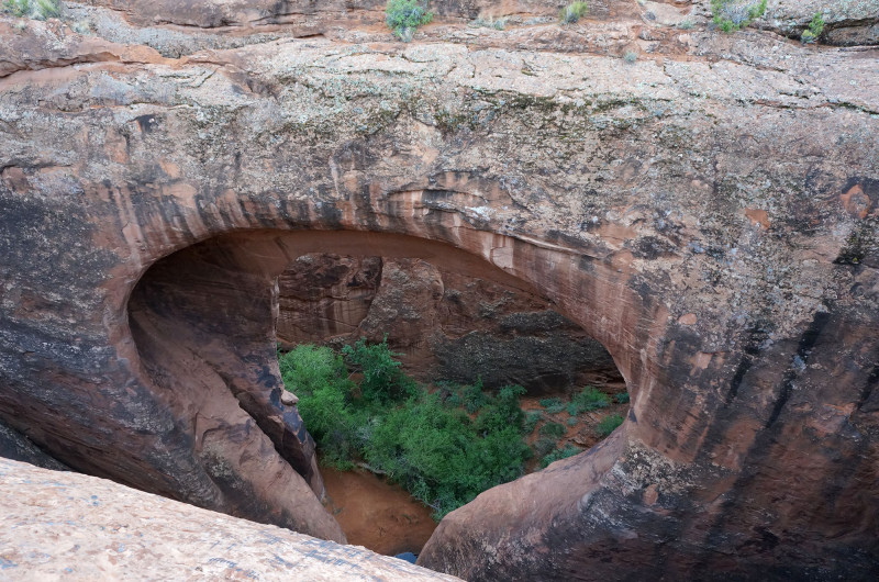
Pool Arch (aka Teardrop Arch) from above
After a fairly steep drop down off a fin into the main gully, I continued east along the massive corridor. I was quickly reminded of the difficulty of this route. There are no major obstacles along the way, but it’s a continuous challenge of finding the best way through brush/rockfalls/drops/etc. It’s a slow go — especially with a sore knee.
After some distance a huge stone spire comes into view ahead. This is the pass out of the canyon that I dubbed “Spire Pass” on my last trip through here. Though the sight meant I was getting close to being done with the tough stuff, I was exhausted and decided to camp when I found a decent spot. The climb up and over would have to wait until the next day.
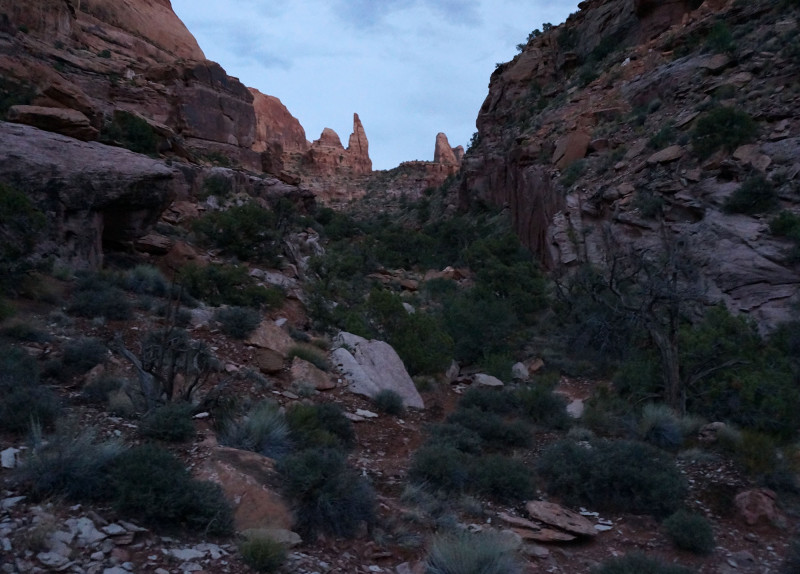
heading toward “Spire Pass”
Day 5
In the morning I got up and looked around for some water because I was running somewhat low. To my surprise, I failed to find any despite the rain from the day before.
I set out for the climb up and over the pass. I enjoyed the the view up on top for a while, before route-finding over to the next valley which provides access through the next set of fins.
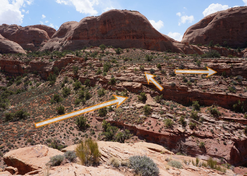
Climbing down I found some pools of water, so I opted to take a break. My knee had been really sore for the last few days and now for the first time I realized it was swollen. 🙁 This is not good. I took a drink of my new water and… it wasn’t good either! It had a very strange taste for some reason. I kept it just in case, but hoped I’d find better water soon.
The route ahead of me would soon end at a huge pouroff. However, after some exploring on my previous trip, I discovered a small gap in the fins upcanyon which leads to the next valley over. The convenient passage was definitely much easier to spot the second time.
From here my route criss-crossed a series of valleys and ridges headed south before turning west again to go down a long corridor. En route there are a few spots that at first appear impassable, but with exploration one will always find at least one fairly easy way to continue. I was glad to find a few more pools of water along the way; and they tasted much better.
Headed down the rock-filled canyon, I decided to remain high and hug the upper cliffs. I found this to be much easier than my route last time which was near the bottom along the main watercourse. Lower in the canyon I saw the Dead End Arch high up on the southwestern canyon wall that I walked right past on my previous trip.
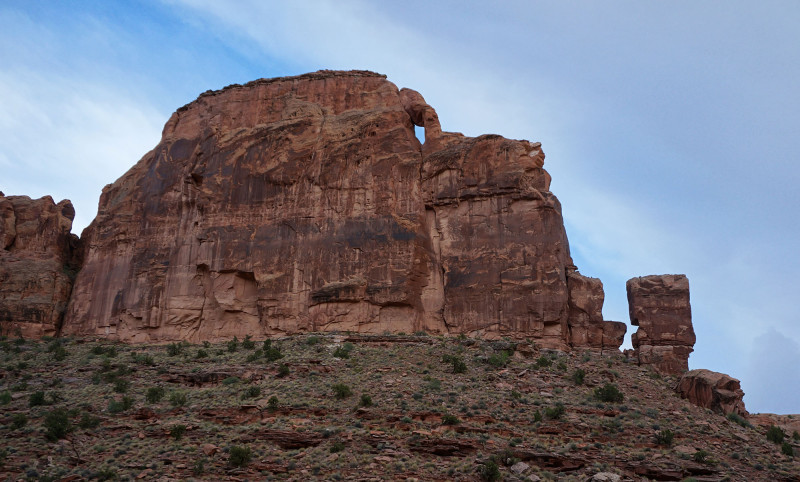
Soon a side canyon joins from the left and then Troll Bridge is visible below. After that it’s just a short distance down to the junction with Pritchett Canyon.
As I headed up Pritchett I was excited to see more pools of water. Unfortunately, after sampling some of these I realized they were no good. They all tasted like oil/gasoline — probably from the many 4x4s that travel this route. 🙁
I ended up camping within view of Window Arch.
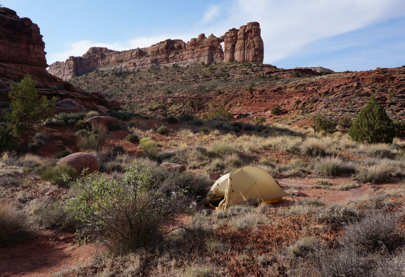
It was a pretty slow/tough day, but it did have one notable highlight — I finally got to see the Solstice Snake! I’d missed this famous petroglpyh on my last trip, but this time I set aside a little extra time/energy to track him down. What makes this rockart unique is that on the summer solstice of each year a beam of light passes through the nearby fins and creates an arrowhead on the snake’s head. Pretty awesome.
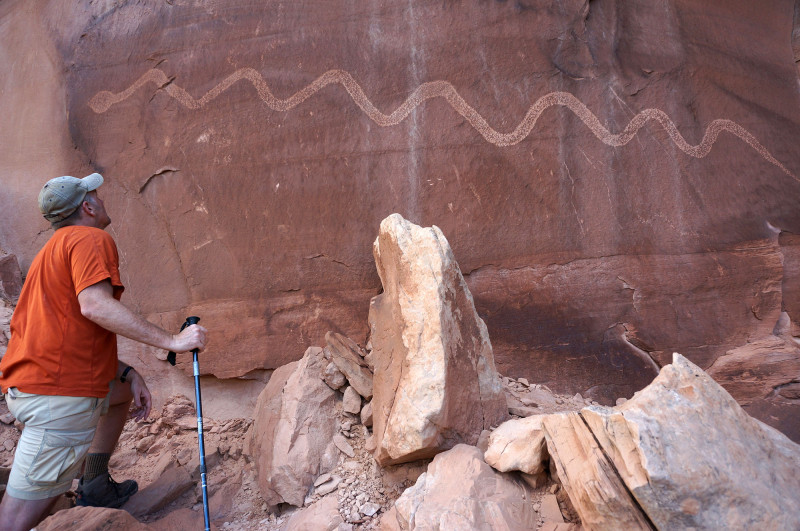
Solstice Snake
Day 6
I headed up canyon and stopped near Ostrich Rock to contemplate a potential short-cut route over to Prichett Arch area. I didn’t investigate it fully, but it didn’t look promising due to an imposing upper cliffband, so instead I went the long way up and over White Knuckle Hill and then around the back side. The good thing about going this way is I got to check out that cool “totem”-like spire again:
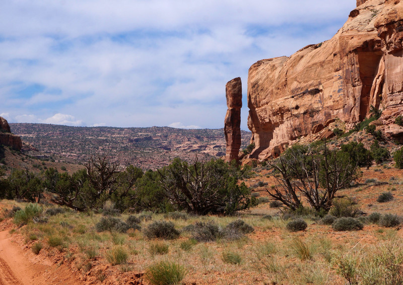
Now nearly noon it was getting really warm again. I was pretty exhausted and my knee seemed worse, but that didn’t stop me from doing the side-hike out to Pritchett Arch. It’s such an incredible span — I just wanted to get there and stand underneath it once again:
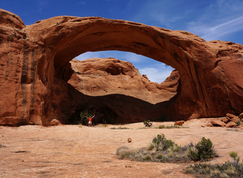
Pritchett Arch
Back on the main route I headed toward Hunters Canyon. As I got close to the big drop into the lower canyon, I was super elated to find a large pool water. I was even more excited when I ran it through the filter and it tasted great.
I scouted the scramble route down the canyon’s southern side which descend two drops that look kinda tricky. Stacked rocks and logs were in place to assist, but it still looked challenging — especially for the solo hiker. Since I had water I decided to pass on doing the full descent, and instead followed the route along the northern side of the canyon.
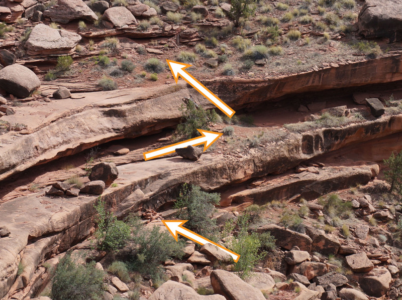
scramble route up from Lower Hunters Canyon
The route along the rim is a nice walk with some great views along the way. I’ve read it’s popular with mountain bikers, though I didn’t see any on this day. Keen-eye observers will spot Hunters Arch on the opposite rim. Easier to spot are all the hikers in the canyon bottom down below.
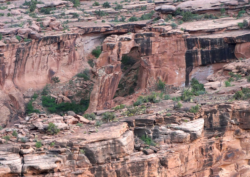
As the sun went down and another storm moved in, I made camp on the slickrock above the junction with Kane Springs Creek Canyon. It rained off and on most of the night.
Day 7
By morning the rain had stopped, though it was still overcast and gloomy when I got up.
The previous night I’d made the decision that once I got down to the road, instead of continuing toward Canyonlands, I would instead head back toward Moab. 🙁 My knee was showing no signs of improvement and and in fact was getting more sore each day. It was also slowing me down too much to continue the hike as planned. I contemplated doing a shorter segment, though I knew my cache allocations would not suffice at this slower rate. This meant that I’d have to shift my strategy to include re-supplies which would slow me down even more. This wasn’t appealing to me so I made the hard call to just abandon the plan while still close to “civilization”. I hoped to recuperate for a few days and then maybe re-launch into an alternate plan with new supplies and a fresh outlook.
With this new agenda, I climbed down the terraced ledges and got to the road near the creek. At this time it began to rain hard once again. I found shelter in an alcove and sorted through my gear for essentials for the walk back to Moab. I’d return to pick up the rest of my gear while retrieving my cache located up the road.
Walking the pavement back to Moab was no fun — but at least it wasn’t 94 degrees this time. Right as I got to town, I met a friendly guy that offered to give me a ride back to my car.
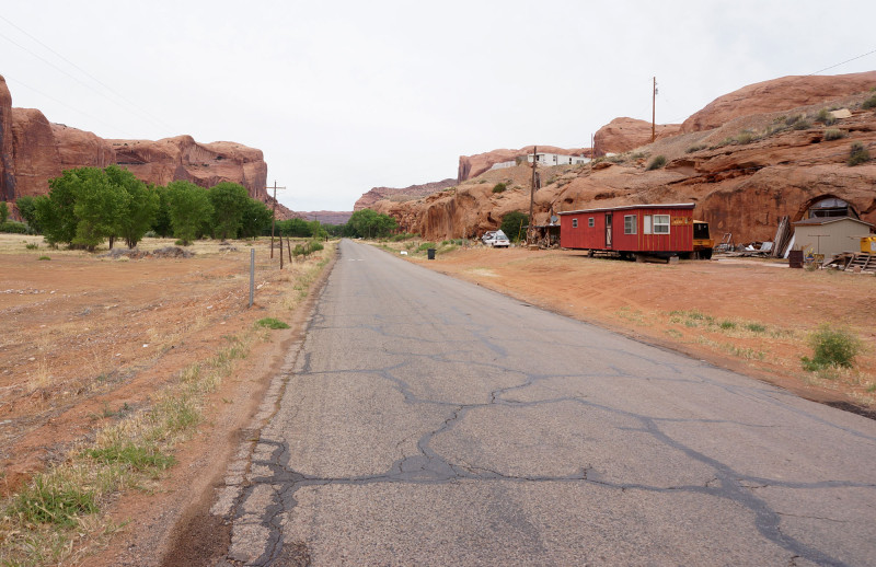
the road back to Moab
After a quick lunch in town, I headed back out to retrieve my gear and camped at one of the organized camps in the open valley along the creek below Hurrah Pass. As the sun went down I made the short walk over to check out the weird formation called Devils Golf Ball (aka Turk’s Rock). I’d only seen it from afar previously, so it was awesome to take this chance to get up close.
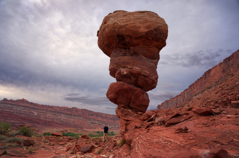
Devils Golf Ball
I returned to my car camp and ate dinner on the picnic table where I could hear a few other groups of campers not too far away. This just felt wrong after so many nights on the trail. Ironically, even with the other people around, for the first time it felt really odd to be alone. It was a weird experience; surely amplified by my mindset of having to abandon my hike.
Over the next few days I traveled through southern Utah retrieving my caches and doing some short day hikes. I’d hoped to do more, but the leg just wasn’t cooperating. I knew it was the right decision to give up on the master plan, but that didn’t make it any less of a bummer.
☼
Update… over a month later, the leg is nearly back to 100%. Maybe I’ll get to take a mulligan this fall! TBD. 🙂
See the Photo Gallery or Route Map for this hike or even… the Hike Video.
.


Hi Jamal I hope you will not get discouraged from the incident and still will carry your plan in spring. I really enjoy the scenery and your quality photography–it was good to see you again. Vaz
Thanks, Vaz! Yep — I’ll be back out there this spring. 🙂
Jamal, great post as always. I am curious as to your intended route over to Bryce. Do you have that handy? I’d love to see it if not too much trouble.
No problem — in broad strokes it was to be down through Canyonlands/Dark Canyon to Hite, then along Lake Powell’s north shore over to Bullfrog, then over 50-Mile Mountain/Kaiparowits to the Paria region and up to Bryce. Mix of previous routes plus some new stuff. More detail available via email if desired. 🙂
Jamal, Good to see another beautiful trip….that Snake is very special…smart people have been around a long time….get that knee back in shape…maybe do strengthening exercises so it is less prone to giving out…great to see and carry ever on….best Allen Bealle
Hey Jamal, thank you once again for sharing your hike, albeit shorter than you wanted. I hope your knee heals this summer so you can indeed set out in the Fall on the rest of your hike! Keep up the wonderful work here!
Jamal, it is always an extreme pleasure to read your amazing trip reports. You give me inspiration to go back and see a few places you hike. I am glad your knee recovered fully. These injuries takes sometime too long to heal.