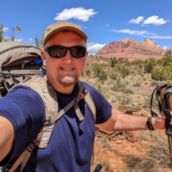
 In spring 2022 I set out on my Zion to Green River Hike. It was an amazing trek even though I didn’t really start in Zion or end in Green River (cue the “It’s about the journey” cliché!) Now that the Daily VLOG is finally finished I wanted to share a bit more about the hike in written form. I’m going to forgo the day-by-day written trip report though as it’s a huge timesuck for me and would be fairly redundant with the videos. However, below is a general recap along with a Gallery and the Interactive Map for the adventure. 2023 Update: the All-in-one Condensed Video is also now available on YouTube!
SOME STATS:
- May 1st start date
- 42 days (including 5 “bonus” days in October)
- 676 miles (“all miles walked” as opposed to “trail miles”)
- 8 caches (plus 3 extra water-only caches)
- 3 beers (one found, two from strangers)
- 1 hour of rain (mixed with snow!)
- 26 days without encountering any other hikers (16 without seeing humans/cars)
HIGHLIGHTS:
I visited so many new-to-me spots this year that had been on my list for a while:
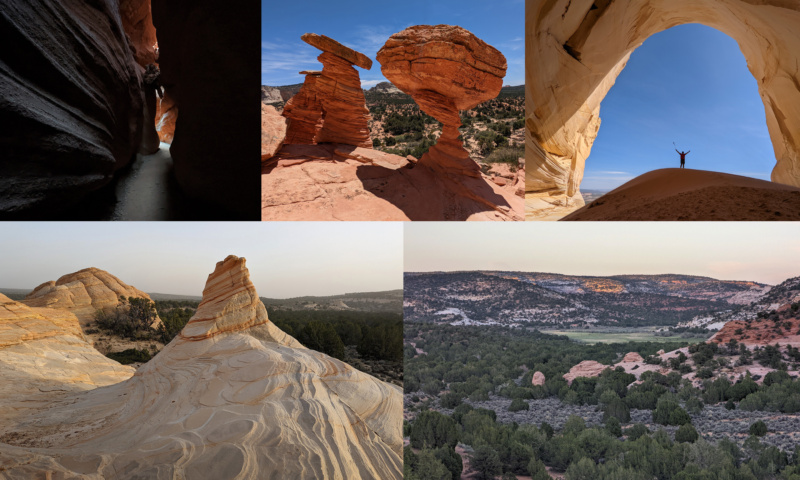
- Mount Canaan, The White Domes, and Water Canyon Arch
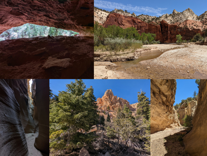
- “Cool Rocks” and The Great Chamber (inside this time!)
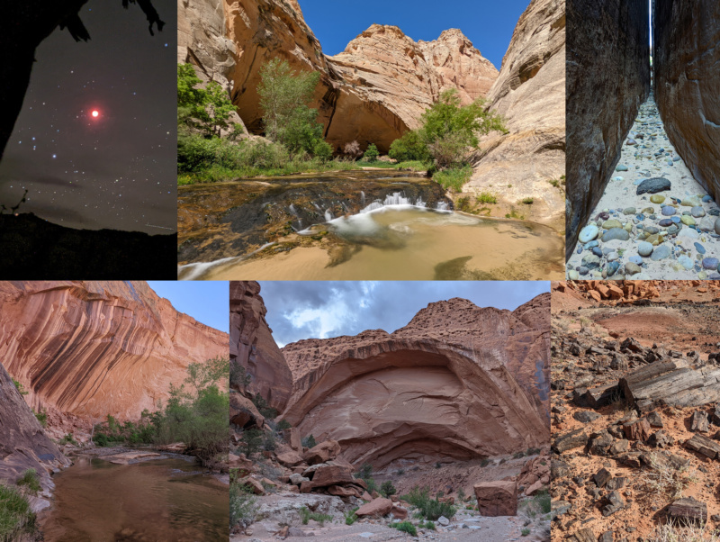
- Upper Upper Paria and Dunham Slot
- Canaan Peak
- Gulch-to-Horse stretch of The Escalante
- Wolverine Canyon
- “Beehive Traverse” in Capitol Reef
- Lower Cathedral Valley section of Capitol Reef
- The Chute of Muddy Creek
And I also re-visited some of my favorite spots:
- The Barracks
- Upper Paria
- Death Hollow
- Upper Muley Twist Canyon
- Black Dragon Canyon
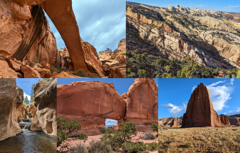
I also enjoyed some completely unexpected experiences. I was fortunate to see a lunar eclipse while along the Escalante (thanks Mom for the alert!) The many original route-finding challenges in the Capitol Reef backcountry and elsewhere were exciting. And lastly seeing a great variety of animals — many of which I don’t normally see on my hikes. They included:
- Feral/Wild Horses
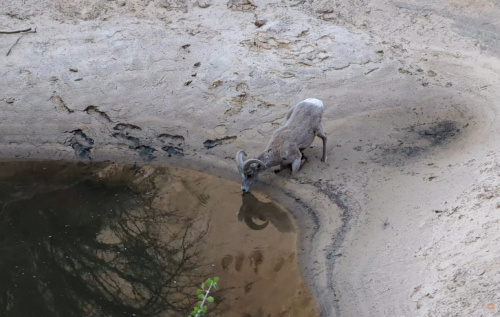
- Bighorn Sheep (including one that stalked me!)
- Elk
- Pronghorn
- Scorpion
- Bobcat
- Rattler and Gopher Snakes
LOWLIGHTS:
There aren’t too many bad memories from this trek, but there were a few. Here’s that list:
Food — I really miscalculated my food allotment for this hike. I tend to carry too much food on trips and thus this year intentionally cut back — both in my pack and at my caches as well (why, oh why?!) The problem was that I cut back too much and then it was compounded when the trip ran longer than expected. Later in the trip I had to ration my food and eventually ran out. It wasn’t a dangerous situation as I was never far from help, but it depleted my energy and eventually led to a slightly premature end to the original spring hike.
Water — the lack of water on this hike was tough as well. I never ran out, but often carried much more than normal knowing that it was an incredibly dry year. Four times I got “bonus” water from strangers which definitely helped ease the pain in otherwise dry sections.
Gear Problems — sometimes I love my gear too much! By that I mean I keep it for too long. I’ve joked for a few years now that I should replace my tent as it was falling apart. Well… I squeezed one more trip out of it. I was lucky that it never rained as it likely would have made for a really wet night. My pack was also well past its prime before setting out as it had carrying my gear for 12 years. My haul strap broke early into the trip and by the end only one of five pockets were still functional due to holes. The hip-belt and one shoulder-strap were barely hanging on with the help of some duct tape. My solar panel and battery system also seemed inadequate this time out. I was definitely shooting more, but it also seemed as if things were charging slower (possibly due to the age of those items as well.)
“Beehive Traverse” — even though I listed this as a highlight and was glad I did it, it was also somewhat a disappointment. Despite being somewhat shrouded in secrecy online, this route seemed to be all the rage several years ago and I was jealous I hadn’t done it. Even though some parts were really amazing, other parts were really awful. The incredibly steep bushwhacks and overly circuitous route diversions just weren’t fun and some spots were potentially dangerous (eg The You-fall-you-die Dryfall!) Part of this could be because I didn’t have official beta for the route and thus multiple times found myself off the ideal route (realized only in hindsight). That said, I still can’t really recommend the route for most people due to the high effort-to-fun ratio. As such I’m excluding my detailed track through this section on the map, I will however still note some key points of interest and happy to share more detail/thoughts via email.
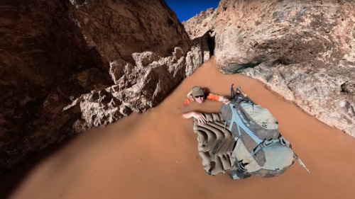
Eardley Canyon Bad Day — the only moment from this trek that was scarier to me than the Beehive Traverse dryfall was the near disaster in Eardley Canyon. After getting stopped by a climbing obstacle and losing a camera in a deep pool, I had to retreat back down the canyon. This required swimming across an over-my-head big pool while floating my pack. Half way across my make-shift raft flipped and it was a truly scary moment. My 360 camera was recording and captured the whole incident. I almost didn’t include the footage in my VLOG because I was somewhat embarrassed as it should NOT have happened if I’d been a bit more careful. It was actually my THIRD time swimming across the big pool (the scout swim, upcanyon swim, then this downcanyon swim) and I admittedly was a bit too nonchalant about the process on the final trip. In the end I kept the whole thing in the video to serve as a reminder to myself (and others) to never become complacent while doing potentially dangerous things in the wilderness.
WHAT I PLANNED, BUT DIDN’T DO:
Besides the ending, I really didn’t deviate too much from my planned route for this trip. On the Interactive Map there is an option to display my potential alternate routes that I considered. One can click on any of those purple segments to read a description of that section.
SECTION OVERVIEWS:
Part 1: Mount Canaan and The Barracks
5 days, 75 miles
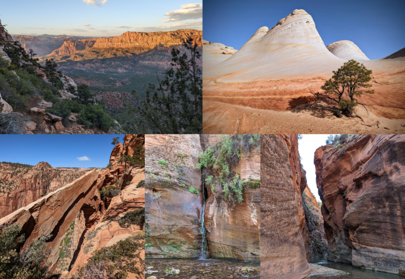
Starting on the first day of May just south of Zion, I climbed the Eagles Crags route up to Mount Canaan. I enjoyed the amazing slickrock including the White Domes area. I visited Water Canyon Arch before heading through the sand to drop down into The Barracks via “French Canyon”. From there I headed upstream enjoying a few side canyons along the way before finishing the section near Hwy 89 and my first cache.
Part 2: Along the White Cliffs
4 days, 68 miles
Leaving the Dianas Thone area I checked out many of the cool sights along the White Cliffs such as Peekaboo Canyon, “Cool Rocks”, and The Great Chamber. From there I kept winding my way eastward through far less popular territory towards Mollies Nipple and enjoyed some cool slickrock along the way. I did not enjoy the deep sand or the ever-present wind.
Part 3: The Upper Paria and The Kaiparowits
5 days, 86 miles
From the Nipple Ranch area I made my way into Starlight Canyon and eventually down to the Upper Paria. From here I walked UP river for the first time ever and enjoyed the many sights along the way. I checked out Dunham Slot for the first time before heading east by skirting Kodachrome Basin and climbing up the Kaiparowits Plateau. My route up underneath Canaan Peak provided some great views and then Horse Spring Canyon was a great remote route down and towards my next cache and the town of Escalante.
Part 4: Escalante to The Burr Trail
5 days, 82 miles
After walking through the town of Escalante I made my way into upper Escalante River Canyon. I climbed up to a bench for camp so that I could enjoy the amazing lunar eclipse that night. The next day I had a great side trip into Death Hollow before continuing on down the Escalante enjoying the many sights along the way over the next few days. I eventually left the river at Horse Canyon and made my way up through spectacular Wolverine Canyon before going cross country over to the Burr Trail.
Part 5: Up The Fold in Capitol Reef
10 days, 164 miles
Leaving the Burr Trail I made my way into Upper Muley Twist Canyon and enjoyed the many arches along the route. I left the upper end of the canyon and continued cross country north along the edge of the Circle Cliffs and to the rim of South Coleman Canyon where I descended via a rough scramble and exited the lower canyon to the front of the reef. From there I made my way up to Sheets Gulch and went all the way up and eventually down Pleasant Creek to get back in front of the reef again. The next few days I did an approximation of the challenging off-trail route dubbed the “Beehive Traverse” by route pioneer Steve Howe. I finished the route and went down Grand Wash and then up Spring Canyon. In the upper end of this canyon I found my own route out and over the top of the Waterpocket Fold and into the South Desert area and eventually to Lower Cathedral Valley — my first time seeing the amazing formations of Temple of the Sun and Temple of the Moon there.
Part 6: Mussentuchit Desert and The Muddy Creek
4 days, 70 miles
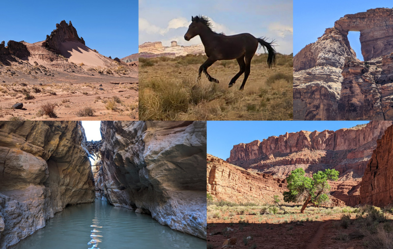
Leaving Capitol Reef I followed a series of backroads through a dry landscape with cool volcanic dikes. Heading toward Mussentuchit Desert I was unexpectedly hit with a late-spring squall hitting me with rain and snow for an hour. This was the only real precipitation of my entire trip and I was grateful for it as otherwise this could have been a dry/hot stretch. After making my way cross-country for a ways I connected with a road again to get my next cache near dry Mussentuchit Reservoir. Next I headed east toward Hebes Canyon where I encountered several feral horses which were somewhat territorial before eventually getting to Muddy Creek. I followed this down through the Tomsich Butte area, past Hondu Arch, and into the narrows known as The Chute. The was an exciting segment requiring floating my pack across one deep section. The lower canyon past Hidden Splendor wasn’t as narrow, but still quite scenic with some interesting old mine ruins as well. The only downside — the deer flies were ferocious!
Part 7: Winding Up and Through The San Rafael Reef
5 days, 69 miles
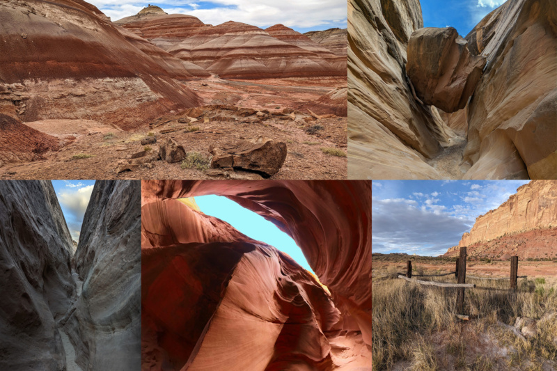
Leaving the Muddy Creek behind I made my way through some colorful striped Bentonite hills before cutting back through the reef at Cistern Canyon. After following the Behind the Reef ATV route a ways I cut back down through the reef via the scramble route that is Ding Canyon and to my next cache. The next day I went up the uber-popular Little Wild Horse slot canyon and then traveled behind the reef again to similarly-named Wild Horse Canyon. After finding another spring dry I was lucky to run into some car campers who helped me out with some extra water (and food!) The next day I made it down to the front of the reef again and continued northeast to find every potential water source dry. Out of food and low on water, I decided to ditch out to the highway to end the hike. I found some bonus water in the lower end of Iron Wash along the way which made the hot walk out to the highway a bit easier.
Part 8: October Bonus Loop
5 days, 62 miles
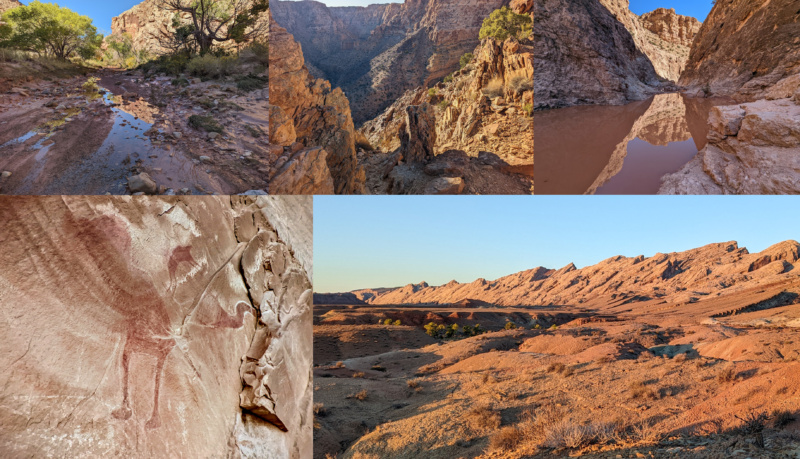
Though I was very happy with my spring hike in general, I wasn’t 100% satisfied since I didn’t quite finish it as hoped. Thus I returned in the fall for a “bonus” trip to complete the hike as planned (well… almost!) I made my way up through Straight Wash and immediately realized that much was different from June with water everywhere after the recent storms. I climbed up along the rim of lower Eardley Canyon and then dropped into the canyon via the super-steep gully above the technical route. From here I’d make my way up Eardley Canyon where the deep pools, mud, and boulders all contributed to a very BAD day. I lost a camera as I attempted to get past a difficult deep pool/climbing obstacle and had to retreat the way I’d come. On the trip back my make-shift raft with my pack turned over in a deep pool making for a scary moment and resulted in very wet gear. The next day I climbed back out the steep gully and tried to dry out as I made my way across the Swell. After crossing Interstate 70 I dropped into Black Dragon Canyon where I reminisced of fond memories from past visits with friends and with my parents. I enjoyed the rock art in the lower end of the canyon before making my way out to the front of the reef for my last night. My final day I closed the loop by walking south in front of the reef visiting several cool spots along the way. Even though I never technically walked to Green River — it was a great hike and I’m glad I went back to finish it up.
~~~
Don’t forget to check out the VIDEO SERIES and THE GALLERY and the INTERACTIVE MAP.


What an amazing trip! I will miss this weekly installment about the desert as I looked forward to your posts daily. It’s hard to find anything you encountered as bad ( minus the loss of your camera) as all things desert are wonderful learning experiences. I thank you so much for sharing your adventures with everyone! I can say say, however, that you maybe dodged some difficulties by choosing Ding over Dang, as Dang has a challenging spot (for anyone with a big pack or a dog) toward its bottom,
I hope you have something special planned this season. I recently saw some fantastic stuff in Comb ridge, and Comb wash. Who knows, maybe I can give you some water or even a Pop-tart! I mean we only missed you by hours at Peekaboo slot!
Again thank you Jamal for bringing us all along!!!
CHEERS, Michael
Thanks! That would be awesome if we crossed paths out there — water and/or pop-tarts would always be appreciated! Cheers!
Amazing series of vlog video. Again, this daily format is so good to capture the pace of you adventures. Loving it! The recap is great and give a way to find specific place by doing a search on your website. The best of both worlds. Thanks you so much for taking the time to film, edit, and publish your hikes. Inspiration for all of us who can hardly reach these incredible places.
Thanks, Jean — I appreciate the appreciation! Hope your trip is going well. ✌