


Going over the top of the Henry Mountains is truly an amazing experience. The official Hayduke Route includes a fantastic ridge route near the apex of the range. But, if snow or weather at the higher elevations is a concern, this alternate might be worth considering. By crossing at Pennellen Pass (get it? it’s the saddle between Mount Pennell and Mount Ellen), this route tops out at 7,800′ compared to the official route’s 10,491′ at Bull Creek Pass or 11,419′ along Mount Ellen’s Southern Summit Ridge (the literal high-point of the Hayduke.) This alternate route also has decent water sources along the way and a couple of interesting canyons not seen by many other hikers.
If headed east to west, begin this alternate south of the official trail at Little Egypt — a cool place to check out some interesting geology. The best way here is via a cross-country shortcut from a southern branch of Poison Spring Canyon (see map), but it’s also possible to get here by simply walking south along Hwy 95.
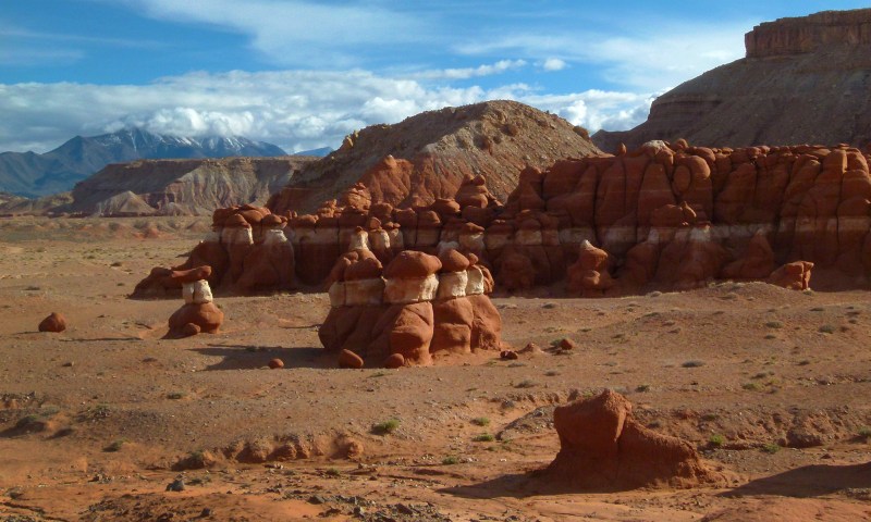
Little Egypt
Follow the gravel road south of Little Egypt to where another road heads west toward the Henrys. Follow this and/or any number of small roads/washes to the area known as Pyserts Hole — an interesting geological “cut” in an uplift of rock.
Headed toward Pyserts Hole
From here leave the road and head south into the very bottom of Raggy Canyon. The following described route is as I traveled it in 2013. Continue south of the mouth Raggy Canyon and climb a somewhat winding route up a side canyon and to the rim of Raggy Canyon (see Interactive Map.) It’s likely that there are many routes through this region, but be warned it’s a rugged area with steep terrain so routes might not be as easy at they look on the map and some trial-and-error might be required. If traveling through the area again, I might opt to continue up Raggy Canyon to near the first major junction and see if it’s possible to climb up to the southern rim from there.
However one gets to the rim, follow it west for about mile to the top of a prominent sandstone slab that slants down into Slate Creek to the south. Enjoy the great views down into Raggy Canyon along the way:

looking up Raggy Canyon
Near the high-point of the slab, drop down toward Slate Creek by finding the path of least resistance (or maybe a path OF resistance in places where the slab is really steep!) It’s possible to follow this drainage all the way down to Slate Creek Canyon to where it is wide open. However, going up Slate from here one will soon enter a slot and find a series of obstacles which can be difficult to navigate. So instead I recommend cutting west as one descends toward Slate Creek and to then follow the rim of the entrenched canyon for a ways.

rim of Slate Creek Canyon
After about a 1/2 mile of walking along the rim it should be possible to get down into the wash. From that point one can walk back down the canyon to see the obstacles/slot if desired, before continuing up the canyon.
Walking up Slate Creek from this spot should be obstacle-free. There are a few sections of narrows to keep it interesting, but nothing which should require any climbing. Depending on the season one may find some water here as well.

Slate Creek
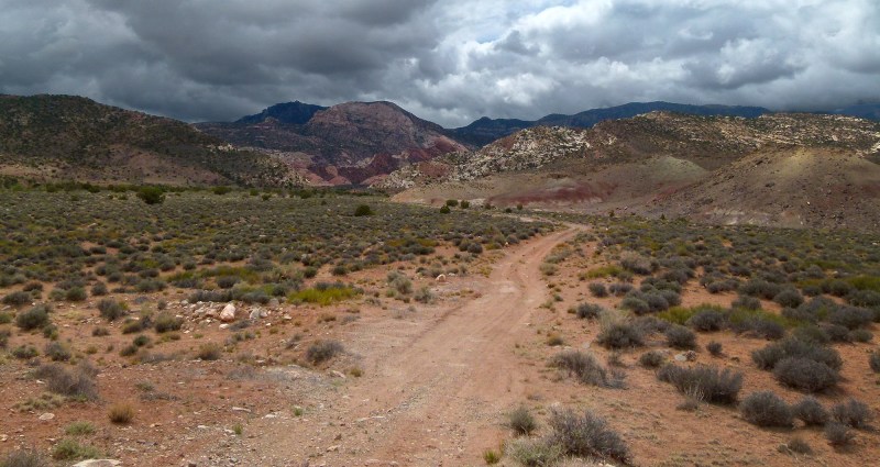
After a few miles is where I left the canyon and climbed up the slopes to the south to reach the road. In hindsight it might be better to continue up Slate Creek a ways farther and climb out near Dark Canyon or even go all the way up to Box Spring near the Pennellen Pass. Note: the drainages in this area can get extremely choked with brush. If you find yourself fighting it too much, seek out a ridgeline for quicker travel.
If following my route as shown out of the Slate Creek, expect some brush and a pesky cliffband on the way up to the road.

above Slate Creek
Once at the road the going gets easier. The road crosses Dark Canyon (small flow in May 2013) before meandering up around the east side of The Horn en route to Pennellen Pass. Just about 1/4 mile before getting to the pass, one can divert north of the road to get to Box Spring. The best water here is in troughs which are down from official spring. A road here takes one west to re-connect with the other roads near the pass.
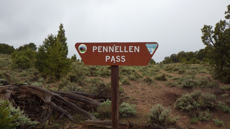
Pennellen Pass Sign
From the pass it’s time to head down the other side of the Henrys. Follow the road to the west to make quick time and in just over a mile one arrives at Airplane Spring. The best water here is in a trough which is about 1/4 mile down from official spring (which is a muddy cow stomp.) There is also a memorial in the area for two pilots who died in a nearby crash:

Airplane Spring Memorial
Continue on down the road enjoying the views of Tarantula Mesa and Capitol Reef in the distance.

looking toward Capitol Reef
In about 3 miles one will come to the area known as Turn of Bullfrog. A road here diverts to the SW, but instead continue north. In about another mile is a road which exits to the west and toward Tarantula Mesa. Take this and you are back on the official Hayduke Route. Turn around and enjoy the view back to Pennellen Pass:
Looking at Pennellen Pass from Tarantula Mesa
Video Reference:
Boulder Mountain to Moab Hike (Burr Trail Switchbacks to Poison Springs Canyon)
Gallery:
-

- Little Egypt
-

- typical landscape east of the Henrys
-

- Headed toward Pyserts Hole
-

- headed toward Pyserts Hole
-

- near bottom of Raggy Canyon
-

- headed up side canyon
-

- view across side canyon
-

- along edge of side canyon
-

- dryfall and slot at top of side canyon
-

- dome land along the ridge
-

- looking into Raggy Canyon
-

- looking west up Raggy Canyon
-

- looking toward Slate Creek — Mt Pennell hidden in clouds
-

- the big slickrock ramp
-

- big slickrock
-

- rim of Slate Creek Canyon
-

- rim of Slate Creek Canyon
-

- looking down into Slate Creek slot
-

- obstacle in Slate Creek
-

- Slate Creek | The Henry Mountains ⮞⮞⮞
-

- Slate Creek
-

- upper Slate Creek Narrows
-

- Slate Creek
-

- above Slate Creek — looking east
-

- Ragged Mountain
-

- Dark Canyon stream
-

- fire damage near The Horn
-

- muddy road
-

- snow Mt. Pennell | The Henry Mountains ⮞⮞⮞
-

- pond near Box Spring
-

- Pennellen Pass Sign
-

- signs near Pennellen Pass
-

- The Horn
-

- Airplane Spring Memorial
-

- Airplane Spring Trough
-

- seeding project
-

- looking toward Capitol Reef
-

- Turn of Bullfrog sign
-

- looking down Turn of Bullfrog
-

- Looking at Pennellen Pass from Tarantula Mesa

