


back to Hayduke reference page
![]()
This short-cut/alternate route bypasses a long bend in the Hayduke Trail as it follows a stock trail and an old mining route around the upper branches of western Muley Creek. Not only is this alternate slightly faster, it’s also more scenic in my opinion and has access to good water. The geology of this entire area makes cross-country travel difficult, but those curious to explore will likely find numerous ways to descend from underneath Tarantula Mesa to the bottom of Swap Mesa.
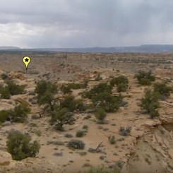
The official Hayduke hugs the cliffs underneath Tarantula Mesa. If headed WEST, find the point at N37.9365, W-110.9438 that juts out and looks over the branching canyon system below. This spot provides a nice view AND a rare ramp to get down to the shelf below.
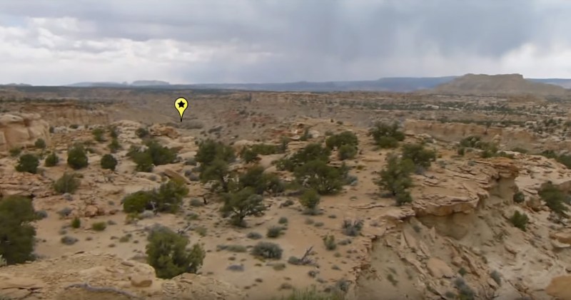
view from top of ramp down. marker in distance is the spring area
Once down off the top, wind your way through a mini-maze of rocks dropping to the lower levels whenever possible. Nothing too difficult here, though the easiest way isn’t always obvious.
A little farther down you will re-enter the wash where the Hayduke runs south toward the spring. Just down from the spring is a drop that creates a nice waterfall (frequently dry or just a trickle.) The water above the falls is OK, but somewhat over-run by cows. I saw a fly-ridden dead cow here in 2013 which made me hesitant about this water-source.
The Hayduke continues up the wash to the NW, but this alternate instead goes downstream and to the right (looking down canyon) of the falls and then follows the western rim of the inner canyon high above the creek below.

In about 15 minutes there is weakness in the rim of the inner canyon making it possible to descend to creek via a rock-slide. At the bottom it’s a pleasant environment with running water, a few cottonwoods and some decent camp spots. (Note: since publishing this a fellow hiker wrote to challenge my definition “decent camp spots” so… YMMV. 😉) Unfortunately the cows can get to this spot as well, but it doesn’t seem as overrun as above the falls. Speaking of which… just follow the stream 15 minutes back upstream to see the falls from below.

the trickle waterfall
Back up on the rim of the inner canyon continue south toward a junction with a western branch. There’s a nice viewpoint at the junction. Continue around the bend and along the north side now and soon you will see another big drop ahead.

Above the drop one will re-enter the wash, but there likely won’t be any more water above this point. Headed west/northwest up this wash one will soon see jet-black bands of coal. In this same area you will see a side canyon on the left with several stone ‘pillars’ piercing the horizon. You want to take this route up.

After a nice stroll up the wash through the pillars and other interesting geology, it’s possible to scramble up and out of the canyon on the left. Soon you will be back above the canyon system and should re-connect with the Hayduke Trail around N.37.9231,W.-110.9622.
Gallery:
-

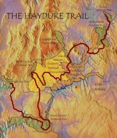
- Area Map
-

- landscape atop canyon system
-
- view from beginning of alternate. spring area marked
-

- access ramp from below
-

- descending mini-maze
-

- mini-maze of rocks
-

- atop waterfall
-

- rim-route around waterfall
-

- access to creek below
-

- the creek
-

- nearing waterfall
-

- the trickle waterfall on Swap Mesa
-

- looking N at rim-route
-

- view S from junction
-

- looking up the western branch
-

- creek below
-

- big drop in western branch
-

- stone pillars mark exit canyon
-

- among the pillars
-

- looking E through ‘pillar’ canyon toward the Henrys

