Week TWO of my 20-day hike from Zion to Capitol Reef.
FYI: a Route Map and Hi-res Gallery are available as well as the Hike Video!
.
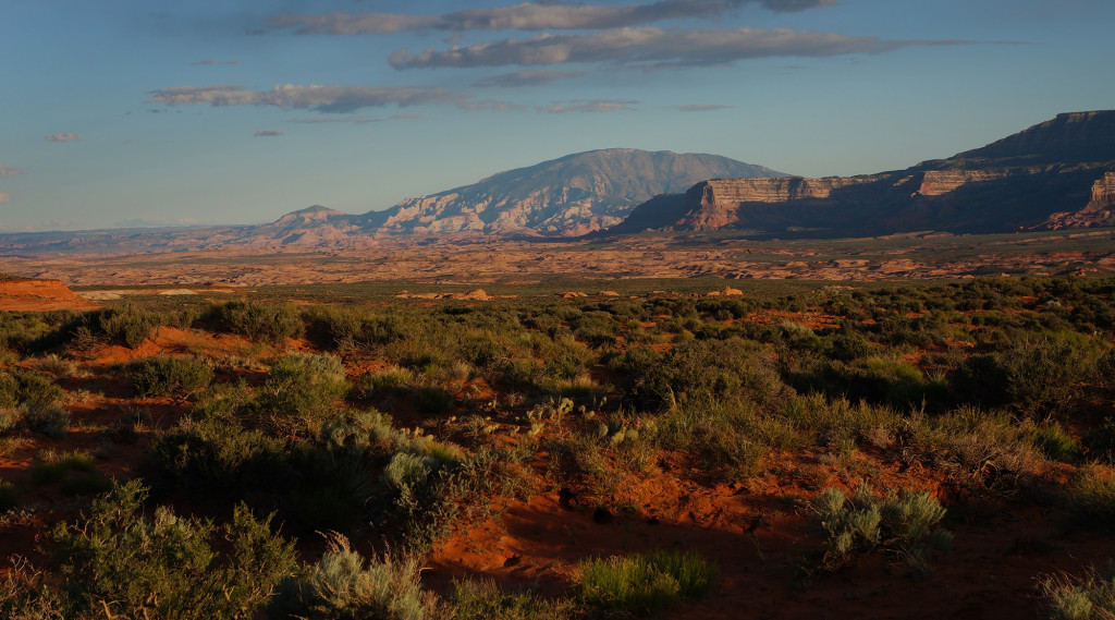
Day 8
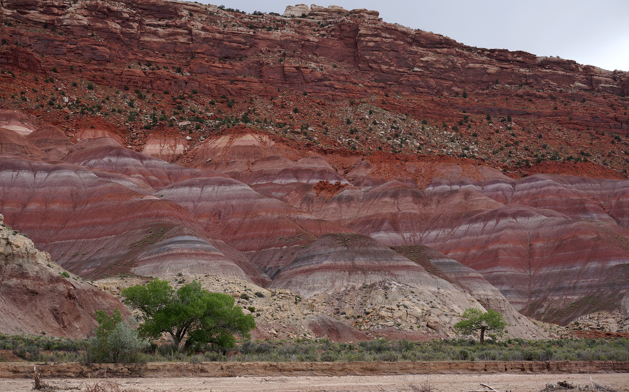
If not for the crazy colorful hills along this stretch of the Paria — I would really hate this section. First the good: the stripped Chinle hills in this region are unparalleled that I know of on the Colorado Plateau. This could have easily been called the Painted Desert. They are amazing.
BUT… walking along this stretch of the river is no fun. The clay sediment makes for an incredibly slick walk that will sneak up on you in an instant. The thicker mud isn’t as slick, but one can sink down shin-deep with no warning what-so-ever. Then there are the cows. Longhorns that will stare you down like they want to kill you. That is if their general stench hasn’t killed you already.
Anyway… when I got to the Pahreah Townsite I checked out the ruins. Not much had changed since I was here many years ago. Continued down through “The Box” and then I left the Paria behind when it turned south and I instead followed Cottonwood Wash and the reef north toward Hackberry Canyon.
When I got to the spot I was going to climb up to Yellow Rock I decided to pass. It was overcast and threatening rain and I needed to make up some time. So instead I climbed out of the wash, crossed Cottonwood Road and began the climb up to Brigham Plains.
Though it never did really rain, storm clouds surrounded me as I made my way along the “admin” road toward Coyote Canyon. When I got close to the canyon I decided to leave the road behind where it turned north on a circuitous route and I instead cut straight across the canyon. In hindsight this was probably not the best plan. The canyon was a little more entrenched than I remembered and it was a fairly steep descent and climb out the other side.
Back on the dirt road I continued around Coyote Point.
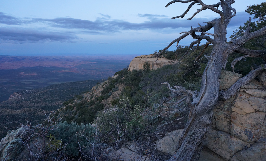
Before heading north along my planned route, I followed the road to near where it drops off the plateau via some switchbacks. It was the wrong time of day, but it was still an impressive view to the south. After taking it in, I doubled back and headed toward Chynoweth Canyon.
This time instead of entering the canyon at its head, I followed the rancher road to the midpoint and camped on the rim above the spring and the dryfall which is just down canyon. The storm finally caught me and it rained off and on throughout the night.
Day 9
I got down into Chynoweth and checked out the spring. Ranchers have added waterworks here so water flows from the overhang in the cliff via pipes to two large tanks. The spring is not shown on maps and I refer to it as “Dead Mouse” Spring as the first time I was here there was a dead mouse floating in one of the tanks. No decreased rodents this time and the water was good.
Less than half a mile down from the spring is a major dryfall in the canyon. It can be bypassed on the south side by walking past a side drainage and then climbing down. The farther you walk before trying to climb down, the easier it gets.
Lower Chynoweth contains a lot of boulders in the wash, but no real obstacles. The wash joins its north fork before finally meeting the Wahweap a little farther down. With all the recent rain I wasn’t totally surprised to see a small flow going in Wahweap.
Headed up canyon I quickly came to an old rusted out bus. How the heck did it ever get out here?
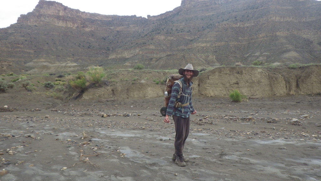
A little farther up I heard “Hey There!” from very close by. I recoiled somewhat in shock — I hadn’t heard another voice in the last 4 days! I look over to see a guy sitting cross-legged on the ground next to a large fire ring. We chatted a bit and he ended up being a very unique character. We actually hiked together for about half the day. His name was Will and I dubbed him Will the Wanderer as he was a nomad living his life out among the canyons and the plateaus. He had been wandering for the last two years, only going into a town every three weeks or so to get essentials — which to him were rice and tobacco! Otherwise he just wandered… foraging as much food as possible.
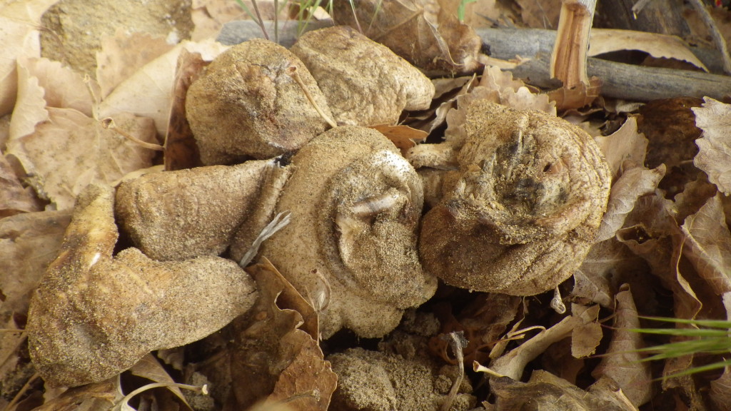
He showed me these berries to eat. He called them Squaw Berries and they were good, though very tart. Only after I’d eaten a handful did he tell me “if you eat too many, they will make your tongue sore.” Wait, what?! As we walked he was feverishly looking around each cottonwood tree in hopes of finding mushrooms. He said there is a certain type that is amazing. The “chicken of the desert” he called them. Unfortunately he never found any.
By early afternoon a storm moved in. We took shelter under one of the many overhangs. We waited for quite a while before decided to push on when it slowed down a little. The creek muddied and began to raise, but it would be an exaggeration to say it was flooding.
We made our way up a portion of Tommy Canyon before Will the Wanderer became entranced by a grove of old cottonwoods. He said it was a special place and he needed to stay for a while. That’s when we said our goodbyes and I continued on alone. Just a bit farther we were going to part ways anyways as I was headed up Fourmile Hollow and he planned to continue up Tommy Canyon and into “dinosaur country”.
As I made my way up Fourmile Hollow I found it easier to walk right up the stream than to fight the brush along the banks. Soon it began to rain hard again though, so I took cover under another overhanging rock. When it slowed some, I got back in the creek and continued up canyon. Near the top of the canyon I decided I should try and find an alcove to camp. It wasn’t the best, but I found one that would that would at least keep me partially out of the rain. As I pitched the tent between the rock wall and a cottonwood tree — I spotted this batch of mushrooms! Will the Wanderer would have been excited!
It rained throughout the night and I was glad to have at least partial protection. As the rain continued I became somewhat worried about a flood. I didn’t think the storm was that large, but I was technically not above the flood plain so it did make for a nervous night of sleep.
Day 10
Awoke to a safe camp and sunshine in the morning. Tried to get my gear out in the sun to let it dry a bit before loading up and moving on.
Soon I was out of Fourmile Hollow and back upon on the backroad headed up toward Horse Mountain Bench. When I was on top, I sought out my cache which I’d dropped 11 days earlier. It was safe and sound where I left it. I reloaded and left the road behind as I headed east cross-country across the Kaiparowits.
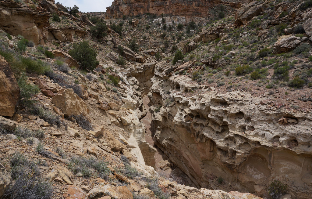
I quickly dropped into a wash and had to bypass a few small drops before coming to he top of what I call “Yellow Paradise Slot”. Back in 2006 I followed the rim on the south side before dropping in down canyon and exploring from the bottom. This time I followed the northern rim and though the views from the top were impressive, there was no way to drop into the canyon! I followed the rim all the way down to the confluence of Paradise Canyon and still no luck. I had to follow this north almost to where a road enters before I could find a way down. This is why the Hayduke Trail follows such as strange circuitous route through this area.
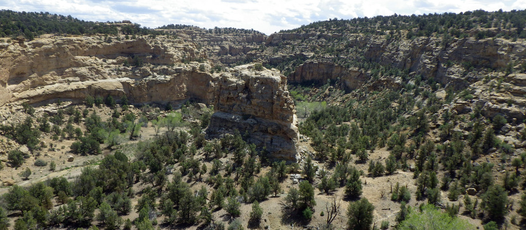
Down in the canyon there was water flowing right away. Paradise is a pleasant canyon with its big blocky canyon walls and many cottonwoods lining the small stream. Based on the tracks, I’d say that ATV riders must frequent the area though.
Farther down Paradise meets Escalante Canyon and together they form Last Chance Canyon. It’s fairly quick walking through this area. Last Chance got its name from the cowboys that considered it the last chance for water while traveling through the area. Thought the water flow has dissipated some, it was still going. However the area is highly trafficked by cows so I waited on water because I knew there were a few wells ahead. When I got to the first one I was surprised to see it spewing like a fountain in the same manner it was back in 2006. This created quite the mess, but I made my way through the quagmire to get to the fresh flow. I took a big drink straight from the source and… ECK! — it was terrible! The water was severely tainted with a sulfurous taste. I dumped the water and instead continued downstream with very little before finding the next well — which was apparent when I spotted the lush grass ahead and then a clear flow of water tricking in from the side. I tracked down the piped source once again and was dismayed to find that once again it was terrible! Now I was worried. A little farther down Last Chance I took some water straight from the creek itself and ran it through the filter to test it out. There was a little bit of “cow” aftertaste, but much better than the sulfur water so I was relieved.
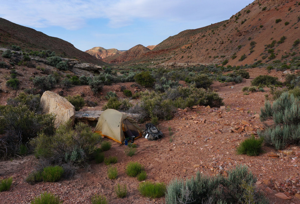
I crossed the Smoky Mountain Road and continued down the canyon which became a little more entrenched. Not too much farther I made camp for the night.
Day 11
In the morning I watched a woodpecker at camp and then continued down Last Chance. Despite the ATV tracks and the cows, it felt like a very desolate place.
The water dried up just before I got to Reece Canyon where I turned to go north. At the junction I decided to do a side hike a quarter of a mile south to Water Canyon hoping for some good water. I would be disappointed as it was dry. I walked a short ways up the canyon and found a trickle of water, but it still wasn’t the oasis I’d hope to see. I filled up with 1.5 gallons of water for the potential very dry stretch ahead. Then I retraced my steps to the mouth of Reece. After checking out the old rancher camp at the location I continued up the canyon.
Lower Reece featured lots of strange rock formation making the walk interesting. I was surprised to find a small seep not too far up the canyon. Then, where I was to exit the canyon at an old road I found a sizeable seep. This actually makes sense as often the only reason there’s a road into these deep canyons is to get to a water source. According to the Hayduke Trail Guide this water is not always present though.
I followed the old road up through the red hills to the east. These are the Burning Hills — so named because they were burnt by old coal fires. In some seams, the fires still burn, but unfortunately I wouldn’t see any of those spots along my trek.
The route quickly gained elevation as it climbed toward the high ridge. The road was clearly defined in some spots and completely non-existent in other places. I made camp about half way up the climb to the ridge.
Day 12
In the morning I continued up and out of Reece Canyon. It was overcast and slightly cool and it gave me the sensation I was hiking in an alpine environ instead of a desert plateau.
About two thirds of the way up I spotted another old road on the hillside to the south. I’m not sure where this road split, but I suspected it was the route I should have been on as it looked to travel more directly to where I wanted to go. I continued on however as I was nearly the top and the old road I was on followed the higher ridge providing better views. Another mile of climbing and I was on top where I intersected the Croton Road — still not a major road, but definitely much larger than the faint track I’d been following. I followed the road south until spotting the drainage I would use to get down into Surprise Valley. This too was accessed by another small/faint spur road.
Once down in Surprise Valley it was only a short distance down to the junction with Navajo Canyon. Again I was surprised to find a small seep here — though it makes sense again accounting for the old road into the canyon. I filled up an extra liter of water though I was still carrying plenty.
The walking down upper Navajo was pretty miserable with its sandy/silty bed. Soon to hardened to a more firm bedrock though.
At one point I came to a sizeable dryfall with no immediately visible way to climb down besides a 12′ sketchy climb. It looked like there was a bypass along the rim so I followed it for a ways only to continue to find no way down. The canyon dropped more and more as I walked about a quarter of a mile along the edge with zero opportunity to drop in. Peering across to the other side showed no possibility on that side either.
Not remembering any mention of this in any of the research I’d done on the canyon I decided I had to go back and look at that climb again.
Re-approaching the main drop, I noticed a crack at the top of the canyon I missed the first time. It provided a fairly easy 10′ climb/slide down into the canyon under a huge boulder. Not bad. Once down in the canyon there were a few boulders to climb down (and under) but it was all fairly easy and cool in this set of narrows.
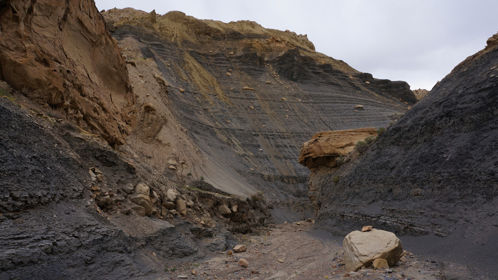
Below the narrows the drainage became full of boulders and navigation tedious. There were a few spots with rocks stacked as assists for those traveling up canyon. Then travel became easier in lower Navajo Canyon which is like no canyon I’ve ever seen as it winds its way through dark black mudhills. It was a eerie setting with the stormy skies overhead. It’s a barren place and I definitely wouldn’t want to be here in the heat of summer. As the wind blew it triggered cascades of the tiny rock chips. At one point a few marble-sized chunks joined a cascade and one pelted me on the head. I decided to move on quickly as to not linger too long!
As the canyon opens up more and more it’s possible to short-cut some of the bends. Doing so at one bend I came across a tarantula out in the open. I’ve seen a few on day hikes before, but this was the first one I’ve seen on any of my long hikes.
Near the bottom of Navajo I cut across the bench to Croton Canyon which was dry. However, just a short distance up canyon water did appeared. However, it was so yucked up by the cows I didn’t want any part of it. Luckily it had been cool so I still was doing OK on water.
Croton Canyon turns into Rogers once above Sunday Canyon. Headed up Rogers was no fun. It’s another boulder-filled ravine with the added complexity of being overgrown due to the presence of water. It was a fairly slow go. Then in the early evening it began to sprinkle. I’d hoped to make it up to Monday Canyon, but when I spotted some overhanging rocks for protection I decided to make camp.
Day 13
It rained off and on throughout the night and then there was a steady rain in the morning. I slept in hoping it would clear up, but it never did. The good news — water was no longer a concern along this “dry” stretch of the Hayduke Route! There were several pools in the rock right beside my tent which made for great drinking fountains!
As I continued up Rogers it was cool to see it flowing with small waterfalls going over the boulders. This is probably not too common of a sight. Very soon I was at the mouth of unmarked and dry Monday Canyon.
Walking up Monday Canyon was another slow go. There are quite a few boulders to navigate in the lower canyon. Then the middle of the canyon contains several dryfalls which must be bypassed. Nothing is technically difficult in this section — just tedious. At one point I found it better to escape the main drainage and after climbing up the ridge to the east travel was much easier through the juniper ridges.
The upper middle part of the canyon levels out and travel is much easier up canyon. The canyon branches several ways so one must pay close attention to the map while traveling up canyon to ensure the proper route. Several alcoves here look like they could be ideal for ancient cultures, but I failed to spot any ruins or other evidence (though I’ve read reports of others who have.)
In the upper portion of Monday the canyon constricts and one will be greeted with a dryfall. The obstacle has a narrow crack on the right side which can be climbed. I’d seen a picture of Hayduker climbing down this, but I failed to find a safe way to climb up solo. Even if I did it was going to be difficult to rope up the pack because of lack of room to make the haul.
So… I searched a short ways down canyon and finally found a brushy bypass . When up on top I took a look at the obstacle from the top and it looked pretty sketchy. I think I’d always use the bypass unless with a competent group.
Above the obstacle the canyon was pretty uneventful, though it did get more and more brushy. The final push out via the side-side drainage was awful and I finally had to just climb straight up the edge before finally emerging on the top in the sagebrush plateau that is 50-Mile Mountain.
I was immediately met by a herd of cows that looked at me like I was some sort of alien.
It was beginning to get dark at this point. I didn’t really want to camp in the middle of the sagebrush plain, so I headed out of my way to the edge of the mountain to the east. Ran into many more longhorns along the way and they didn’t seem too pleased that I was invading their space.
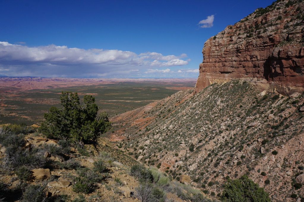
As the sun dipped below the horizon the wind really picked up and it got COLD. I passed a few patches of snow as I got close to the mountain’s edge. Then, just before, nightfall I got the view which I’d longed to see: the cliffs fell away and I peered out unto the entire Escalante basin and to the Henry Mountains in the distance. Awesome!
The wind was really howling at this point. I found the best possible shelter I could spot and made camp. Most of my gear was still wet from the rainy last few days. I got in my tent/bag and tried to warm up. It would be one of my coldest nights in Utah!
Day 14
After a few more pics from the edge near camp, I headed back inland and across the plateau of 50-Mile Mountain. The trail shown on maps is pretty hit and miss among a network of cow trails. Speaking of cows… I quickly ran into more of them.
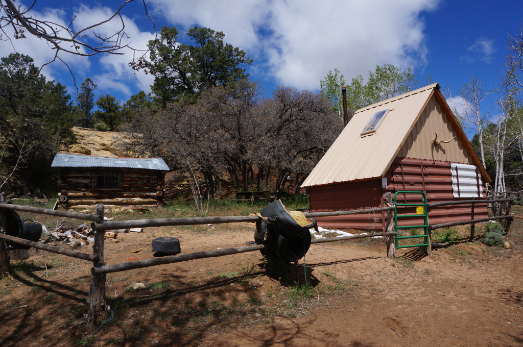
Found no water at Gates Draw, but found good water in a tank at Pocket Hollow (along with more cows!) I made my way to Mudhole Spring and the BLM lineshack that is located there. Despite the warning sign, the water was good here.
Next I headed east back toward the edge of the mountain. I’d planned to continue south, but since I was a few days behind schedule I knew I had to make a short-cut and skip lower 50-Mile Mountain as well as Willow Gulch and 40-Mile Wash. I was bummed, but it had to be done. So instead I stayed on the Hayduke Route for a little longer and made my way down Middle Trail. Actually… I wasn’t able to spot the tail at the top so I ended up making my own way before stumbling on what I believe to the old trail. After dropping a few hundred feet in elevation the current, well used trail came into sight and from that point on travel was much quicker dropping down the Straight Cliffs.
Once atop the bench, I followed the up-and-down ATV trail over to the more-used road. Then I dropped down the switchbacks of the 50-Mile Bench Road to the plains below.
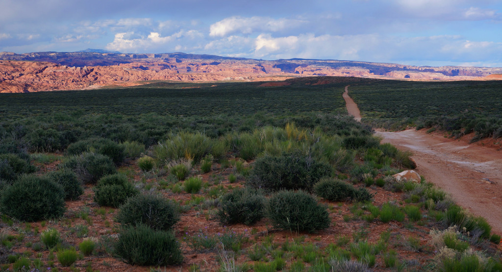
Near the bottom I took off cross-country once again to connect with the Hole-in-the-Rock Road. Then the long road walk out 40-Mile Ridge Road. Definitely more road walking today than I like, but it’s beautiful country and I had to do it to connect with my next cache. I’d left it near the Watertank TH. I’m glad I’d logged the GPS coordinates because it was very difficult to find in the late-day sun.
Back at the tank I was surprised to see how full is was compared to when I dropped the cache over two weeks prior. There were only two vehicles at the TH, but there was a couple coming back along the trail just as I was setting out. We chatted a bit and then they were kind enough to take my excess sack of trash. I love my new method of self-contained caches so I never have to return to a cache site after the hike, but the downside is that if I don’t find a place along the way to get rid of garbage it really begins to add up. So… I was happy Marco and Debbie helped out.
The sun quickly disappeared behind 50-Mile Mountain so I made my way back WEST toward Hurricane Wash as far as I could before finding a decent camp in the sand and slickrock.