


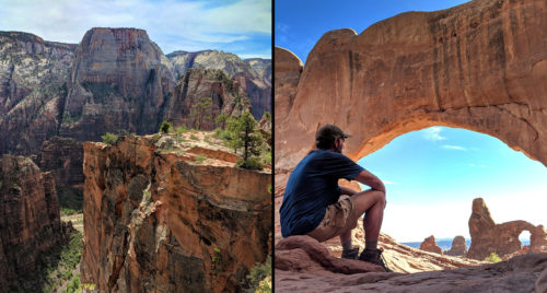
Zion to Arches Hike Report
watch segment video
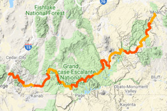
interactive hike map
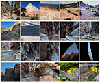
photo gallery
(previous: Dark Canyon to Fable Valley ⟺ next: Hayduke north from Canyonlands)
Through the Needles
May 24, 2018
Day 37 (continued)
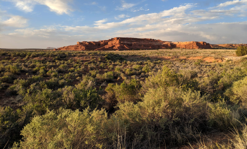
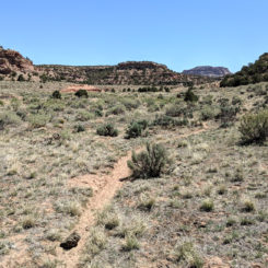
Still on the Fable Valley Trail I continued to round the bend leaving behind the good views into Gypsum Canyon. As I crested a ridge I could see a long distance ahead in the direction I was traveling and into Beef Basin.
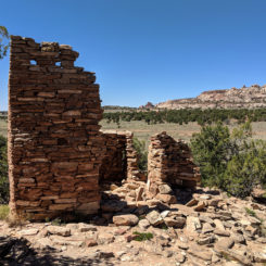
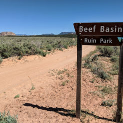
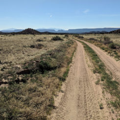
Soon I was at the trailhead. I checked the register to see all the Haydukers who’d left there name over the past few seasons. From here I picked up a Jeep road and continued through the basin as the sun went down. Along the way I noticed a few dilapidated ruins beside the road.
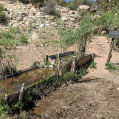
Soon I came to the wash for Gypsum Creek which is where I’d camp for the night. There was no water near the road, but luckily within 5 minutes of walking downstream I found plenty of water. There are a lot of cows in the area so the water had a bit of a “twang” to it even after filtering, but I was still glad to have it.
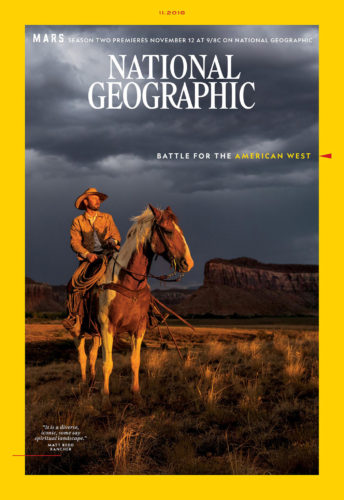
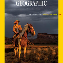
UDPATE: just 6 months after meeting rancher “Redd” in Beef Basin, he graced the cover of National Geographic. The issue featured an article “Battle for the American West” which focused on the recent debate over national monuments and public land.
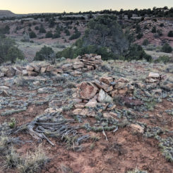
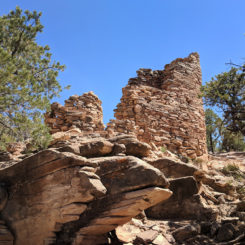
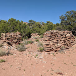
I left the spring area via a rough road that came in from the north. After a short distance along that route I opted to go cross-country again to investigate a nearby area. There was a spot on the map that piqued my interested — a spur road dead ended from the opposite direction in the middle of nowhere. I figured there had to be something of interest there. And and I approached via a forest of junipers, all of a sudden it was obvious what was there.
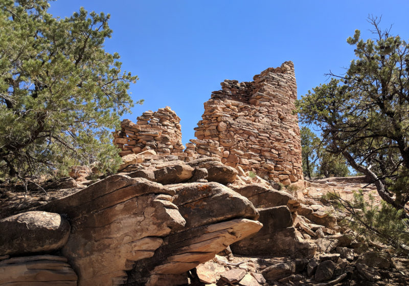
After spending some time at this ruin, I followed the spur road back to the main dirt road that ran through the area known appropriately enough as Ruin Park.
I know there are more ruins in this area, but I didn’t take take to investigate. In fact, in an effort to save time I’d left the Hayduke Trail and had opted to head toward the Jeep road that enters Canyonlands from the south.
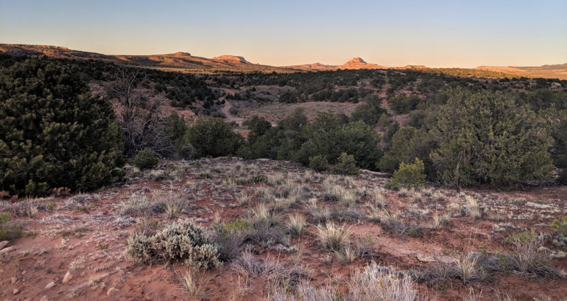
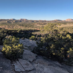
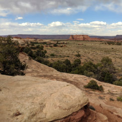
As I continued on my way westward I eventually I cross an area known as Pappy’s Pasture with the Henrys once again visible to the west.
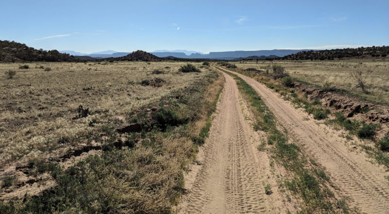
looking west in the Pappys Pasture area
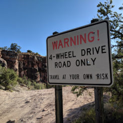
There were a few more dilapidated ruins just off the road. I kept falling the road to the west and rand into a solo camper just off the road. It ended up being a guidebook author who was out exploring the area. We chatted for a bit and he gave me some extra Gatorade and then I kept on my way. I was approaching an area known as Bobby’s Hole and a notorious section of road that is often impossible even to four-wheel drives. The route sharply drops down into a grabben. The road was pretty rough, but not as bad as many I’ve seen around Moab. I had absolutely no probaly walking it. 🙂 Looking back the at the hard spot:
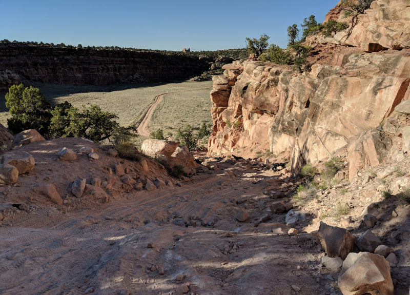
rough road near Bobby’s Hole
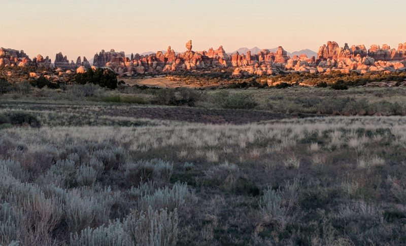
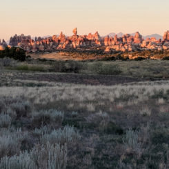
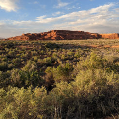
Once down it was easy walking north along the relatively flat walled-in corridor. Yellow flowers dotted the surroundings. I passed through the southern entrance to Canyonlands as the sun was going down. I made it to a rise just in time to see sunset on the Needles.
Before long I followed a wash up a ways and made camp in the Butler Zone.
Day 39
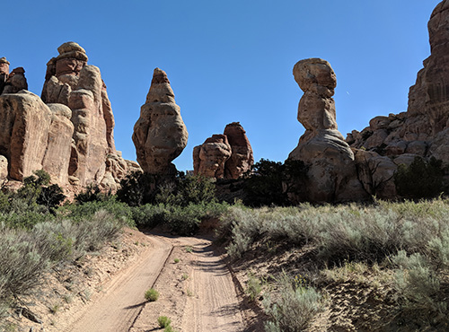
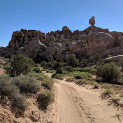
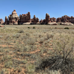
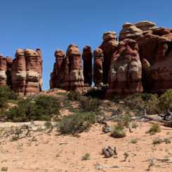
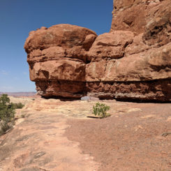
Got up in the morning and retreated to the Jeep Road and continued north toward the Needles. I passed a few backcountry Jeep camps before the road went down through some cool formations.
Soon I was at a junction where I followed the spur road east toward the Joint Trail Trailhead. Once at the end of the road I was surprised to see NOBODY parked there yet this morning despite it being memorial Day weekend. I made use of the pit toilet facilities and then hit the trail.
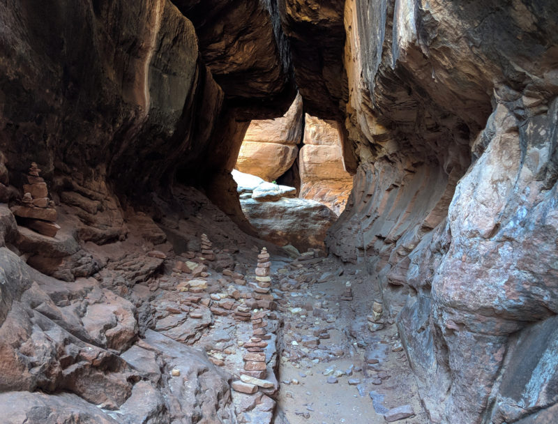
After it wandered a bit through the slickrock the trail climbed a cool rock staircase and into a cavernous room created by overhanging rocks. This spot is often called the “Cairn Room”. I did my best to make sure that moniker didn’t apply after my visit!
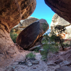
From here the route opens up a bit. Though a large opening with a boulder beckons to the right, the correct path forward is to the left and farther up the joint.
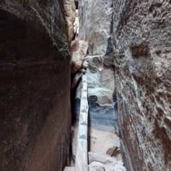
Soon the route really gets narrow and the experience is very similar to that in a slot canyon. Unlike most slots though, the walls here are flat and nearly vertical.
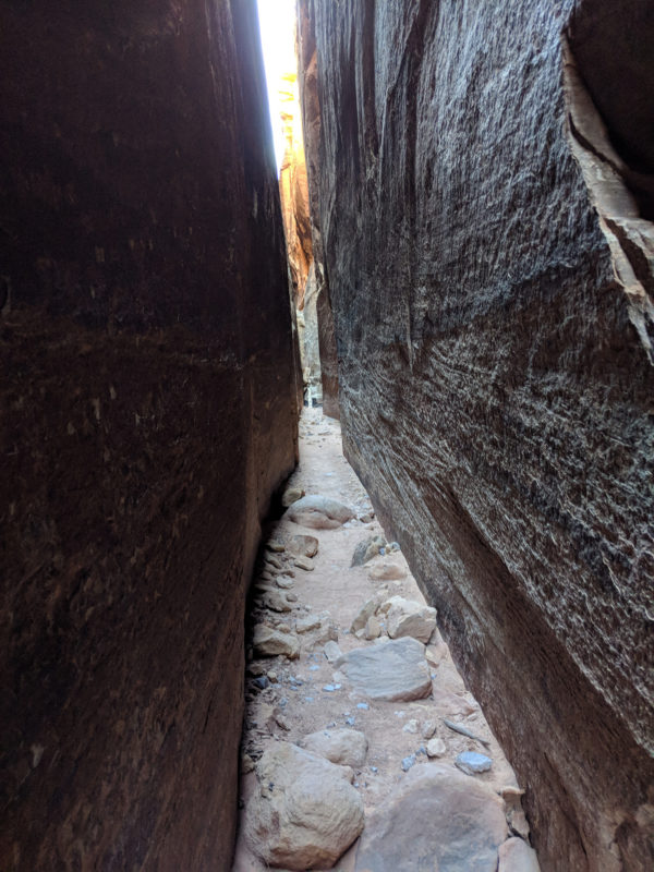
the Joint Trail
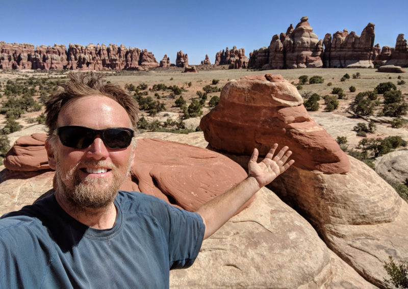
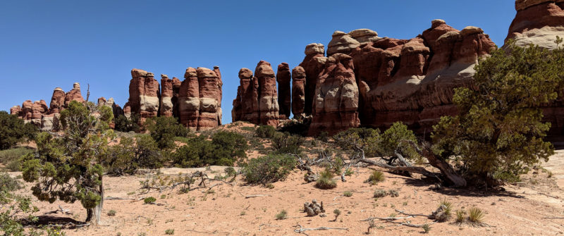
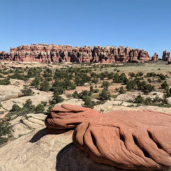
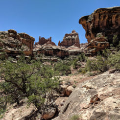
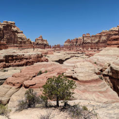
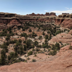
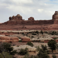
The narrow passageway goes for quite a longs ways and climbs up a log ramp at one point. I was lucky to not run into anyone while in there as getting past one another might have required a special dance along much of the route! Soon more and more daylight seeped in as the the canyon got more shallow and then there was a hard right and another stone starcase leading up into full daylight. I emerged on the edge of Chesler Park — arguably the “central park” of the Needles District. I followed the short spur route to the nearby scenic overlook. It was a great place for a break to soak it all in:
Chesler Park
While enjoying the view I realized I hadn’t been to this VERY spot in over 20 years! I’d been through the Needles and even in Chesler Park since then, but it has been a looong time since I’d been on the southern edge and done the Joint Trail.
Headed out I contoured the southern edge of the park along the trail eventually passing the designated camping areas. Ahead I saw Nearby I saw the first group of people that I’d seen in a while. I wouldn’t get a chance to talk to them though before meeting them I came to a trail junction where I took the other route headed to Elephant Canyon. Just before dropping into Elephant Canyon, I passed this unique row of pinnacles which I’d remember giving a dubious moniker on my previous visit:
“Phallus Wall”
I followed the steep route down into Elephant Canyon — getting a glimpse of the small granary on the way down. Also on the way down I ran into a few more groups of people. This would be a trend for the rest of the day.
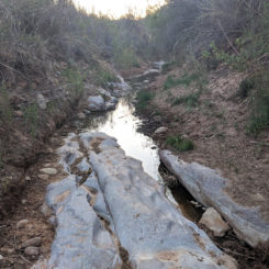
Once in the bottom of the canyon there was no water like there had been in the past. But, I was still hopefully that I’d fine some on my diversion up the canyon. Sure enough, about halfway up the canon there was a few pools of water.
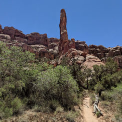
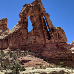
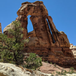
Soon I saw the crazy “spire” ahead. I knew it wasn’t just a spire though and soon I was climbing the ladders and up the steep slickrock to see the entire purpose of my diversion… Druid Arch. I’d seen it before, but I was still no less amazing this time. There is just something so grand and amazing about this arch. Pictures really do not capture it’s size adequately. But… that didn’t stop me from trying:
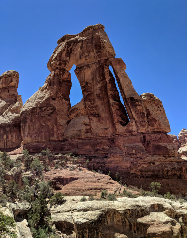
Druid Arch
After enjoying a short break at the arch, I climbed back down and retreated back down the canyon.
I had originally wanted to hike over to Squaw Canyon and then take the Peekabo Trail to Salt Creek, but alas time was short so I opted for a more direct route out of the Needles. And, I’m kinda glad I did as I’d never taken this stretch of trail and though it might now be as amazing as the former, it was still cool to see and it rambled through more joints, over slickrock, and even through a small arch en route to the trailhead and road’s end at Squaw Flat Campground.
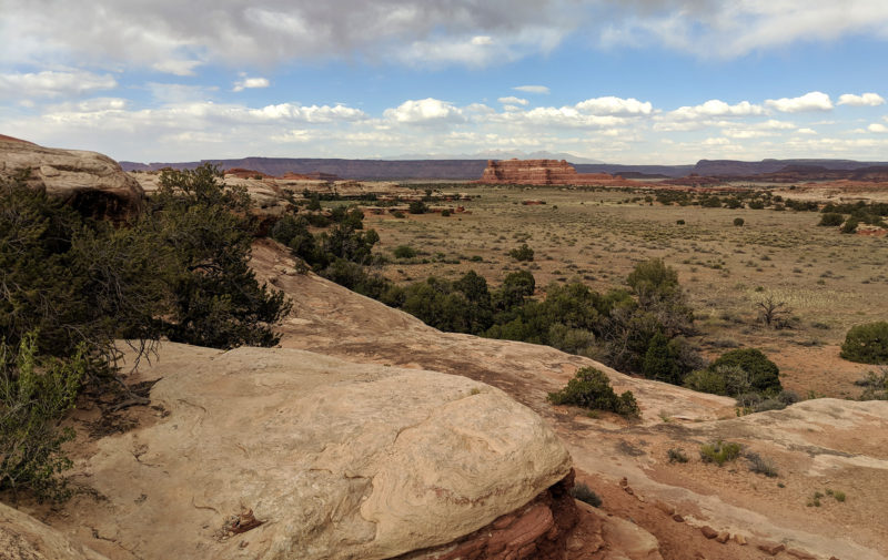
trail to Squaw Flat
This route also got me to water quicker. And though I was able to grab some extra in Elephant Canyon, it was great to have it pure straight out of a spigot at the camp! Again I probably drank 2 liters right away!
From here I walked the paved road out of the campground and toward the visitor center and park boundary. I was walking through the campground at dinnertime so I could smell everybody cooking their evening meals of hamburger, steaks, and more. It smelled so good!
I followed the Park road as the sun was going down and enjoy the views of Woodenshoe Arch and Six Shooter Buttes in the distance. Soon I was leaving the park and closing in on my camping area near by the Needles Outpost. This was also the location of my next cache/re-supply, but as it was late in the day I’d wait until morning to pick it up and just enjoyed the sundown.
nearing Needles Outpost
From here I’d head north toward Moab along portions of the Hayduke, but… details on that will have to wait for Part 13: Hayduke north from Canyonlands.
Photo Gallery:
-
- looking back into Beef Basin


-
- Homewater Spring — just off the official Hayduke route
-
- “Redd” — the rancher I met in Beef Basin
-
- Beef Basin Ruin
-
- ruin in Ruin Park
-
- looking west in the Pappys Pasture area
-
- dilapidated ruin in Pappy’s Pasture
-
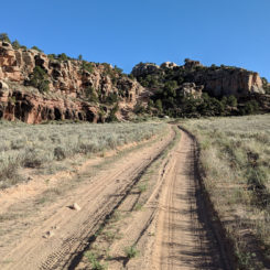
- winding road near Bobby’s Hole
-
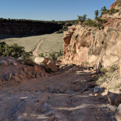
- rough road near Bobby’s Hole
-
- looking south as 4×4 road exits graben
-
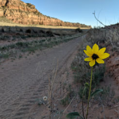
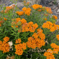
- graben flower
-

- Canyonlands South Entrance
-
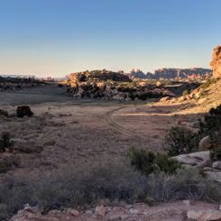
- looking north to the Needles
-
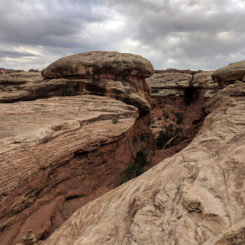
- The Needles from the south
-
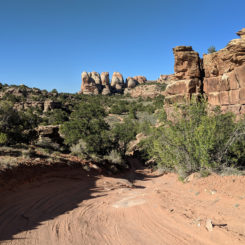
- nearing the Needles
-
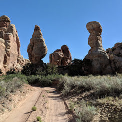
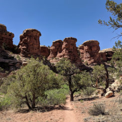
- interesting rock spires
-
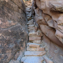
- stone staircase along the Joint Trail
-

- “Cairn Room”
-
- Joint Trail
-
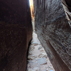
- The Joint Trail
-
- Joint Trail
-
- log climb on the Joint Trail
-
- Chesler Park viewpoint
-
- Chesler Park
-
- route through Chesler Park
-
- “Phallic Wall”
-
- dropping into Elephant Canyon
-
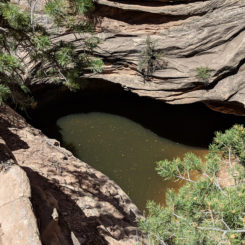
- pool in Elephant Canyon
-
- hmm… what’s that spire?
-
- Druid Arch
-
- Druid Arch
-
- view back down Elephant Canyon
-
- Elephant Canyon
-
- trail to Squaw Flat
-
- trail to Squaw Flat
-
- trail to Squaw Flat
-
- trail to Squaw Flat
-
- cool plant/flower
-
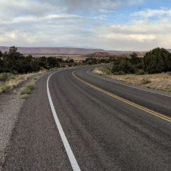
- Needles park road
-
- Woodenshoe Arch
-
- nearing Needles Outpost