


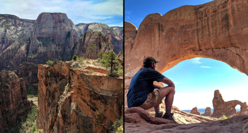
Zion to Arches Hike Report
watch segment video
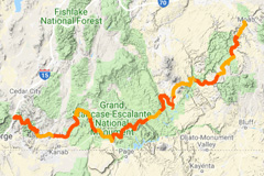
interactive hike map
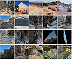
photo gallery
(previous: Swett Canyon and around Lake Powell ⟺ next: Through the Needles)
Dark Canyon to Fable Valley
May 22, 2018
Day 35
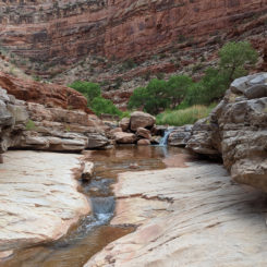
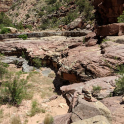
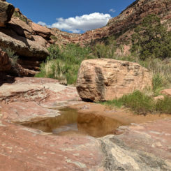
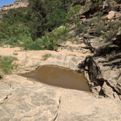
Got up in the morning and continued on the road towards dark canyon. Last time I was through this area I tried a cross-country shortcut, but this time I wanted to follow the road to investigate a potential water source. the authors of the Hayduke route guide book talk about a pothole where the road crosses upper Horse Tanks Wash. It didn’t look like an area that would have water from afar, but to my surprise when I got there I found a layer of sandstone and a large pool. I used the opportunity to fill up even though I was still okay on the water.
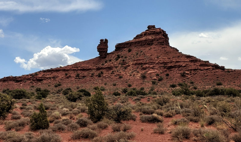
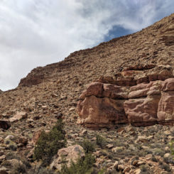
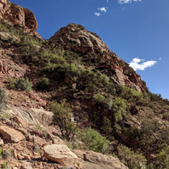
Continuing up to another road the road finally went by the rock formation known as Squaw and Papoose:
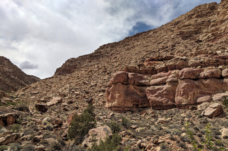
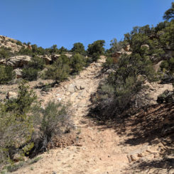
Just around the bend from here I actually went cross-country once again towards dark canyon. The Hayduke route follows that this is the original way to dark canyon but a more modern trail has been made up above the cross-country route was fairly straightforward there was one ramp of sandstone the required a semi steep climb down but otherwise it wasn’t too bad.
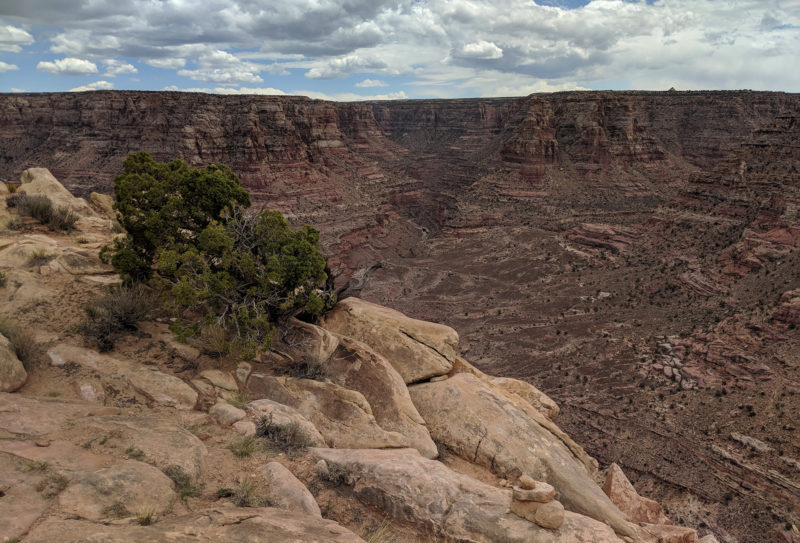
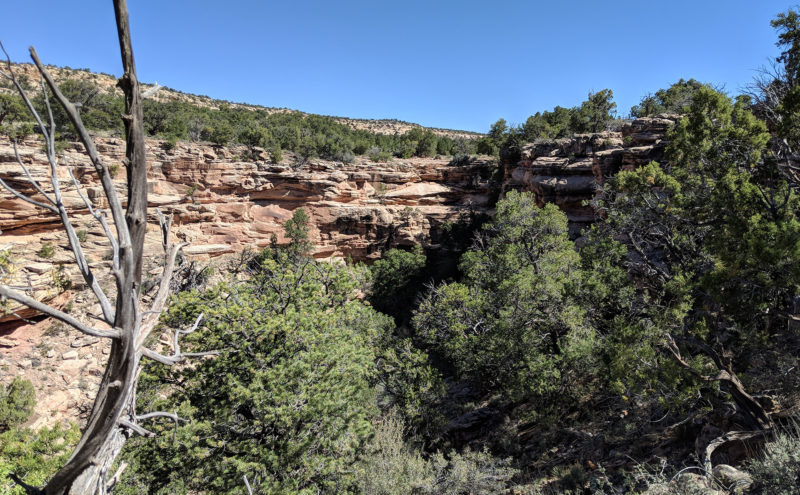
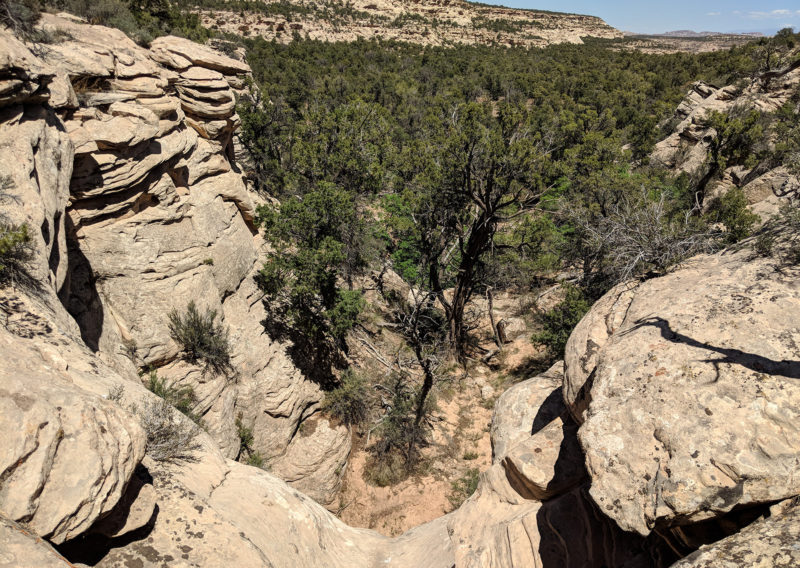
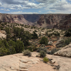
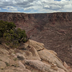
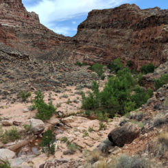
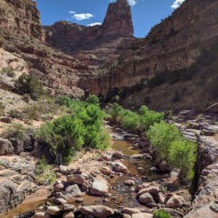
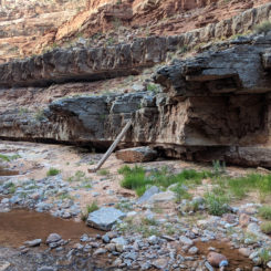
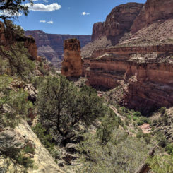
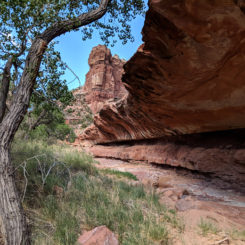
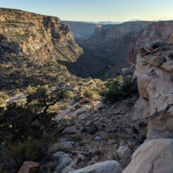
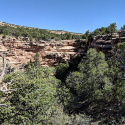
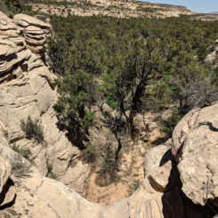
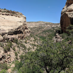
A little farther ahead I was at the junction with the official trail and followed toward the edge as Dark Canyon comes into view. I took a break in some shade under a ledge and moments later another group of people came by. They were the first people I’d seen since leaving Nick at the road the day before. We chatted for a while and then they continued on down the route. Soon I was to the big drop off and looking into the chasm of Dark Canyon; quite the incredible view:
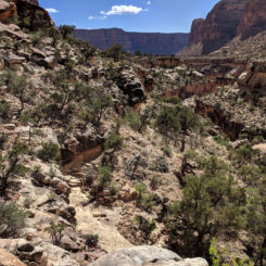
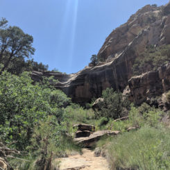
I slowly made my way down and before too long I was at the bottom of a small dry fall in the side canyon. There was a good view back up to what I just descended.
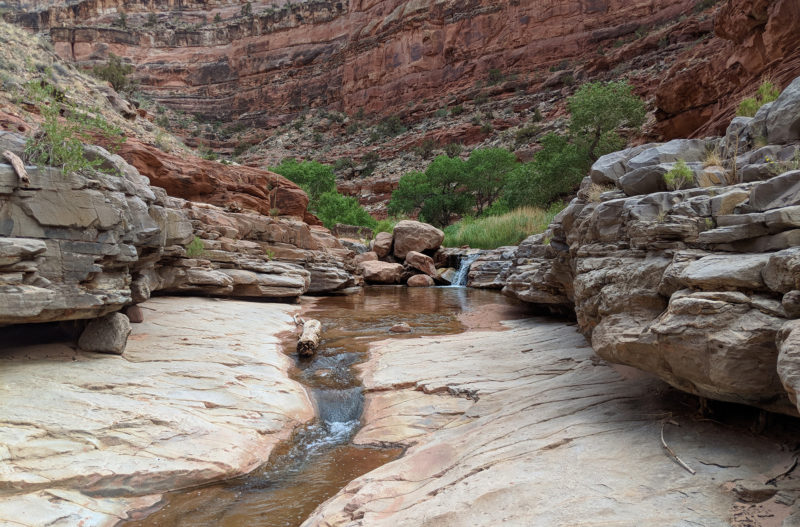
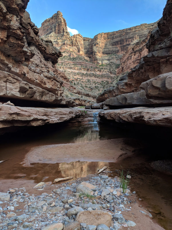
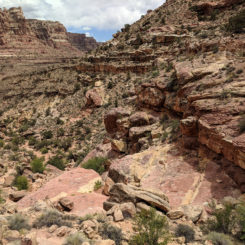
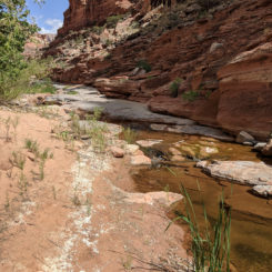
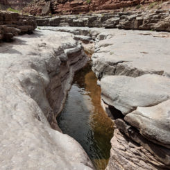
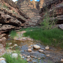
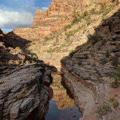
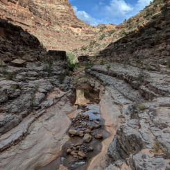
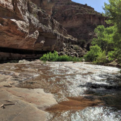
from there it was only about another 15 minutes and I was actually in the main canyon itself and next to the glorious water that seems to always run down dark canyon. I made my way up the canyon and soon was walking along the stone ledges that typifies most of Dark Canyon.in fact for most of this route one is actually not walking along the stream but instead of on these ledges 10 to 15 feet high above the inner part of the canyon.
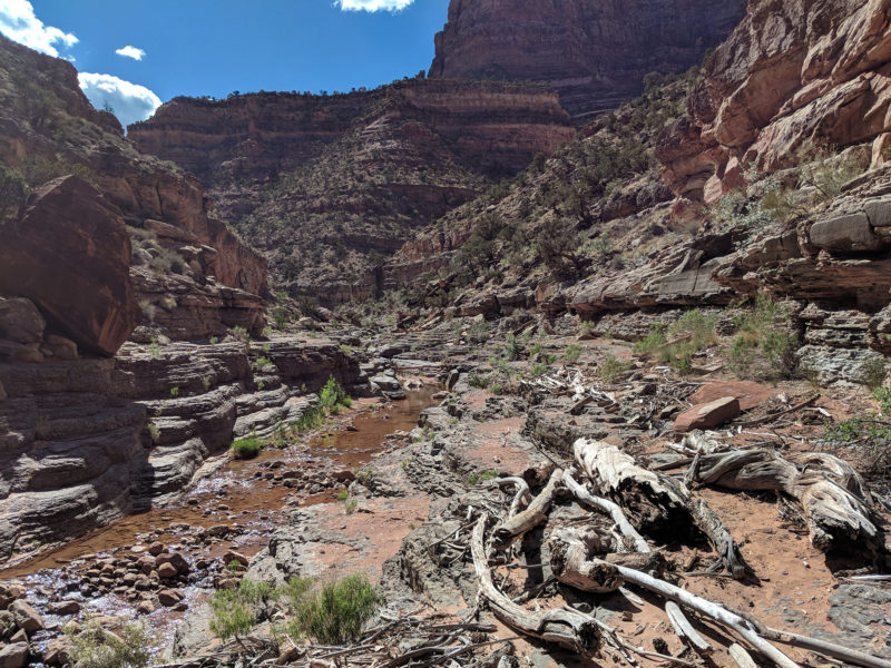
There’s actually quite a bit of Driftwood along portions of this route which is somewhat terrifying to think that at certain points the water fills the center part of the canyon which is just kind of scary.
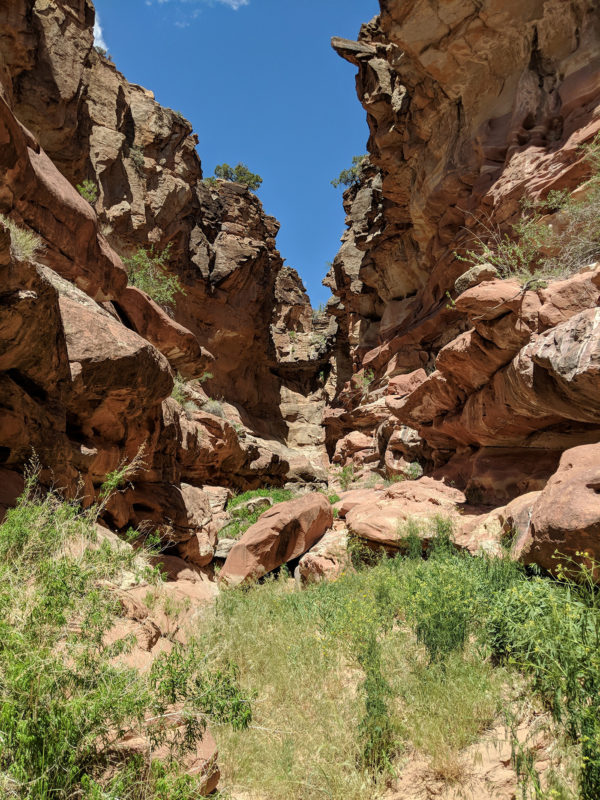
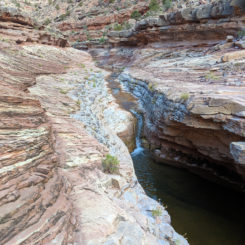
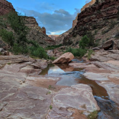
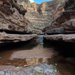
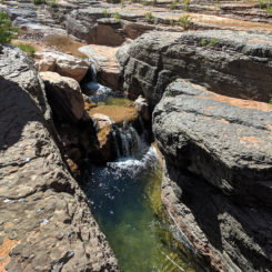
I found myself in the bottom of the canyon for one stretch at the walls around me closed in. There was a series of pools and little waterfall and each would require a short climb to a ledge for an bypass.
However, soon the walls grew taller and I came to a really deep pool that filled the canyon ahead and extended around the corner. I wasn’t optimistic that I’d be able to get up whatever lie ahead and definitely didn’t want to go for a swim to see if it was possible. Thus, I turned around and began looking for a way to get to the higher cliffs. Aout 50 yards back was a log leaning against one of the upper walls which looked like it could be used as a ramp.
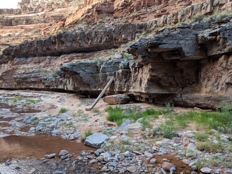
It was slick — but it worked. I walked the ledge up to near the obstacle and my instinct was correct I would not have been able to climb up directly. Unfortunately the path ahead was not easy. The slant of the rock was a little too precarious for my taste. If I’d slipped I’d plunge into the deep pool about 10 feet below. Thus, I decided to retreat again.
I shimmied back down the big log and began looking on the opposite side of the canyon for way up. I finally found a series of ledges that were climbable. I had lugged up the pack with a rope at one spot to make it a little easier, but then I was up on the higher ledges and it was easy easy to continue on up the canyon and around the obstacle. I didn’t run into this problem last time I was in the canyon as I must have stayed on a higher route initially. It as a good example of how each time the adventure can be different.
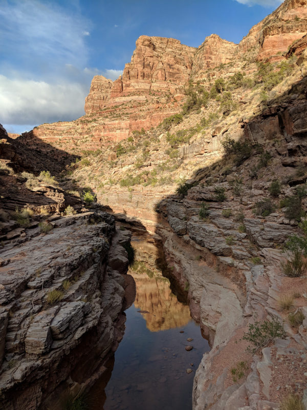
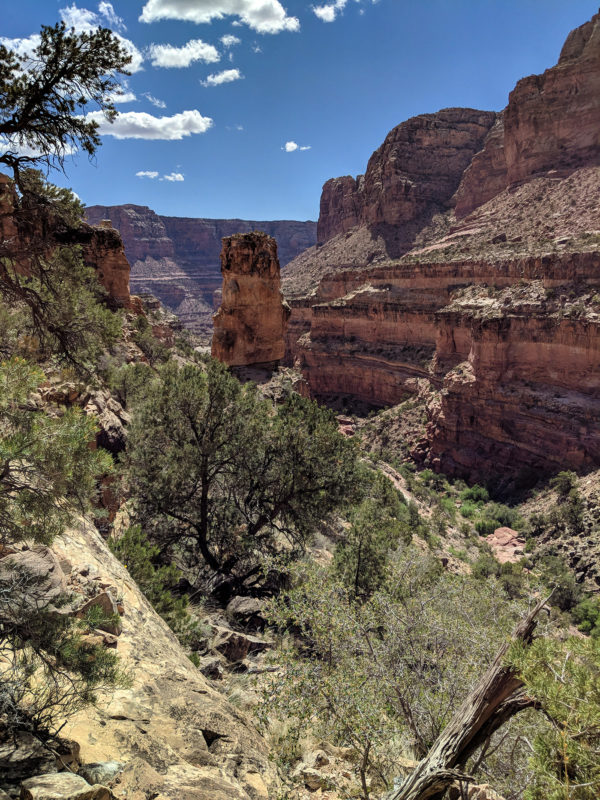
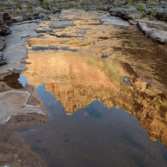
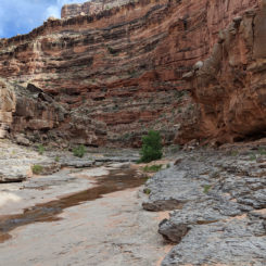
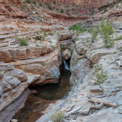
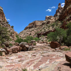
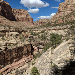
Continuing up canyon the walls towered even more and it becomes very reminiscent of the inner part of Grand Canyon. As the sun was going down there were great reflections all along the creek.
Dark Canyon magic
I walked a little farther and then decided to make camp for the night.
Day 36
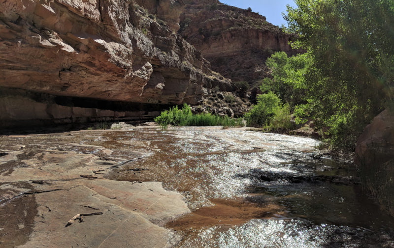
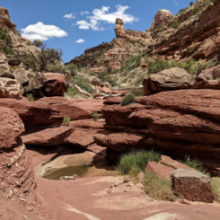
In the morning I got up and continued up canyon along more ledges and beautiful pools which really beckoned to be swam in, but I resisted the temptation as it was still early in the day. The next portion of the canyon is one of my favorite areas as there’s a spot where the water thinly spreads out across a layer of sandstone. It’s hard to capture in photos, but it really is a cool spot:
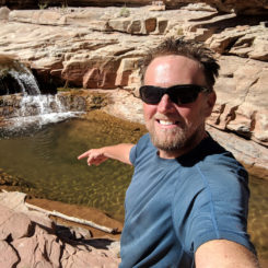
Just around the bend up from this spot was another pool with a small waterfall. Now the temptation was too great and I decided I had to take a swim in the water. The water was REALLY cold, but it was still an amazing experience.
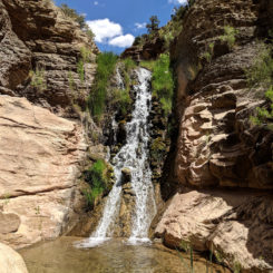
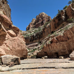
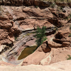
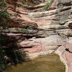
Just a bit farther and I was to the junction of Youngs Canyon where there’s a waterfall near the bottom end of the canyon. This is where I’d leave Dark Canyon and head to the north.
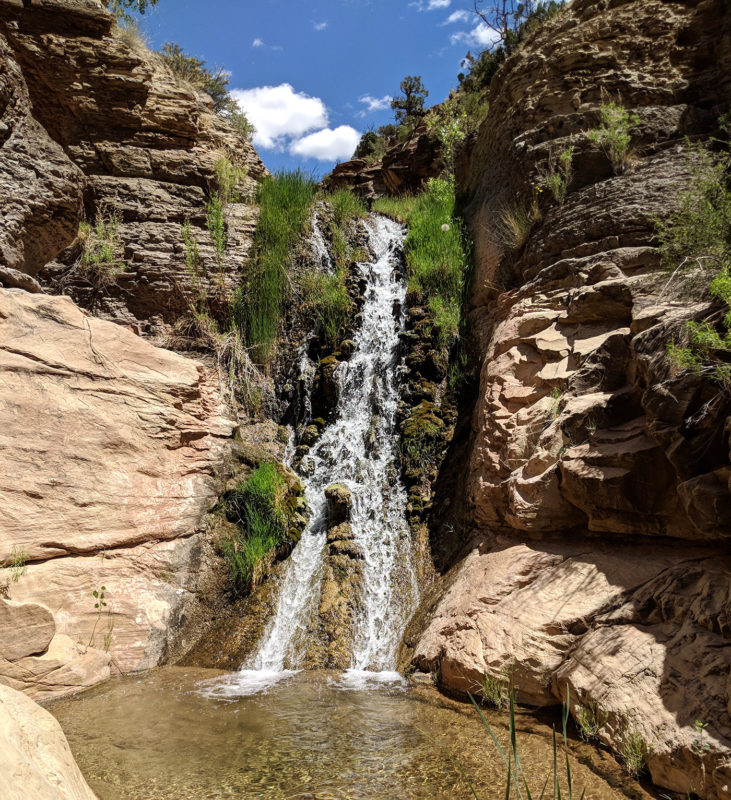
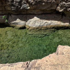
To get around the waterfall there was a bypass on the east side exiting Dark. Soon I was above the falls and overlooking a emerald green pool. Guide book author Steve Allen calls this pool one of the most beautiful he’s ever seen and I think I’d have to agree. I was tempted to take another swim, but instead I decided to move on.
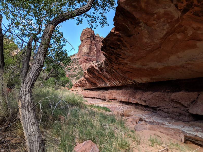
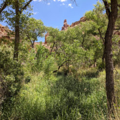
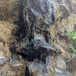
Continuing up Youngs at this point becomes quite brushy as one approaches the spring in the lower end of the canyon. At the spring one will actually find a dripping wall which provides the water for the area. Up from this spot the brush thins out a bit.
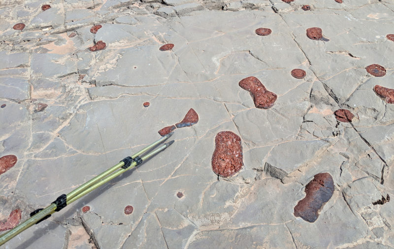
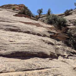
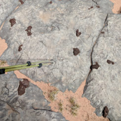
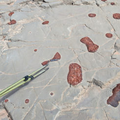
A little farther up the canyon I climbed a series of small dry falls and then found myself in a completely dry canyon walking up slabs of sandstone. The geology in the section was quite amazing with stripes of different colored rocks lining the canyon floor.
After climbing another dryfall I noticed a cool rock pinnacle high above ahead of me. I knew farther up canyon I had to use a bypass past a “thumb”, but didn’t think I was at that point yet. I continued up the canyon and had to I climb of another series of dry falls — this time a bit larger. Next I came to a deep pool that had to be bypassed with a rather steep climb up a sandstone bowl above it. I called this spot the “Pothole Plunge”. There I go… making up names again! 🙂
Above the pool I continued up canyon walking on a solid stone floor once again. There were more exampled of conglomerate geology that was cool.
Just a bit farther and the towering walls really began to close. I had a bad feeling which was quickly realized… a gigantic dryfall which I knew there would be no easy way to get around. I must have missed a bypass somewhere down the canyon.
I turned around and walked back down the canyon looking at the canyon walls and ledges searching for any possible bypass — but there was none to be found. I continued back down the “Pothole Plunge” and then down the various dryfalls all while keeping an eye on impermeable walls. Soon I was back at the area with the “thumb” rock pinnacle. Even though it was not the “Upper Bypass” that I originally thought, maybe there was a way up here as well as it looked like a route could go up here as well. I started up a side canyon at that spot and then noticed a large rock cairn that I hadn’t noticed earlier. That gave me more confidence, but there was still no obvious route up. I just picked a round-about way up to the interesting rock formation.
I made my way up and around the “Thumb” feature and then continued up the canyon along the ledges. I was only on the middle ledges and could tell from below that that wouldn’t be enough — I needed to get to the top layer in order to get past large dryfall. I kept heading up looking for a way to climb higher, but nothing yet. There were a few more scattered cairns, but they really didn’t mark a distinct path. Looking back toward the “Thumb” formation.
Soon I found a small path and followed it in the seemingly wrong direction. It quickly led to a shear wall with a about a 12-foot climb up to the top there is no way that that was definitely NOT backpacker friendly and I was not about to attempt it. Instead I kept following the canyon ledges north.
I eventually came to a weakness in the top layer. I was about to scramble up at this spot by pushing the pack up one section and then climbing up the rest and pulling it behind me. It was great feeling to be up on top and I could see it was easy walking from here. I was quickly past the dryfall far below and cruising up the canyon.
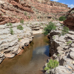
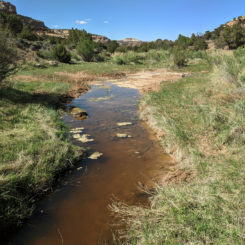
Soon the route dropped back to the canyon floor in the middle portion of Youngs Canyon. A little bit up farther from here there was water once again and I used the opportunity to fill up my jugs. There was also some interesting overhanging ledges in this section as well.
The section was a little bit brushy, but not too bad and before too long I was finally at the “Upper Bypass”. I could see the “notch” formation way above me that I’d need to climb to. This was an extremely slow climb up a talus slope. It’s probably one of the steepest slopes I’ve ever ascended with parts of ground giving away below me with each step. It’s not like I would in danger of plummeting to my death, but if I fell it would be a long roll/slide down that I did not want to endure! After about 20 minutes of climbing and I was up in the notch and then around the corner and gazing back down the canyon I’d just been coming up for most of the day. Even the Henry Mountains were poking up over the canyon rim and visible on the horizon:
looking back down Youngs Canyon from the “Upper Bypass”
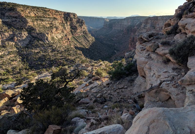
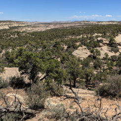
From here the route continued up ledge by ledge until finally I was at the on top of the plateau headed north. It a entirely new type of view and seemed weird to be walking across the flat-topped plateau as the sun was going down:
About 20 minutes later I was across the plateau and at the spot where I needed to drop back down into the canyon. It took a little bit of effort to find a weakness in the top layer again where I could descend. Once down on the lower level I made my way around a side canyon and back into the upper portion of the Youngs. The Hayduke guidebook author talk about a huge drop-off in main canyon near here, but I didn’t see it. I must have made my way down in a little farther north of their description.
By the time I was back down in the wash it was fairly late in the day. I found a place in to camp nearby and cooked some dinner.
Day 37
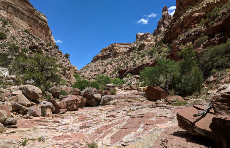
Continued up the canyon the next morning and was quickly greeted with more small dryfalls — nothing major, just enough to make it a bit tedious. There also a few more pools of water which I was happy to find. Soon the canyon opened up quite a bit as I neared the junction with Horse Pasture Canyon. I’d take this canyon as an exit from Youngs and before too long I was at the spot where there was a well-defined trail leaving the wash to climb up and around major dryfall.
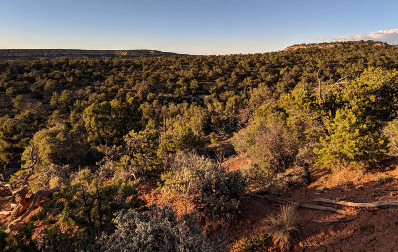
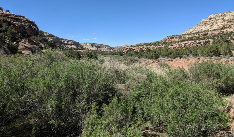
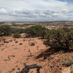
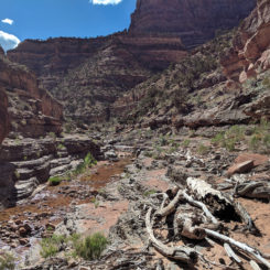
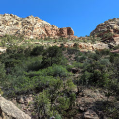
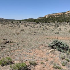
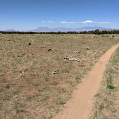
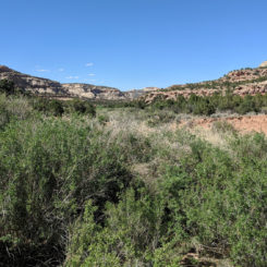
Above this canyon was really wide open. Walking up the wash proved to be sandy and not fun, so I got out and crossed the sagebrush-dotted plain. I eventually found an old road that led up the upper rough portion of the canyon and seemed like it had to be much easier than going up the canyon bottom.
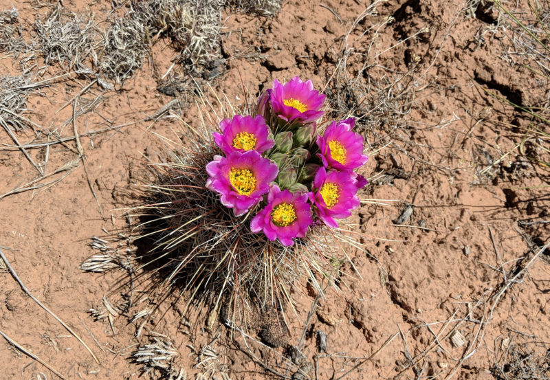
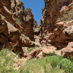
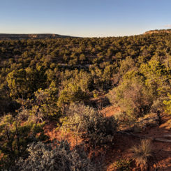
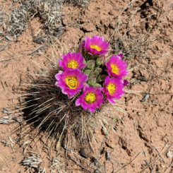
Before too long I was actually up on top and near a stock pond which was unfortunately dry. There was a group camp set up nearby with a lot of equipment and several vehicles but I didn’t see any actual people. I continued along the road across the Dark Canyon Plateau. Soon I was somewhat surprised to run into three Jeeps at a junction of this remote backroad. We chatted for a while and they offered up some water which I gladly accepted. I continued in a different direction than them and soon left the road entirely as I went cross-country toward Fable Valley. Along the way I marveled at the cactus in bloom:
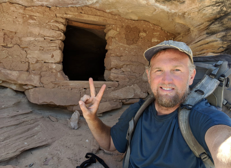
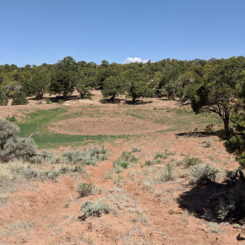
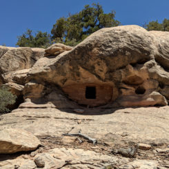
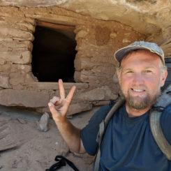
I was headed for a series of drainages to descend toward a side canyon of Fable Canyon. There were some minor drops as first, but nothing bad. As I was walking down one of the washes I was surprised to see a little ruin on one side of the canyon not far off. I went up to take a closer look it was quite the pleasant surprise.
Continuing on down the side canyon the dry falls became more and more difficult. There were never any spots that required any real climbing, but many of them were tedious and took quite a bit of scouting work to find a steep descent.
The entire wash was dry to my dismay, but there was to be a spring ahead so I anxiously awaited that. But, when I got to that spot however there was no water to be found. Instead I found another major dryfall — the biggest thus far. This one even more work to get around via a steep route through the brush. Once back to the canyon floor and underneath the dryfall there was water so I was happy. The location is a bit farther north than the spring labels on the map, but this must be water source as indicated. From this point on there were no more dryfalls and walking was pretty easy and before I knew it I was in the big opening of Fable Valley.
I didn’t see any water here yet but there was plenty of brush in fact I almost had to go into a tunnel of brush to continue on down the canyon. Before long the brush subsided and I was walking along a small cow-impacted stream. This soon ran dry and I was in a wash.
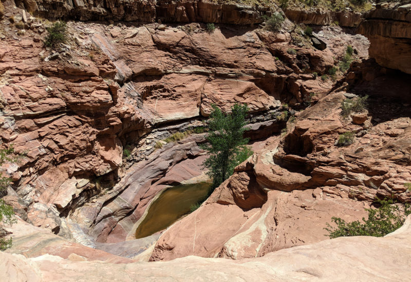
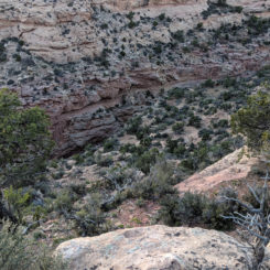
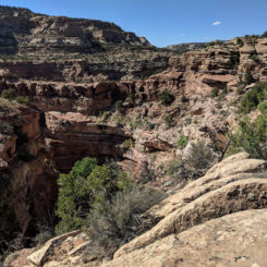
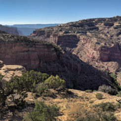
I wasn’t walking in the sandy wash for too long before I came to the spot where there was a huge drop into lower Fable Canyon. I left the wash there to follow an established route along the northern rim eventually to the spot where the junction with Gypsum Canyon.
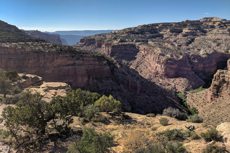
above the junction of Fable and Gypsum Canyons
From here I would wind my way north and then east back into Beef Basin and on towards Canyonlands. But… details on that will have to wait for Part 12: Through the Needles.
Photo Gallery:
-
- water source in upper Horse Tanks Wash
-
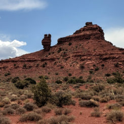
- Squaw and Papoose Rock
-
- old route to Dark Canyon
-
- minor downclimb
-
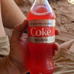
- Gatorade via powder
-
- loooking toward Dark Canyon
-
- top of Sundance Trail
-
- dropping into Dark Canyon
-
- nearing the bottom
-
- looking back up the Sundance Route
-
- finally at the bottom
-
- clear water
-
- conglomerates in Dark Canyon
-
- conglomerates in Dark Canyon
-
- cool pools
-
- awesome Dark Canyon
-
- walking the ledges above the creek
-
- Dark reflections | Dark Canyon⮞⮞⮞
-
- Dark Canyon
-
- Dark Canyon
-
- a precarious ledge
-
- the log ramp up
-
- climbing up ledges
-
- Dark Canyon
-

- reflections| Dark Canyon⮞⮞⮞
-
- Dark Canyon
-
- Dark Canyon
-
- Dark Canyon
-
- waterfall Dark Canyon
-
- Dark Canyon
-
- Dark Canyon
-
- cool spot in Dark Canyon
-
- leftovers from a flood
-
- the pool I swam in | Dark Canyon⮞⮞⮞
-
- waterfall at bottom of Youngs Canyon| Dark Canyon⮞⮞⮞
-
- “Emerald Pool”
-
- brushy area near spring in lower Youngs
-
- spring in Youngs Canyon
-
- small dryfalls
-
- cool geology | Youngs Canyon ⮞⮞⮞
-
- minor dryfalls below “Thumb” formation
-
- approaching the major dryfall
-
- more conglomerates | Youngs Canyon ⮞⮞⮞
-
- “Pothole Plunge”
-
- “Pothole Plunge”
-
- the lower big dryfall
-
- above the “Thumb”
-
- climbing up to top layer for “Lower Bypass”
-
- walking ledges above inner canyon for “lower bypass”
-
- walking ledges above inner canyon for “lower bypass”
-
- water in middle portion of Youngs
-
- overhangs in middle portion of Youngs
-
- middle portion of Youngs
-
- looking up at the “Notch”
-
- looking up at the “Notch”
-
- view from “Upper Bypass” | Youngs Canyon ⮞⮞⮞
-
- crossing the plateau for the “Upper Bypass”
-
- dropping back down into the canyon above “Upper Bypass”
-
- big dryfall in upper Youngs
-
- open canyon near junction with Horse Pasture Canyon
-
- old road out of Horse Pasture Canyon
-
- dry stock pond
-
- top of Dark Canyon Plateau
-
- looking toward Fable Valley
-
- cactus in bloom
-
- surprise granary
-
- surprise granary
-
- dryfall in side canyon to Fable Valley
-
- dryfall in side canyon to Fable Valley
-
- big drop near spring in side canyon to Fable Valley
-
- water is side canyon to Fable Valley
-
- Fable Valley
-
- uninviting water in lower Fable Valley
-
- looking into lower Fable Valley
-
- above junction of Fable and Gypsum Canyons