


Zion to Arches Hike Report
watch segment video
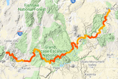
interactive hike map
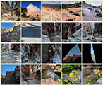
photo gallery
(previous: The Barracks ⟺ next: Bryce to the Paria)
Part 3: Up the Grand Staircase
April 27th, 2018
Day 10
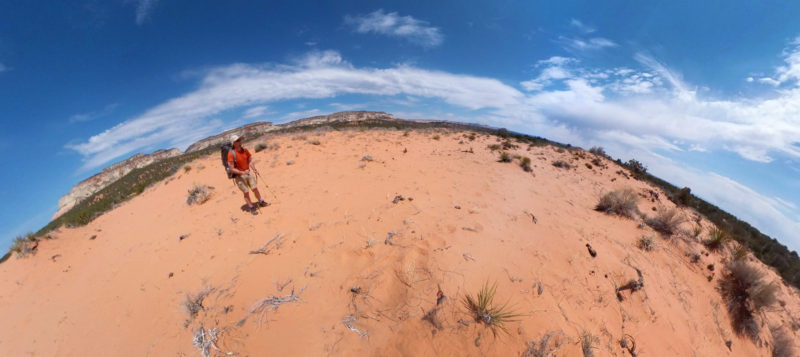
Once I was loaded up with all the new stuff from my cache, I set out from my camp near Dianas Throne. I began by walking the old highway south to the “Oasis” that I’d found several years ago. I was surprised to see it dry this year. From there I left the road and headed NE cross-country and through the through the coral pink sand.
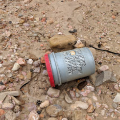
There were dozens of “clay pigeons” left as trash in this area. I also found lots of new mining claims staked into the ground.
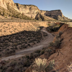
After slogging for a while I intersected a 4×4 road which I then followed for a bit before leaving it when I got close to the rim of Red Canyon. Once there I climbed down the extremely steep (and brushy) slope into the canyon and walked down the wash from there.
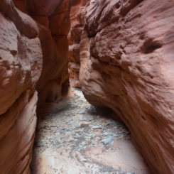
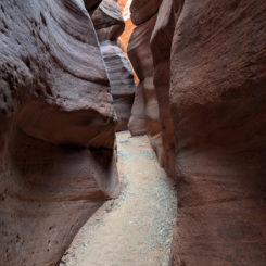
The upper portion of Red Canyon has shallow narrows with some nice spots of striped sandstone. The canyon alternates between narrow and more open sections. There were no major obstacles, but in one narrow section I had to climb down a short logjam.
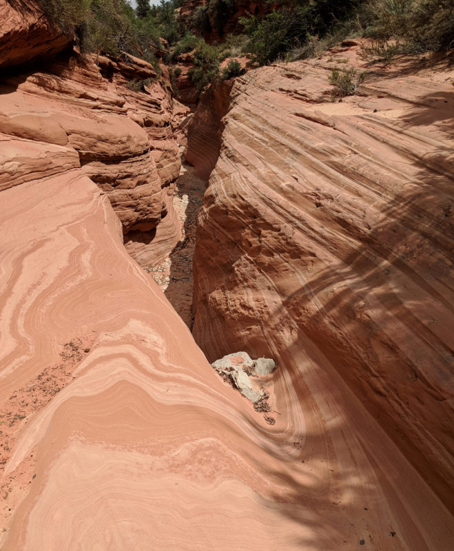
Upper Red Canyon
After about 20 minutes of walking down the canyon, it slotted up again tighter than before and I soon came to a chockstone with a big drop on the other side. I’d never read any account of this — but not many people do this upper portion. It might have been feasible to chimney down the 12-15′ drop, but I didn’t want to risk it — especially since I didn’t know what awaited around the next corner. So… I backtracked and got out to the wider portion of the canyon and eventually found a way to climb back up to the rim.
along Red Canyon
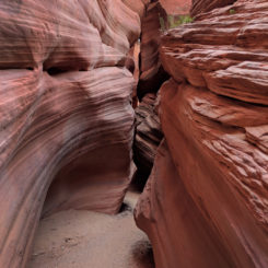
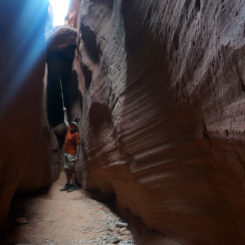
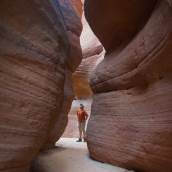
I followed the canyon’s rim down for about 20 minutes and finally found a spot to descend back down into the wash. At that point I dropped my bag, took my cameras and went back up to see the canyon from the bottom. People drive up this part of the sandy wash. In fact — a tour group was just leaving as I arrived at the entrance to the slot. This lower section is known locally as Peek-a-boo Slot (confusingly similar to the one near Escalante) and though local brochures compare it to Antelope Canyon — it’s not THAT awesome (though it’s still worth a visit.)
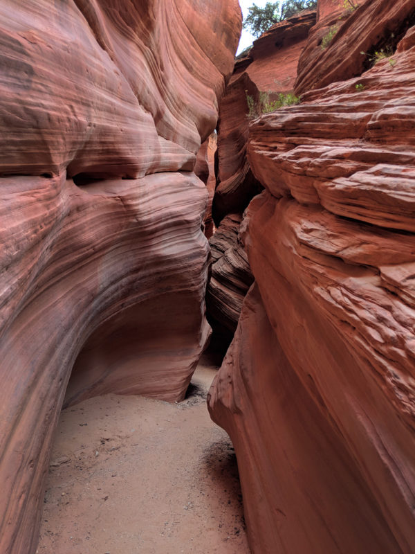
Red Canyon (aka Peek-a-boo Slot)
Red Canyon (aka Peek-a-boo Slot)
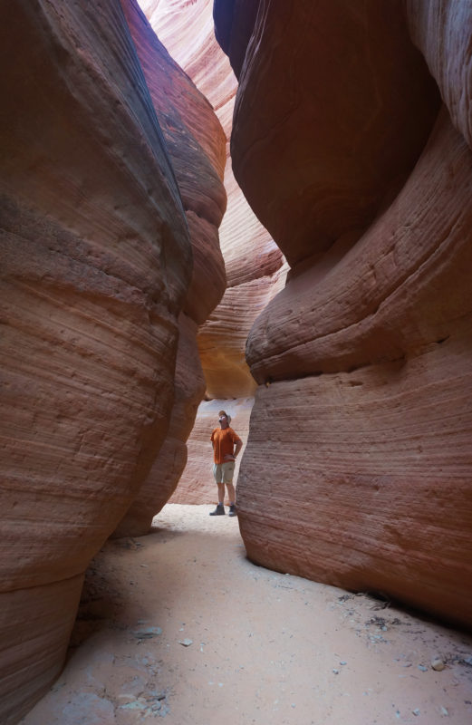
I went through two good sections of narrows before arriving at the chockstone that had stopped me from above. From this vantage point I realized that climbing up/down this might be impossible.
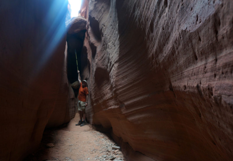
obstacle in Red Canyon
After some photos I headed back down and out of the slot and then continued down the seemingly wide-open sandy wash.
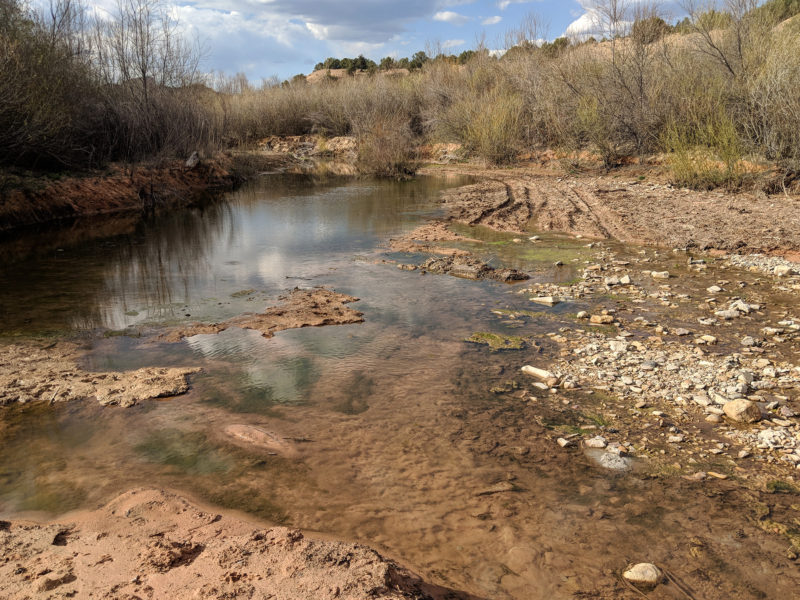
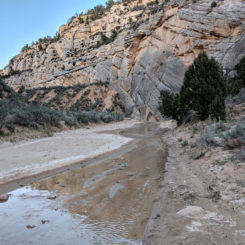
Before too long I arrived at Kanab Creek. Here I loaded up on water. An ATV route crosses here, but I didn’t linger too long as it’s actually private property — though it’s not posted “Keep Out” and the only sign asks people to please close the gate after crossing. Within a few hundred yards after crossing the stream one is back on Public Land.
Kanab Creek
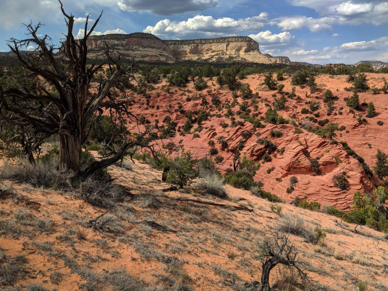
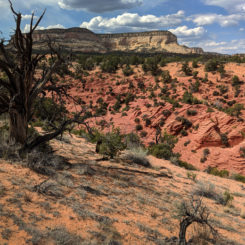
Continuing on the road I passed through a bunch of sagebrush fields and then at an intersection where one road went north toward Cutler Point and another south toward Kanab, I instead kept going east cross-country and climbed up the hills. Fairly suddenly it got really windy as a storm appeared to be moving in. It never did really rain on me, but there the wind got pretty crazy and the precipitation in the sky made for an incredible rainbow.
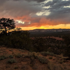
I climbed higher to find a place to camp and enjoyed the colorful sundown on the White Cliffs.
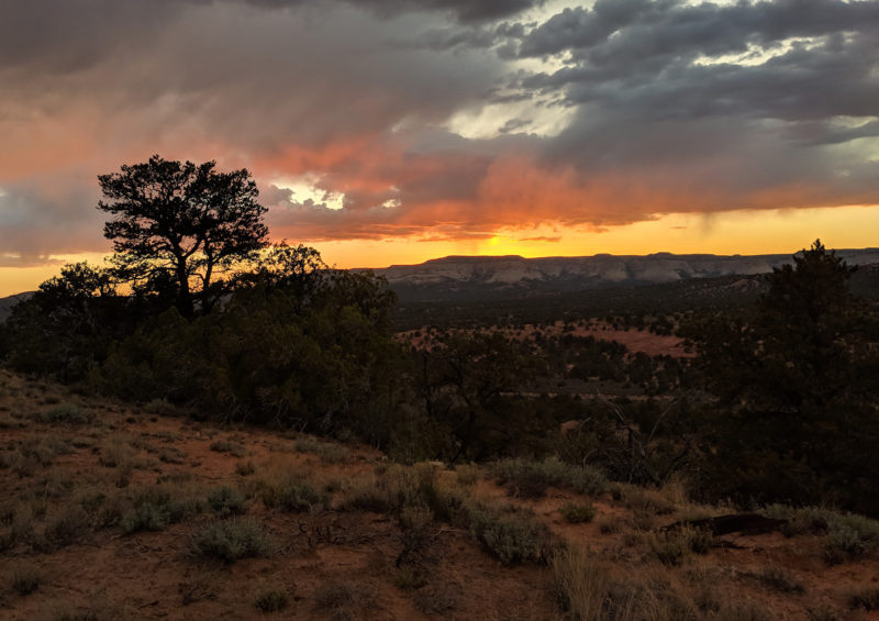
sunset on Elkheart Cliffs
It wasn’t a very productive day in terms of mileage. I spent too long in the morning re-packing my gear with the new supplies and then getting in and then out and then back into Red Canyon. But… it was still a good day despite the low mileage.
Day 11
Heading out to the east in the morning until I finally intersected another ATV road. I enjoyed the views of the colorful White Cliffs to the north — some really cool stuff awaits those who explore that area, but alas there was no time for me to do so on this day.
Soon I was at Red Butte. This is a fascinating outcrop of sandstone, but in the mid-day sunlight it wasn’t nearly as colorful as when I was there last time in the late afternoon. The wind was really picking up and as I was shooing some video it actually blew over my 360-degree camera on the tripod. Then… as I was inspecting the new scratches, a wind gust actually blew my main camera from its resting spot and rolled it across the ground. I’d soon realize that the lens broke in the process. 🙁 So… from this point on I’d only shoot with a scratched up 360-camera and my phone (I’m so glad I recently upgraded to the Pixel 2 which captures pretty great video and photos.)
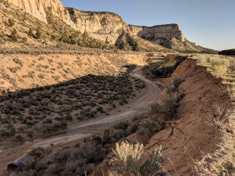
From here I left the ATV route behind and once again headed cross-country toward Johnson Canyon. I skirted some private property to the north and explored a few waterworks areas , but there was no water to be found. By the time I got to the road I was running low on water and somewhat afraid I’d run dry if Skutumpah Canyon ahead was not flowing. I actually resorted to picking up partially-filled water bottles people had evidently thrown from their cars while driving along. I found nearly 1L of water this way and if desperate I thought I’d be able filter this and/or boil it for cooking. But alas, there was no need as I found a flowing stream once I arrived at Skutumpah Canyon. This is where I left the road and began walking up the canyon itself.
Lower Skutumpah Canyon
I was a little anxious about this canyon as I knew nothing about it. Some maps show one small parcel of private property a short ways up the canyon. It looked like it might be difficult to get around if it was indeed fenced/posted. But luckily when I arrived in that area, there was absolutely no sign or fence of any kind. Once past the questionable area I found a decent place to camp and enjoyed watching a near-full moon rise over the canyon wall.
Day 12
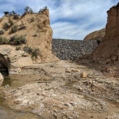
In the morning I continued up Skutumpah Canyon on an overcast day. I was very dismayed as I ran into a bunch of pollution — discarded oil bottles, tires, and plastic buckets. There’s a large “ranch” on private property just upstream and I can only assume that they are the ones responsible.
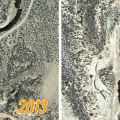
When I got to the private property line, I was surprised to see a rock dam bridging the canyon. This has to be a fairly new development as it doesn’t appear on any SAT imagery as of 2015. In fact, looking at recent imagery is interesting as it shows there was a major change in the watercourse in this part of the canyon sometime between 4/2013 and 7/2015. Compare it here:
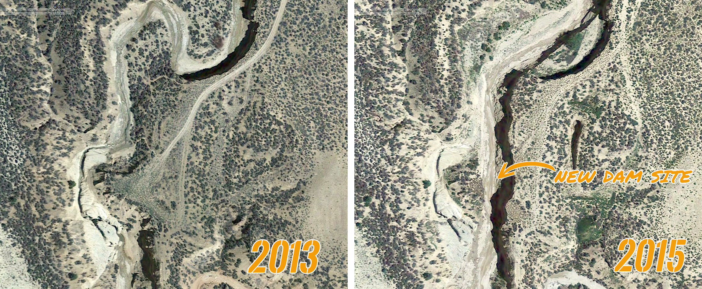
Skutumpah Changes
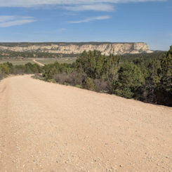
From the dam I had to swing to the east up a side drainage to stay on public property. I eventually worked my way up to another ATV road. Once up on high group I could see the Pink Cliffs in the distance to the north and soon I connected to Skutumpah Backroad which I would walk for many hours to the NE.
Pink Cliffs in the distance
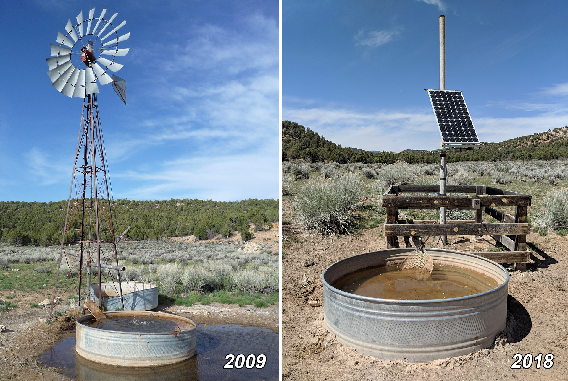
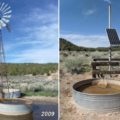
After a few hours of walking I came to the “Windmill” at the junction of Slide and Coal Canyons. This feature is just off the road on the south side and it too has changed in recent years. Technically it’s no longer a windmill, but instead a solar-pumped well. What once once overflowed with water, now just trickles into a catchment system which on this day was buzzing with bees. I’m sure the water was still fine, but I ran into a nice guy from New Mexico with his car at the well who had stopped for lunch and insisted that I fill up from his ample water containers. It made life easy for the moment.
well along Skutumpah Road
Back walking up the road I soon ran into a lady in a white truck that stopped to chat. As she got out of her vehicle I realized that she was a ranger — and not just any ranger, but the same one I’d run into 12 years ago on my Grand Staircase-Escalante Hike! And… she actually remembered me as well! Good to see Ranger Sue again!
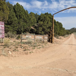
In another 30 minutes or so of walking I finally got to the Deer Springs Ranch area. After slowly making my way past the open-range longhorns, I turned onto Meadow Canyon Road and followed it north toward the Pink Cliffs.
Meadow Canyon
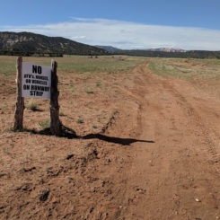
This road is private, but is an approved easement for access to the National Forest, so one should not leave the road as inviting as the ponds may be along the way.
Just after sundown I passed the gate and entered the National Forest. I camped nearby and used the remaining daylight to grab some water from the the nearby creek/pond.
Check out the full photo gallery below or continue reading the next section… Part 4: Bryce to the Paria.
Photo Gallery:
-
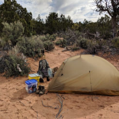
- camp near Diana’s Throne
-
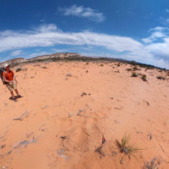
- Coral Pink Sand
-
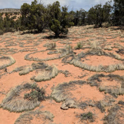
- Utah Fairy Circles?
-
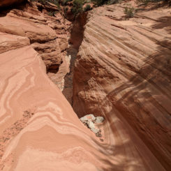
- Upper Red Canyon
-
- Red Canyon (aka Peek-a-boo Slot)
-
- along Red Canyon | near Kanab
-
- Red Canyon (aka Peek-a-boo Slot)
-
- obstacle in Red Canyon
-
- Red Canyon (aka Peek-a-boo Slot)
-
- Red Canyon (aka Peek-a-boo Slot) | near Kanab
-
- layers of sediment
-
- Kanab Creek
-
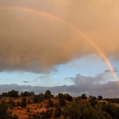
- rainbow
-
- sunset on Elkheart Cliffs
-
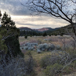
- near Cutler Point
-
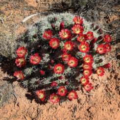
- cactus in bloom
-
- Lower Skutumpah Canyon | The Grand Staircase ⮞⮞⮞
-
- Skutumpah Canyon
-
- trash in Skutumpah Canyon
-
- Skutumpah Dam (private)
-
- Skutumpah Changes
-
- Pink Cliffs in the distance
-
- well along Skutumpah Road
-
- Ranger Sue
-
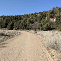
- Skutumpah Road
-
- Deer Springs Ranch
-
- the airstrip
-
- old air strip sign
-
- Meadow Canyon Road
-
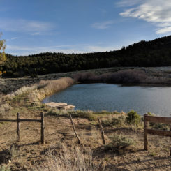
- Meadow Canyon pond
-
- Meadow Canyon | The Grand Staircase ⮞⮞⮞
-
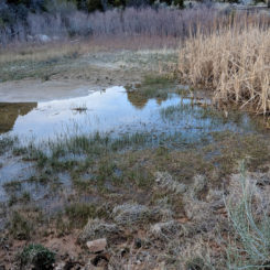
- pond in Meadow Canyon