Part of the Kanab to Hanksville Hike 2006
More pictures available in the Gallery
Day 23
Yes! I have conquered the Escalante! I was sooo bummed at the idea of ending my trip headed west — the direction from which I began. But, now that won’t be the case. I got up and had to get past one last bend in the river. Because of how it was walled in I would have to walk in the river quite a ways going upstream. But I did it and I was happy to be at the mouth of Choprock Canyon with my last river crossing behind me. That is… Assuming I can get out the top; which is not absolute.
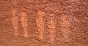 I spent some time looking at a large panel of petroglyphs. It was the largest collection I’ve seen yet on the trip.
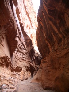 Then I was headed up canyon. Choprock is the canyon where two BYU students died last summer. The canyon has many forks and they were canyoneering in the water-filled slots of the south fork; whereas I’ll be in the more tame north fork. The only problem is that since I didn’t plan on being here, I’m navigating the canyon by memory w/o any trip reports or route maps. “Was that Left, Right, Left or Left, Left, Right?” I think Chop is possibly my favorite canyon so far. Right away it has big walls with undercuts. Then, I entered a section of narrows which went for over a mile. I could touch both walls with outstretched arms here as the walls towered hundreds of feet above — often completely blocking any sunlight.
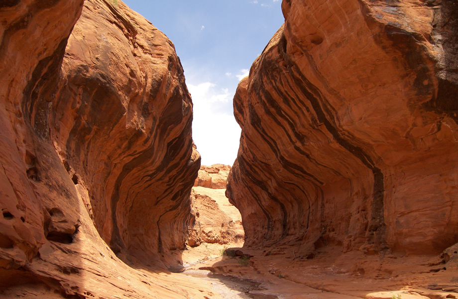
I was a little nervous because there wasn’t any water and I had to fill up for the long, dry hike once out of the canyon. But, soon the canyon widened a bit and there were pools of water ounce again — so I filled the reserve. The huge walls in this section were amazing. Two to three hundred near-vertical sheer red sandstone twisting around each bend. I felt like a mouse in a giant maze. Some sections were undercut on both sides giving the impression of a giant subway tube. The next section had big boulders which had fallen from the sides. Some were as big as a house!
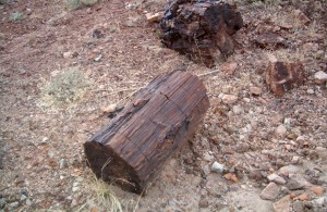 Then I entered the mud hills. They were a deep purple and lime green. I spotted some rocks which piqued my interest so I went to investigate. Sure enough — it was petrified wood! Big chunks and even a few logs!
I continued on and climbed out the top of the canyon. I had a great view to the west; Capitol Reef and the Henrys in the distance. The only problem — I ended up 200 feet up on a cliff. I’m sure I’ll find a way down, but that’ll be tomorrow as I decided to camp right there.
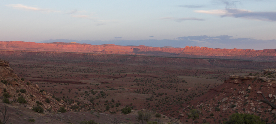
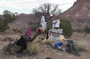 Unpacking I immediately realized that my water reserve had sprung a leak! Everything in my pack was wet. I hung it all out to dry in an old, twisty juniper tree trunk. I’m not sure if I was more upset about everything getting wet or losing a precious liter of water. Sunset was amazing again. This time the sun’s final rays lit up the Waterpocket Fold. Dinner was trail mix and a hunk of cheese. Boy I’ll be happy when I get to that next cache; hopefully tomorrow night.
Day 24
So today out of nowhere a mountain lion attacked me. Ok, not really. My friend Mark tells me that fun/pleasant equals boring and that I’ve been lucky to have so many challenges along the way. Well today I had a great fun and pleasant day wandering the desert — sorry Mark. I left my camp and walked toward the huge cliff which blocked my path. At the edge the view was great. And, I just happened to walk up to a rare spot it was possible to descend. Hopping down the boulder fall, I was down in about 15 minutes and to the rough gravel road below.
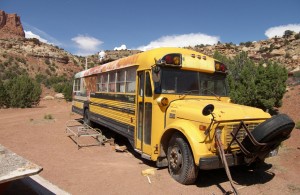 Headed up the road it was hot. I was afraid I would run out of water. If only I still had what spilled in my pack. Soon I spotted an old mine off to the side of the road. On the opposite side hidden behind a small hill was a corral and and old school bus. I went to investigate. The spot looked like it was still used on occasion as a rancher’s camp. I found a huge container of fresh water — so I filled up! Soon I came to a small spring with more water. A few miles up the road a huge storm approached: menacing clouds, thunder and lightening. When it began to rain I took cover under a rock/tree. But, the rain stopped right away and the storm seemed to calm down leaving a much cooler partially gray sky. So I kept going.
Several miles farther up the road I met some people in a truck. It was a nice couple from Arizona who were out car camping. “Kinda out in the middle of nowhere, aren’t ya?” the man asked. I told them that they were only the second group I’ve seen in the last week. They gave me more water and a granola bar and went on their way and again I was alone in the desert. Shortly after that I decided to leave the road and travel cross-country again. These sections are tougher, but they often cut mileage and add a real sense of adventure. I climbed to near the top of Wagonbox Mesa. At near 7000 feet the views behind me were awesome. I could see the entire Escalante basin and then in the distance the Kaiparowitz Plateau where I crossed more than a week ago.
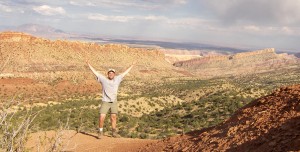 Then, as I rounded the corner the views to the east were even more incredible. Spiking out of ground far below were the red/orange/tan spires and domes of Capitol Reef National Park. The Waterpocket Fold ran for miles in both directions. In the middle-ground were the blue and gray eroded cliffs of Tarantula Mesa. And behind, the towering summits of the Henry Mountains. I was actually close enough now to see detail on their slopes: the pine and aspen groves and the absence of snow which was present 24 days ago. The Henrys beckoned, but alas I knew my journey would have to come to and end at their foothills. I had hoped to make it to their far side and to the pavement of highway 95. But, that can wait for a future trip; maybe a shorter one with good company.
Truth is I wanted to have an adventure and I’ve done that ten fold. I also wanted to raise awareness of this great undeveloped landscape and hopefully I’ve done that too. One doesn’t have to hike 300 miles to enjoy this land, there is ample access via gravel roads suitable for any car in the right weather. There is plenty of access for short hikes or jumping off points for multi-day adventures. What there is not, and hopefully won’t be any time soon, is congestion, 24′ motorhomes, shuttle buses, tour buses, formalized campgrounds, overflow campgrounds, hiking quotas, 6:30am lines for popular permits… or pavement. Please support groups that protect this and other fragile lands: The Sierra Club and The Southern Utah Wilderness Alliance (www.suwa.org) are two.
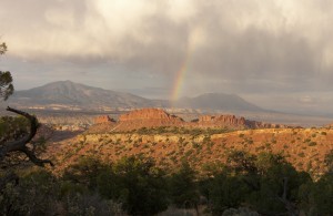 I spent almost 2 hours on that ridge watching the sun go down casting its near final rays on this awesome landscape. I had almost forgotten I still needed to climb down and hike several miles through uncharted territory before dinner/camp- and only if I made it to my next cache would I have dinner! So I started down. While on the ridge another storm had brewed. Thunder, lightening and wind quickened my pace down from the summit. Then, about half way down, the clouds parted and the sun’s true final rays shown through casting a rainbow right in front of me over the red-rock desert with the blue mountains behind. Overwhelming! It’s a sight I will never forget and one I know pictures won’t do justice.
I continued down as the setting lingered. Soon it faded and started getting dark. That’s when I thought I was almost down and came to a huge chasm. Hey — what do you know, there is drama! The canyon was steep sided and rocky. I had to scout a long time in the twilight to find a way I thought I could get down. And, boulder by boulder, I did. In the beginning it looked extremely daunting, but when broken down into a series of manageable short climbs, it wasn’t that bad. Now it was dark and I still had a few miles to go. But, I really wanted that dinner so I put on the head-lamp and continued through the desert in the dark.
By 10:30 I reached my destination and had the unique challenge of finding my cache in the dark. That took another 20 minutes. But, by a little after 11pm I was in my tent ready to enjoy my last dinner in the wilderness. It was… ramen noodles with salmon, cheese and crackers, applesauce and dried apricots. It was a great final night. All that is left tomorrow is a short hike through Capitol Reef and to the main gravel road where I will meet my parents. 🙂
Day 25 — The final day!
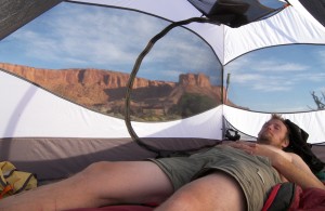 It’s hard to believe that the final day is here. The whole trip went kinda fast in a way; probably because I was always on the go and always had something to do. People asked me before I left if I was on sabbatical to “find myself” and/or contemplate life. That wasn’t the intent and the fact is — there was no time for it. I was perpetually focused on the current task: how do I get down this canyon, how do I get up this canyon, how do I get across this mesa, where can I get more water, where exactly am I, are there any mean animals around, is that cow friendly, why won’t these #*&! flies leave me alone, how deep is that water, how do I get through this brush, have I gone far enough for the day, where’s a good place to camp, etc.
A typical day was like this:
7:30 wake up, set out solar panel
+1 hr – elaborate and send report
+.5 hr – breakfast (cereal or bars), wash up
+1 hr – filter water, organize, bandage feet
+.5 hr – break camp, repack
10:00-11:00 hit the trail
Hike 20-40 minutes, rest 10, repeat
1:00 snack break (Clif bar)
Hike 20-40 minutes, rest 10, repeat
3:00 extended mid-day break (granola bar)
Find, filter more water if needed
Hike 20-40 minutes, rest 10, repeat
5:00-8:00 my favorite hiking period
Hike 20-40 minutes, rest 10, repeat
8:00-9:00 find good camp
+1 hr – make camp (unpack, pitch tent, organize)
+1 hr – prepare and have dinner
+1 hr – write daily outline, study maps for next day
11:00ish sleep
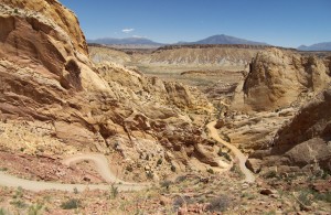 I began the day exploring a few twists of Lower Muley Twist Canyon. The Mormon pioneers said this canyon was twisty enough to twist a mule and hence the name. Then, I descended the switchbacks of the Burr Trail which cut down through the towering spires of Capitol Reef and to the valley floor 800 feet below. I’m now officially on the upward slopes of the Henry Mountains and to the road where my parents will pick me up.
I hiked down the road a ways to enjoy the ever-changing view back on Capitol Reef. Eventually I passed the 111° W latitude line. This means my journey had spanned three lines of latitude — almost 1% of the way around the globe!
That’s when I decided to stop. It was a very hot day and I saw a lone tree just off the road. I planted a flag on the side of the road that my parents would see and then went and rested in the shade of the tree.
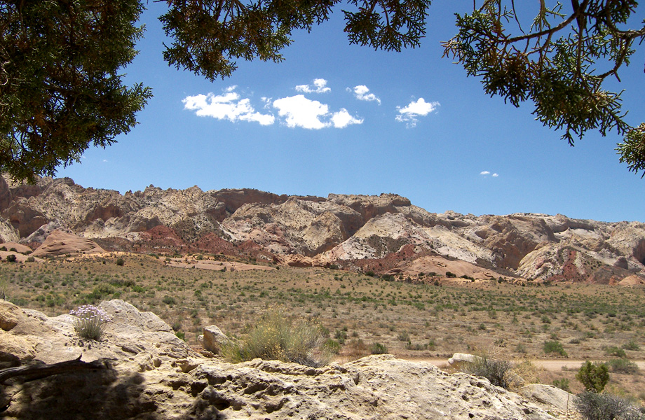
Within an hour, and right on time, I see my parent’s truck coming down the dusty road. I stand up and wave happily. Then… I see them drive right past me! They were looking the other way and didn’t see me or my flag. I get out in the road and see them pull over a 1/2 mile ahead. Whew — that was close! Then… They started again and continued over the horizon!
I ditched all my gear and continued after them down the middle of the road. There was a trailhead a few miles ahead and I hoped to find them there. But, I had only walked about 20 minutes and I saw them coming back my way and this time they couldn’t miss me… and they didn’t. It was hugs all around, a cold drink from the cooler and my journey was over. 25 days and 283 miles after it began.
Time to hit the shower!
Thanks again to everyone who wrote before and during my trip. Your support was greatly appreciated. In the coming weeks I will be adding more to the site: post-hike thoughts, gear reviews and of course, lots of pictures!
Post Hike Summary
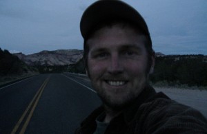 After a long drive home, I am back in Burbank! After three days of big meals, I still weighed in 20 pounds less than when I left and my body fat has decreased by 9.5%.
I am just beginning the long task of wading through the 3 hours of HD video and over 1000 pictures from the trip.
If you would like to be notified when this site is updated with pictures, expanded thoughts, gear reviews and more, send me an email at jamal@greenjam.com.
Thanks again everyone.
Next up… the Southern Sierras or maybe the Grand Canyon east to west.
All the best until then,
– Jamal
More pictures available in the Gallery


