![]()
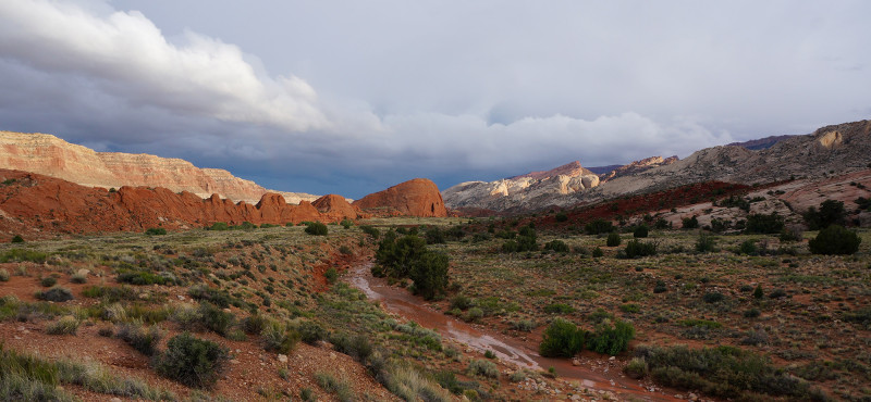
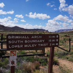
Lower Muley Twist is a spectacular canyon in Capitol Reef just south of where the Burr Trail Road cuts through the mid-section of the park. Supposedly the name originates from pioneers claiming the canyon could “twist a mule” with its many meanders. Lower Muley Twist is known for its amazing high walls and huge/deep undercuts which differentiates it from its nearby sibling Upper Muley Twist and its arches and narrow canyon (see this page for more on Upper Muley Twist).
Lower Muley Twist can be done as a long day hike, but one might enjoy it more as an overnighter. The canyon is part of the Hayduke Trail so it’s becoming more popular with long-distance thru hikers. The canyon is dry except for seasonal potholes/outbreaks, so plan accordingly. Long-distance hikers can count on a few reliable “tanks” found on the east side of the reef most of the year.
If not doing the canyon as part of a thru-hike, one will do the hike as an out-and-back, or make a partial/full loop via a route along the eastern side of the reef. These options are detailed after the main description.
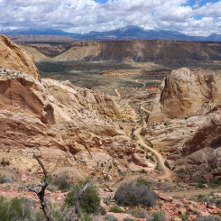
Burr Trail Switchbacks
Hiking Down Lower Muley Twist
Lower Muley Twist officially begins at a small parking area along the Burr Trail Road just west of the famed switchbacks. If you arrived here from the west via Boulder, definitively drive up to the top of the hill to take in the view before setting out.
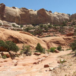
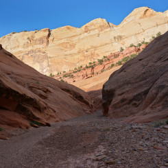
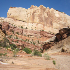
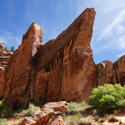
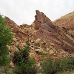
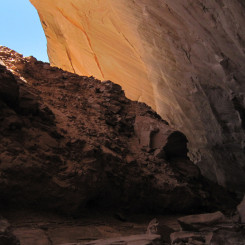
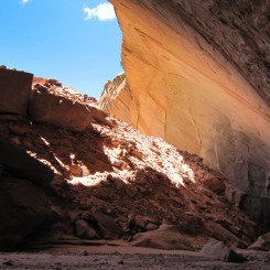
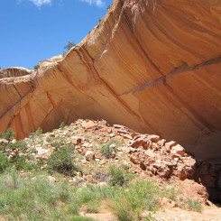
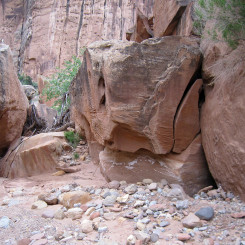
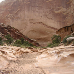
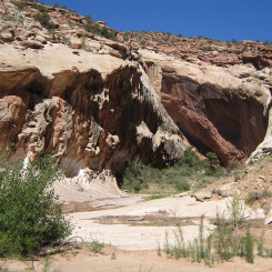
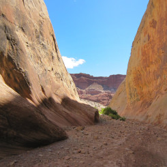
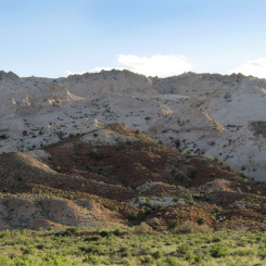
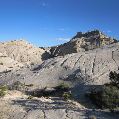
The uppermost part of LMT cuts down through the red Wingate sandstone. The canyon is fairly narrow and includes a few short sections which could almost be considered ‘slots’.
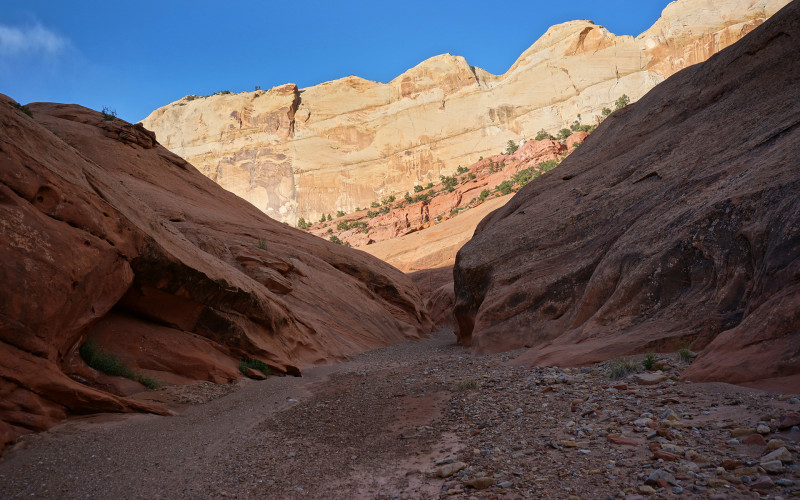
upper Lower Muley Twist
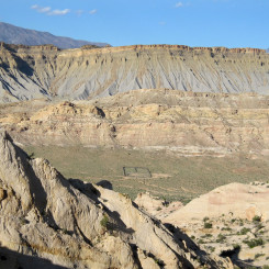
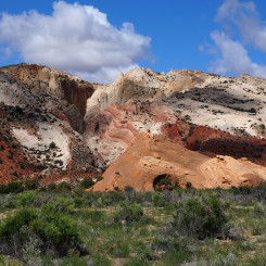
After just over 2 miles one comes to a wide-open junction where a major drainage enters from west providing views up to Wagon Box Mesa.
Continuing downward the canyon becomes a bit more entrenched and in another mile or so one might encounter small outbreaks of water depending on the season. In about another mile one comes to the next milestone — the junction of the Post Cutoff Route which climbs up and over the fold (see loop options below).
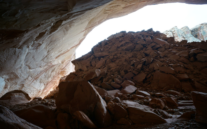
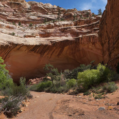
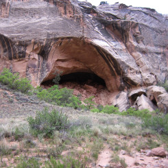
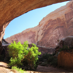
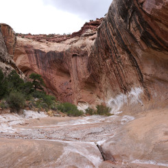
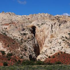
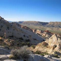
On down canyon the walls begin to tower higher and higher and the route becomes more “twisty”. At near 6 miles from the TH one notices a strange rock formation which looks like it possibly used to be part of a great natural arch/bridge. Just past this one enters the first major undercut of the hike.
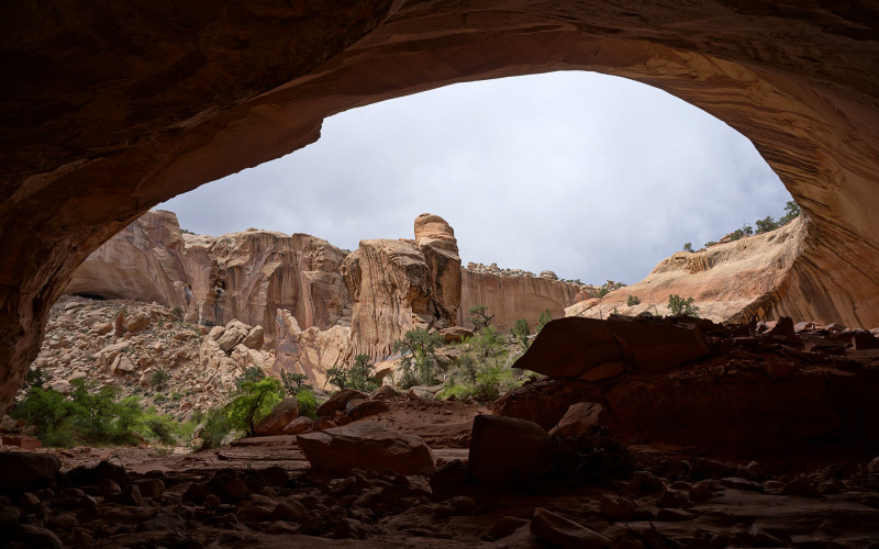
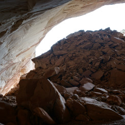
In a little over a mile farther down the canyon hikers come to the next major undercut. For this one hikers go behind a a huge debris pile which blocks much of the daylight from penetrating to the back of the undercut.
Undercut #2
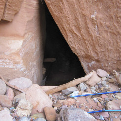
Just past Undercut #2, one comes to the only obstacle of the route — a rockfall which blocks the main wash. Multiple routes exist which go around (or through) the minor obstacle.
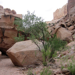
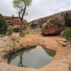
Less than a quarter mile down from the rockfall a substantial drainage enters from the left/east and frequently a big pool is found near the junction. A large cottonwood and unique-looking gigantic boulder mark the spot if the pool is unfortunately dry.
In just over another mile one comes to another junction where a major drainage enters from the west. If one is hiking UP the canyon at this point he/she needs to take note to go the “right” direction here.
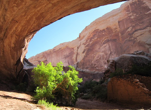
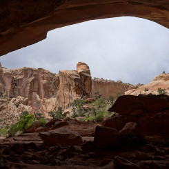
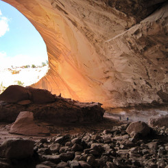
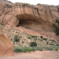
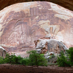
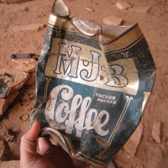
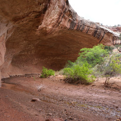
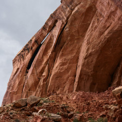
The canyon widens a bit and continues to wind its way to the south. At about 10.5 miles from the TH one comes to the final giant undercut — this time on the western side of the canyon. This undercut is known at the Cowboy Camp and one will find many relics and “cowboyglyphs” dating back over 100 years.
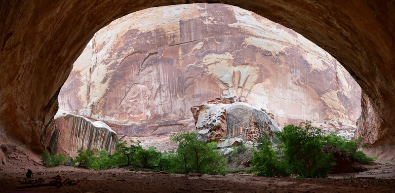
Cowboy Camp Undercut
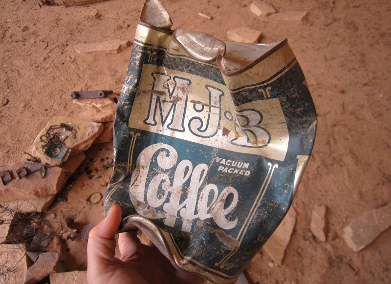
Cowboy Camp
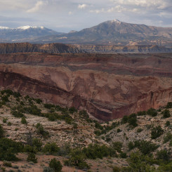
A few bends south of the Cowboy Camp is another major drainage coming in from the west. This is final tributary of LMT and the bottom portion can be explored as a short diversion. The lower end has scenic sculpted walls and then a large arch which hugs the the high northern wall. Continuing past the arch is a difficult cross-country route to the top of the Waterpocket Fold which one can then connect to the west to the Moody Canyons area.
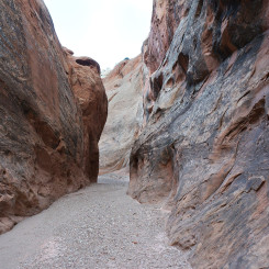
Back to Lower Muley Twist and continuing down, the canyon soon turns left and into the massive Navajo sandstone fins of the reef. The canyon becomes fairly narrow, but there are no major obstacles as it cuts through the reef.
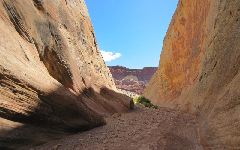
Exiting the Lower Narrows
In less than a mile the canyon widens and one emerges into the seemingly expansive Grand Gulch where the route intersects Halls Creek (usually dry).
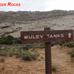
From here a one-mile diversion to the south will take one to the Muley Tanks water source and nearby Hamburger Rocks geological feature. Read more about this spot in the Hamburger Rocks Guide.
Otherwise… one has the option of turning around and heading back up the canyon or heading up east of the reef along the Halls Creek route.
Halls Creek Trail
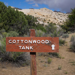
It’s 5 miles in up Halls Creek to the parking area at The Post. It may not be as exciting as the canyon, but the route is quicker and has some great views of The Fold along the way. One also passes Cottonwood Tanks and Willow Tanks en route and a keen eye will spot a large natural bridge in one of the canyons cutting into the reef.
At the trailhead parking for The Post there are toilets, but no running water or trash receptacles. From here it’s another 5 miles along the Burr Trail road to get back to the original TH atop the switchbacks. Along the way, Headquarters and Surprise Canyons beckon further diversion to explore.
Instead of walking the road, one may also close the loop via the 2-mile Post Cutoff Route and then hike back up the upper portion of Lower Muley. This is a fun route which goes up over the fold with some great views along the way. There’s also a small arch on the north side near the top of the route.
Key Milestones:
- 0.0 — top trailhead along the Burr Trail
- 2.3 — junction with drainage from west (Wagonbox Mesa view)
- 3.9 — junction with the Post Cutoff Route
- 5.9 — Undercut #1
- 7.1 — Undercut #2
- 7.2 — Rockfall area
- 7.5 — possible pool
- 8.7 — junction with drainage from west
- 10.4 — Cowboy Camp Undercut
- 10.9 — junction with drainage from west (western exit possible)
- 12.5 — Lower Narrows end and junction with Halls Creek
- +1.0 — diversion to Muley Tanks/Hamburger Rocks
- +5.0 — back along Halls Creek Route to The Post
- +5.0 — The Post to top trailhead via the road
- +2.0 — Post Cutoff Route (LMT to The Post)
Video Reference:
2010: Escalante to Monticello
2016: Burr Trail Loop
2015: Zion to Capitol Reef
Gallery:
-
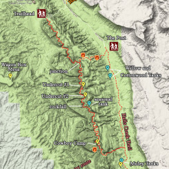
- Area Map of Lower Muley Twist
-
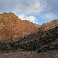
- Burr Trail Switchbacks
-
- upper Lower Muley Twist
-
- upper Lower Muley Twist
-
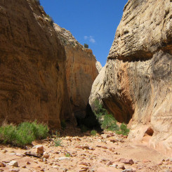
- narrow passage
-
- colorful walls
-
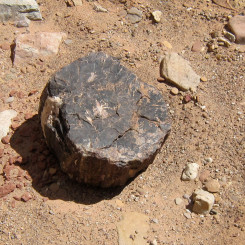
- Petrified Wood
-
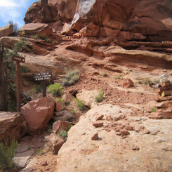
- junction of Post Cutoff Route
-
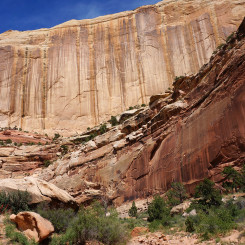
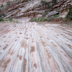
- streaked walls
-
- possible fallen arch?
-
- Nearing Undercut #1
-
- Undercut #1
-
- Undercut #1 (note hikers)
-
- Fin below Undercut #1
-
- Sidewall Cave #1
-
- Sidewall Cave #2
-
- Undercut #2
-
- Undercut #2
-
- Undercut #2
-
- Undercut #2
-
- Looking down canyon to Rockfall
-
- Looking down canyon to Rockfall
-
- Rockfall Rabbithole
-
- Looking up canyon to Rockfall
-
- Pool in Lower Muley Twist
-
- Cowboy Camp Undercut | Lower Muley Twist ⮞⮞⮞
-
- Cowboy Camp Undercut
-
- Cowboy Camp
-
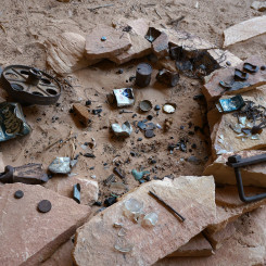
- Cowboy Camp Remnants
-
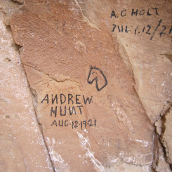
- Cowboyglyphs
-
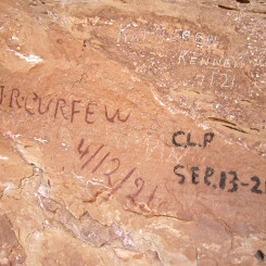
- Cowboyglyphs
-
- looking upstream to Cowboy Camp Undercut
-
- western exit canyon
-
- western exit canyon
-
- arch in western exit canyon from LMT
-
- difficult unofficial route leaving bottom of LMT
-
- Cool geology in lower LMT
-
- Bottom End of LMT
-
- Exiting the Lower Narrows
-
- The Lower Narrows
-
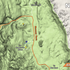
- map of Muley Tanks area south of LMT
-
- Hamburger Rocks seen south of Muley Tanks
-
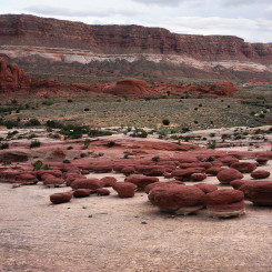
- The Hamburger Rocks
-
- Halls Creek Trail
-
- Looking to Deer Point
-
- Camp overlooking bend in Halls Creek
-
- Natural Bridge Canyon
-
- Near The Post
-
- Post Cutoff Route from The Post
-
- Post Cutoff Route
-
- Post Cutoff Route
-
- Post Cutoff Route
-
- Headquarters and Surprise Canyons along road