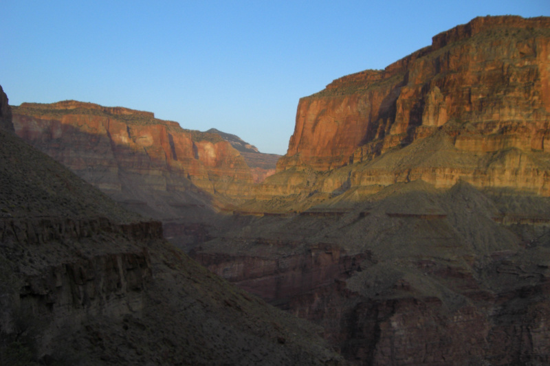
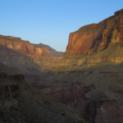
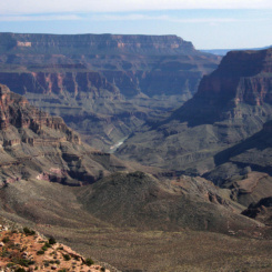
typical sundown scene near Tapeats Creek
About halfway through Section 13 in the Grand Canyon, hikers on the Hayduke Trail arrive at Thunder River. I haven’t done the portion before here, but I hear that descending from Swamp Point on the north rim down through Saddle Canyon along Tapeats Creek is one of the tougher sections. Thus the route from the junction with Thunder River over to Deer Creek Falls might seem relatively easy — though nothing ever seems to be too easy in the Grand Canyon!
Carefully cross Tapeats Creek to find the trail climbing up toward Thunder Spring. This crossing can be especially treacherous in spring high water. People have died here — so definitely make sure you find a good place to cross and don’t underestimate the power of the water.
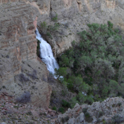
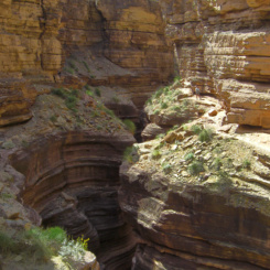
It’s said that Thunder River is the shortest river in the world. Not sure if that’s true or not, but it does seem strange that Thunder River feeds into a creek. In any case, within no time one will be up underneath the roar of water that is Thunder Spring. It’s amazing that so much water can gush out the side of the canyon like this. It’s a great place for a break and to fill up on water.
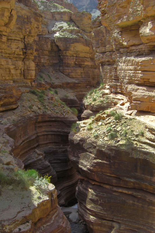
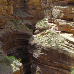
From the spring the trail steeply zig-zags up the western wall through the higher cliffs. It’s a workout as it’s over 1200′ in elevation gain in less than the mile from Tapeats Creek. There are great views back on Thunder Spring and all the way back up Saddle Canyon.
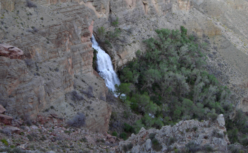
Thunder Spring from above
looking back up Saddle Canyon
Before too long one arrives at the top of the cliffs and to Surprise Valley.
NOTE: an alternate route to Deer Creek is possible via Lower Tapeats and the Colorado. It’s used more often by loop hikers and is not recommend for many Haydukers, but see below for details.
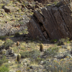
Crossing Surprise Valley can be a scorcher when it’s hot as there’s very little shade to be found. It’s just about 2 miles to get over to where one begins dropping down toward Deer Creek drainage. About half-way across the valley one will pass a trail junction where the Thunder River Trail leads up to the North Rim to Indian Hollow (or Monument Point via the spur Bill Hall Trail.)
Surprise Valley
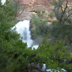
The descent to Deer Creek Canyon begins slowly at first, but then the trail quickly drops through the Red Wall formation down to the actual creek. One can see Deer Creek Spring shooting out from a crack in the wall on the way down.
Deer Creek Spring
It’s a nice area down along the creek — and thus it’s a popular area for backpackers. There are pit toilets in this area (as there were in Upper Tapeats.)
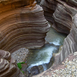
Headed downstream the walls close in and one enters the lower canyon. It’s quite scenic in an area known as the “Patio” as the creek begins a series of cascades as it enters a slot canyon. The trail clings to the wall as the creek rushes and falls deeper and deeper into the canyon below. Keep an eye out for handprint pictographs on the opposite wall across the canyon from of the trail.
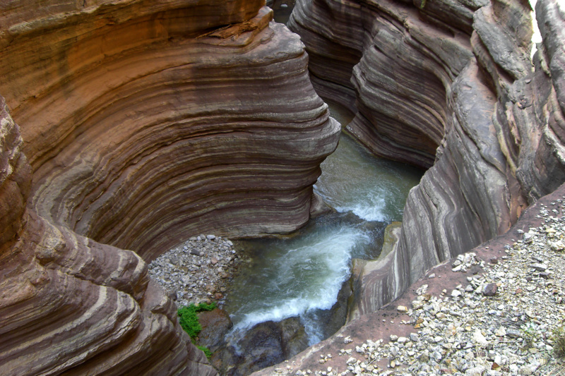
Deer Creek enters slot canyon
just down from the “Patio” area of Deer Creek
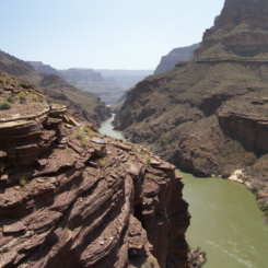
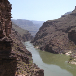
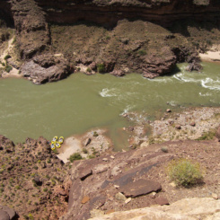
Before long one emerges from the canyon to a dramatic view over the Colorado River and the Granite Narrows (the narrowest section of the Grand Canyon’s inner gorge.)
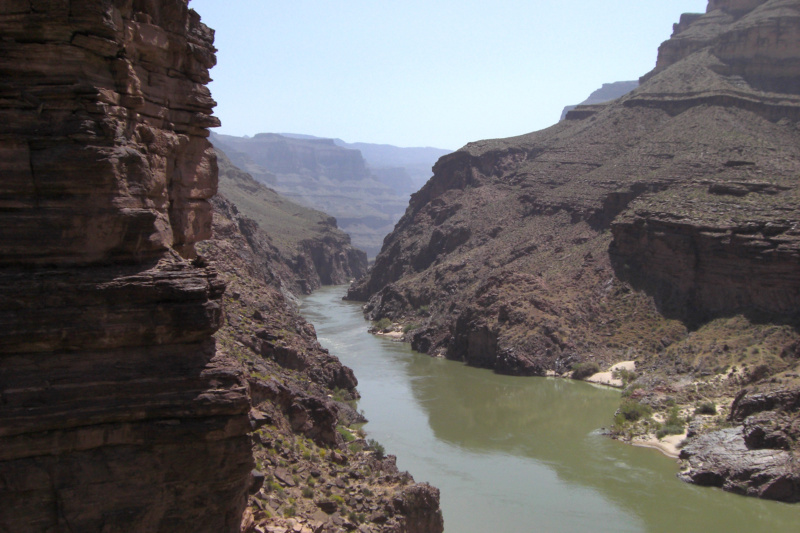
view of Granite Narrows
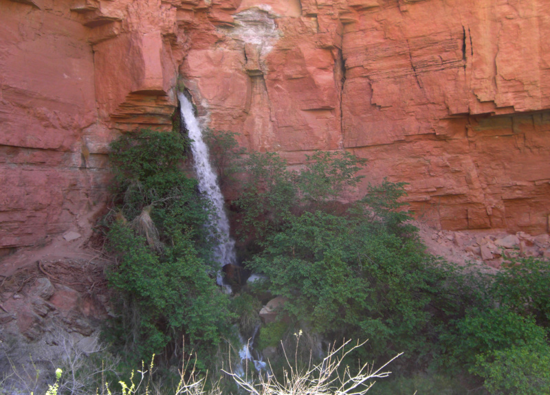
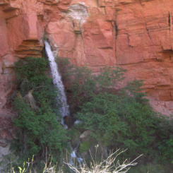
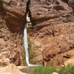
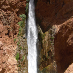
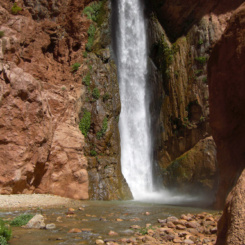
From here the trail descends to the river via a few switchbacks. At the bottom you are likely to meet up with rafters as it’s a very popular place to stop and check our Deer Creek Falls. The picturesque waterfall emerges from the slot canyon above and plunges approximately 100′ in a sheer drop.
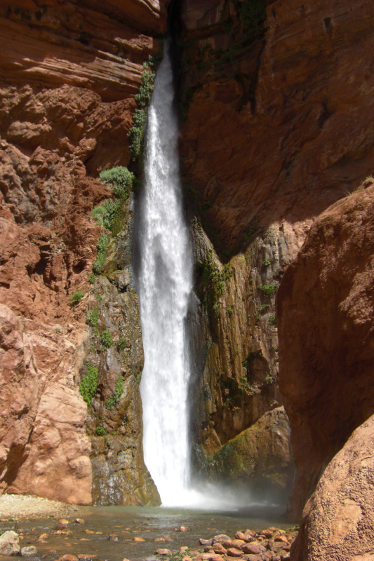
Deer Creek Falls
From here Haydukers will continue down along the Colorado River. Read about that stretch via Deer Creek to Hack Canyon.
Lower Tapeats Alternate
Instead of going up to and across Surprise Valley, one can get to Deer Creek with an alternate route via Lower Tapeats and along the Colorado. Continue down the Tapeats to the river staying on the east side as much as possible. From there a route heads west initially along the river before climbing a rougher section through the cliffs. I haven’t personally done this, but here is the description via the NPS:
“Between Lower Tapeats Camp and Deer Creek Camp, a rough, but established route has created the possibility of a loop hike from Surprise Valley. At the mouth of Tapeats Creek start downriver near the shoreline to the obvious dark, almost black, granite-like obstruction. Follow the cairned route up the steep, decomposing face to the top and traverse the outcrop to the precarious descent back to river level. This passage involves genuine hand and toe climbing and a light 25’ rope for the packs will prove invaluable. Continue downstream for about 1/2 mile to a distinct trail marked by cairns that provides access up and away from the river. Follow this to a saddle east of Deer Creek, and then descend to the drainage and the nearby designated campsites.”
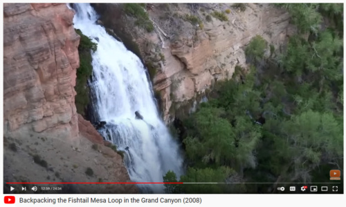
VIDEO REFERENCE:
GALLERY:
-
- typical sundown scene near Tapeats Creek
-
- Thunder Spring
-

- Thunder Spring from above
-
- Thunder Spring from above
-
- looking back up Saddle Canyon
-
- Surprise Valley from above on the Thunder River Trail
-
- Surprise Valley
-
- Deer Creek Spring
-
- Deer Creek enters slot canyon
-
- “Patio” area of Deer Creek
-
- “Patio” area of Deer Creek
-
- view of Granite Narrows
-
- view of Granite Narrows
-
- looking down on rafters at Deer Creek Falls
-
- Deer Creek Falls
-
- Deer Creek Falls
-
- Deer Creek Falls