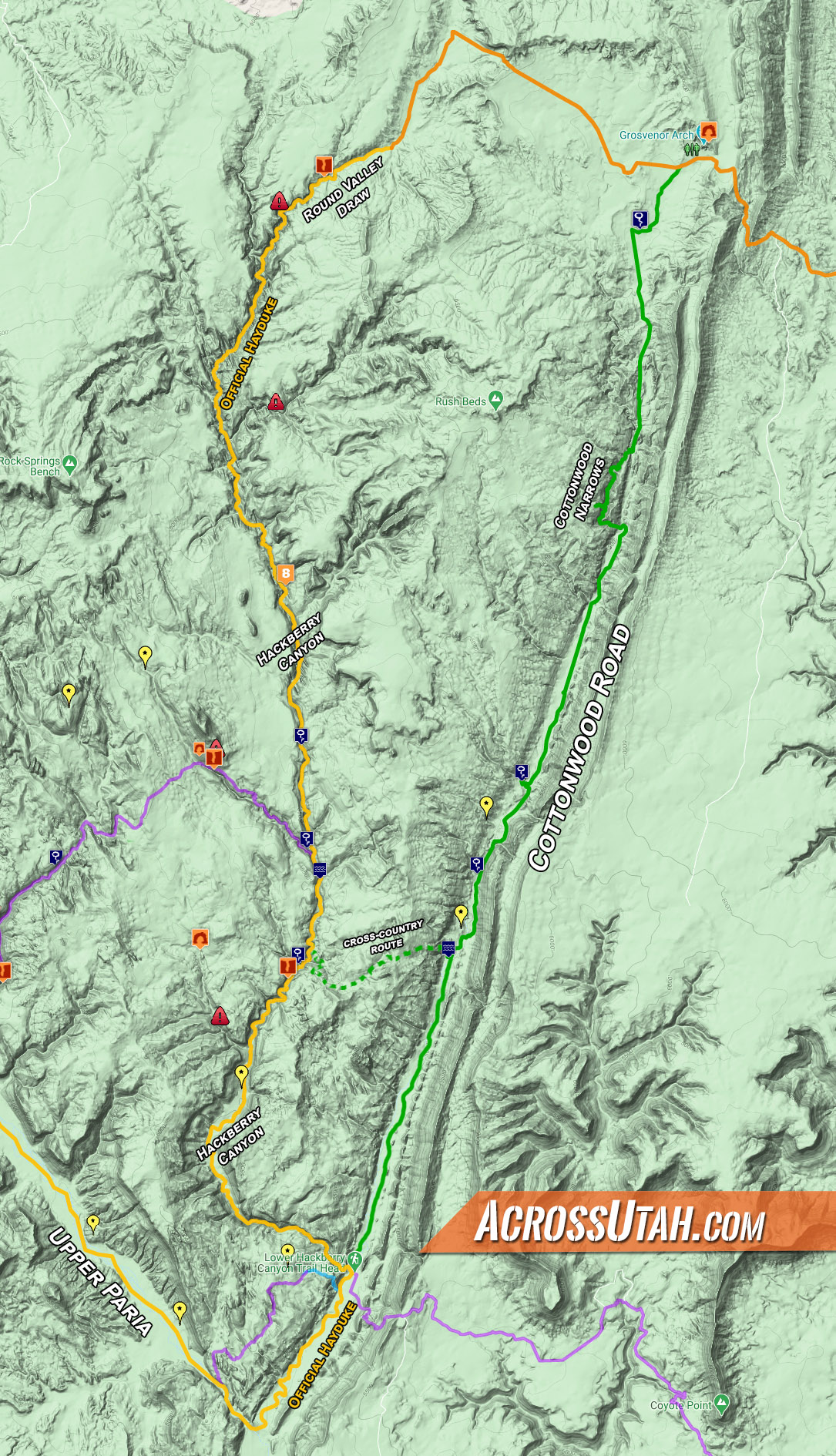
click to see full-rez map
For thru-hikers on the Hayduke Route or similar trek, walking Cottonwood Road south of Grosvenor Arch is not as lame of an alternate as it might sound at first. Sure — it’s a road and I personally try to avoid roads whenever possible, but this backroad is actually quite scenic, doesn’t see that much traffic, and would definitely be faster to walk than the official route down Round Valley Draw and Hackberry Canyon. Skipping the amazing Round Valley Draw would be a bummer, but in some ways it might be best to do that as a day hike as some hikers have had difficultly climbing down into that slot canyon and it’s not a place one wants to be after/during/before a big storm. Along the road alternate one could visit Cottonwood Canyon Narrows — not nearly as impressive, but still a decent substitute. Also on the plus side of the equation would be skipping the sand slog that comprises much of upper Hackberry. So I sum it up like this:
PROS:
- Shorter/Faster (approx 16 miles vs 26miles)
- Skipping Bad Hackberry Canyon (the sand slog)
- Cottonwood Narrows
- Interesting Geology along the Cockscomb
CONS:
- Missing Round Valley Draw
- Missing Good Hackberry (mid-to-lower canyon)
- it’s still a road
For those who are tempted, here is the description…
Soon after leaving the Grosvenor Arch area, take a short-cut route to the south to visit the Solar Well before connecting with Cottonwood Road. Note that the well is sometimes turned off and dry early in the season so it might not be reliable source of water (but it’s always been full for me in April/May.) Once on Cottonwood Road it’s about 2.5 miles south of easy walking to get to this scenic portion of road:
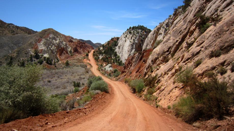
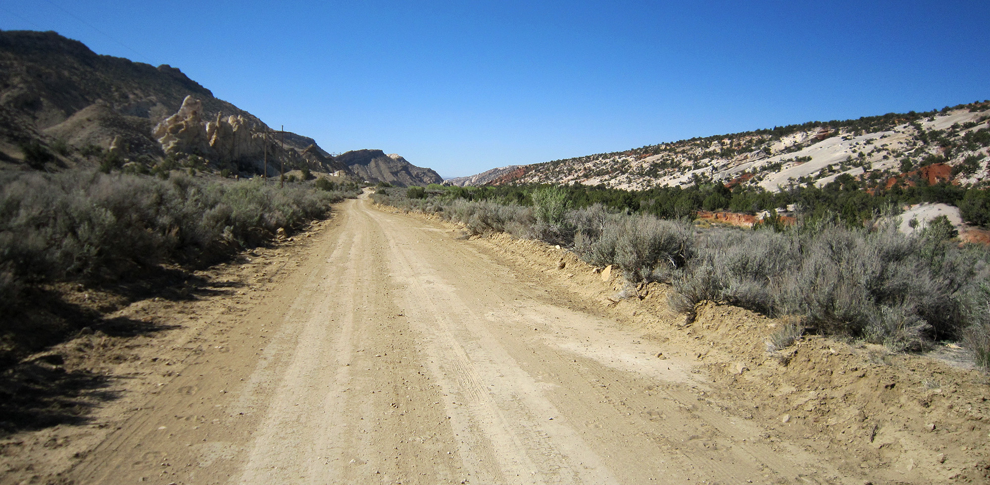
Cottonwood Road
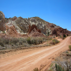
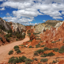
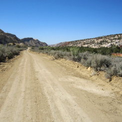
Access to the Cottonwood Canyon Narrows is on the right at the low-point of the road. At this spot it’s possible to enter the narrows and then follow the canyon south as it parallels the road hidden from view for the next mile or so. However, before doing that, I recommend dropping your bag and walking another few minutes along the road to take in the view looking back north. This is probably the most-scenic (and thus photographed) portion along the drive:
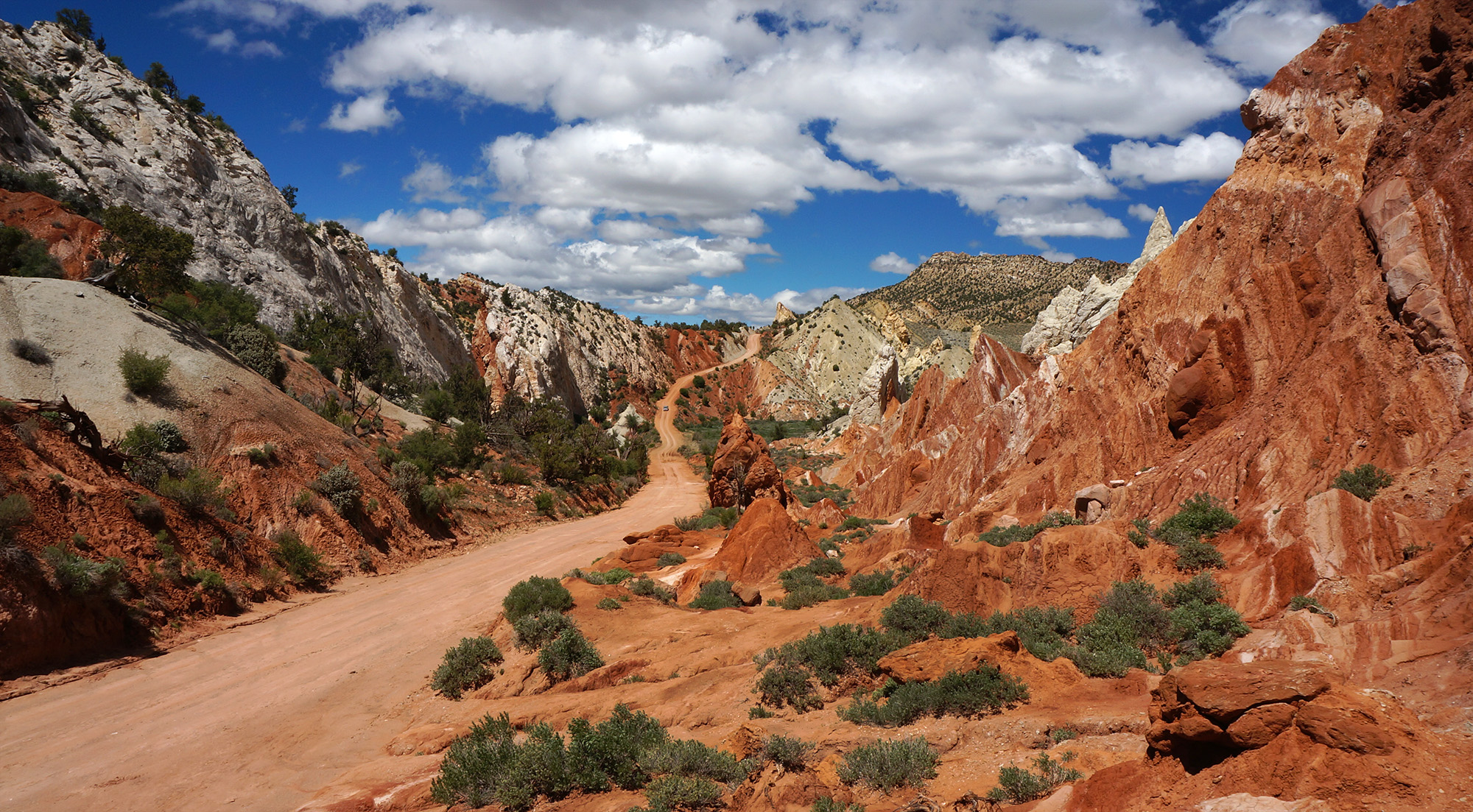
a classic view of Cottonwood Road
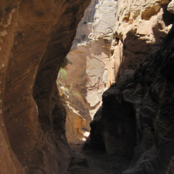
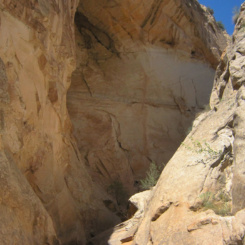
Back at the entrance to Cottonwood Narrows leave the road and get down into the wash. You eventually want to head down canyon (left), but first you may wish to explore a little ways UP the canyon as that is one of the most narrow stretches. It’s actually possible to access the canyon from farther north and walk down the whole thing, but that requires doing a long stretch of uninteresting sandy wash before getting to the “good stuff” — so I recommend just taking a short stroll up from the junction.
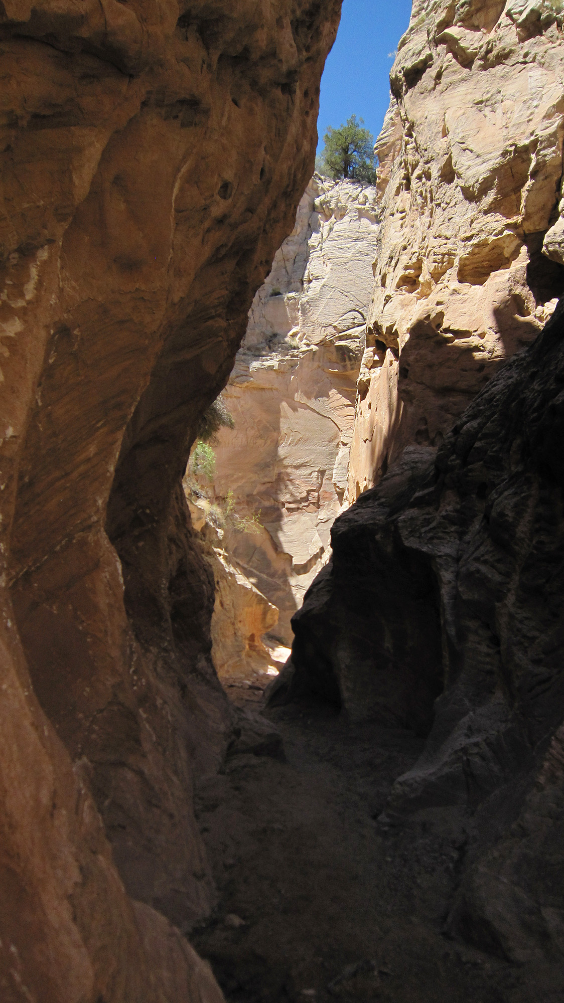
Cottonwood Narrows — short upper section
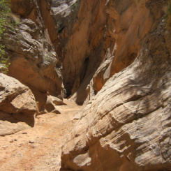
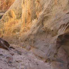
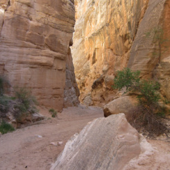
Headed down canyon one is quickly surrounded by towering walls. It never gets extremely tight, but definitely still qualifies as “narrows”. There may be a boulder or two to scramble over, but nothing which will break your pace much at all.
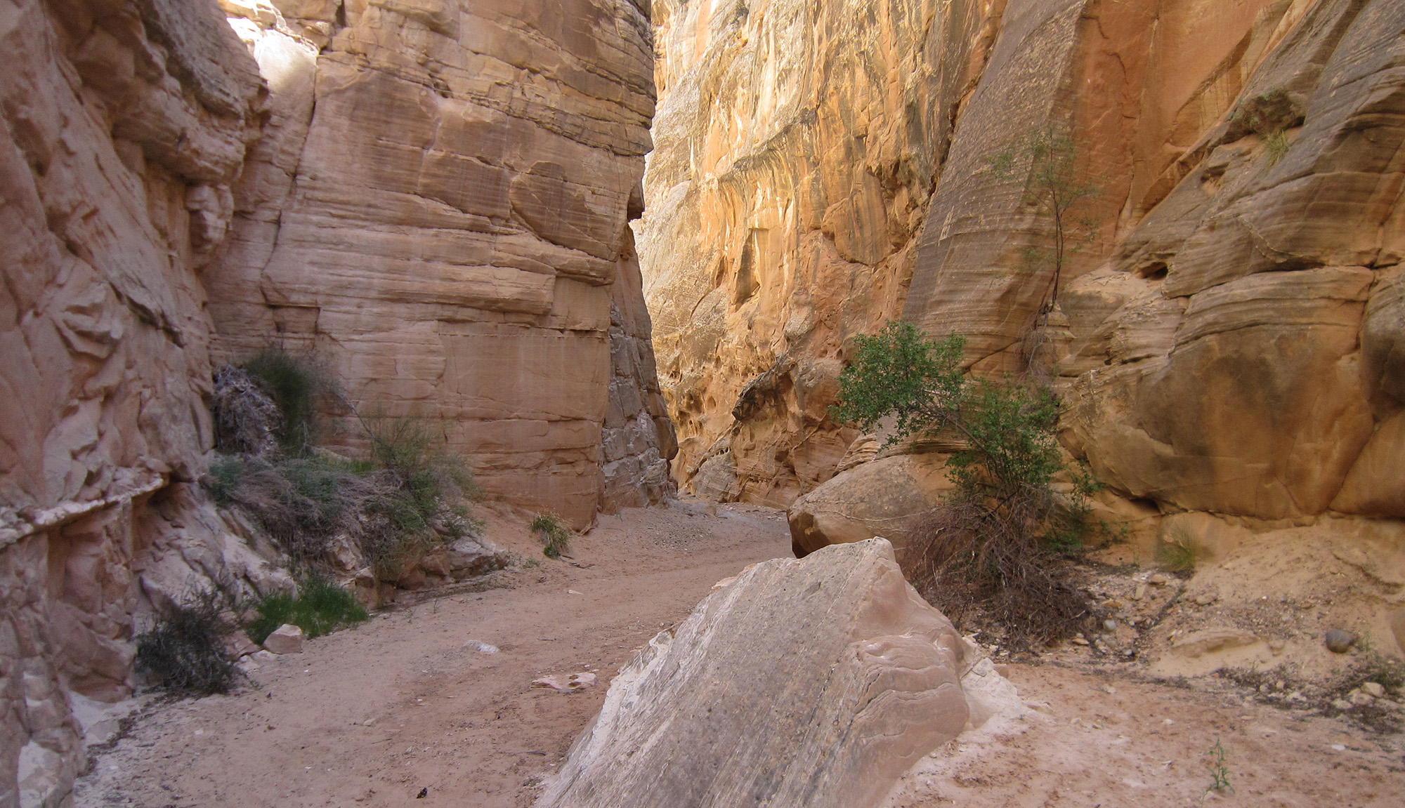
Cottonwood Narrows
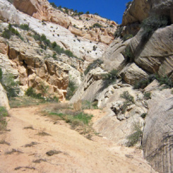
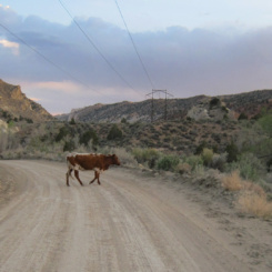
The canyon widens some near its southern end. A side-canyon entering from the west makes for a fun short diversion before ending at a massive dryfall. Then a little farther down canyon one soon exits from the narrows and is back out at Cottonwood Road. There’s a marked parking area here for hikers. Continue walking the road southward where you might see more cows than vehicles.
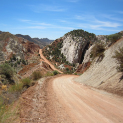
headed south on Cottonwood Road
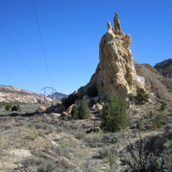
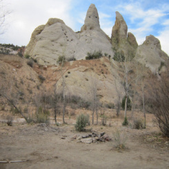
After about 3 miles or so of fairly fast walking, one arrives at a spring area which is frequented by car campers. There are lots of cool rock pinnacles in the area. The spring here can be trampled in by the cows, but it’s still likely to be one of the better resources for water in the area.
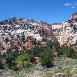
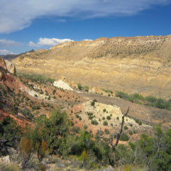
From here south Cottonwood Wash is likely to have intermittent water early in the season and might even overflow onto the road in a few spots making for a muddy mess. The Cockscomb formation continues to provide interesting geology to see. Just off the road are several “shark fin” formations along with some white and purple mudhills that have become a favorite spot for photographers. Just south of these oddities is where it’s possible to climb the rugged cliffs to the west for a route into the middle of Hackberry Canyon. This can be used as a shortcut to Stone Donkey Canyon if desired.
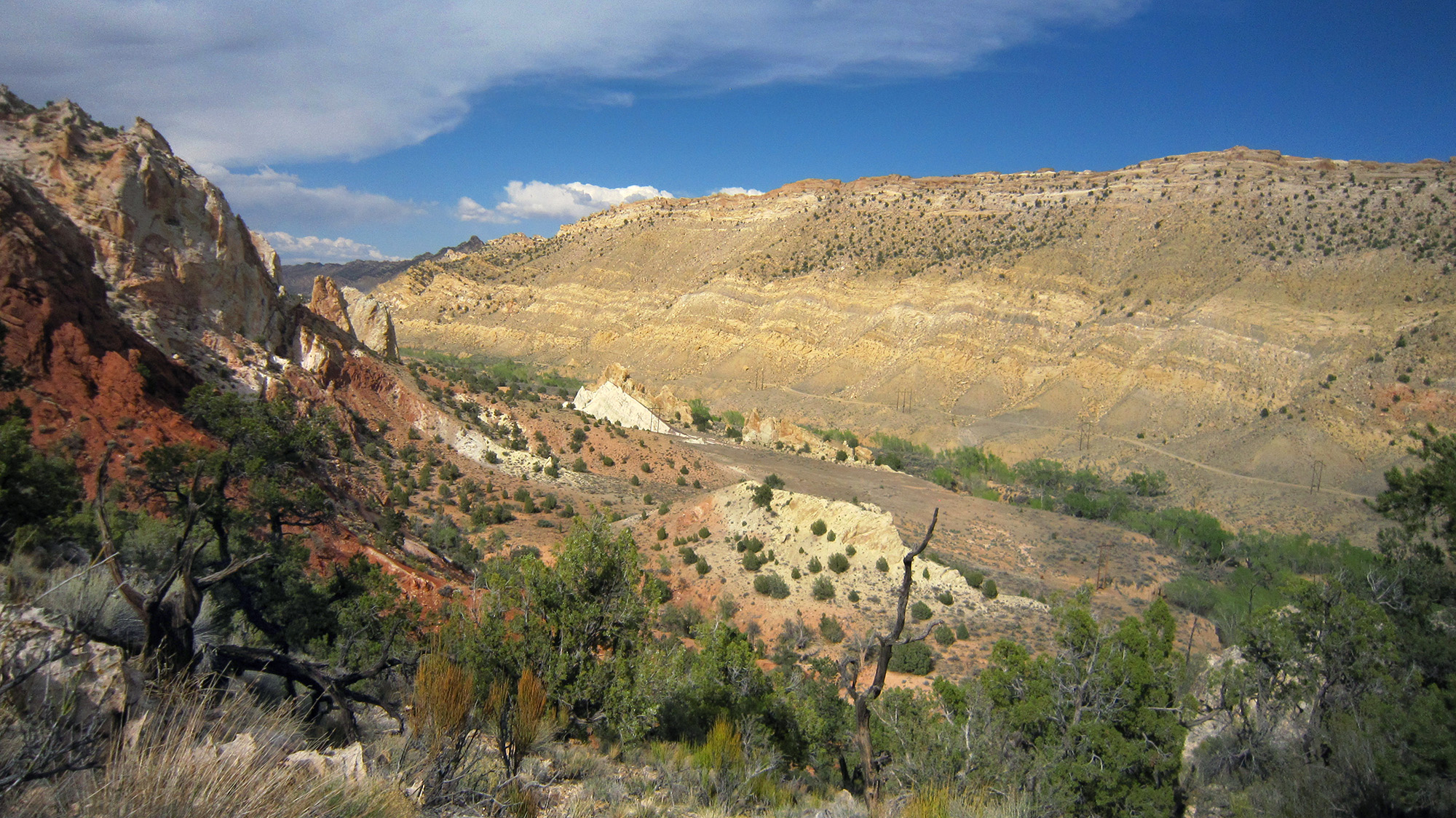
view down from rugged route over to Hackberry
Another 4-5 miles of relatively fast walking and one will see the opening of the Hackberry Canyon on the right. There’s a parking area here for those hiking up the Hackberry Narrows or to Yellow Rock.
This spot also marks the re-joining with the official Hayduke once again and thus the end of the alternate. THOUGH… instead of following the official route down Cottonwood Wash to the Upper Paria, I’d highly recommend the alternate route up to Yellow Rock and then south via “Valley of Color” to the river. It’s longer/slower, but… think of all the time you just saved walking Cottonwood Road!
GALLERY:
-
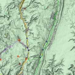
- area map
-
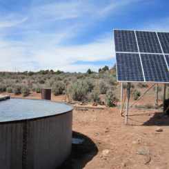
- solar well south of Grosvenor Arch
-
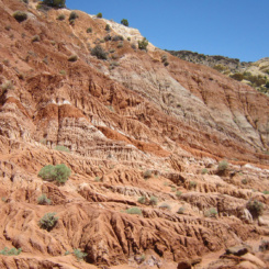
- interesting geology
-
- approaching Cottonwood Narrows access point
-
- Cottonwood Narrows access point (parking just south)
-
- classic view
-
- Cottonwood Narrows — short upper section
-
- Cottonwood Narrows
-
- Cottonwood Narrows
-
- Cottonwood Narrows
-
- Cottonwood Narrows
-
- southern end of Cottonwood Narrows
-
- bottom exit from Cottonwood Narrows
-
- headed south on Cottonwood Road
-
- interesting geology along Cockscomb
-
- resident
-
- cool rocks near camp area and spring
-
- view down from rugged route over to Hackberry