The Hayduke Trail officially begins where the Salt Valley Road enters Arches National Park along the park’s northwestern boundary. The route follows this backroad southeast for about 2 miles before turning onto the Tower Arch Jeep Road heading southwest toward the Klondike Bluffs. In less than two more miles and just south of the Marching Men rock formation, the Hayduke turns southeast once again onto another small road.
I haven’t done this initial 4-mile roadwalk of the Hayduke as I opted to do an alternate beginning from the Canyonlands Airfield. Starting from either spot though, an alternate route through the Klondike Bluffs and a diversion to Tower Arch adds less than a mile and is likely worth the effort IMHO. See the Alternate Start/Tower Arch Page for all the details.
Continuing south one heads straight toward the La Sal Mountains along the very sandy road. One definitely doesn’t want to slog through here on a hot day. I’ve seen a few trip reports call this area Little Valley, but in reality Little Valley is one valley to the west. This area doesn’t seem to have an official name on maps, therefore I always refer to it jokingly as “NOT Little Valley”.
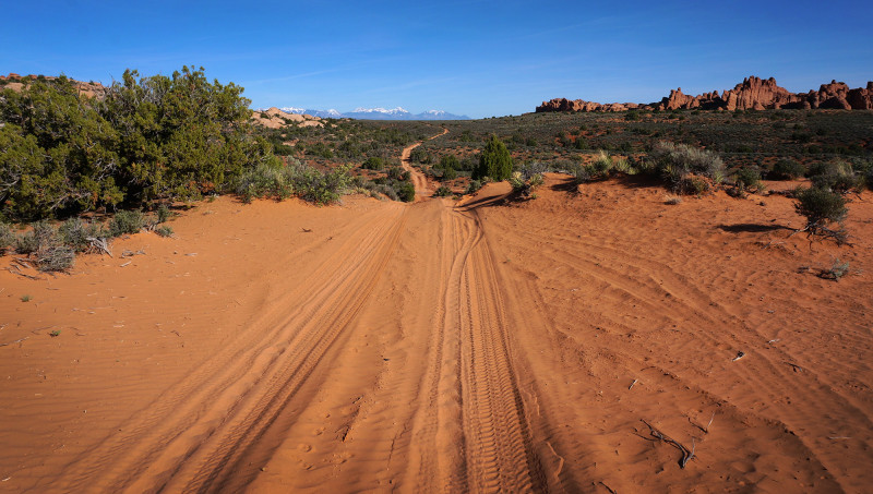
sandy road through “Not Little Valley” in Arches
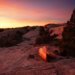
The next 2-3 miles follow the road through the sand before dipping down into a wash close to the west side of the valley. The Hayduke officially skirts east here, but I found it easier to follow the road through the wash. Also, in this area is where it’s easy to exit the park to the west to camp amidst the slickrock without the need for a permit.
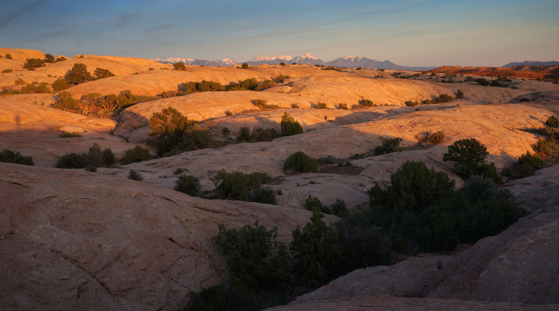
slickrock just west of park boundary
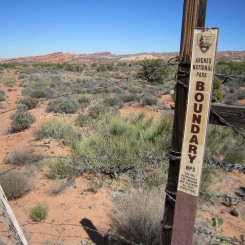
From here I found it easier to follow some dirt roads outside the park to “cut corners” of the park boundary. Soon one will come to a transfer station for an underground pipeline. Here if not already on the official route, one should re-enter the park and then follow the fence along the boundary to the south.
According to the Hayduke Guidebook, one should follow this fence along the boundary south to eventually enter the wash west of Herdina Park. However, at some point the fence no longer runs due south as indicated in the Guidebook or older maps. Instead it runs SSE. I still recommend following the fence as it’s the path of least resistance and makes navigation simple. It does end at a slickrock outcrop however which will take some work to descend. The easiest route is just west of where fence ends.
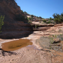
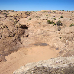
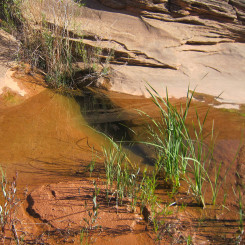
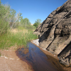
Once down in the wash, head south and soon one will cross the Willow Spring Jeep Road. Keep heading down to soon intersect a drainage coming in from Willow Spring itself. One will likely find water here, but if not a short walk up to the actual spring should yield results.
below Willow Spring
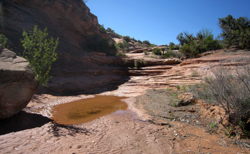
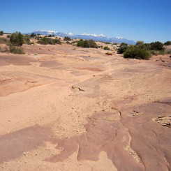
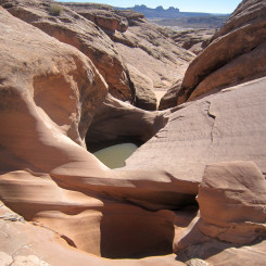
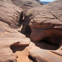
Continuing down the wash the water quickly disappears. The wash becomes rougher and rougher as it cuts through the sandstone. One will need to pass through several mini slots and negotiate short drops. Those sections which are too difficult, can easily be bypassed by going up and over the slickrock domes and then re-entering the wash.
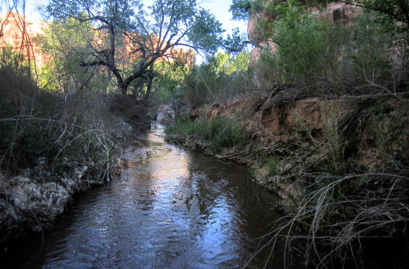
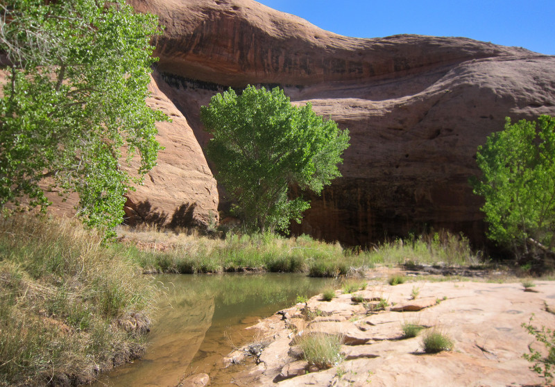
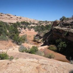
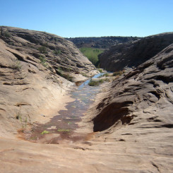
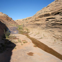
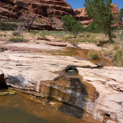
As one begins to drop down into Courthouse Wash more water should appear. Then the route becomes very brushy before one gets to flowing water when officially arriving in Upper Courthouse Wash. Headed down stream it’s likely to continue to be very brushy and the easiest route is likely right down the ankle-deep stream.
Upper Courthouse Wash
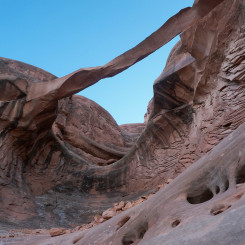
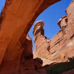
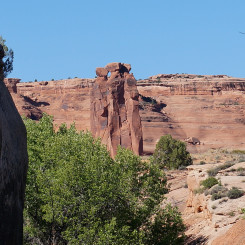
Ring Arch
Before long one should notice a major canyon coming in on the right. This is Sevenmile Canyon and it’s in this area that the flowing water will likely disappear into the deep sand.
The official route here follows the wash down to the park road in just over 3 miles, but I actually found the walking easier up on the banks south of the wash. This is definitely the preferred route if making the diversion to Ring Arch which I recommend.
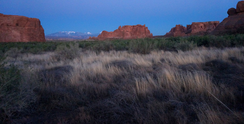
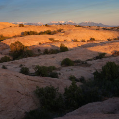
twilight in Arches
Water should reappear before intersecting the road. This section is again very brushy and one might find it easier to exit on the north side, cross the road, then follow an established trail down into Lower Courthouse Wash.
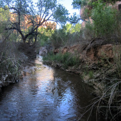
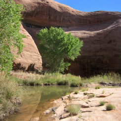
Headed down through Lower Courthouse Wash the walls quickly close in. Progress may be slowed by a backup of water caused by occasional beaver dams. Depending on where one crosses, the slow-moving water could be waist deep in this section. Slowly the canyon walls get taller and open up a bit. The water is likely to disappear again before re-appearing in the lower end.
Lower Courthouse Wash
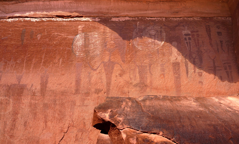
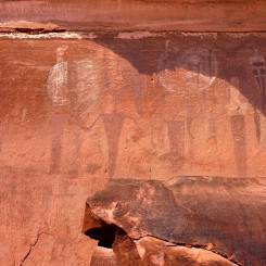
In the bottom section of Courthouse Wash one will pass a large alcove and then a couple of terraced trickle-falls leading to large pools. Then, at the very bottom one will see the highway ahead as well as a sign which marks the short diversion to climb up to the Courthouse Wash Pictograph Panel.
The next section of road-walking to and through Moab is no fun — especially if it’s a hot day. A pedestrian bridge now crosses the Colorado River just east of the main highway bridge and thus should be considered the official route now. On the south side of the bridge is Matrimony Spring, but one is not likely to need it because there’s a fairly new city park adjacent to the river with water fountains, restrooms, and trash bins. 🙂
From here… continue walking the paved streets through Moab. The route goes right past a small convenience store making grabbing a cold drink or similar very tempting. Otherwise there are plenty of other places just off the route in town. Moab makes for a good chance to re-supply and/or re-energize if needed at a motel/restaurant before continuing on into the more “wild” part of the Hayduke via Moab to Lockhart Basin.
Video Reference: 2017 Through Arches and Behind the Rocks
Map Reference: 2017 Through Arches and Behind the Rocks Map
Photo Gallery:
-
- under Tower Arch
-
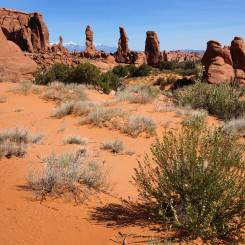
- the Marching Men
-
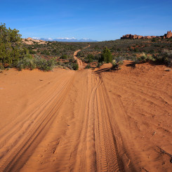
- sandy road headed south in Arches
-
- slickrock just west of park boundary
-
- sundown on night 1
-
- Arches western boundary
-
- walking the fence near boundary
-
- slickrock near Herdina Park
-
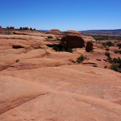
- slickrock north of Herdina Park
-
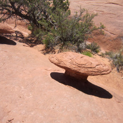
- slickrock mushroom near Herdina Park
-
- nearing Willow Spring
-
- near Willow Spring
-
- near Willow Spring
-
- impassable potholes
-
- slickrock slot
-
- slickrock canyon
-
- nearing Courthouse Wash
-
- nearing Courthouse Wash
-
- nearing Courthouse Wash
-
- Upper Courthouse Wash
-
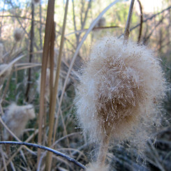
- fluff
-
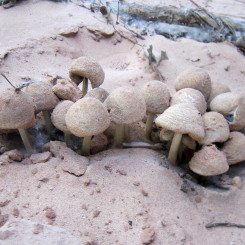
- toadstools
-
- Upper Courthouse Wash
-
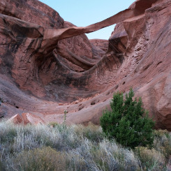
- Ring Arch
-
- Ring Arch | Arches
-
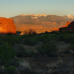
- sun going down on the La Sal Mts
-
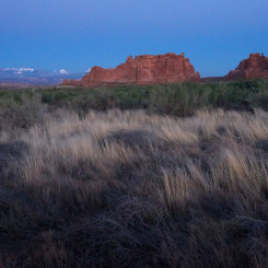
- twilight in Arches
-
- the Three Gossips
-
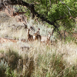
- deer along Courthouse Wash
-
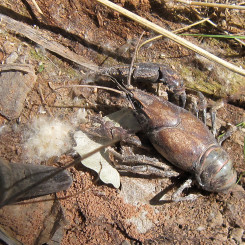
- crayfish?
-
- Lower Courthouse Wash
-
- Lower Courthouse Wash
-
- Courthouse Wash Pictographs | near Moab
-
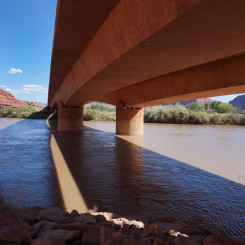
- under Colorado River Bridge
-
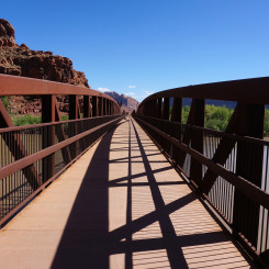
- the pedestrian bridge
-
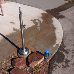
- water at the river-side park