


– part of the Hayduke Reference –
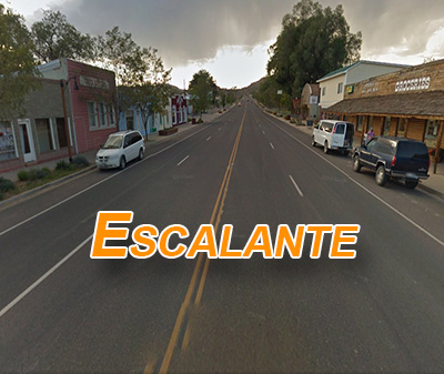
Almost all Hayduke Hikers end up in the town of Escalante for a re-supply (or do an inconvenient cache pre-hike.) Getting to this small town from the route usually means a long and sometimes difficult hitch along the Hole-in-the-Rock Road. However, many great canyons in this region provide possible alternates which allow hikers to simply hike through the town instead.
The Via Escalante East alternate connects the Burr Trail Switchbacks (HDT Section 6 start point) to Escalante and is covered below. The Via Escalante West page focuses on connecting to the west. Doing this eastern part of the alternate would mean bypassing the amazing Coyote Gulch (and more). This is a bummer, but if one has already hiked Coyote Gulch, wants to avoid its spring crowds, doesn’t want to hitch, or all of the above… then consider the following options.
I’ll present two possible routes coming in from the east. Highlights of the southern route detailed below include Choprock Canyon, Harris Wash, Big Horn Canyon and Phipps Canyon. Highlights of the northern route (detailed in a separate post) include Upper Muley Twist, Egg Canyon, The Gulch and Boulder Creek Narrows. The two routes routes converge to follow the upper Escalante River and an opportunity for a spectacular side trip into Death Hollow before arriving in Escalante. I personally prefer the southern route, but each has its own pros/cons.
NOTE: a more direct path is possible by skirting Wagonbox Mesa en route to Little Death Hollow (or Wolverine Canyon) and then to the river before hiking up to where the other two options converge. This route is considerably shorter, but I don’t recommend it. Little Death Hollow is amazing, but it’s slow and problematic with a big pack. Then the extended stretch up the Escalante is overgrown and slow as well. Overall the route is not nearly as scenic.
.
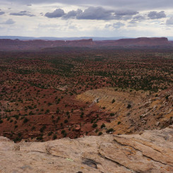
The Southern Route (approx. 85 miles from top of Burr Trail)
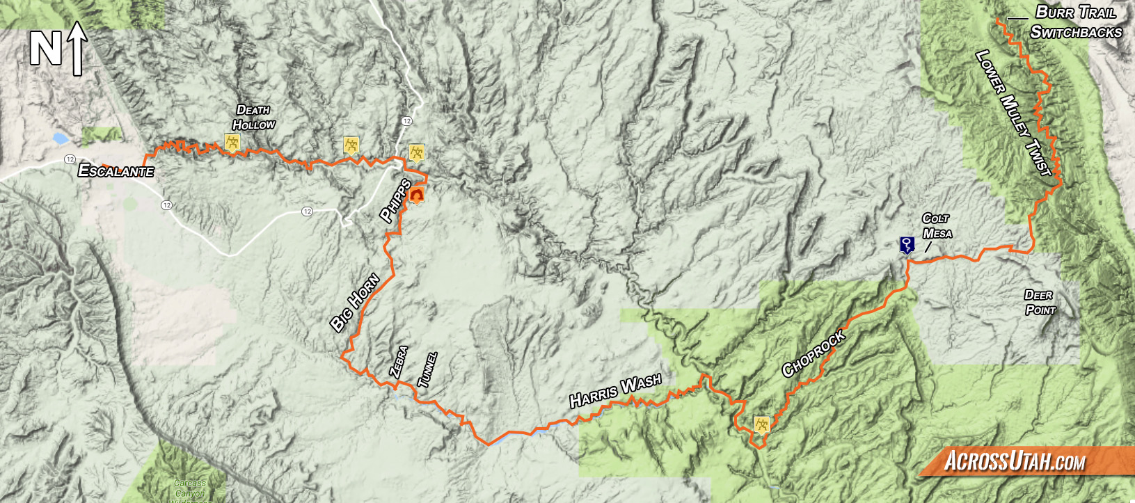
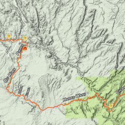
— click for full-size map —
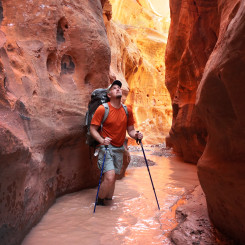
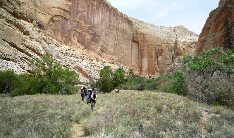
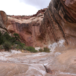
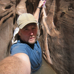
The first part of the this alternate isn’t an alternate at all; simply hike down Lower Muley Twist Canyon as described by the book. As you near the end of the canyon (about two bends south of the Cowboy Camp and huge undercut), a canyon cuts in from the west and provides an escape. Head up this canyon for a difficult climb to the top of the Waterpocket Fold.
NOTE: It’s also possible to link to the southern route from the top of Red Slide. To do this, instead of dropping over the pass to Mid Moody, continue on the mining road to the old miner’s camp north of Deer Point mentioned below. This option adds about 10 miles.
.
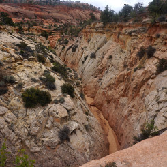
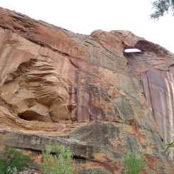
The escape route from LMT is easy at first. Spot a large arch tucked against the northern wall as you make your way up the first part of the canyon. There will be some boulders to climb up and over, but nothing too bad.
western exit canyon from Lower Muley Twist
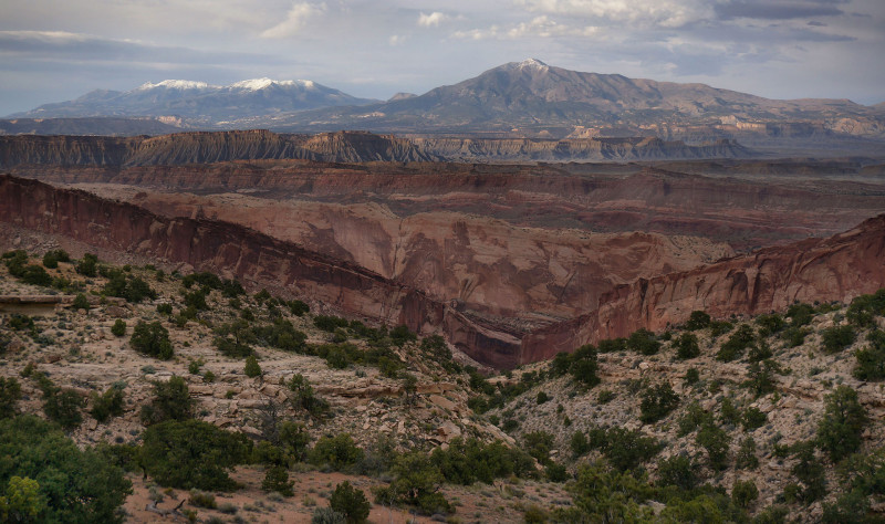
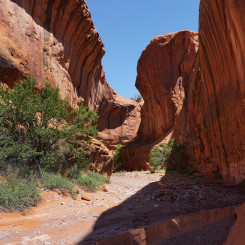
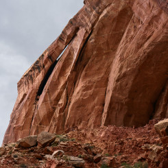
Once past the initial part of the canyon — one can see the Fold rising sharply straight ahead. Several drainages come together in short succession. Following most of these will soon lead to slots which are impassable. Instead, pick a ridge which separates the canyons and start climbing. It’s steep — but nothing technical. There will likely be water in the potholes on the way up — though it will require climbing back down into the canyon to fetch (easier in some places than others.) Near the top of the incline is a cliffband which might take a bit of scouting to find the best way up. Again no real climbing is involved. Make sure you turn around every now and then as you climb to enjoy the great view behind you.
view back from the difficult unofficial route leaving bottom of LMT
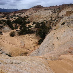
Once up on top, head SW and you will find yourself in a rather flat mesa and a sparse juniper forest. Keep an eye out for an old road which heads south — it’s really nothing more than a clear-cut line through the trees now. Head this direction not worrying if you are on the actual road — just stay on high ground for a mile or so as you head toward Deer Point.
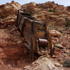
One can follow this old road all the way to the bench below Deer Point and to an old Mining Camp. A quicker option though would be to go cross-country down a ridge and drop into the drainage below the camp. If you do follow the road though, the camp is just below where the old road goes up a ramp to the top of a higher bench before bending back to connect to the top of Red Slide. From the camp it’s an easy scramble down into the drainage below.
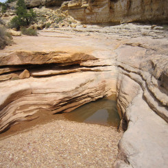
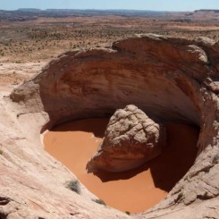
Follow the drainage down canyon to the west. Before long you will come to a spot where there’s a few minor drops (all easy to bypass) and you might find potholes of water. Continue on down canyon until it opens up near what looks like a “trident” or “pitchfork” on the map. When you get to the second junction exit to the west and make a beeline toward Colt Mesa.
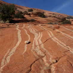
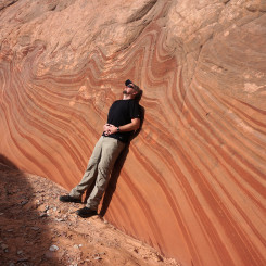
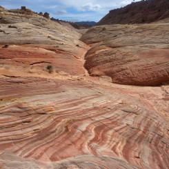
Colt Mesa waterworks
One can go around either side of Colt Mesa. I think the southern side is a bit easier to walk, but the northern side might provide more shade if it’s a hot day.
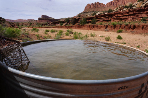
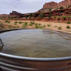
On the western end of the mesa near the Moody Canyons Road, there is a piped spring with water tanks. The ruins from an old prospector site are also nearby.
From here you will head down the road for about one mile before climbing up a bench to access the upper portion of Choprock Canyon.
NOTE: one can also go north from Colt Mesa and then down Silver Falls Canyon. This is the shorter and quicker route, but it’s not nearly as spectacular as going down Choprock. Water is also much more abundant in Choprock.
.
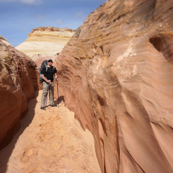
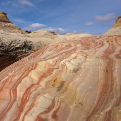
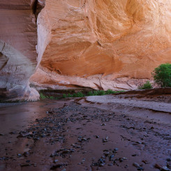
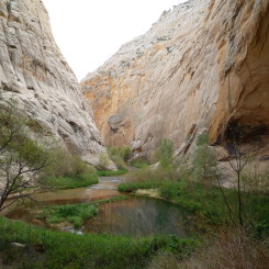
The upper part of Choprock Canyon is fairly wide open as you make your way down through the colorful Chinle mudhills.
An old road can still be seen in some spots and makes progress faster if followed. Petrified wood and hoodoos are a common sight in this part of the canyon. After about 4 miles you might come across an outbreak of water — depending on the season. In about another mile is a major junction — keep going downstream.
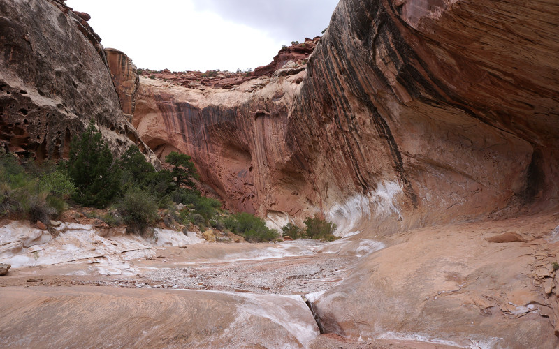
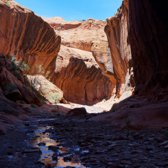
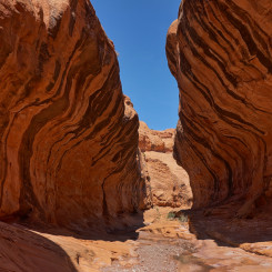
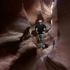
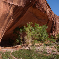
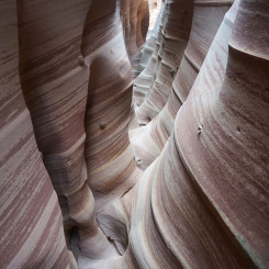
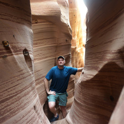
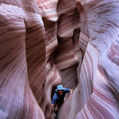
As you continue downstream the walls begin to rise and close in. In less than a mile you should be at running water and then soon at the junction with the North Fork of Choprock (aka “Poison Ivy” Fork by author Steve Allen). This scenic canyon is worth a side trip up — at least 15 minutes or so to see the cool alcoves which make for good camps. Good camping is also found near the junction. This is the only remaining good camping until after the narrows near the bottom of the canyon.
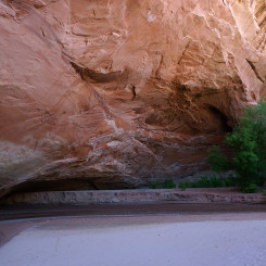
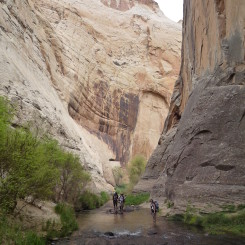
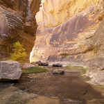
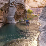
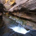
The next 3-4 miles are truly amazing. First is a highly entrenched canyon with fluted walls, then an extended sections of narrows, and then finally a deeper entrenched canyon. Depending on the season this section could be mostly dry, with scattered pools or with flowing water. There are no major obstacles — not even really any minor ones.
-
- Choprock Canyon
-
- Choprock Subway
-
- Choprock Narrows
-
- Lower Choprock
When the canyon begins to open back up look for a side canyon on the left — this is the South Fork of Choprock. This too is a nice scenic side hike. In about 15 minutes the canyon ends at a dryfall which marks the end of the Choprock canyoneering route.
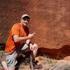
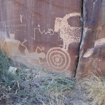
Continuing down the main canyon one will soon come to nice alcove. Another bend down the wash there is a good panel of petroglyphs on the south-facing wall. In about another 1/4 mile one comes to the confluence of the Escalante River.
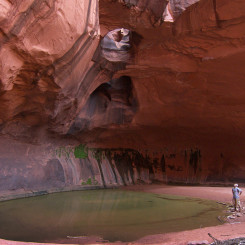 If you have time for another side-hike… downstream about 2 miles is Neon Canyon and The Golden Cathedral. IMHO it’s one of the coolest sights around and worth the effort if you can spare a few hours. See the petroglyphs on the wall just before getting to Neon. And, if you want to make a day out of the diversion, Ringtail Slot is only another mile down canyon on the same side of the Escalante.
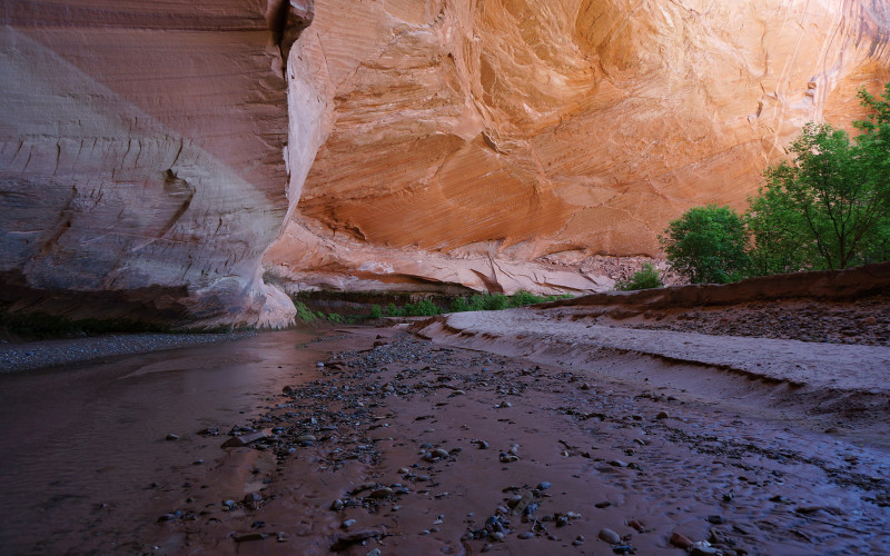
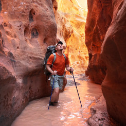
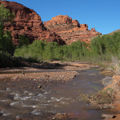
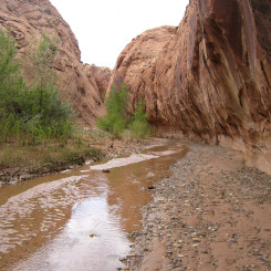
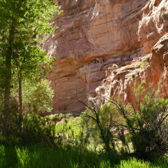
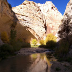
Sooner or later… head north up along the Escalante. There’s a decent trail in this area cutting each bend of the river. Unfortunately the trail fades as it enters the deep brush when necessary to cross the river. Several river crossings will be necessary and though the river isn’t’ deep, the banks are frequently steep and overgrown making crossing a frustrating process at times.
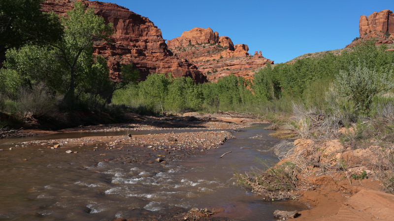
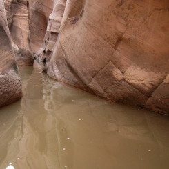
Escalante River
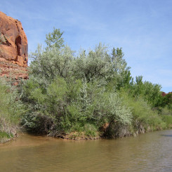
Make sure not to miss Harris Wash coming in from the west. It’s easier to spot the opening of the canyon than the actual small stream where it meets the Escalante. Head up stream.
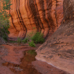
The lower end of Harris Wash has a perennial stream, several great undercuts and ample camping. Though not as amazing as Coyote Gulch, Harris is still a pretty amazing canyon where one will be hiking in the shallow stream most of the time. Watch out for quicksand.
After hiking up canyon about 8 miles you will pass the boundary as you exit Glen Canyon Rec Area (and enter Grand Staircase-Escalante National Monument). A few miles past this the stream will dry up and shortly after that you will come to the road at the Harris Wash TH.
NOTE: here another diversion is possible to the north to see Red Breaks and its many slots and the unique feature known as the Volcano.
.
For the next mile one can stay in the wide-open wash or follow the road on the south side probably passing a lot of cows either way you go. When the road turns southwest and heads up a hill, make sure you are back in the wash which turns northwest and enters another stretch of nice canyon.
As the walls close back in you will pass a cattle gate which attempts to keep the cows out of the Upper Harris area. Soon the water will begin running again and it’s a pleasant scene for the next few miles.
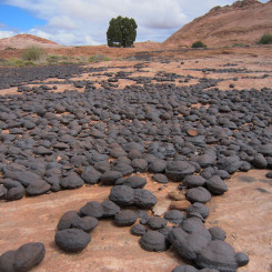
Soon the canyon dries out once again and opens up a bit, but is still surrounded by cool slickrock buttes on all sides. You might see a bunch of day hikers in this area en route to Tunnel Slot and the colorful Zebra Slot. Both of these are worth the side trip. Connect them via a high-route and check out the Moqui Marbles.
It’s another quick 3 miles up Harris to get to the bottom of Big Horn Canyon where you want to head north.
NOTE: one could also just continue up Harris to get to the HITR Road. I see reports of many hikers doing this as it’s definitely the quickest and easiest way to Escalante, but if you choose this route BOY ARE YOU MISSING OUT! The suggested route really hits some of the best spots in the area and is well worth the extra effort.
Headed up Big Horn Canyon, make sure to do a quick 15-minute side trip into the West Fork before continuing up the main canyon. Big Horn is a great canyon which has some extremely colorful slickrock dissected by a long shallow slot. Read more about the canyon in the Big Horn Hike Guide.
-
- West Fork Big Horn
-
- Lower Big Horn Shallow Slot
-
- Shallow slot in Main Fork
-
- lower Main Fork | Big Horn Canyon ⮞⮞⮞
After exiting the upper reaches of Big Horn, you will be on the Spencer Flat Road (aka Old Sheffield Road.) Depending on where you came up, it might just be a matter of crossing the road to where it’s possible to drop down into upper Phipps Canyon. Descend a colorful slickrock bowl, bypass a dryfall or two, and make your way down into the main wash and head down canyon.
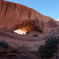
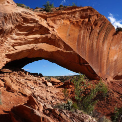
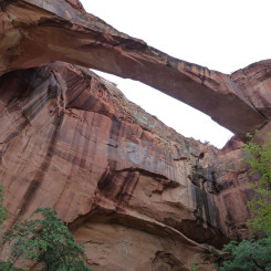
After a couple of miles water will appear again and the route gets really brushy for a stretch. Less than a mile after this point a side canyon opens up to the east. This is where a popular scramble route climbs up to Phipps Arch. Drop your bag and make the diversion — it’s worth it.
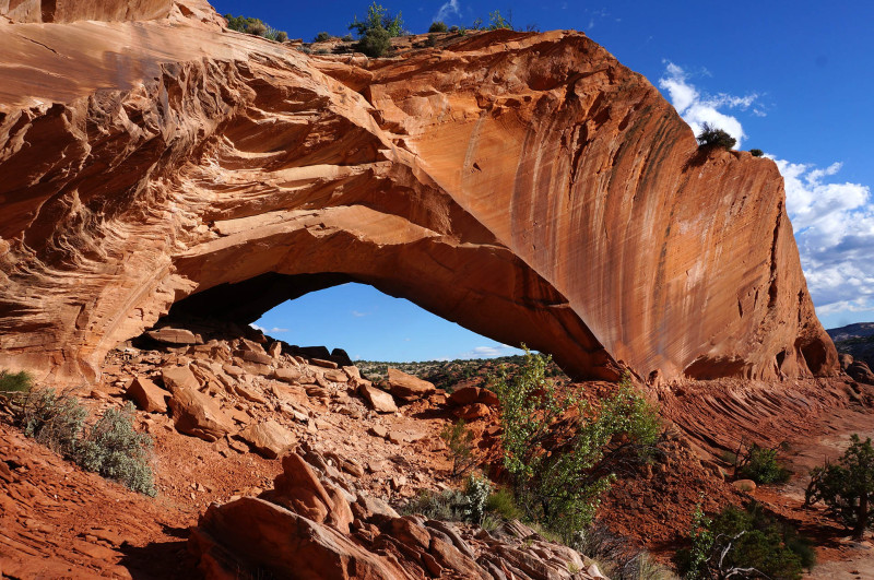
Phipps Arch
Continue down Phipps and soon a side canyon enters on the left where one can do a side-hike to the not-that-impressive Maverick Bridge. In about another half mile Phipps ends where it meets the Escalante. Turn left when the canyon opens up before ever coming to the river. Follow a fairly distinct trail here upstream crossing the river once (or three times). Make sure to stay on the official route here to avoid private property. Soon you will be at the the Hwy 12 bridge and the Escalante River TH parking area.
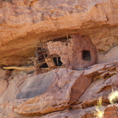
NOTE: two granaries can be spotted near the bridge. One on the northern wall just before arriving at the bridge and then one on the opposite wall seen from the bridge.
.
Continue up the Escalante on a fairly well-worn trail that cuts most bends in the river. Make sure to not miss the Escalante Natural Bridge on the southern wall about 1.5 miles upstream from the man-made bridge.
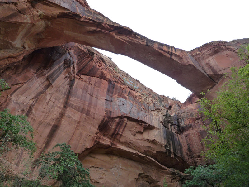
Then around the next corner be sure to spot the natural arch, small ruin and petroglyphs high on the southern wall.
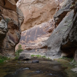
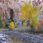
Continuing up canyon one will pass Sand Creek entering on the right and then the walls begin to tower more and more. In about 4 miles Death Hollow will enter from the right and provide most of the water for the Escalante at this point. A diversion up Death Hollow will definitely reward those with a few hours to spare. In fact one could hike up to the Boulder Mail Route and then continue to Escalante. This is the most scenic way to go, but much longer and slower since you have to manage big packs through the narrows. One can compare the options in my 2008 Death Hollow Loop trip report.
If not opting for this longer option, just continue up the Escalante (which may be intermittently dry by now) for another 8 miles or so. Watch for some more petroglyphs along the way.
When the canyon completely opens up one can head south up a trail to the Escalante River TH and parking area. From here, follow the road past the cemetery and into town for your re-supply, zero day, or whatever luxuries await you (my choice is to always indulge in a Subway sandwich!)
NOTE: try to not land in Escalante on a Sunday or you will find many establishments closed (including the Market, Post Office, etc.)
.
To continue west either hitch down Hole-in-the-Rock Road to re-connect with the official route, or walk out of town on the Smoky Mountain Backroad and connect the Via Escalante West alternate to Grosvenor Arch.
Compare the above with the northern option of the Via Escante East.
Video Reference:
Burr Trail Loop Hike 2016
The first half of my Burr Trail Loop Hike (2016) travels much of the route described above (in reverse).
My Escalante to Monticello Hike (2010) went down Harris, up Silver Falls and dropped into Lower Muley Twist.
My Nevada to Colorado Hike (2009) went through Escalante and down the river including a side-trip into Death Hollow.
Gallery:
-
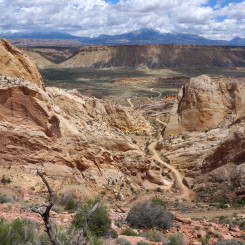
- area map
-
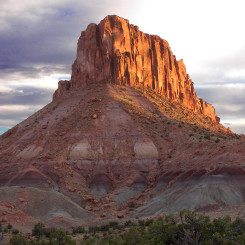
- Burr Trail Switchbacks
-
- western exit canyon
-
- arch in western exit canyon from LMT
-
- difficult unofficial route leaving bottom of LMT
-
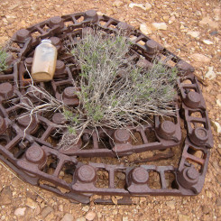
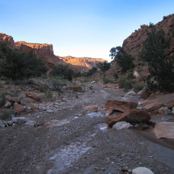
- Old Mining Road Trash
-
- Deer Point Bench looking SW
-
- Potholes NW of Deer Point
-
- Colt Mesa Prospecting Site
-
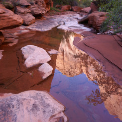
- Colt Mesa Water
-
- Top of Choprock
-
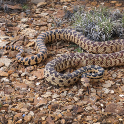
- Great Basin Gopher Snake
-
- Upper Choprock
-
- Choprock Canyon
-
- Choprock North Fork
-
- Choprock Subway
-
- Choprock Narrows
-
- Lower Choprock
-
- South Fork Choprock
-
- Lower Choprock
-
- Choprock Petroglyphs
-
- Diversion — the Golden Cathedral
-
- Escalante River
-
- Harris meets the Escalante
-
- Lower Harris Wash | Trip Report ⮞⮞⮞
-
- Lower Harris Wash
-

- Diversion — Red Breaks Main Fork
-
- Diversion — The Volcano
-
- Upper Harris Wash
-
- Upper Harris Wash Sunset
-

- Tunnel Slot
-
- Moqui Marbles
-
- Zebra Flooded
-
- Zebra Slot | Trip Report ⮞⮞⮞
-
- Zebra Slot
-
- Zebra Canyon
-
- Exiting Zebra Canyon | Trip Report ⮞⮞⮞
-
- striped slickrock in Upper Harris Wash | Trip Report ⮞⮞⮞
-
- West Fork | Big Horn Canyon ⮞⮞⮞
-
- West Fork Big Horn
-
- Lower Big Horn Shallow Slot
-
- Shallow slot in Main Fork
-
- lower Main Fork | Big Horn Canyon ⮞⮞⮞
-
- Above pools in Middle Big Horn
-
- Upper Big Horn
-
- View over to Phipps Canyon | Trip Report ⮞⮞⮞
-
- Upper Phipps Canyon
-
- Diversion — Phipps Arch
-
- Diversion — Phipps Arch | Trip Report ⮞⮞⮞
-
- approaching granary before Hwy 12 bridge
-
- granary east of Hwy 12
-
- Escalante Natural Bridge (arch)
-
- arch and ruin near Sand Creek
-
- Death Hollow
-
- Death Hollow Giant Alcove
-
- Death Hollow Alcove View
-
- Death Hollow | 2008 Trip ⮞⮞⮞
-
- Scary Step Pool
-
- Death Hollow Narrows
-
- Death Hollow Narrows | Trip Report ⮞⮞⮞
-
- Upper Escalante River
-
- Petroglyphs
-
- Upper Esclante Canyon

Excellent route and description Jamal! We hiked a fair part of this in October 16 and these canyons are beautiful and worthy of any thru hike (or any other hike for that matter!). The only parts we haven’t seen are upper Harris, Bighorn and Phipps but they look great too.
We tried hiking up Death Hollow from the Escalante but found the water to be too cold and deep (water levels were generally high when we tried after some floods). Also there is a lot of poison ivy on the river banks. Anyway we hiked an alternate on the Bowington Trail as described by Steve Allen which parallels Death Hollow to the east. It is an great sick rock route and the descent west back into Death Hollow on the Boulder Mail Trail is quite magnificent.
Looking forward to your other alternate Hayduke route too. The two routes could possibly be combined into a long loop- I guess that’s roughly what you did last year?
Anyway keep up the good work, your posts make great reading and provide lots of ideas for future hikes!
Brian
Thanks, Brian. The second post is now up. And, yes — my big loop from last year incorporated much of these two routes. It really does make for an excellent big loop. If one started and ended at the Gulch that would be about 160 miles without ever crossing a paved road!